November 18, 2023
Posted by Meteorologist Beau Dodson
** Updated Sunday, November 19, 2023 **
A widespread shower and thunderstorm event will push into the region Sunday night and linger into Tuesday.
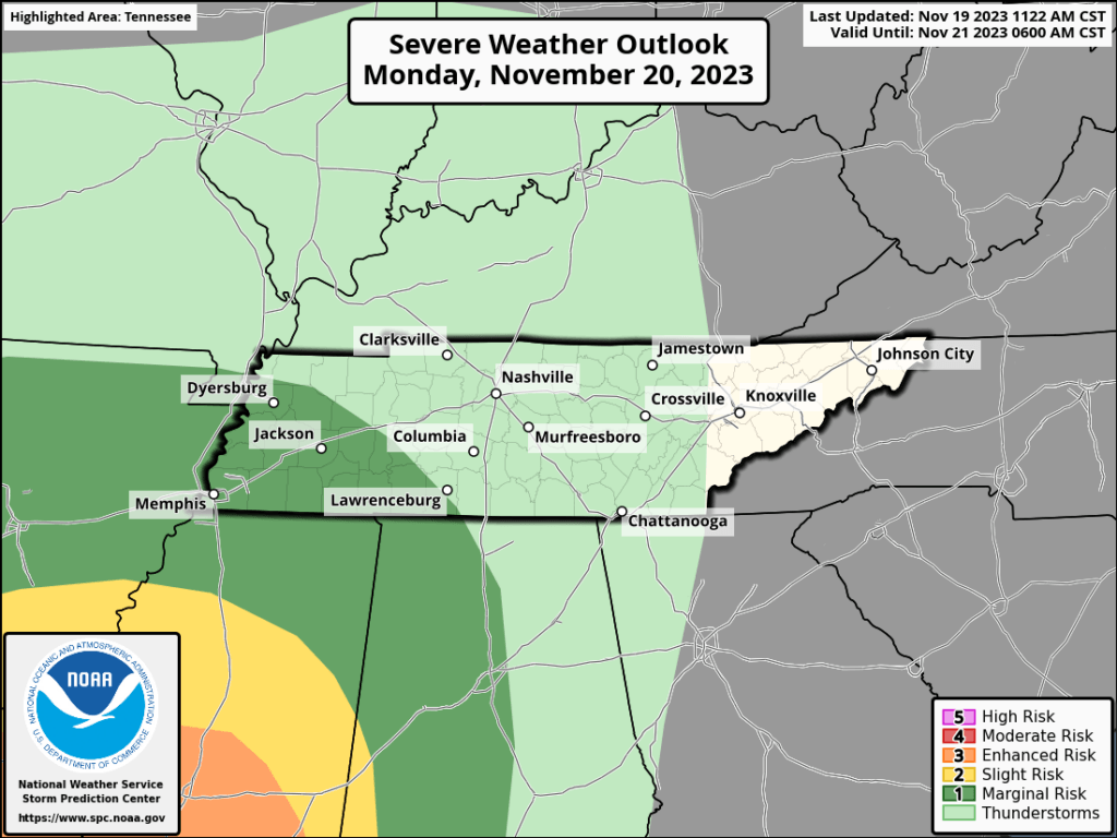
At this time, it appears the threat of severe weather will remain to our south. With that said, I will be monitoring trends in the guidance.
If the area of low pressure passes to our north and west, then our risk of thunderstorms will increase.
For now, I do have thunderstorms in the forecast. The only threat, as of this forecast update, is lightning.
The Storm Prediction Center is forecasting severe thunderstorms for Arkansas into Mississippi (areas to the south of there, as well). The risk inches ever so slightly towards the Missouri Bootheel, as well.
The light green zone, shown on this map, is where lightning will be possible. The dark green and yellow zone is where thunderstorms could be severe. The primary concern will be damaging wind gusts. There is a low-end short-lived tornado risk, as well.
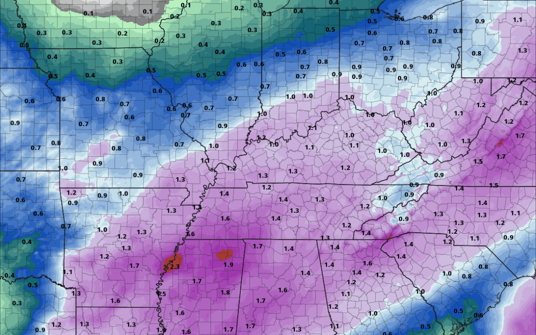
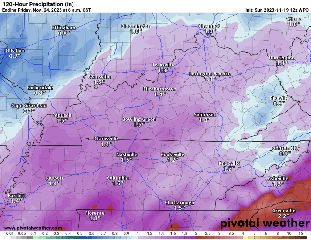
Rainfall totals will likely top one inch from this event.
Here is the latest rainfall outlook. Most of this will fall Monday into Tuesday morning.

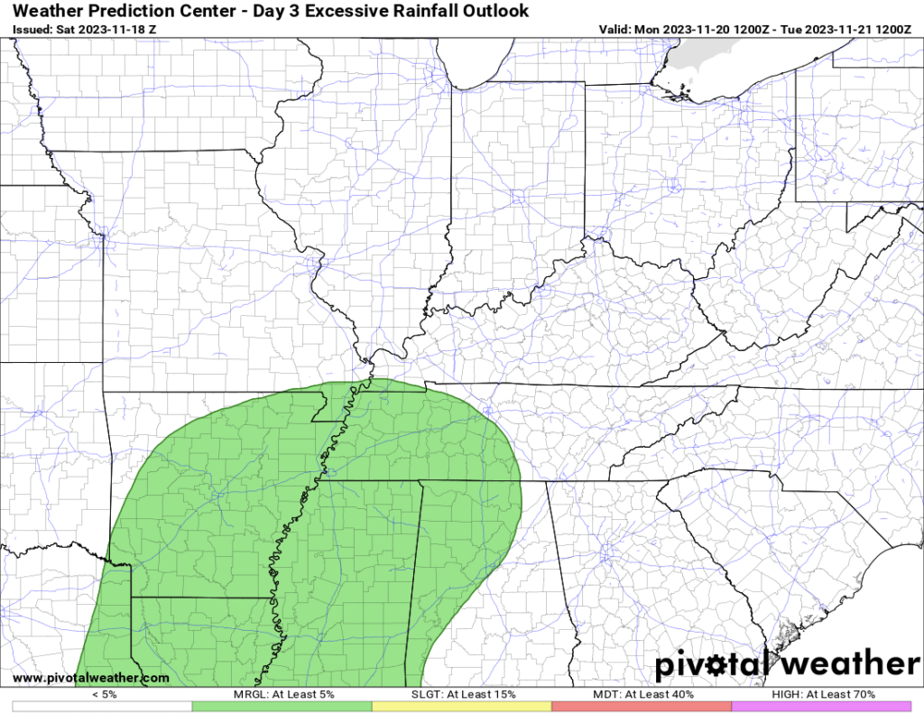
The WPC has placed our far southern counties in a level one excessive rainfall outlook. That simply means that there will be a low-end risk of flash flooding.
Widespread flash flooding is not anticipated.
Wednesday and Thursday will be dry and chilly. High temperatures will likely remain in the 40s. Morning lows will dip into the 20s and 30s.
Monitor updates.