Posted by Meteorologist Beau Dodson
November 22, 2023
HAPPY THANKSGIVING, EVERYONE! I hope you and your family have a wonderful holiday weekend.
Want more weather information? Then subscribe to Beau Dodson Weather Talk. You can do that at www.weathertalk.com
No local travel concerns today, tomorrow, or Friday. The only true travel concerns will be along the East Coast of the United States. A large storm system will bring snow and rain to many areas. If you have flight plans to the northeast, then be sure and check ahead for any travel delays.
Looking for snow? Well, not the best news. Those who love snow will have to be patient. I keep looking for snow chances, but they just are not showing up in the charts. Not yet at least.
The going forecast for December has been for above average temperatures. Now, that does not mean we won’t have cold shots. That also does not mean we won’t have snow or ice chances.
It simply means that when you average out the 31 days, it should end up above average. Perhaps well above average. We will see how it goes.
The BAMwx Team (who helps me with long range forecasting) are predicting a top three warmest Decembers for the nation as a whole.
Long range forecasts are always problematic. Meaning, confidence is never great. We have been batting about 70% on our monthly outlooks.
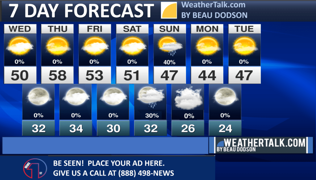
In the short-range, I am tracking light rain chances Saturday night/Sunday. Rain totals would be light. Likely 0.00″ to 0.10″.
The WPC shows very little in the way of rainfall over the next seven days.
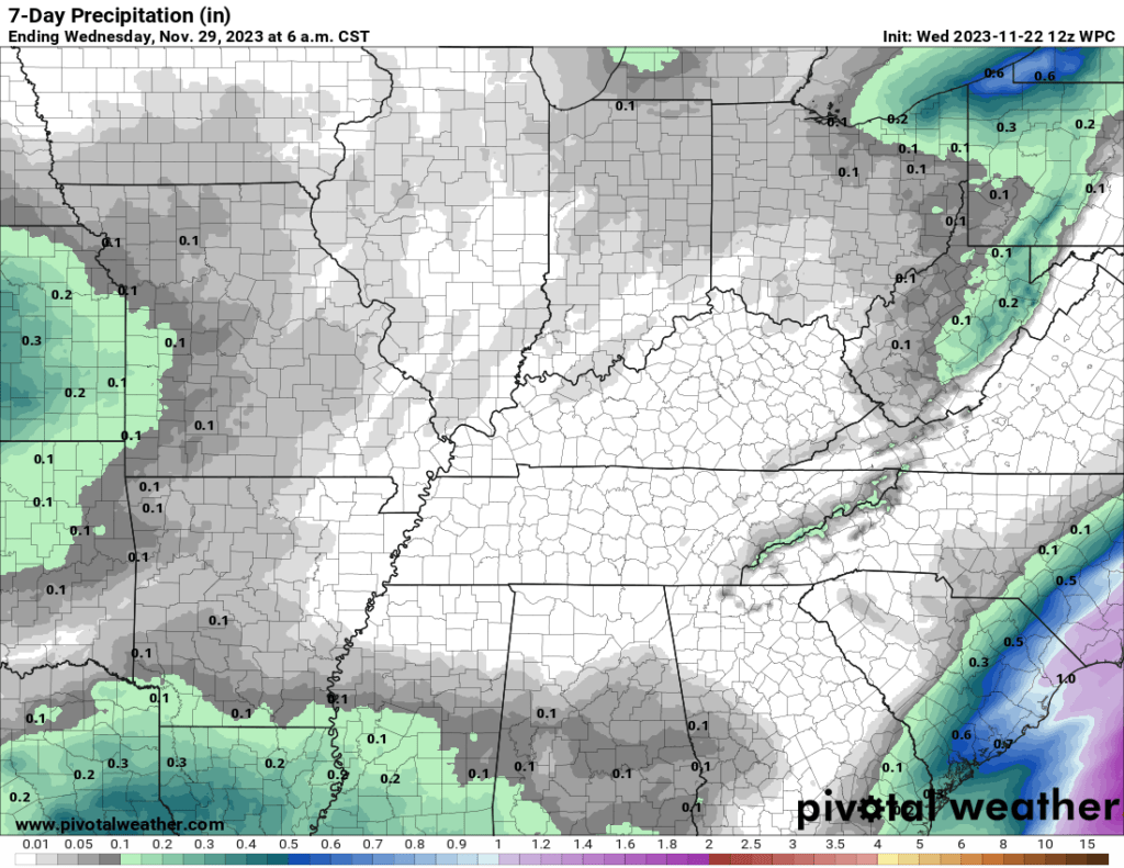
There could be a little sleet or snow mixed in with the rain late Saturday night and Sunday.
I am forecasting temperatures to remain above freezing. Thus, even if it did snow or sleet it would not stick or cause impacts. No big deal.
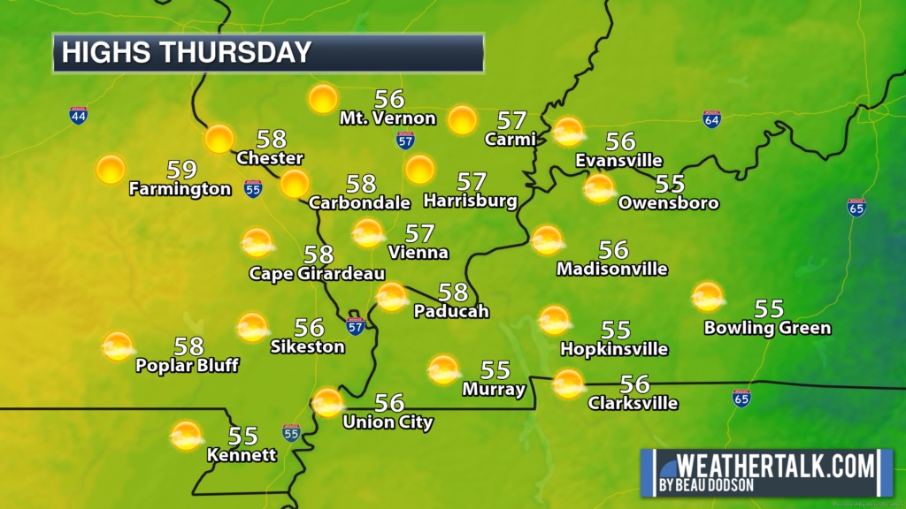
Temperatures Thursday (Thanksgiving Day) will average near to slightly above average. You can expect widespread 50s.
Your seven day outlook.
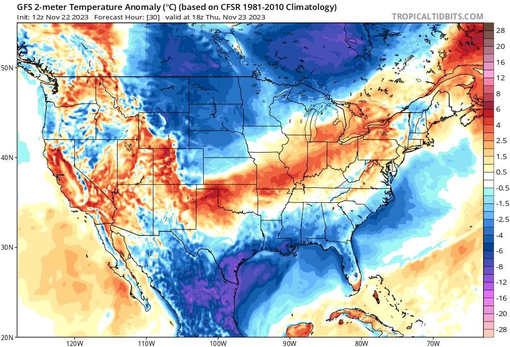
This graphic shows you how many degrees above or below average temperatures will be. Notice the red colors. That represents slightly above average temperatures.
Temperatures will turn colder behind the system Saturday and Sunday.
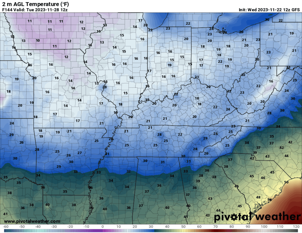
As a matter of fact, the GFS model shows cold air Tuesday and Wednesday morning. Lows in the 20s. Can lows drop into the teens? I can’t rule that out. Either way, cold.
This graphic below shows you well below average temperatures by next week. Several days of cold air.
This is for Tuesday morning. Those pink colors represent well below average temperatures.
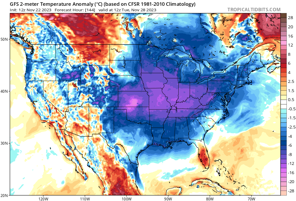
The GFS low temperature graphics for Tuesday and Wednesday mornings. We will see if these verify. I do believe lows will dip into the 20s.
That isn’t extreme for this time of the year, but it is cold.
Highs would remain in the 40s both Tuesday and Wednesday.
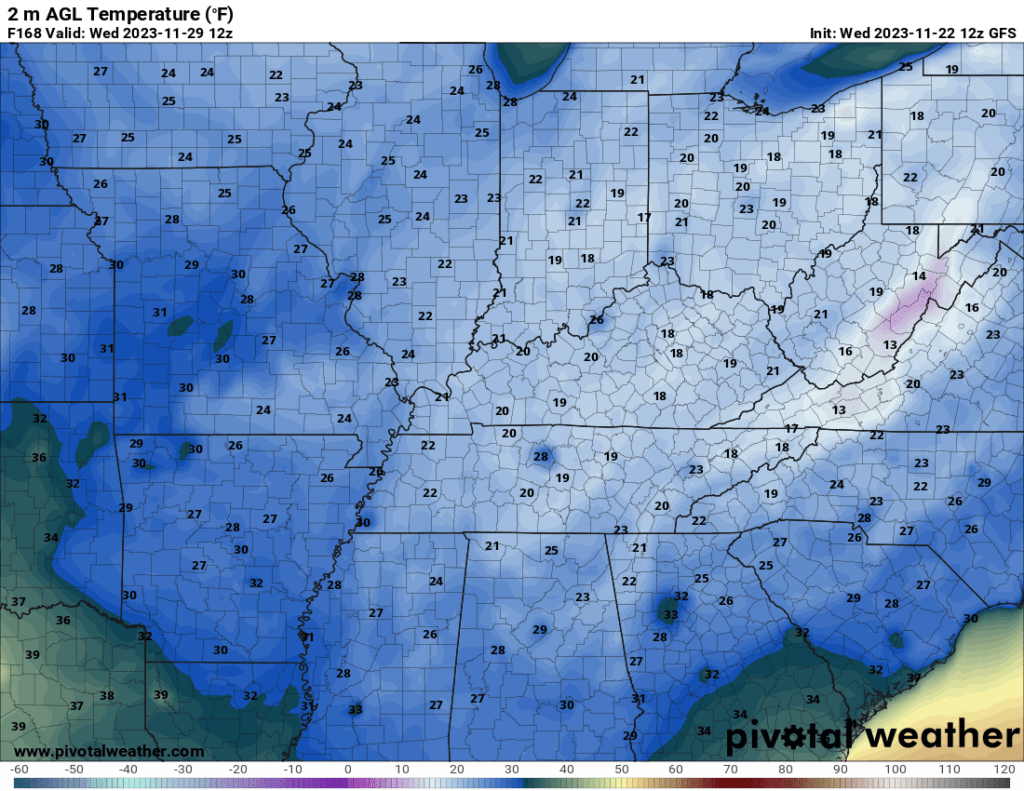
Tuesday morning lows. Brrr.
Wednesday morning lows.
I will keep watching for snow! For now, nothing of interest stands out in the long range.
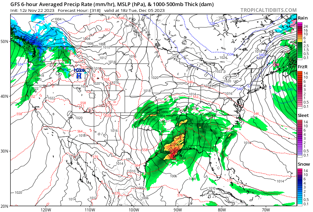
The GFS shows a larger system around December 5th. That is in the extended long range. I always tell you to discount anything past day four or five.
I will keep an eye on it. We still need rain. Many areas are dry.
This graphic shows you a possible system around December 4th and 5th.