November 24, 2023. 8:20 AM.
Posted by Meteorologist Beau Dodson
A winter storm will impact portions of the central United States today into Sunday.
The primary area of concern will be across Idaho, Wyoming, Utah, Colorado, Nebraska, Oklahoma, Texas, and Kansas. Snow will eventually spread into Missouri, Iowa, and Illinois, as well.
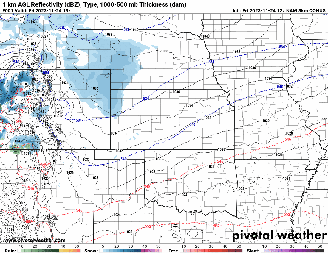
Future-cast radar shows the snow developing and spreading east northeast. Blue represents snow. Green is rain. The timestamp is located in the upper left-hand side of the graphic and is in Zulu time. 12z=6 AM. 18z=12 PM. 00z=6 PM. 06z=12 AM.
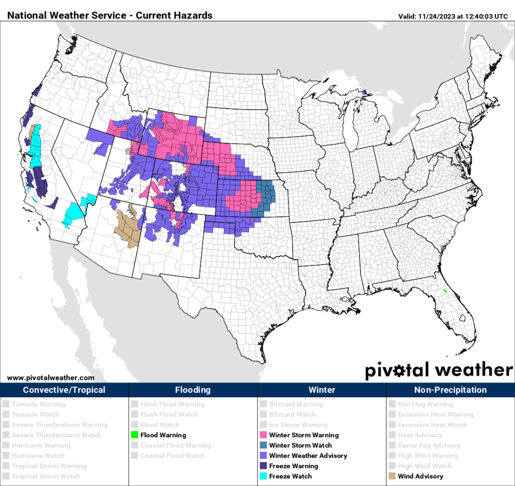
A variety of winter weather products have been issued for those areas.
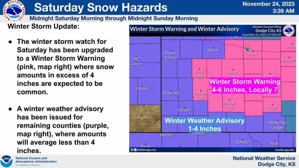
Pink represents where winter storm warnings are in effect. That is where the snow is likely to be the heaviest.
The National Weather Service in Wichita, Kansas has issued winter storm warnings for portions of central Kansas. You can see that on this graphic. Snow totals are likely to exceed four inches in the pink zone.
This will lead to hazardous driving conditions.
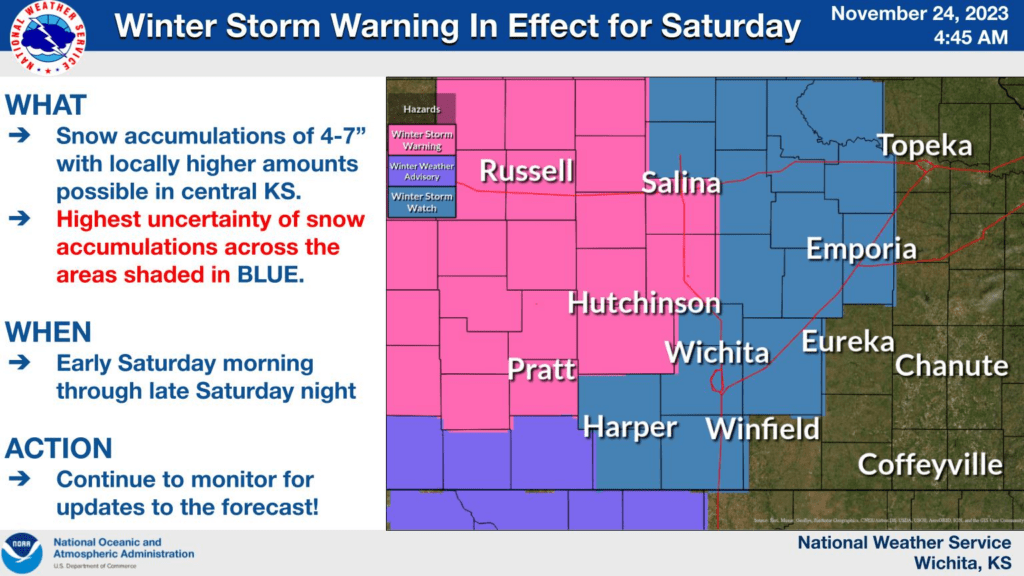
The Dodge City, Kansas NWS also issued winter storm warnings for portions of their forecast area.
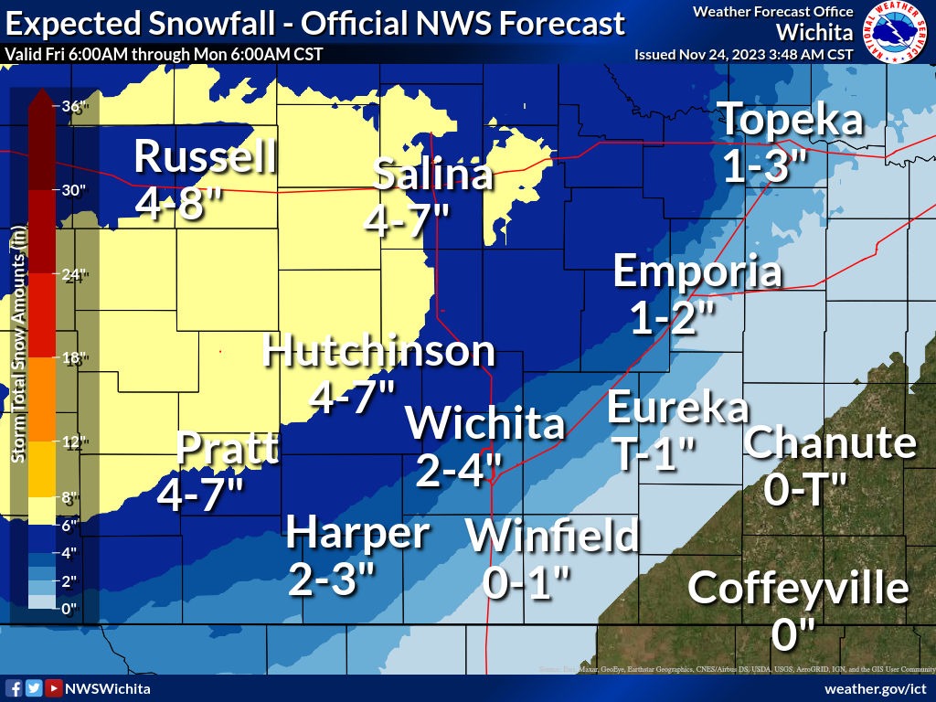
Kansas snowfall totals.
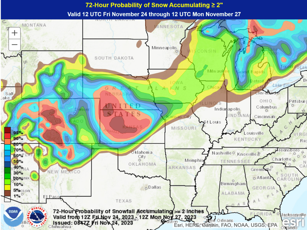
The latest WPC Map shows you the probability of two or more inches of snow.
As you can see, this will miss our local area. Our region will experience rain showers late Saturday night into Sunday. Perhaps mixed with non-accumulating snow/sleet. No impacts.
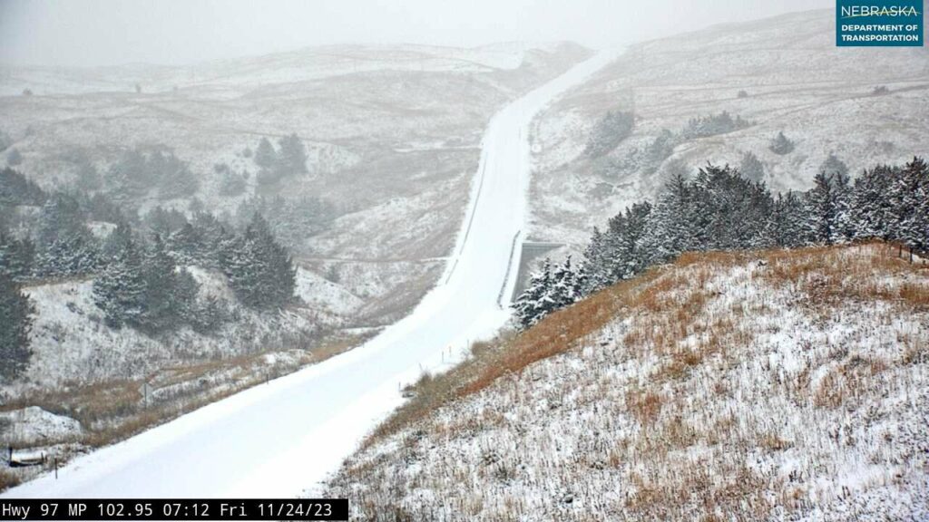
Highway 97 S of Mullen, Nebraska.
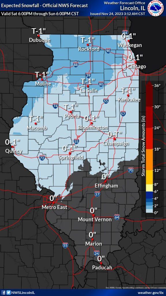
Missouri and Illinois may experience some light snow, as well.
Here was the prediction from the local National Weather Service Offices.
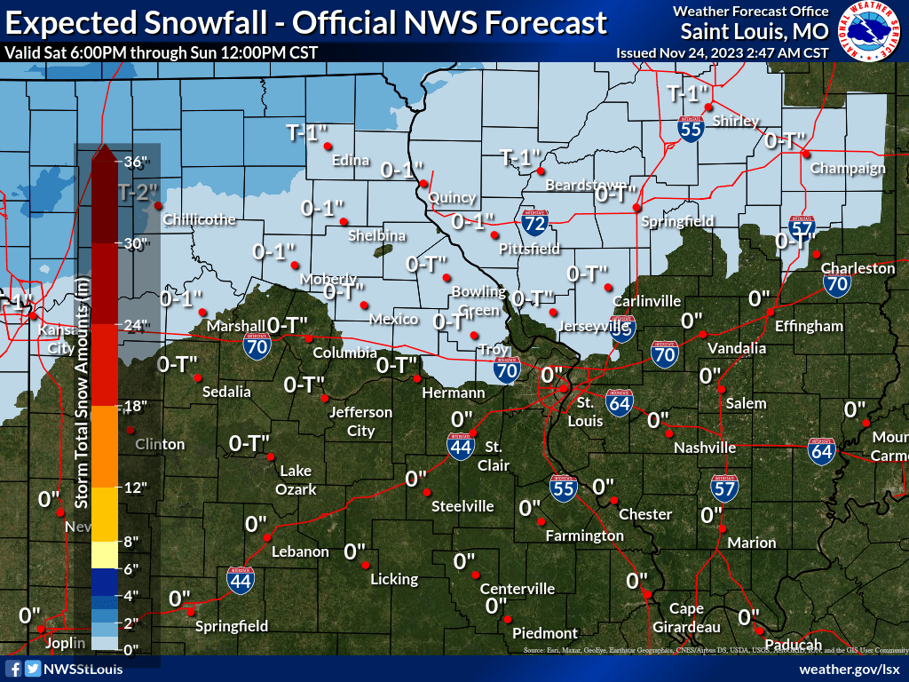
Illinois snowfall forecast.