Saturday, November 25, 2023
Posted by Meteorologist Beau Dodson
Update at 3:30 PM.
No changes to the forecast below. A winter storm will push into Missouri, Iowa, and Illinois tonight and Sunday. North of our local area.
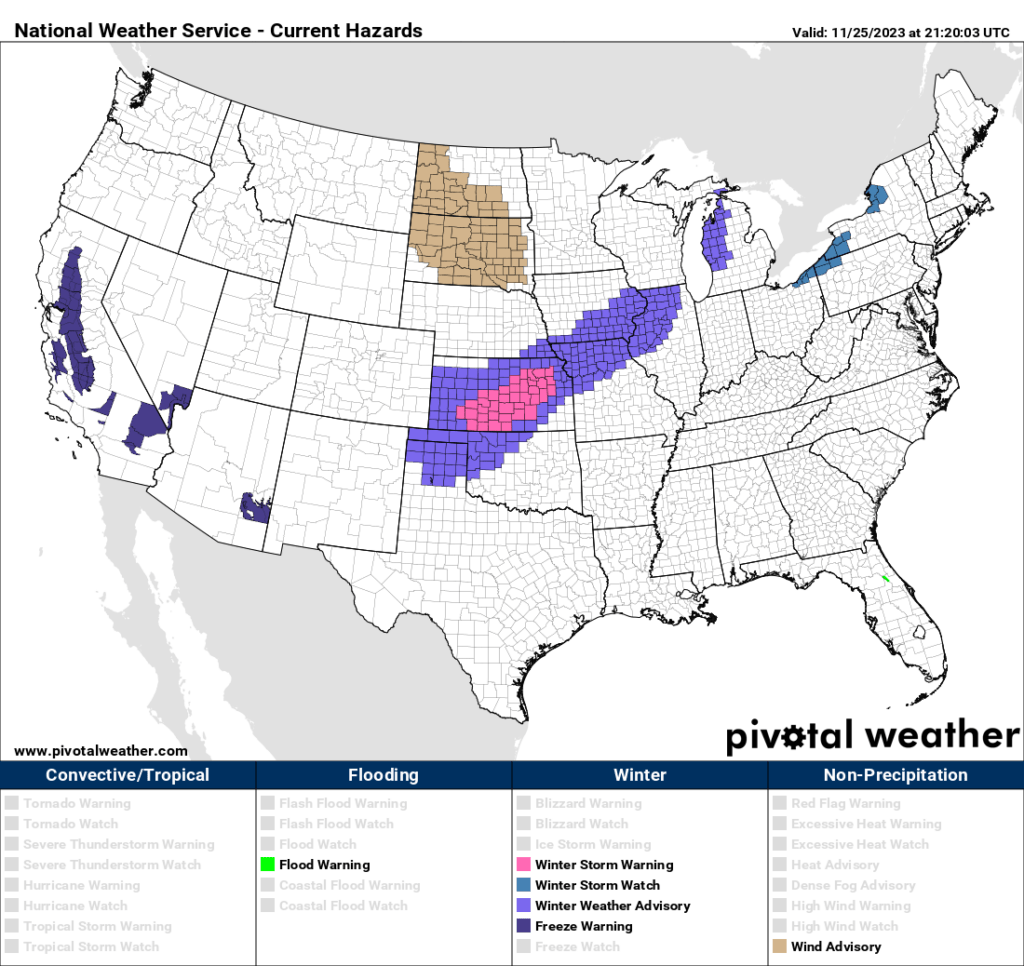
Here are the latest winter storm warnings and winter weather advisories.
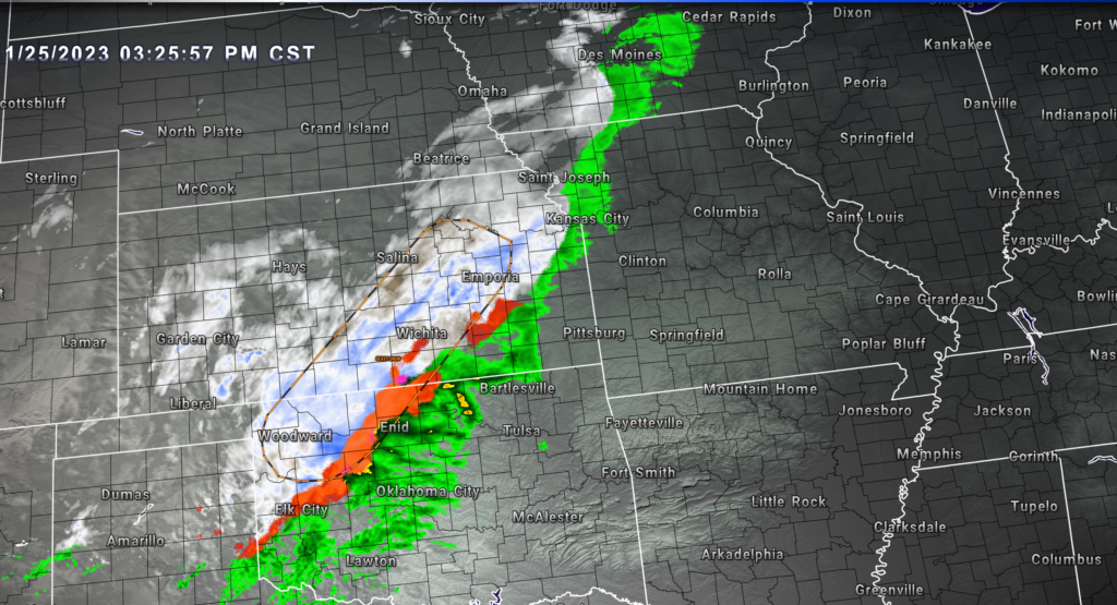
Radar at 3:30 PM showed widespread precipitation moving east northeast into the Missouri Valley.
Rain will arrive in our local area tomorrow.
Live radars can be viewed below.
Want to receive more weather information straight to your phone?
You can receive a daily forecast (hand typed by me), severe weather alerts, ice storm warnings, winter storm warnings, a daily blog, regional and long range videos, and more!
Subscribe at www.weathertalk.com
After subscribing, you can download the Beau Dodson Weather App from the app stores!
Have questions? Email me at beaudodson@usawx.com

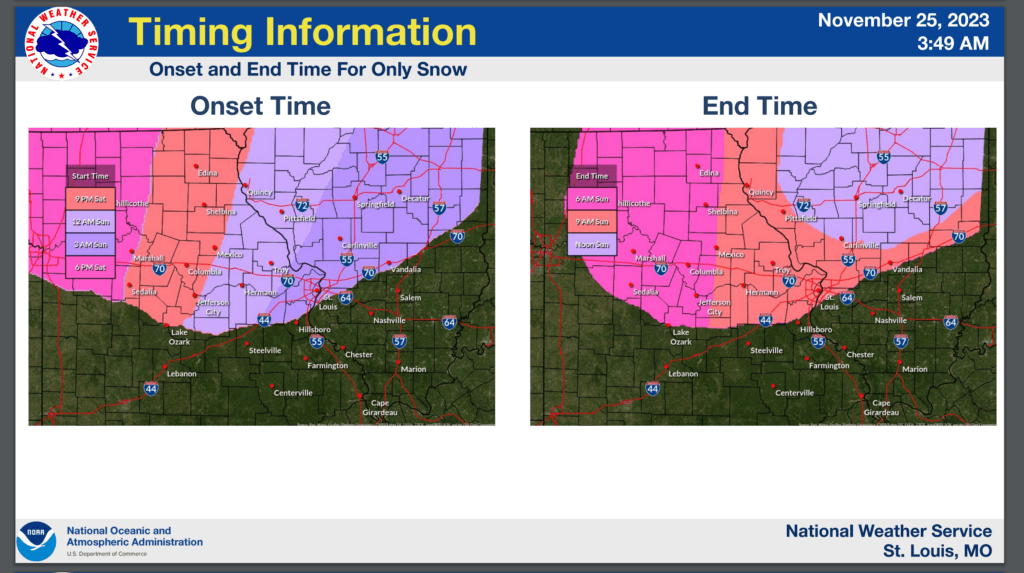
Timing of the winter storm? Today into Sunday. Spreading from Kansas (now) into northern and central/northeastern Missouri and northern Illinois tonight and Sunday.
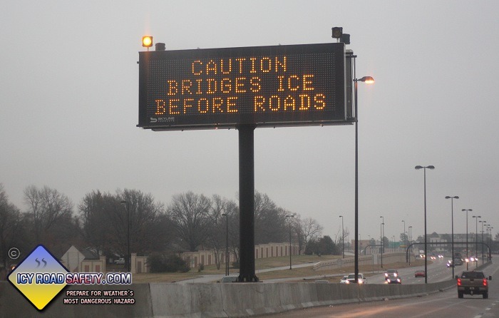
What is the primary concern? Icy road conditions.
Will this impact my local forecast counties in southeast Missouri, southern Illinois, western Kentucky, and northwest Tennessee? No. We will experience rain. I am not concerned about snow or ice in our local area.
Important Links
Beau Dodson’s Zoom Radar. Track the snow and rain. Click here.
National Weather Service. Click here.
Missouri Department of Transportation. Click here.
Illinois Department of Transportation. Click here.
Iowa Road Conditions. Click here.
Icy Road Safety Website. Useful tips and information. Click here.
A winter storm will impact portions of the central United States today into Sunday. The good news is that I do not expect any travel concerns in my forecast area.
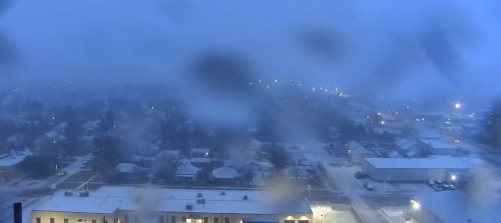
This morning’s Great Bend, Kansas, SkyCam was showing snow falling on the city.
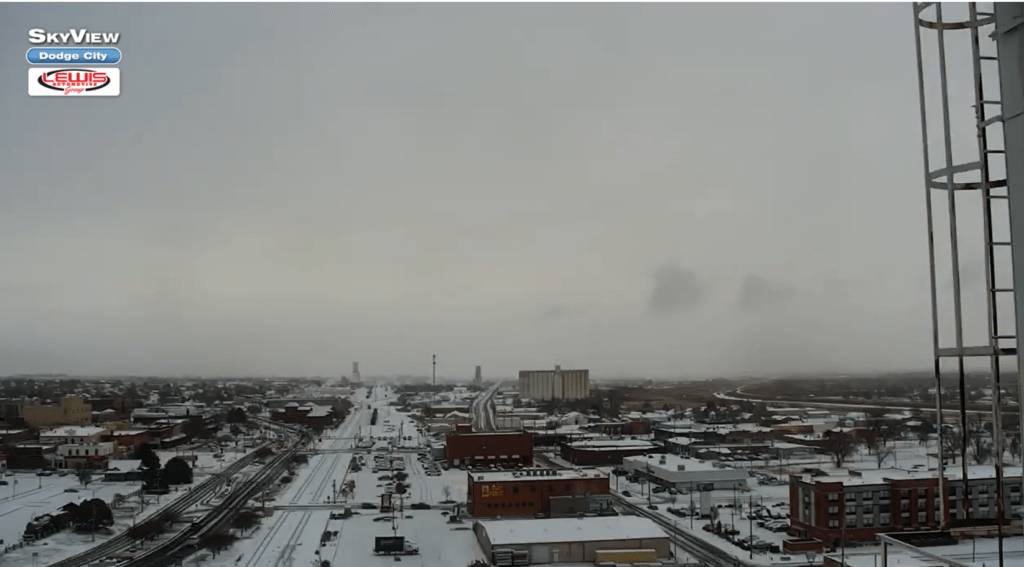
The Dodge City SkyCam was also white with a fresh blanket of snow.
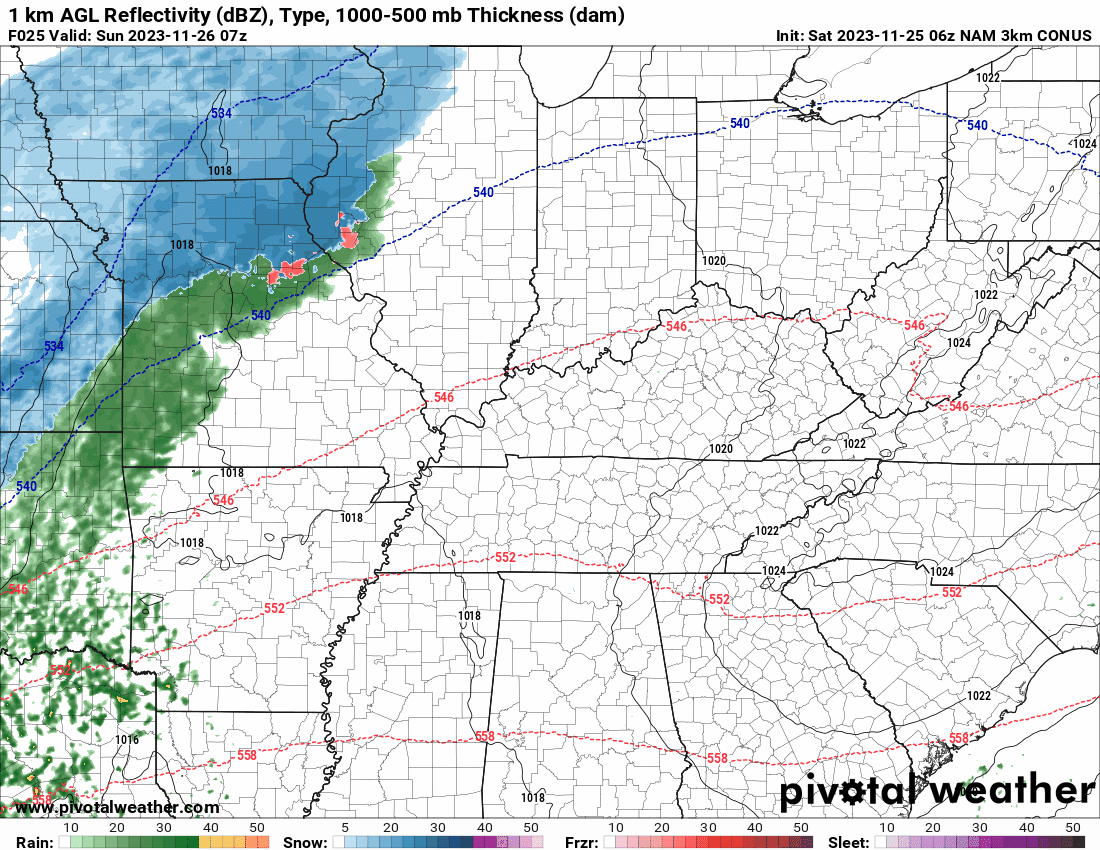
We will have rain overspreading our area late tonight into Sunday.
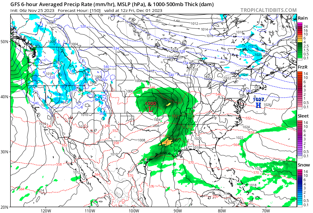
You can see that on this future-cast radar from the NAM model.
Blue is snow. Green is rain. The timestamp is located in the upper left corner of the animation. It is in Zulu time. 00z=6 PM. 06z=12 AM. 12z=6 AM. 18z=12 PM.
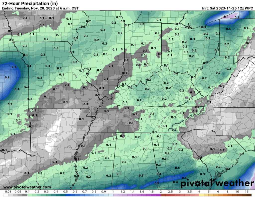
Rainfall totals are expected to be light. Here is the rainfall outlook. Not much.
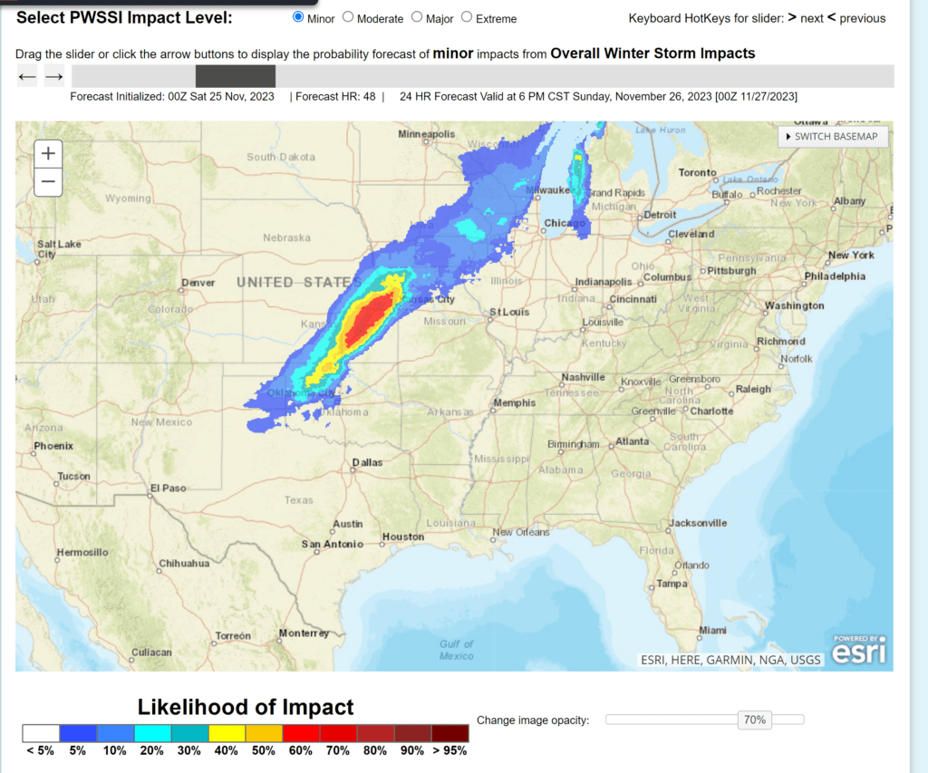
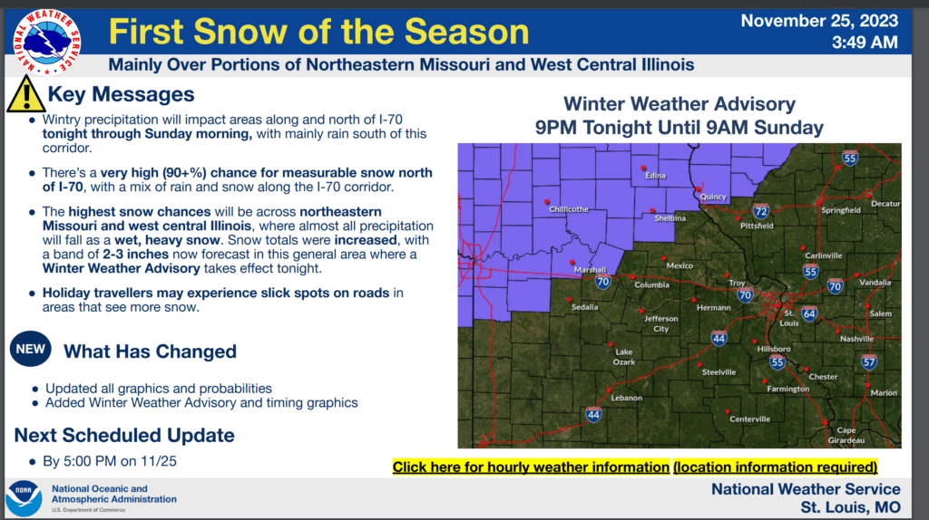
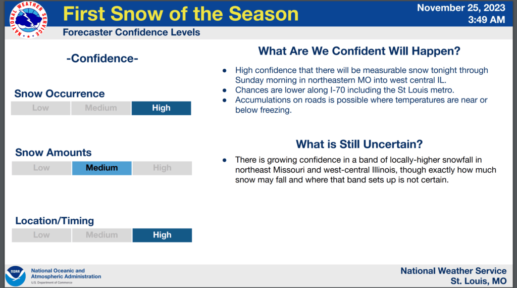
A variety of National Weather Service winter weather products have been issued from Kansas to Wisconsin. Winter weather advisories and winter storm warnings.
The pink zone is where the heaviest snow is anticipated. That would be a winter storm warning.
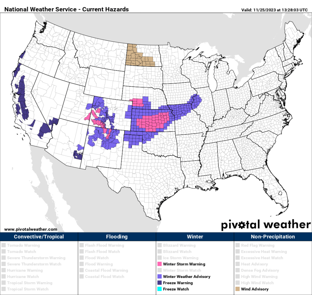
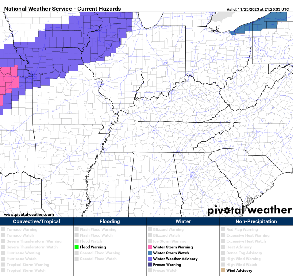
If you are traveling northward, then you will want to monitor road conditions.
This graphic shows you where at least minor travel issues are anticipated. Perhaps moderate in some areas, as well.
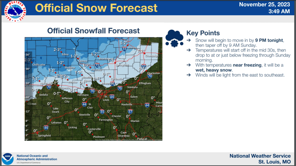
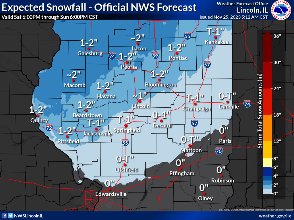
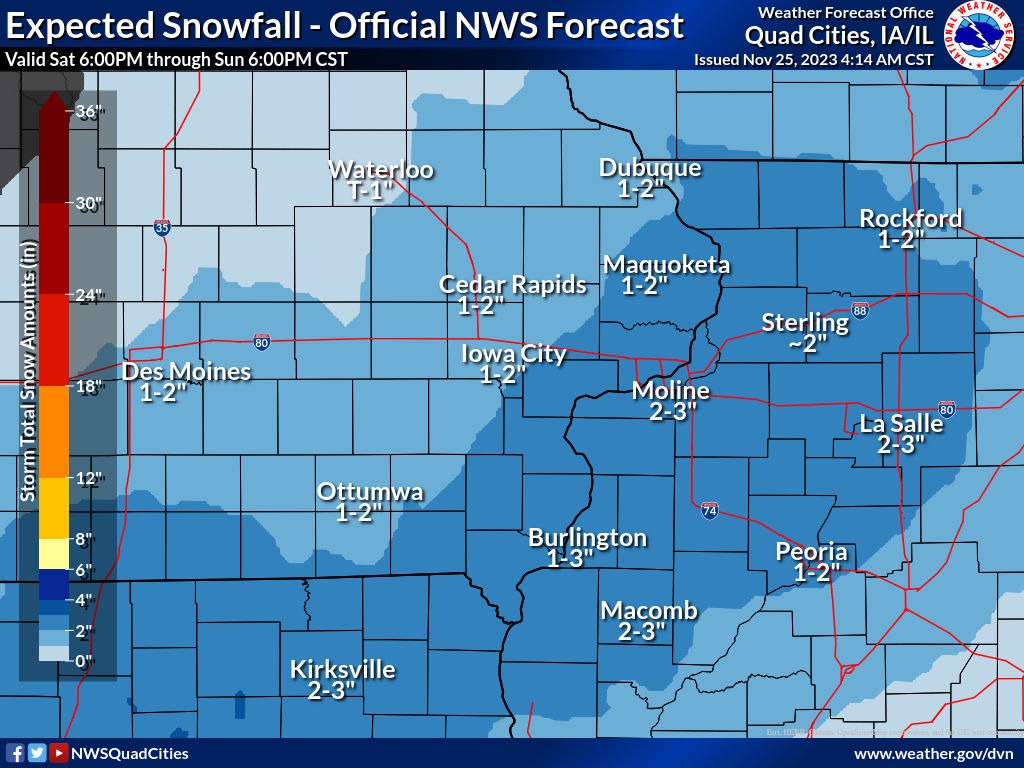
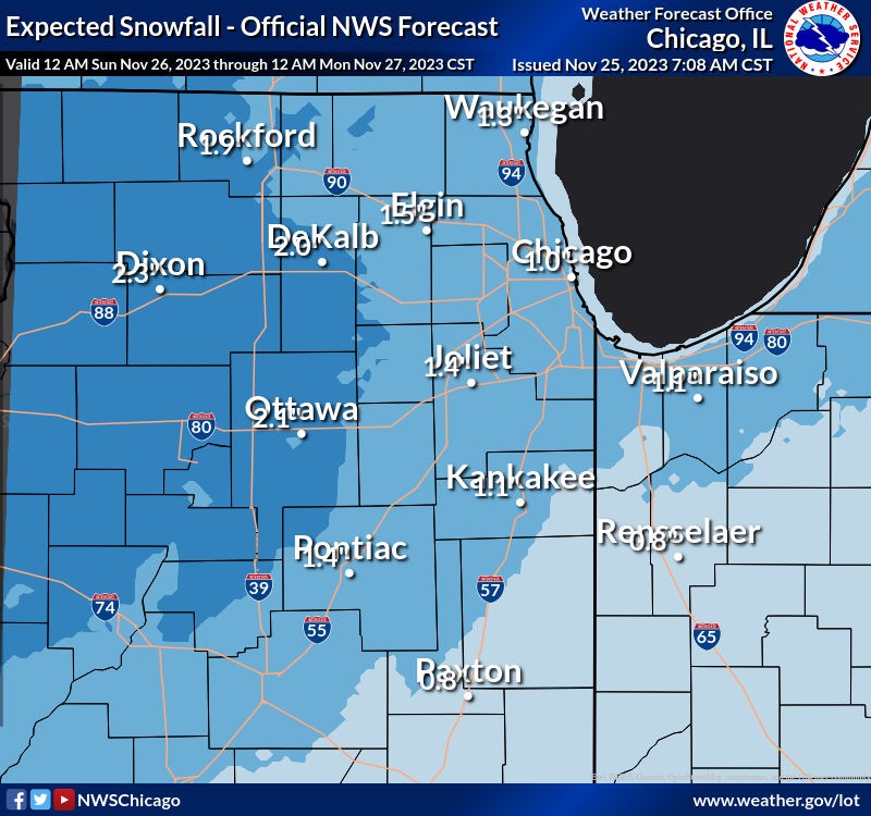
NWS forecasts for snow totals show a large stripe of one to three inches. Pockets of higher totals.
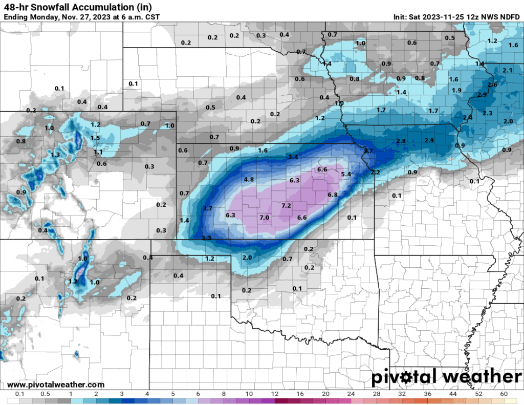
Here are some NWS graphics concerning expected snow totals. The southern edge of this may end up being on grassy surfaces only.
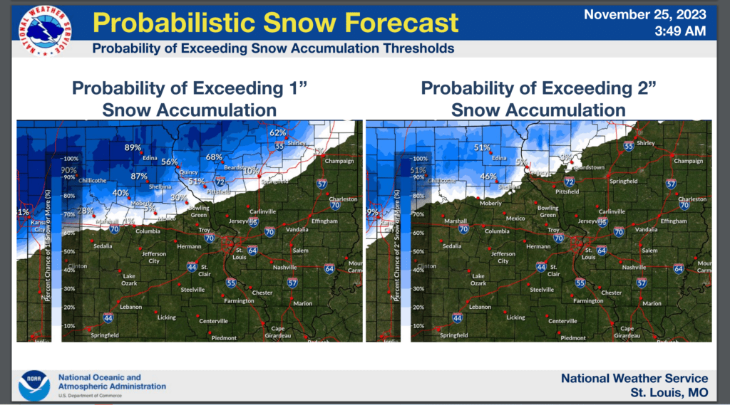
St Louis, NWS Office. Snowfall forecast. This is valid 12 PM Saturday through 12 PM Sunday.
The bulk of the snow will fall late Saturday night into Sunday morning near the St Louis area.
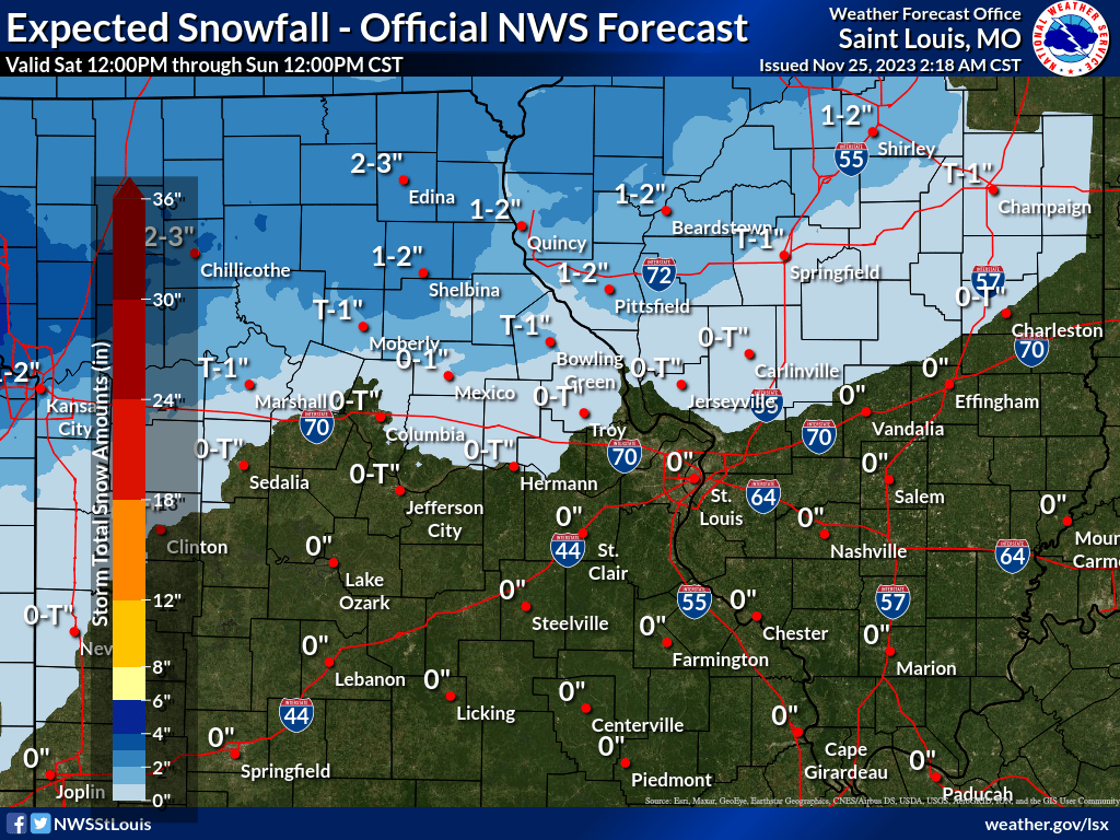
Some comments from the St Louis NWS Office.
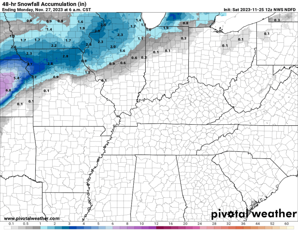
Here are some additional NWS Offices.
Lincoln, Illinois NWS. Expected snowfall totals. This is valid 6 PM Saturday through 6 PM Sunday.
Quad Cities, Iowa NWS. Expected snowfall totals. This is valid 6 PM Saturday through 6 PM Sunday.
Chicago, Illinois NWS. Expected snowfall totals. This is valid 12 AM Sunday to 12 AM Monday.
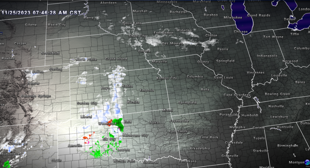
Radar at 7 AM Saturday showed widespread snow spreading across Kansas and Oklahoma. Some snow showers in Iowa, as well.
Colder air will filter into our region as we move into the new work-week.
Brrrr weather!
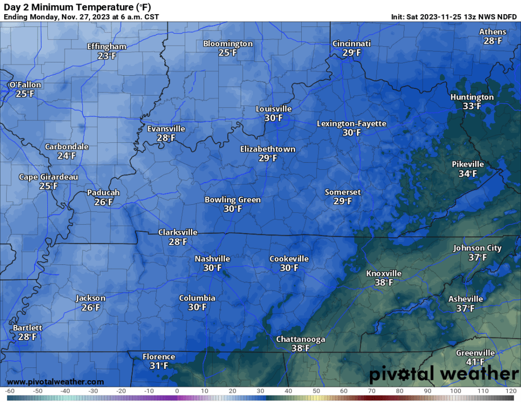
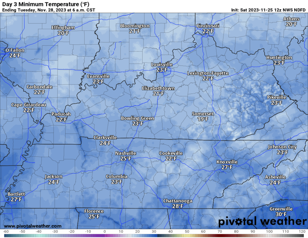
Monday Morning Low Temperatures
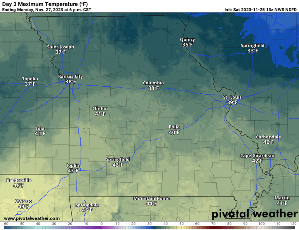
Monday High Temperatures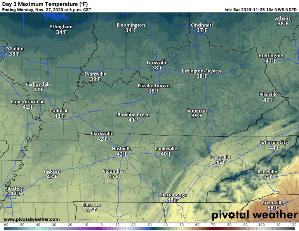
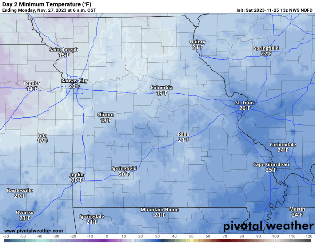
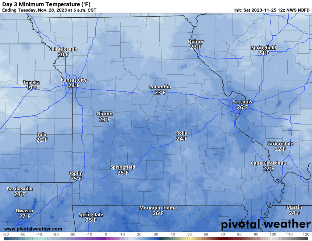
Tuesday Morning Low Temperatures
Rain will enter the forecast Thursday night into the weekend.
The GFS model shows showers and thunderstorms in the region Friday. For now, the threat of severe weather appears to be minimal. I will monitor trends in case the system is stronger than anticipated.