November 29, 2023
Posted by Meteorologist Beau Dodson
A decent day on tap for the region. No weather concerns today or tonight.
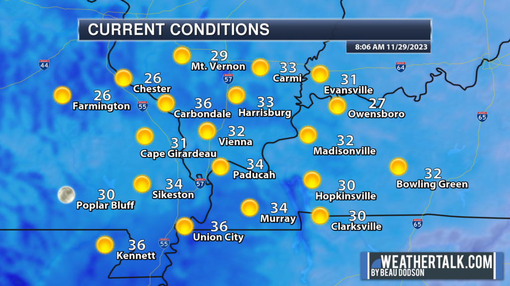
8 AM temperatures were chilly, but nothing too extreme for late November.
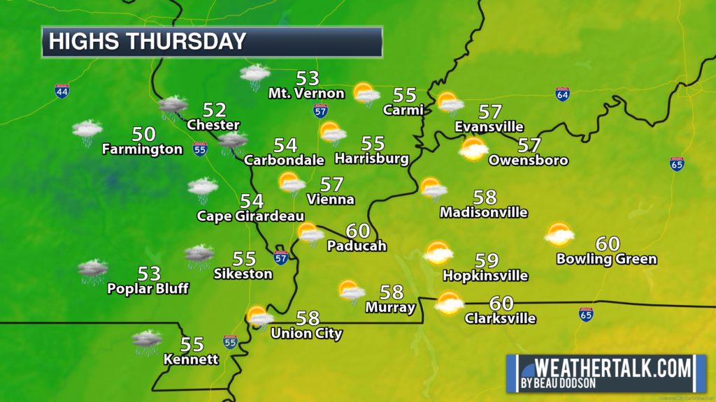
The weather takes a turn as we move into Thursday and Thursday night.
An area of low pressure and cold front will push into the region. Southerly winds will bring moisture into the region from the Gulf of Mexico.
A few showers will be possible Thursday morning. These will approach from southeast Missouri. As we move through Thursday, rain chances will increase west to east.
Widespread rain will develop Thursday evening and night. You can expect radar to be covered.
Those rain showers will linger into Friday morning. An isolated thunderstorm could be embedded in the rain. No severe weather concerns.
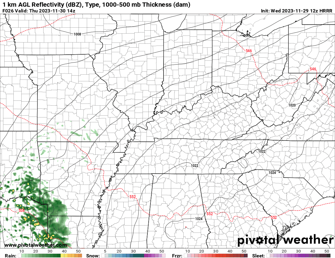
The HRRR model future-cast radar shows the showers spreading into the region Thursday.
The timestamp is located in the upper left. It is in Zulu time. 00z=6 pm. 06z=12 am. 12z=6 am. 18z=12 pm.
Generally, rain totals are expected to range from 0.5″ to 1.00″.
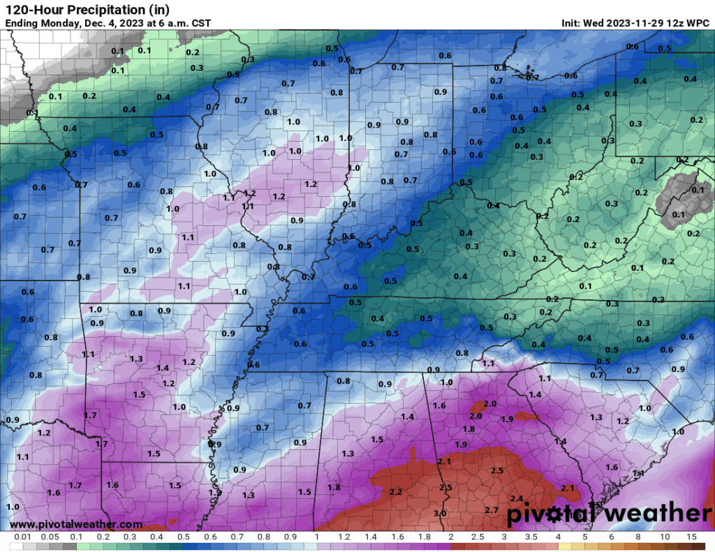
Low end shower chances will linger into the weekend. More the most part Friday night into Sunday should be dry. I have capped rain chances, for the time being, at 20%.
Those wanting snow will just have to wait a bit longer. I am currently not tracking any snow or ice storms.

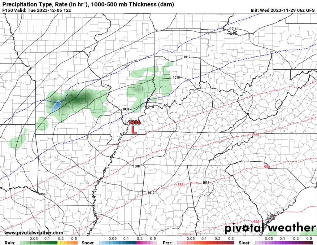
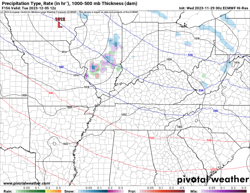
I am watching next Tuesday/Tuesday night/Wednesday. A fast-moving clipper could bring a few showers or flurries. Colder temperatures, as well (at least briefly colder).
Both the GFS and EC model show spotty light precipitation next Tuesday.
If you would like to receive app alerts, then subscribe to www.weathertalk.com
Become a VIP member and supporter.
Severe weather alerts, ice storms alerts, winter storm alerts, daily blog, daily videos, long range outlooks. my daily hand typed forecast, and more!
Once subscribed, you can download the Beau Dodson Weather app!