November 30, 2023
Posted by Meteorologist Beau Dodson
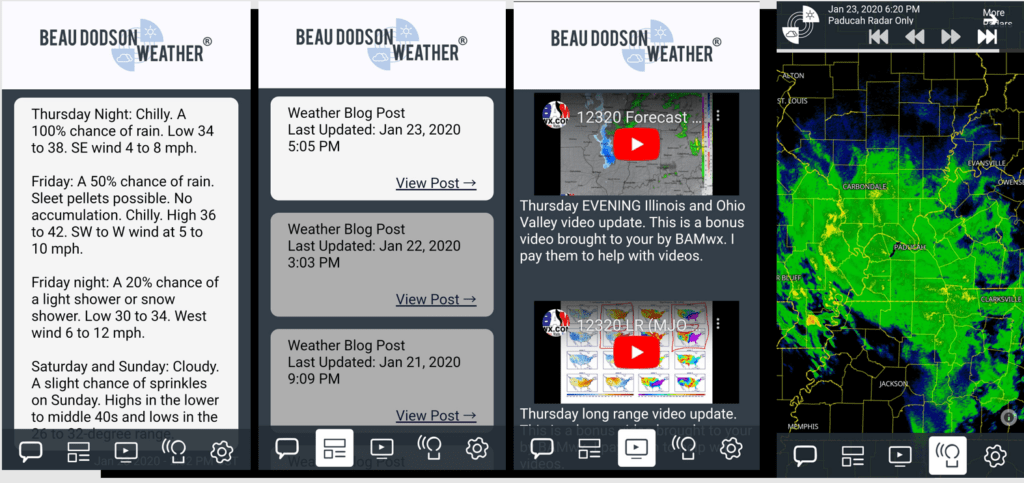
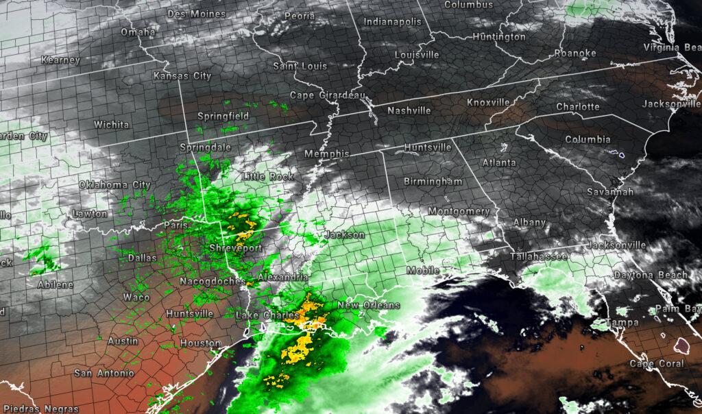
Our widespread rain event is beginning to develop to our south and southwest.
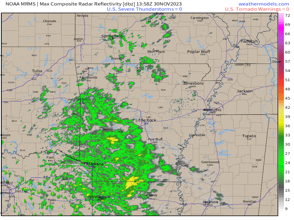
Here is a 7 am radar snapshot. Spotty showers are beginning to form over southern Missouri. Other showers have formed across Oklahoma and Arkansas.
All of this will spread northeast as we move through today.
9 AM Radar. You can see rain developing to our south southwest.
Links to my live radars.
Interactive local city-view radars. Clickable watches and warnings.
https://wtalk.co/B3XHASFZ
Backup radar site in case the above one is not working.
https://weathertalk.com/morani
Regional Radar
https://imagery.weathertalk.com/prx/RadarLoop.mp4
*NEW* Zoom interactive radar (with storm chaser streams)
https://wtalk.co/AVWG7GM7
A rumble of thunder will be possible tonight and tomorrow morning. No severe weather concerns, thankfully.
Rain chances rapidly ramp up this evening into tonight. The bulk of this rain event will be tonight.
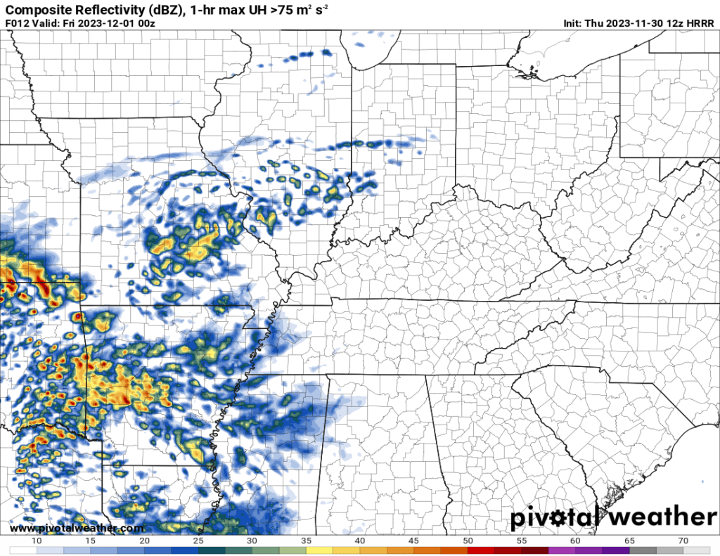
The Hrrr future-cast radar shows what radar might look like at 6 pm tonight.
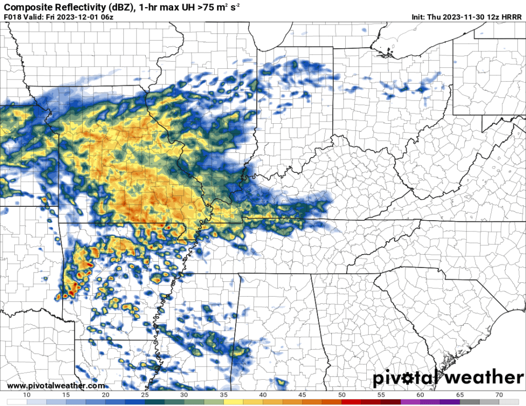
Then what radar might look like at 12 am tonight.
And finally, what radar might look like at 6 am tomorrow morning.
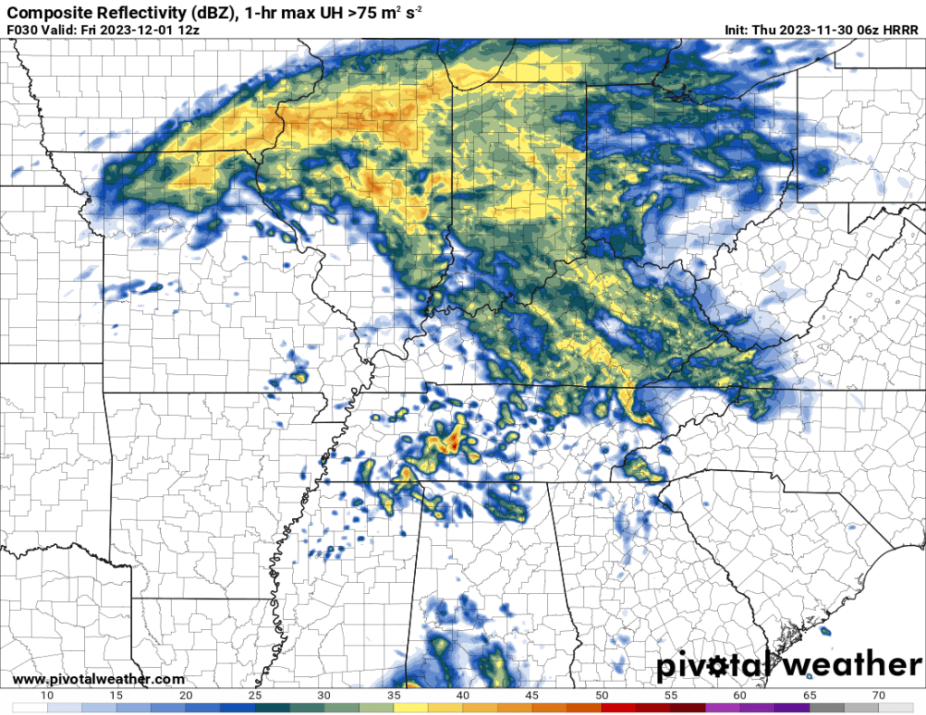
A few showers may linger into Friday afternoon and evening. The bulk of it, however, will be over.
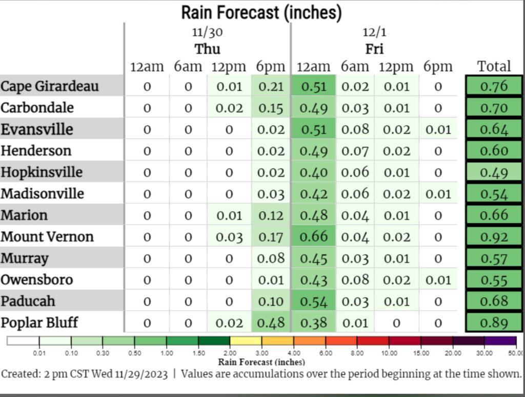
Timing of the highest rain chances.
If you would like to receive app alerts, then subscribe to www.weathertalk.com
Become a VIP member and supporter.
Severe weather alerts, ice storms alerts, winter storm alerts, daily blog, daily videos, long range outlooks. my daily hand typed forecast, and more!
Once subscribed, you can download the Beau Dodson Weather app!