December 2, 2023
Posted by Meteorologist Beau Dodson
Happy first weekend of December!
There are numerous Christmas parades today, holiday open houses, Christmas tree lightings, and other holiday festivities. I hope you and your family can enjoy some of them.
We are waking up to cool damp conditions. Patchy dense fog in the region. Even some drizzle. Mostly cloudy sky conditions over much of the region. Although, a few areas are partly cloudy.
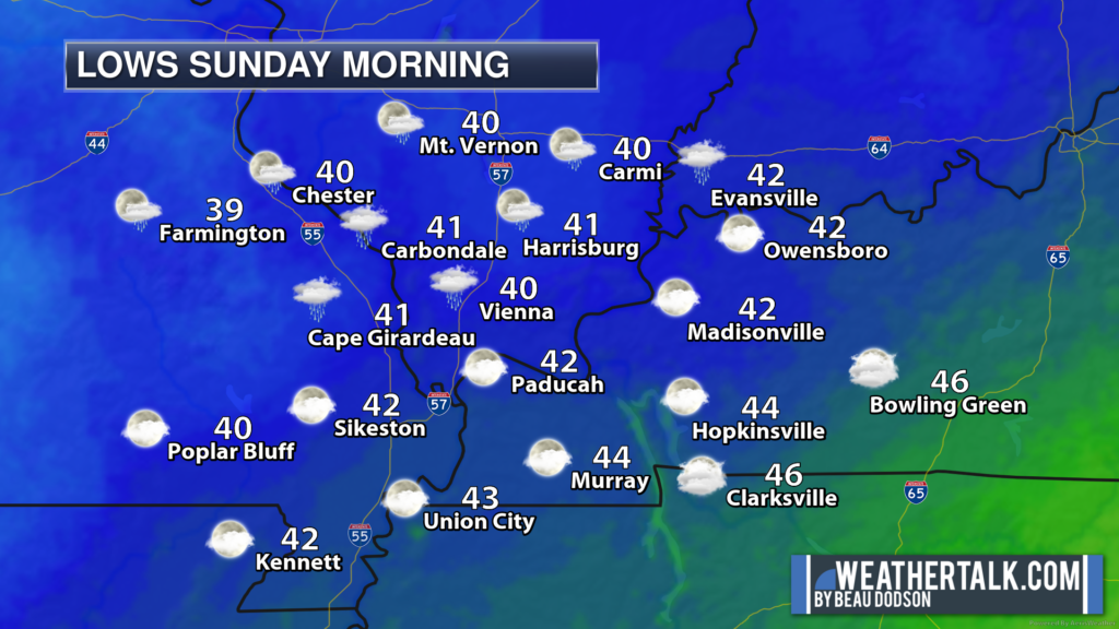
7 AM temperatures. Quite the range of morning temperatures. Clouds kept some areas warmer. Clearing kept some areas cooler.
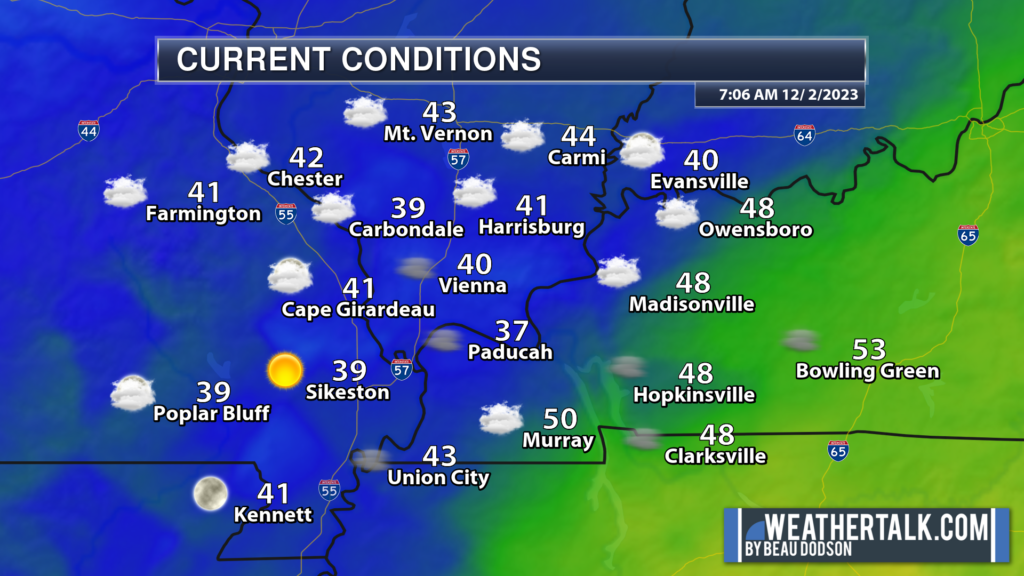
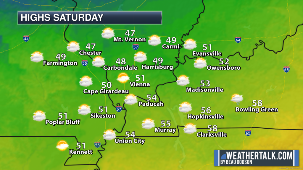
Overall, not a bad day across the region. It will be cool. The fog will mix out over the coming hour or two. That will leave us with a mix of sun and clouds throughout the day.
Temperatures will remain on the cool side, but nothing to write home about.
A fast-moving weak system will thicken clouds tonight. A few light showers will be possible, as well. Rain totals of 0.00″ to 0.05″ are anticipated. Not much. Perhaps enough to wet the sidewalk.
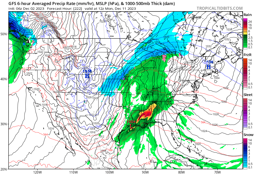
I am not tracking any significant storm systems. I am watching December 10th and 11th for another rain event. Too early to know if thunderstorms or severe weather will be a concern.
I am watching this system. The GFS and other models are showing a precipitation event around December 10th and 11th. Long way off in the forecast world.
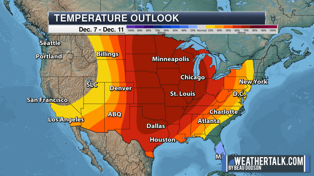
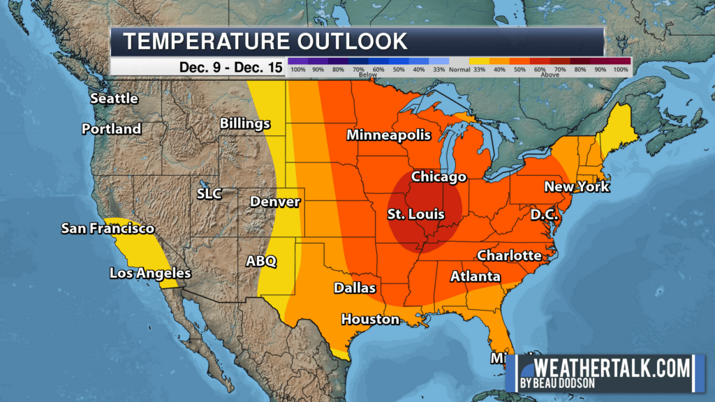
Overall, temperatures are likely to remain at or above seasonal levels through week one and two. At times, it will still be cool.
The deeper shades of red mean a higher confidence in the eventual forecast outcome. Red is above average temperatures.