December 3, 2023
Posted by Meteorologist Beau Dodson
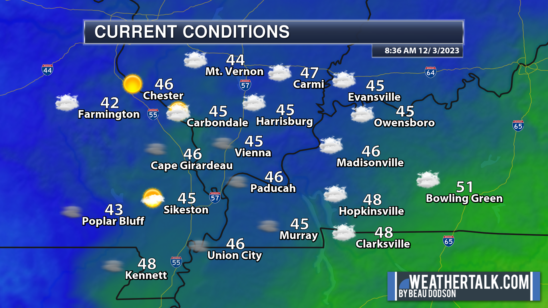
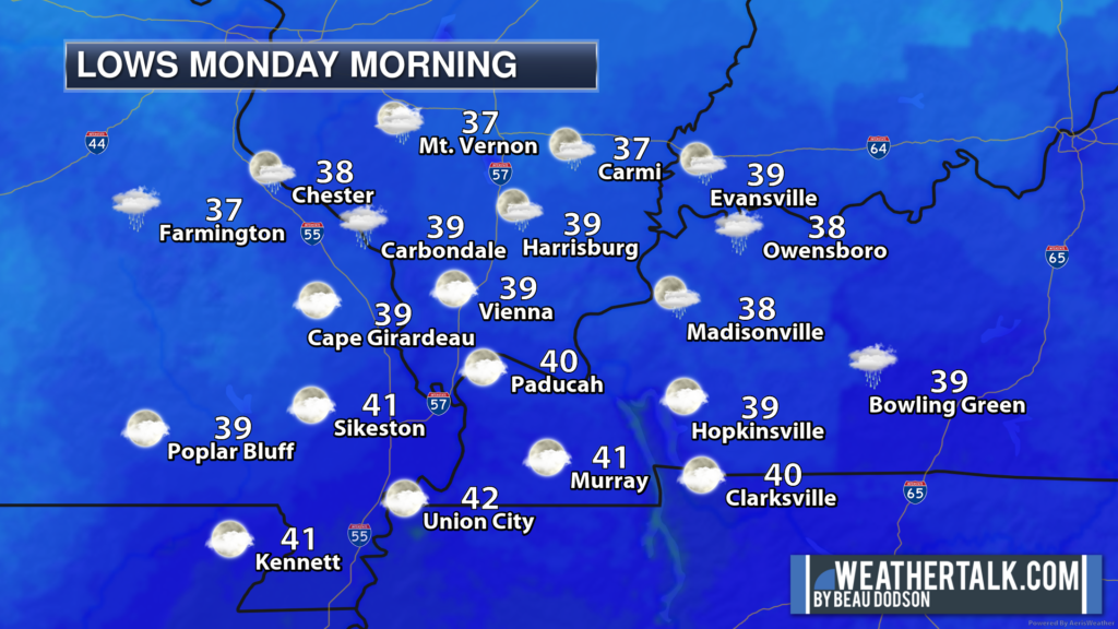
We are starting off the morning with cool temperatures. Nothing extreme. We still have lingering clouds in the area (especially eastern counties). Patchy fog, as well. Perhaps a sprinkle or patchy drizzle here and there. For the most part, however, the region is dry.
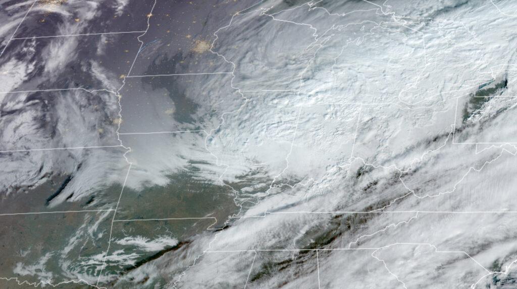
Satellite shows clearing sky conditions approaching from the west southwest.
This was the satellite image at 9 am.
We are expecting another fast-moving weak system to move across the region tonight and early tomorrow. Isolated showers will once again be possible. Rainfall totals will be a trace up to 0.05″. Many areas may simply remain dry.
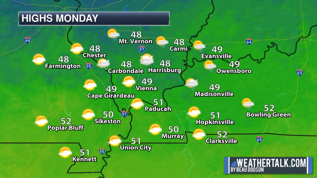
We will have a slow warming trend as we move through the week.
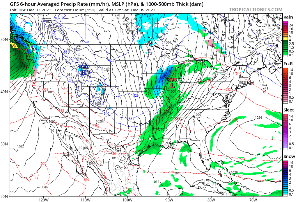
I continue to watch December 9th through the 11th for another cold front. This front will likely bring rain to the region. Perhaps even some thunderstorms.
There could be snow well to our north. If you have travel plans this weekend, then monitor updated forecasts.
It is too soon to know if severe weather will be a concern. I am closely monitoring it.
Monitor updates over the coming days.
The GFS model shows that front moving through the region Friday night into the first half of Saturday. Other models are a bit slower. We will monitor trends over the coming days and fine tune the forecast.
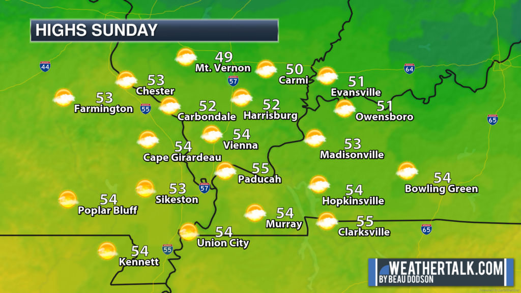
Green is rain. Blue is snow.
Want to receive more weather information?
Regional videos, long range weather videos, daily blog updates, hand typed forecasts from my keyboard to the Beau Dodson Weather app, severe weather alerts, ice storm warnings, and more!
Subscribe at www.weathertalk.com and then download the Beau Dodson Weather App from the app store.