
December 5, 2023
Posted by Meteorologist Beau Dodson
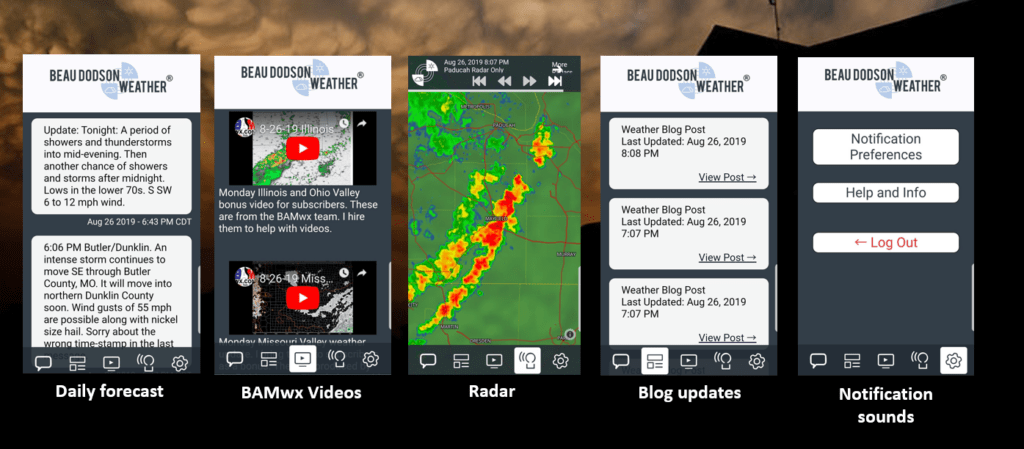
Want to receive more weather information? And receive that information straight to your cell phone?
Regional videos, long range weather videos, daily blog updates, hand typed forecasts from my keyboard to the Beau Dodson Weather app, severe weather alerts, ice storm warnings, and more!
Subscribe at www.weathertalk.com and then download the Beau Dodson Weather App from the app store.
Apple users: Beau Dodson Weather App
https://wtalk.co/9EZYG8A8
Android users: Beau Dodson Weather App
https://wtalk.co/ZEWYU8ME
Samples of what you receive.
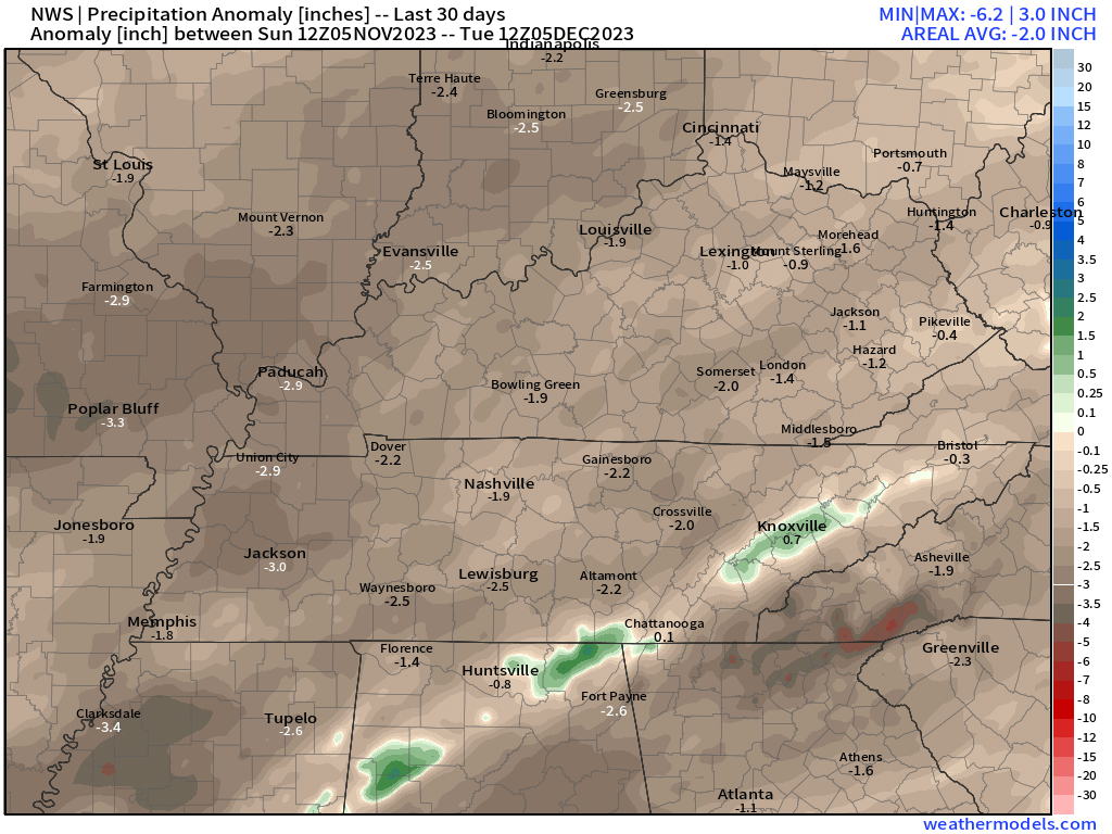
I hope everyone is having a nice week! Our first week of December has been rather uneventful. At least in the weather department! I suppose quiet is good. We do need rain. It remains mostly dry.
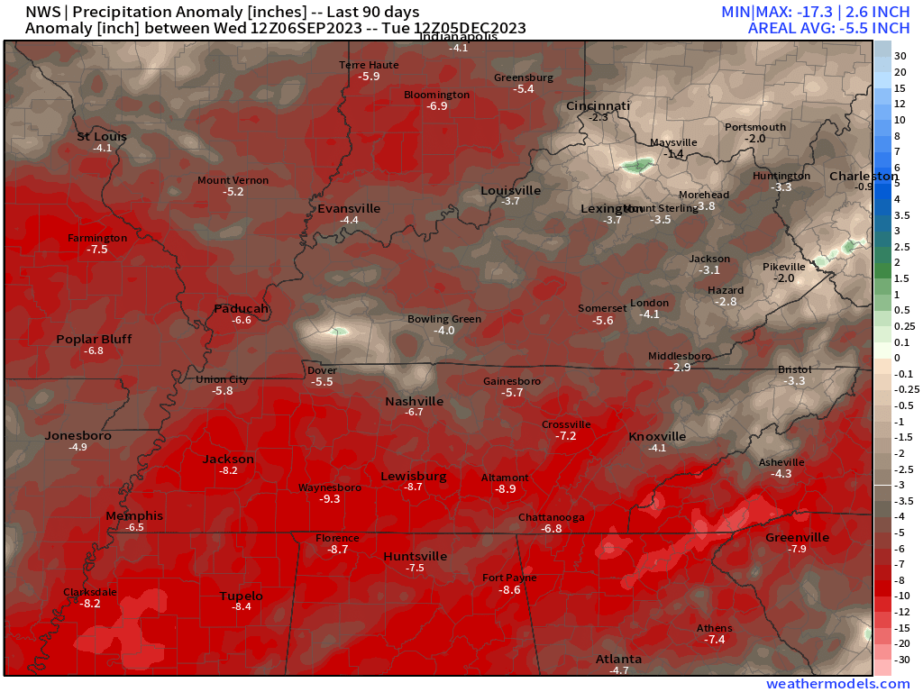
Here are the 30 and 90 day precipitation anomalies. A lot of brown on this graphic. That equals dry conditions.
Ninety-day precipitation anomaly
I know many of you continue to ask me about snow. I will talk a bit more about that below.
First, the primary concern over the coming seven days will be a weekend storm system. A rather potent one, at that.
A cold front will push across the central United States Friday night into Sunday.
An area of low pressure is forecast to develop in Arkansas and move northeast Saturday morning and afternoon. The low will push into our area.
The area of low pressure is key to who will have snow vs rain vs thunderstorms. It also is in control of whether severe weather will be a concern.
Typically, severe weather occurs on the east-southeast side of the area of low pressure. That is where the warm air resides.
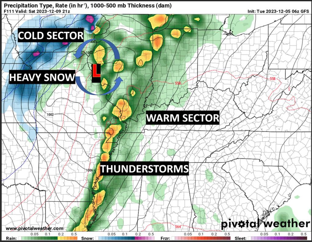
Here is an example.
This is the GFS Model for this coming Saturday. The surface weather map is for the afternoon hours.
You can see the big red L. That is the area of low pressure. Low pressure rotates counterclockwise. If the low passes to your north and west, then we are in the warm sector.
It is pulling Gulf of Mexico area northward up and around the low. I drew some arrows. The warm air is drawn northward. Meanwhile, cold air is pulled south and west behind the center of low pressure. That is the cold sector.
The south and east side of the system is where the highest chance of thunderstorms exists. It is typically where one looks for the threat of large hail, damaging wind, and tornadoes.
Keep in mind, there are many variables that go into severe weather forecasting. Just because a low passes to your north and west does not mean severe weather will develop. You also need wind shear and moisture (high dew points).
With this particular system, it does appear that we will be in the warm sector. The next question is whether there will be enough wind shear and moisture for the development of severe weather.
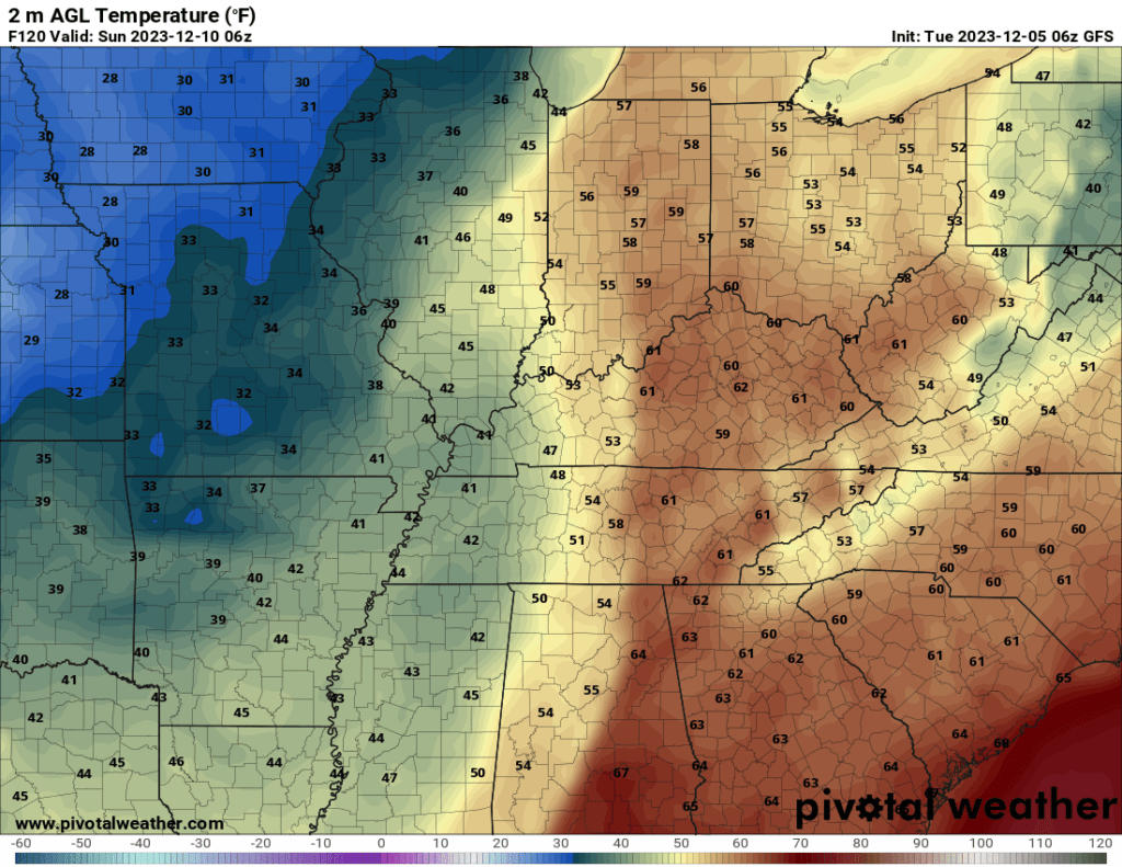
Here is the temperature map. You can see the warm air ahead of the system. Cold air behind it.
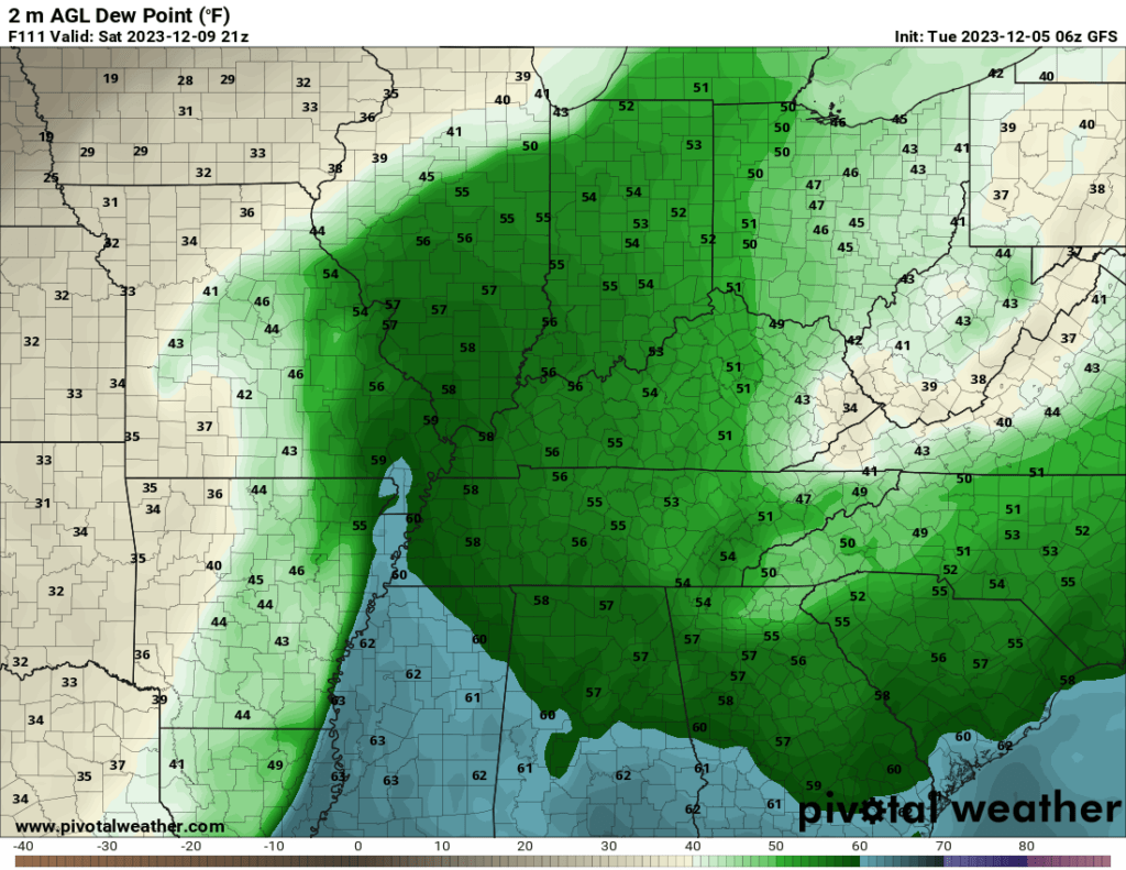
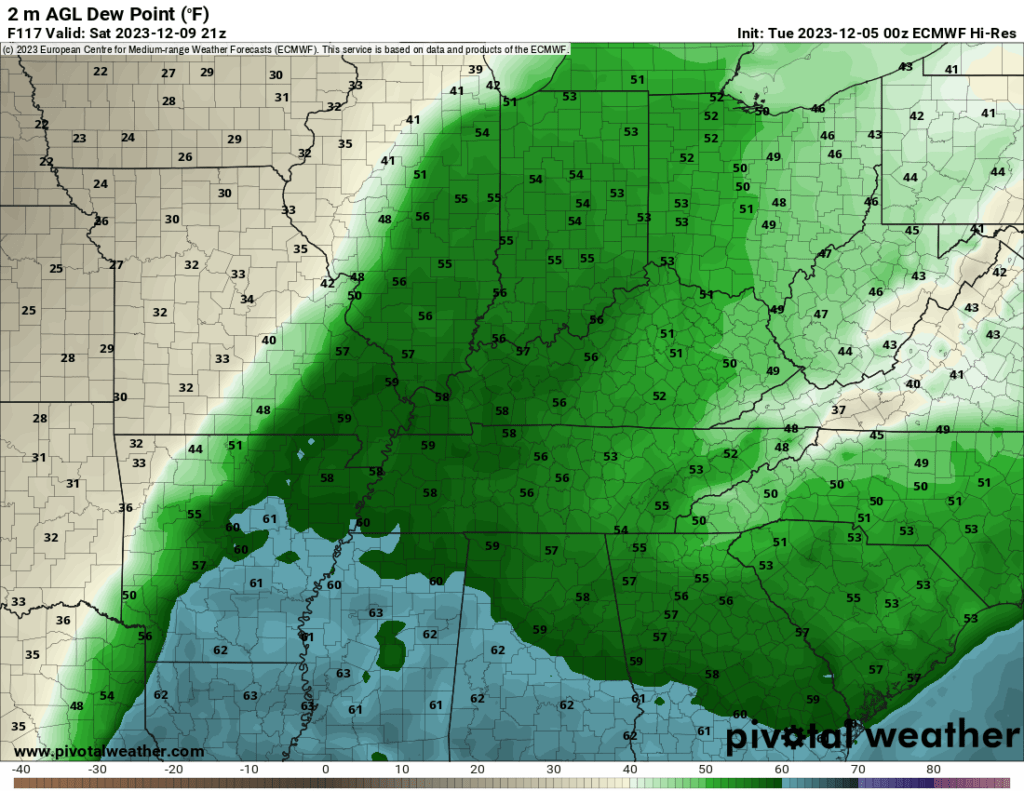
Let’s look at dew points.
Typically, I look for dew points of 58 degrees and above when forecasting severe weather.
Models are showing mid to upper 50s, for the most part. Marginal for severe weather.
With that said, data does push 58 to 62 dew points into portions of northeast Arkansas and the Missouri Bootheel. Perhaps into western Kentucky and northwest Tennessee, as well.
If dew points were in the 60s then I would be worried. For now, dew points aren’t looking all that impressive. I will monitor trends over the coming days.
GFS MODEL DEW POINT FORECAST
EC MODEL DEW POINT FORECAST
There remain questions about how deep the center of low pressure will be. Also, the exact track is still in question.
I am currently forecasting the low to pass over our region or to our north northwest. That means showers and thunderstorm chances will rapidly increase Friday night into Saturday. Lingering into Sunday.
I expect the heaviest rain to fall Saturday.
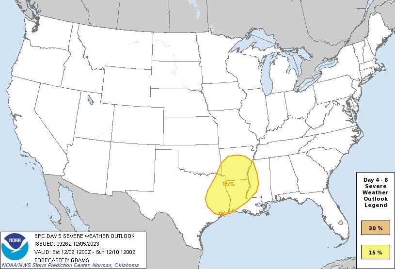
The Storm Prediction Center has outlined portions of Texas, Arkansas, Louisiana, and Mississippi for a level two or higher risk for severe weather Saturday.
You can see the outlined region on the graphic below. The SPC also said they are likely going to place our region in a level one risk. Just how far east northeast is still in question. The event is several days away.
The SPC may place portions of our region in a marginal level one severe weather risk for Saturday morning and afternoon.
The primary concern will be damaging wind and perhaps short-lived tornadoes. QLCS tornadoes are possible if a line of storms forms (a squall line). QLCS tornadoes tend to last a few minutes and are only on the ground for a few miles. They are usually EF0 to EF2 in strength.
Most of our region’s tornadoes are QLCS tornadoes. The December 10, 2021, tornadoes were supercell tornadoes. Supercell tornadoes tend to be larger and more intense. They usually are on the ground longer. This is NOT that type of event.
At this time, we are not forecasting a tornado outbreak. Monitor updates, as always.
Rainfall totals will likely hit one inch across most of the region from this event. The WPC/NOAA is a bit more bullish and is forecasting one to two inches of rain.
WPC rainfall totals forecast.
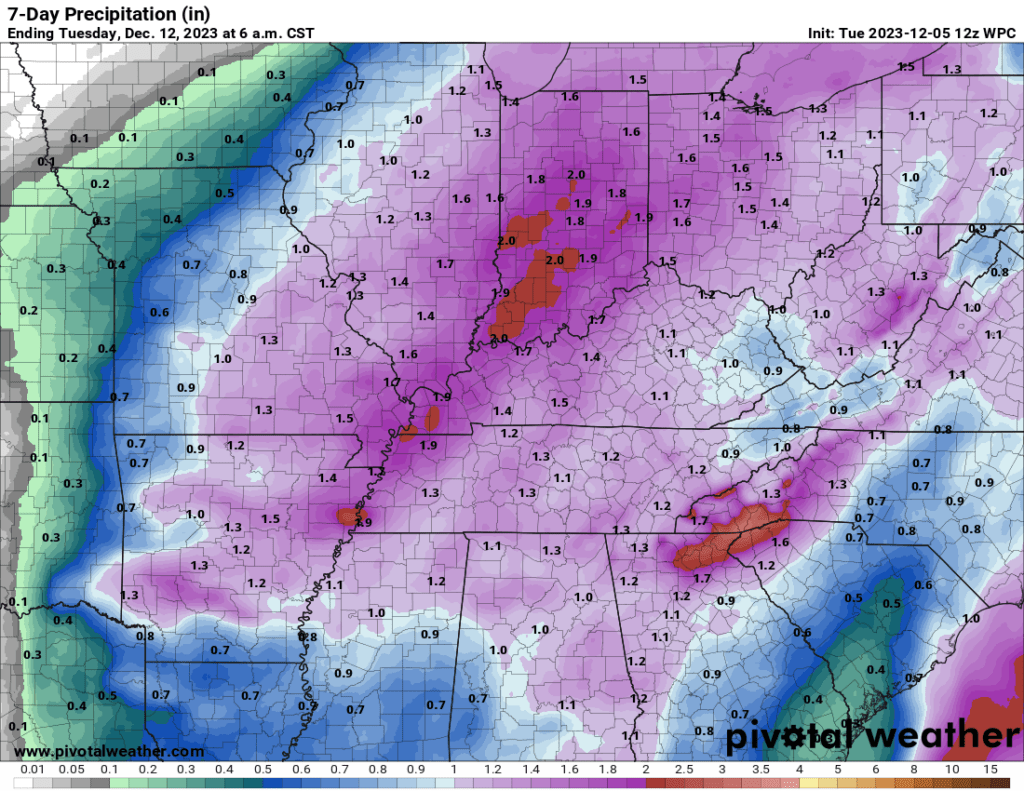
The models are leaning more towards the lower end totals, but adjustments are still likely.
What about snow?

Yes, it is true that models occasionally show snow around here by Sunday and Sunday night.
The EC model has led the way in forecasting snow. The model runs four times each day. Here was one run that showed accumulating snow in our region.
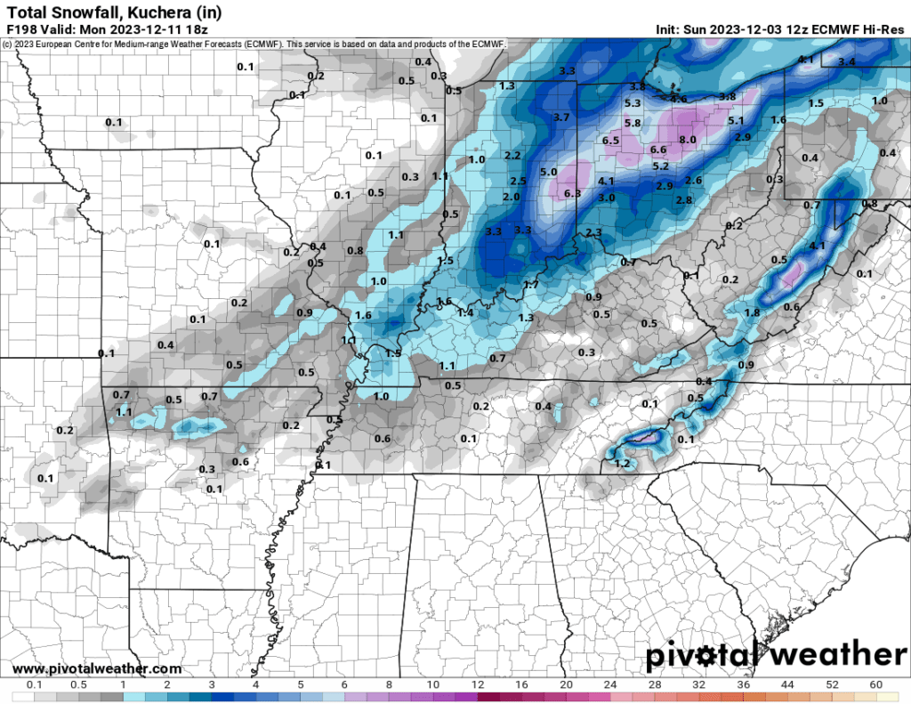
But, the EC has been an outlier. It has consistently been stronger and deeper with the area of low pressure. It drags colder air into our region fast behind the system.
That has led to it showing heavier snow.
Other models are not as bullish.
I like to look at ensembles when forecasting snow.
Remember, ensembles are the same model ran over and over and over again. Up to 100 times!
They begin the model with slightly different variables. The more squares that agree, the higher the confidence in the forecast outcome.
If 90 out of 100 squares show heavy snow, then my confidence in snow is high. If only ten of the squares show snow, then my confidence in snow is low.
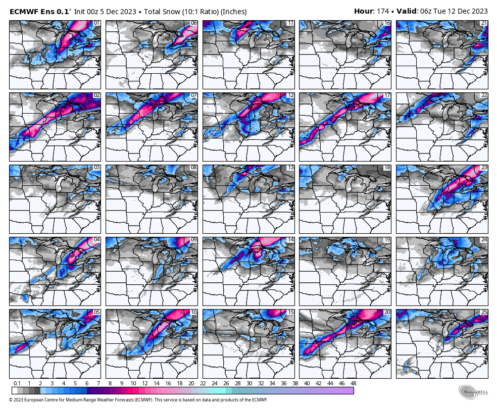
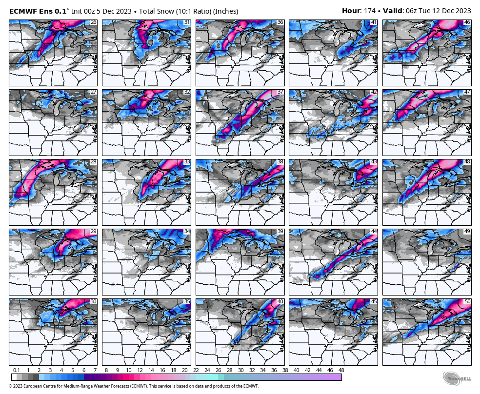
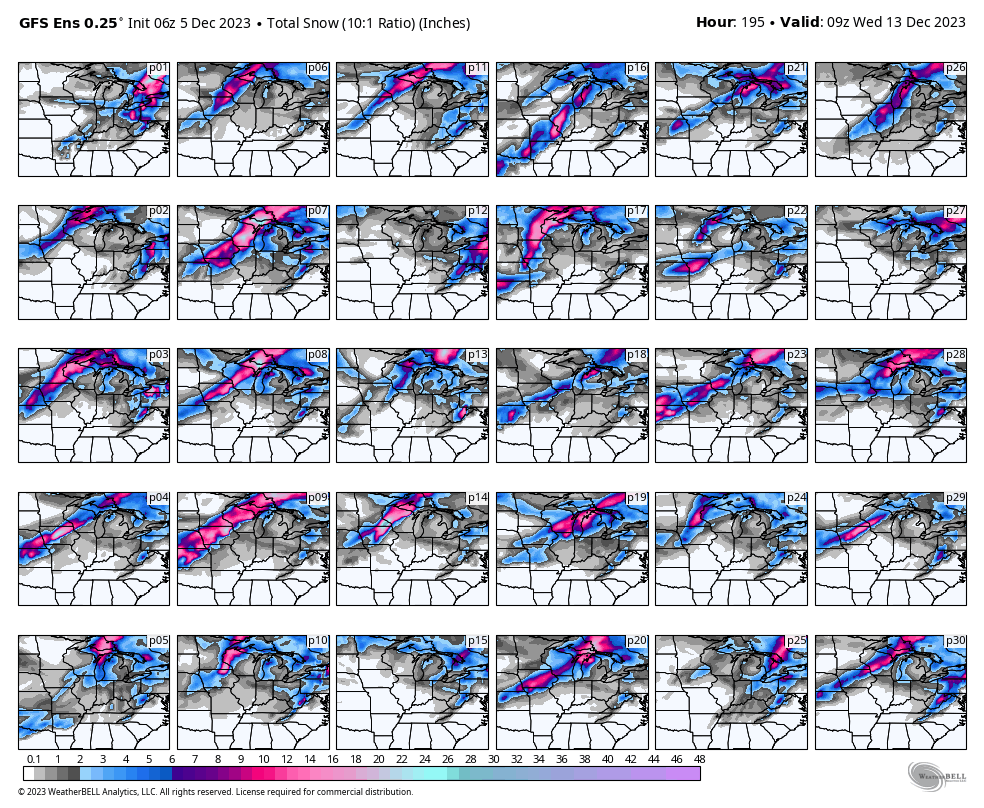
Let’s look at the ensemble snowfall totals for this event.
How many squares show the heavy snow over our area? Perhaps four or five of the squares. There are a total of 75 squares.
Not many.
The bulk of the ensembles show the heavy snow well away from my forecast counties.
Quite a few of the squares do show snow showers in our region. I can’t rule out the rain ending as a brief wintry mix as the system pulls away.
Typically, rain ending as snow around here does not amount to much. For now, don’t get too excited snow lovers. Keep checking back for updates.
Adjustments to the forecast are always possible. Esp this far out.
Let’s look at the mean of the ensemble squares.
What is the probability of one inch or greater snowfall this weekend?
Here is the GFS and EC models.
The GFS says no chance.
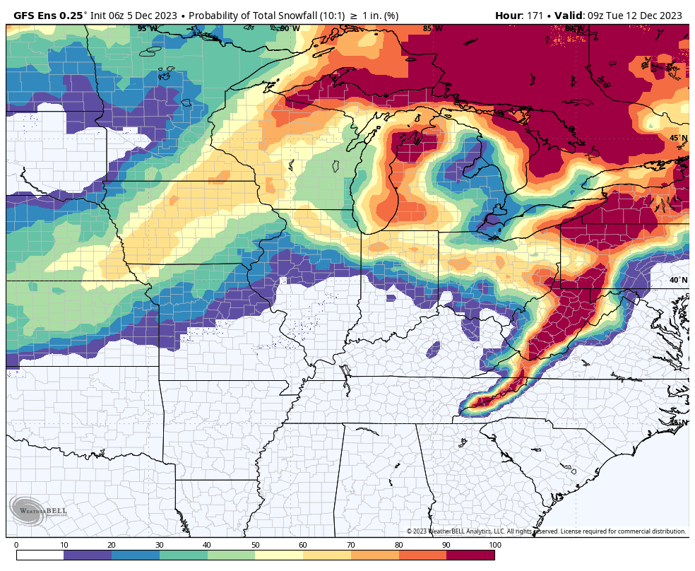
The EC model shows low chances.
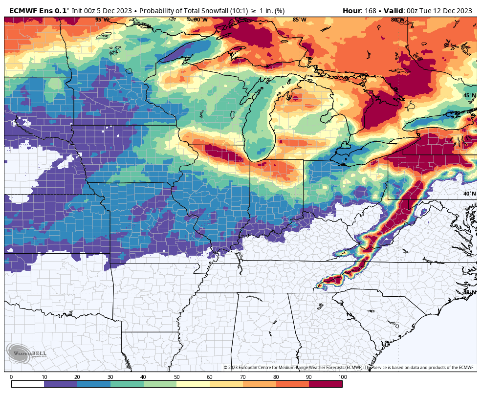
So, for now at least, the chances of a white Sunday and Monday are looking pretty slim. That doesn’t mean we won’t have snow. The event is still several days out. Adjustments are always possible.
I could see a case for rain ending as rain/snow Sunday and Sunday night. With little or no accumulation. That is going to be my current forecast. Then, I will monitor trends in the data and adjust accordingly.
Windy conditions are likely into this weekend. Numerous days and nights with 10 to 20 mph gusts. There will be time periods of 20 to 35 mph wind gusts. Christmas decorations won’t appreciate the wind gusts.