December 6, 2023
Posted by Meteorologist Beau Dodson
Forecast discussion below
Want to receive more weather information? And receive that information straight to your cell phone?
Regional videos, long range weather videos, daily blog updates, hand typed forecasts from my keyboard to the Beau Dodson Weather app, severe weather alerts, ice storm warnings, and more!
Subscribe at www.weathertalk.com and then download the Beau Dodson Weather App from the app store.
Apple users: Beau Dodson Weather App
https://wtalk.co/9EZYG8A8
Android users: Beau Dodson Weather App
https://wtalk.co/ZEWYU8ME
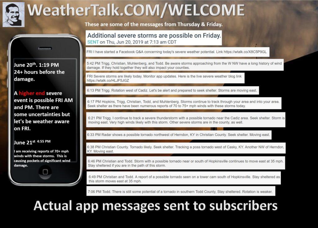
Samples of what you receive.

Good day, everyone. I continue to track a strong weekend storm system. Snow lovers will not be happy. At least for now.
There is still a small chance this system produces snow in our region. It is a long shot, but I am watching it.
The track of the low is still too far north and west. That places us in the warm sector. The warm sector is where showers and thunderstorms will occur.
We would need a second low to form along the Gulf of Mexico and move up along the front in order to produce higher snow chances. Could that happen? It could, but the odds are low. Some models do show that happening.
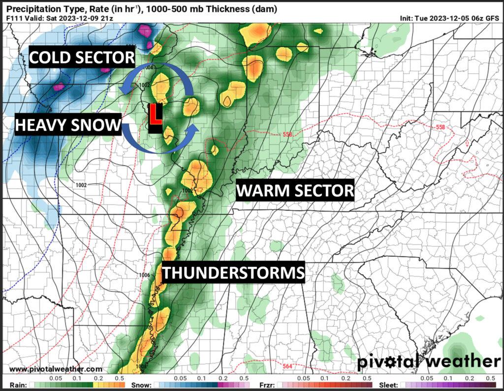
The cold air will remain well to our west and north (at least early on). With time, the cold air will slowly ooze into our region, but most of the moisture will be gone by then.
I can’t rule out the rain ending as snow or snow/rain showers late Saturday night into Sunday. Accumulation appears unlikely. As always, I will continue to monitor it for you. This event is still several days out.
Again, the only thing that could drastically change the forecast is if a second low forms to our south and east.
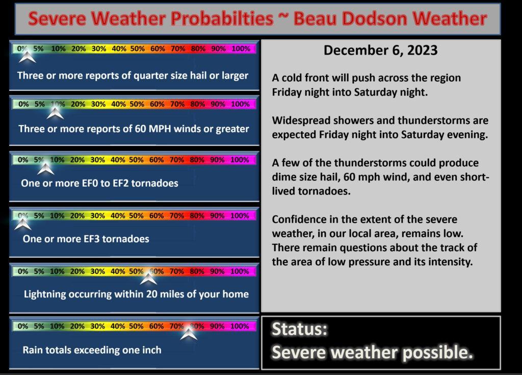
I am somewhat concerned about the risk of severe thunderstorms.
First!
The big tornado in 2021 was produced by a supercell thunderstorm. Those tend to be large, long tracked, and violent. This is NOT that kind of setup.
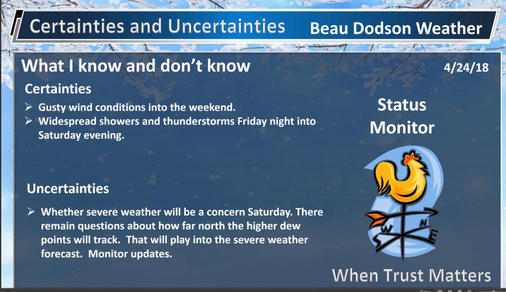
There remain questions about how far north and east to bring the severe weather threat.
Confidence in severe weather developing remains low. For now, at least. I expect confidence to increase by Thursday night and Friday. That will bring us into the high-resolution model timeframe.
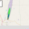
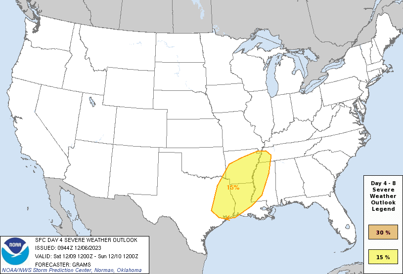
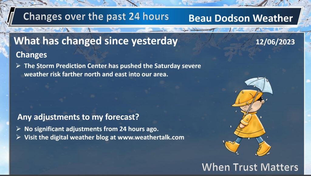
This is the current Storm Prediction Center severe weather outlook. The SPC is a branch of NOAA. They have shifted this north and east with every update over the past three days.
They will likely place our region in a level one risk for Saturday’s severe threat. The yellow zone below will be at least a level two risk zone. It could be a level three in some areas.
The level one outlook won’t be issued until late tonight. That will be the first outlook that will include level one risk zones. The risk levels go up to five. One is the lowest. Five is the highest.
The primary concern will be damaging wind and perhaps a QLCS tornado risk. QLCS tornadoes tend to be short-lived. They are typically EF0 to EF2 in strength.
QLCS tornadoes tend to be embedded in a line of thunderstorms. They are hard to warn on. They can even happen in-between radar scans.
The big tornado in 2021 was produced by a supercell thunderstorm. Those tend to be larger, long tracked, and violent. This is NOT that kind of setup.
This weekend’s setup is a common winter event for our region. Low CAPE/energy, marginal dew points (moisture), and strong wind shear (turning of wind with height).
All of that makes for a low confidence forecast. A marginal severe weather setup.
The bottom line is that we should monitor updated forecasts for Saturday. Adjustments in the parameters are likely and that would cause a shift in the forecast.
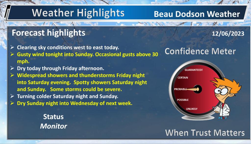
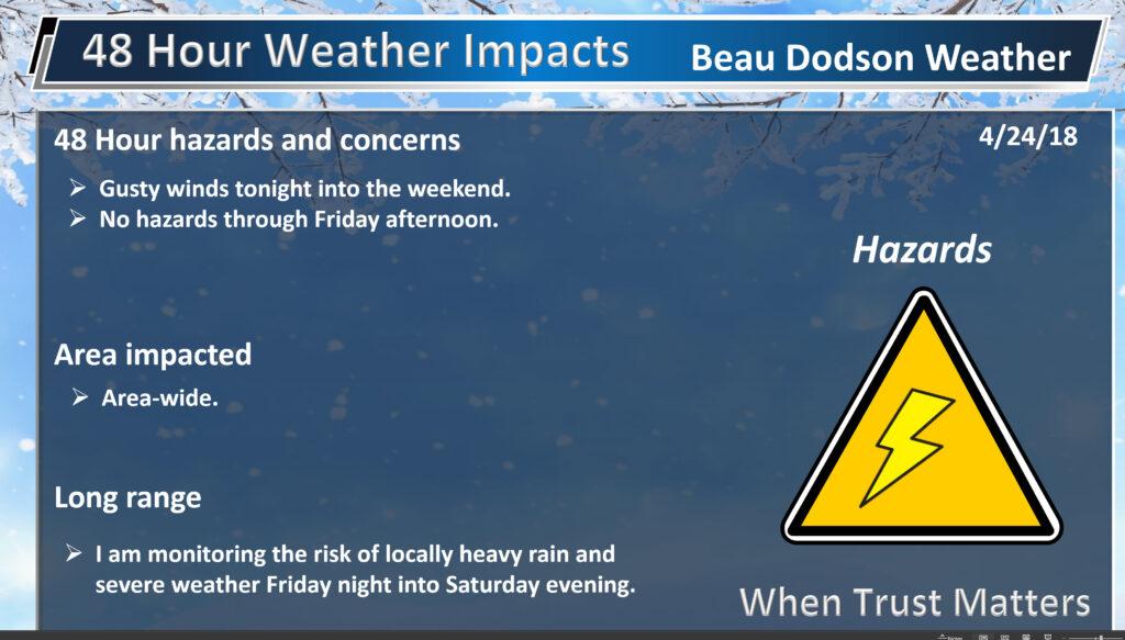
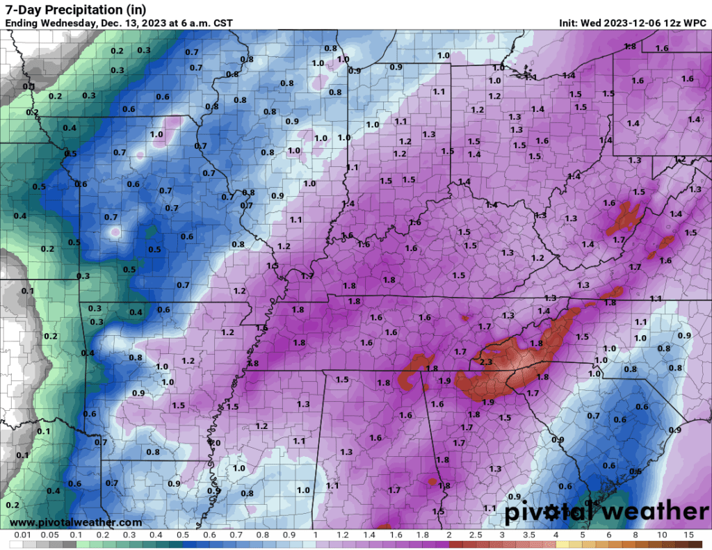
Rainfall totals will vary. I am forecasting a widespread one-inch rain event. There could be totals over an inch.
The WPC/NOAA rainfall outlook shows that nicely. Take the general idea from this.
Monitor updates concerning the weekend system. I will know quite a bit more over the next 48 hours.