December 7, 2023
Posted by Meteorologist Beau Dodson
Forecast update (scroll down)
Want to receive more weather information? And receive that information straight to your cell phone?
Regional videos, long range weather videos, daily blog updates, hand typed forecasts from my keyboard to the Beau Dodson Weather app, severe weather alerts, ice storm warnings, and more!
Subscribe at www.weathertalk.com and then download the Beau Dodson Weather App from the app store.
Apple users: Beau Dodson Weather App
https://wtalk.co/9EZYG8A8
Android users: Beau Dodson Weather App
https://wtalk.co/ZEWYU8ME
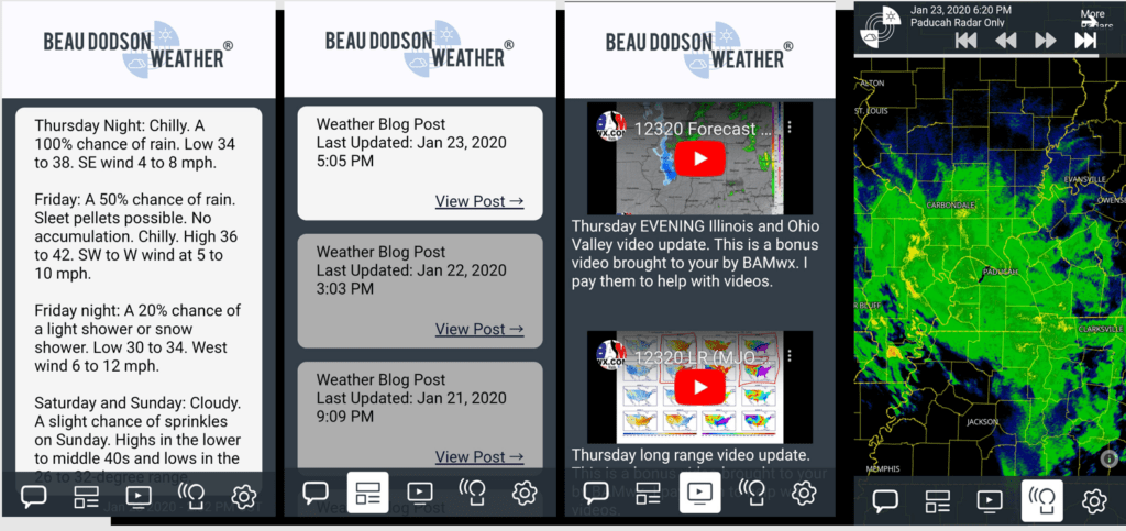
Samples of what you receive.
Highlights
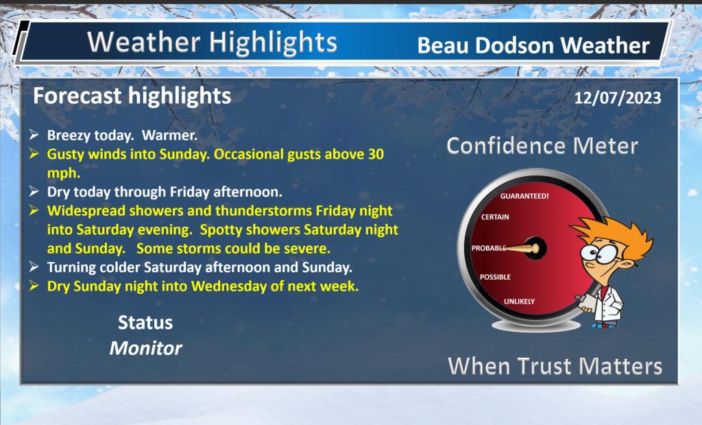
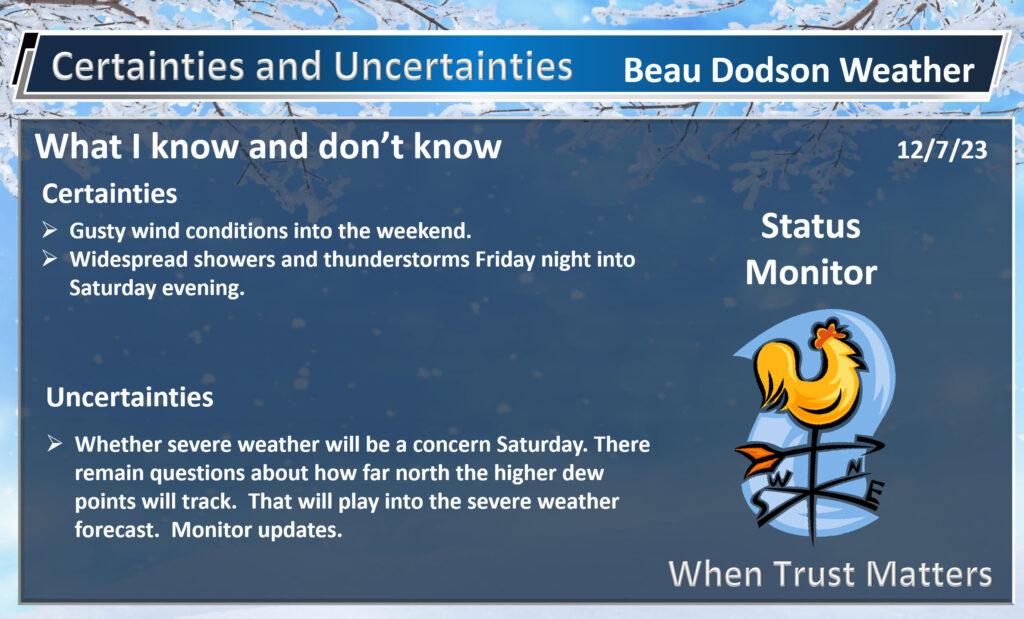
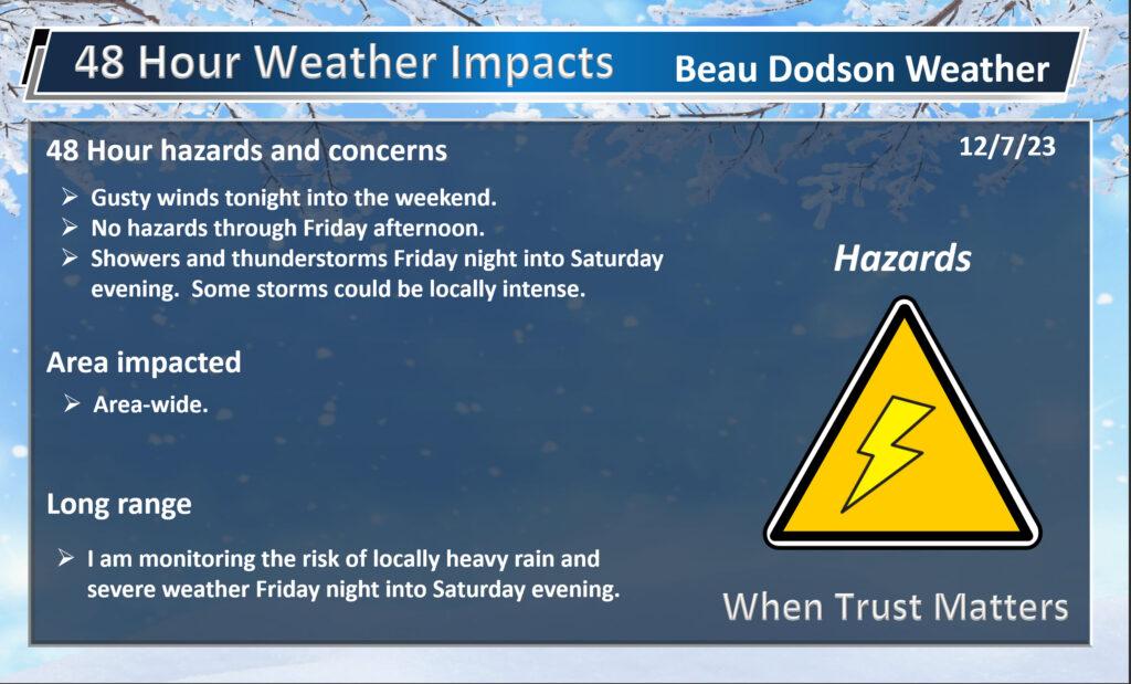
No weather concerns today through Friday afternoon. Gusty wind, from time to time. Warming temperatures.
A strong cold front will push through the region this weekend.
I continue to monitor the risk of severe weather Saturday. This is a conditional low-end risk of damaging wind and short-lived tornadoes.
It is possible that we avoid severe weather altogether. This is what we call a conditional severe weather risk.
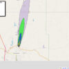
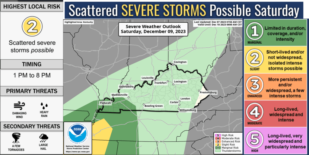
Currently, the Storm Prediction Center has portions of our region in a level one severe weather risk. The scale goes to five. Five being the highest risk.
A level two risk (slight risk) extends into northwest Tennessee. The yellow zone.
The light green zone is where lightning is possible, but storms should remain below severe levels. The dark green zone is the level one risk. The yellow is a level two risk.
There are some severe weather ingredients, with this event, that are lacking or questionable. If those ingredients are not in place, then severe weather won’t develop.
This is not unusual for December. We typically see these marginal events during December and January. I call them babysitting events. There is a decent chance nothing will happen, but we will have to closely monitor the radars.
This is NOT like December 10, 2021. December 2021 was a supercell thunderstorm outbreak. Supercells produce long tracked violent tornadoes. We are NOT forecasting supercells Saturday.
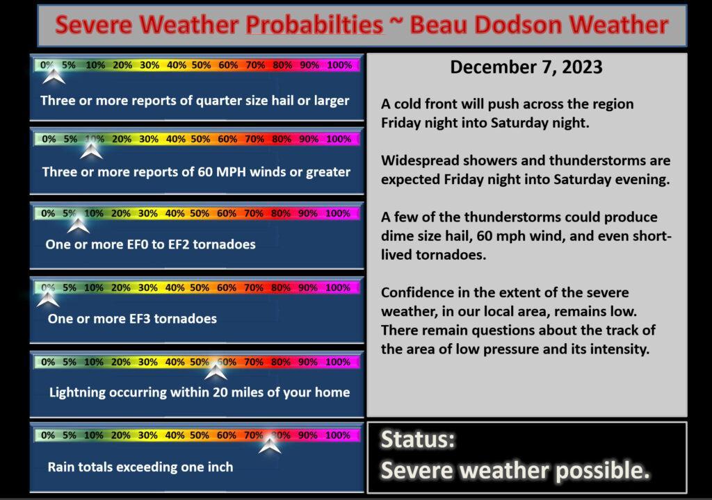
The front will enter southeast Missouri Saturday morning and then continue eastward across our region. The front will slow as a wave of low pressure develops along the Gulf of Mexico and moves northeast along the front.
Widespread showers and thunderstorms will push into the region Friday night into Saturday. Now, there have been some changes.
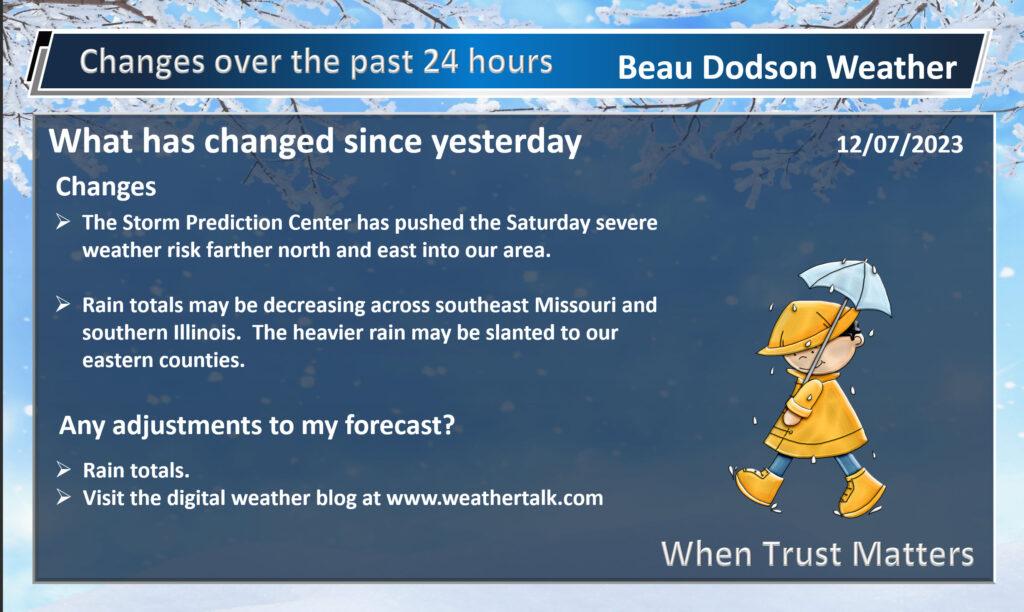
One change, from 24 hours ago, is to lower rain totals across southeast Missouri and southern Illinois. And, I am not sure we are done with adjustments.
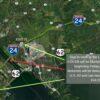
Several days ago, the rain totals map looked like this.
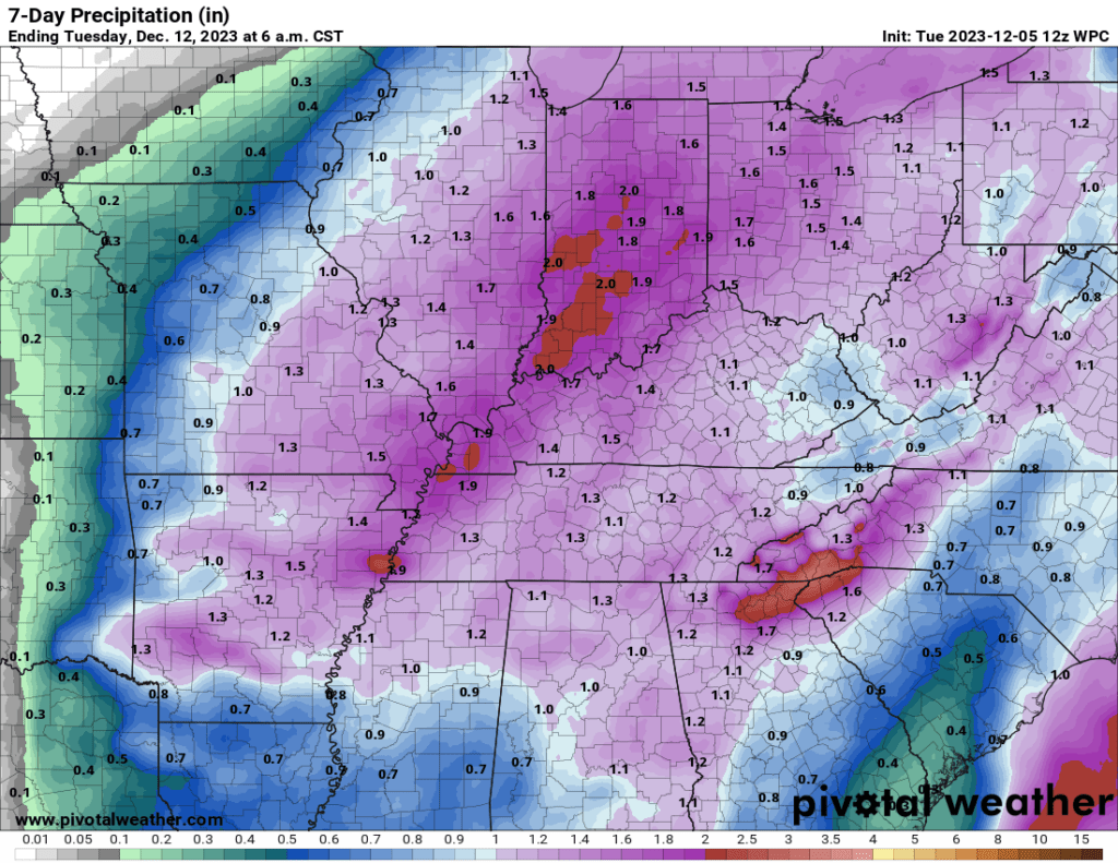
Now, look at this new map. Quite a change for portions of the area.
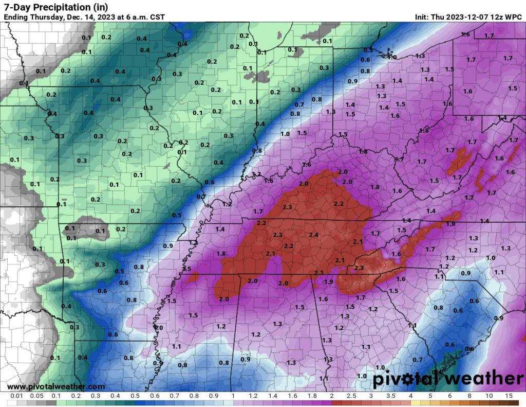
The primary reason for the change is that the first area of low pressure will not be as strong as earlier forecast. That is the low-pressure center that tracks northeast into Missouri, Iowa, and Illinois.
That one will produce scattered to numerous showers and thunderstorms across the area Friday night and Saturday.
The second wave of rain will develop to our south and move north northeast. How far west this rain shield pushes will be key to rain totals in our area.
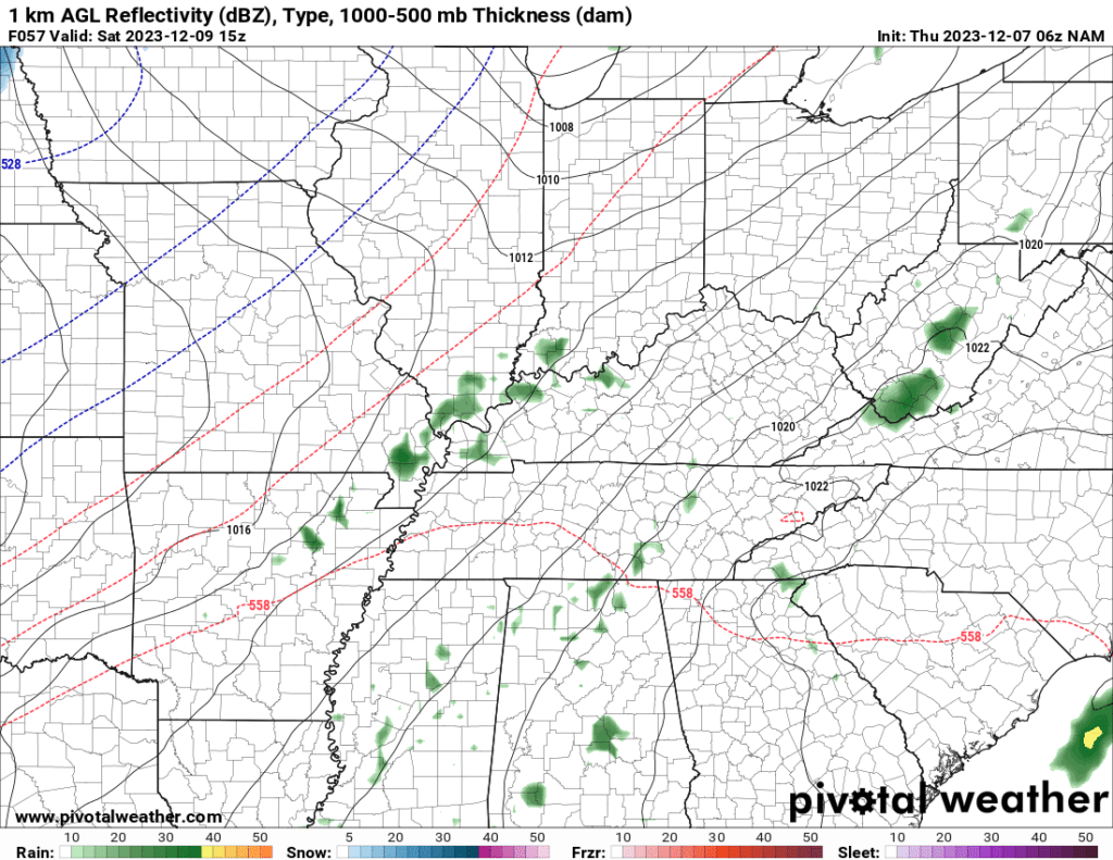
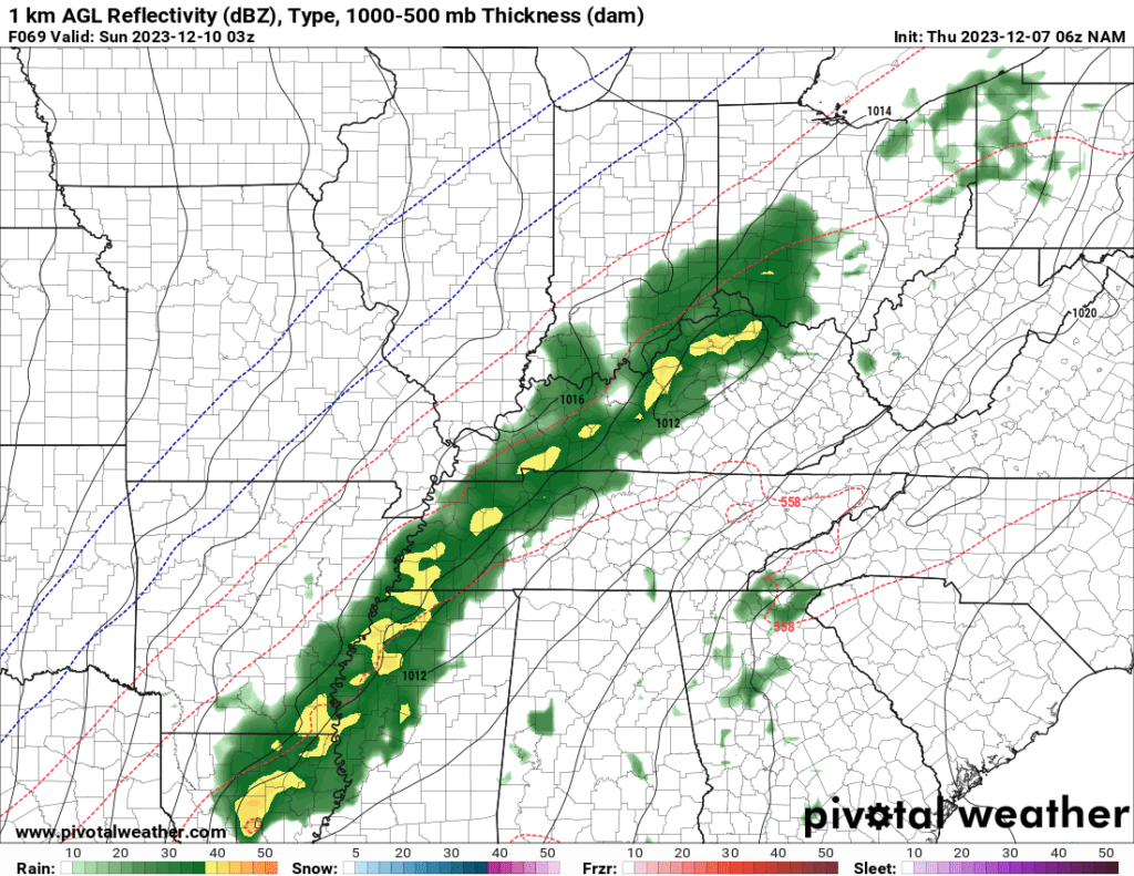
You can see that development on these two graphics.
Round one of rain will be with the cold front Friday night and Saturday. Round two will be Saturday afternoon into Saturday night.
9 AM future-cast radar from the NAM model. Scattered to numerous showers and thunderstorms in the region.
Now look at Saturday afternoon. Notice how the rain area expanded and increased in intensity. That is occurring in response to the wave of low pressure moving northeast along the front.
That storm may turn into quite the snowstorm for the northeast United States.
Showers will linger into Saturday night as colder air arrives. There is a chance that a few wet snowflakes will mix in with the rain. No accumulation or impacts anticipated.
Sunday will deliver a mix of sun and clouds. Perhaps a few lingering showers or rain/snow showers.