Forecast update (scroll down)
Want to receive more weather information? And receive that information straight to your cell phone?
Regional videos, long range weather videos, daily blog updates, hand typed forecasts from my keyboard to the Beau Dodson Weather app, severe weather alerts, ice storm warnings, and more!
Subscribe at www.weathertalk.com and then download the Beau Dodson Weather App from the app store.
Apple users: Beau Dodson Weather App
https://wtalk.co/9EZYG8A8
Android users: Beau Dodson Weather App
https://wtalk.co/ZEWYU8ME
Samples of what you receive.
Good day, everyone. I hope you enjoyed the weather over the past week. A bit cool, at times. Windy, as well.
We have an active weekend ahead of us. We have been talking about this system for about two weeks! Now, it is almost upon us.
First. This is NOT like December 10, 2021. Not even close. There are no similarities between tomorrow’s risk and that one. The December 2021 event had MUCH higher severe weather parameters and ingredients.
With that said, if a tornado hits your home, then for you it is like December 10th. That is why I don’t like to compare events. It only takes one tornado to ruin the day. Let’s stay weather aware.
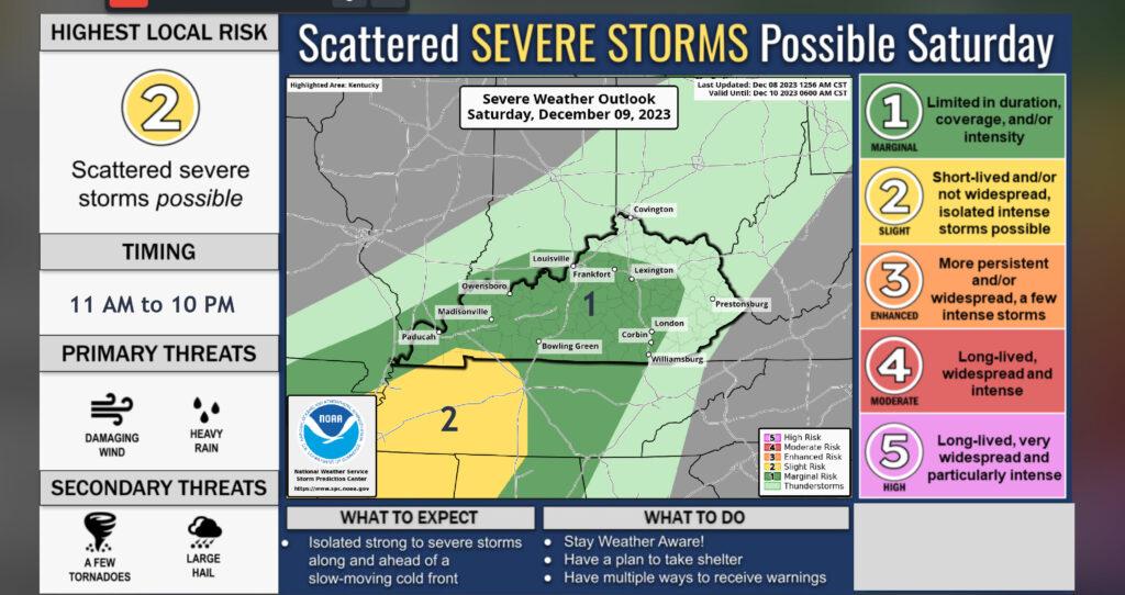
We are now in a level one and two risk of severe weather Saturday. The primary time of concern will be 11 am through 10 pm.
Weather Highlights
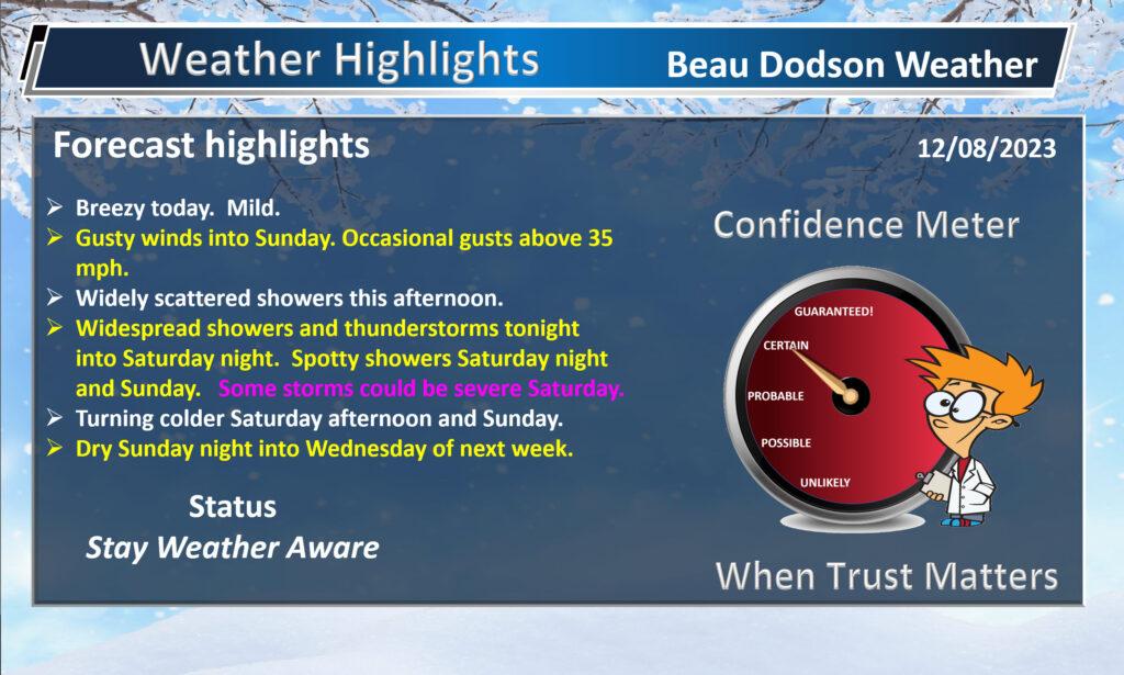
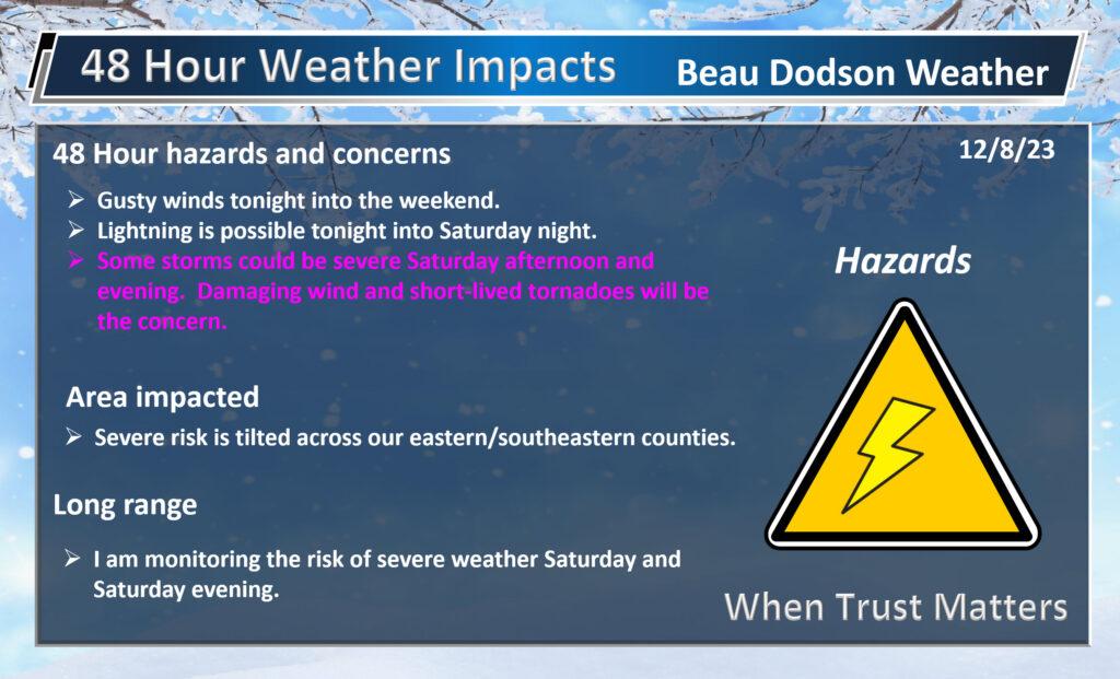
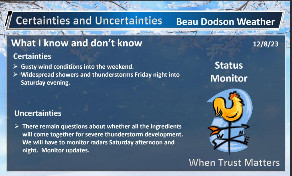
The primary concern will be damaging wind and short-lived QLCS tornadoes.
What are QLCS tornadoes? I knew you would ask!
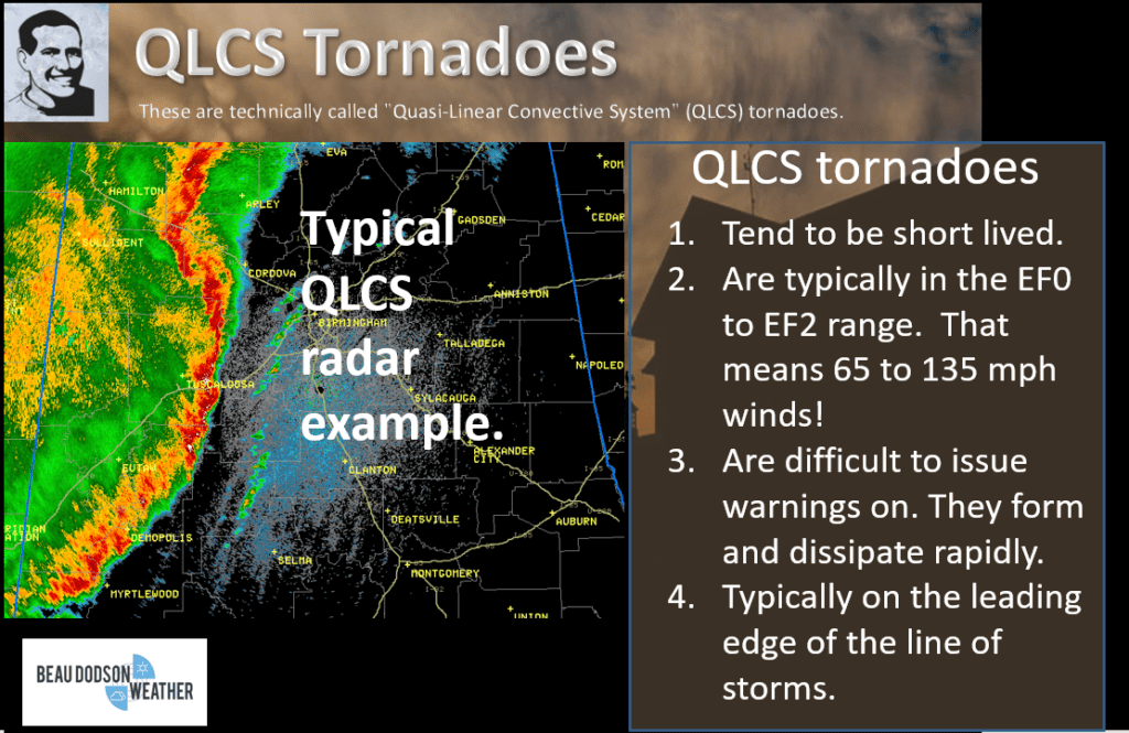
Let me show you some future-cast radar imagery. I did not focus on tonight’s rain or tomorrow mornings.
This animation is showing you the timeframe of concern when thunderstorms could become severe. Time-stamp upper left. Zulu time. 00z=6 PM. 06z=12 AM. 12z=6 AM. 18z=12 PM.
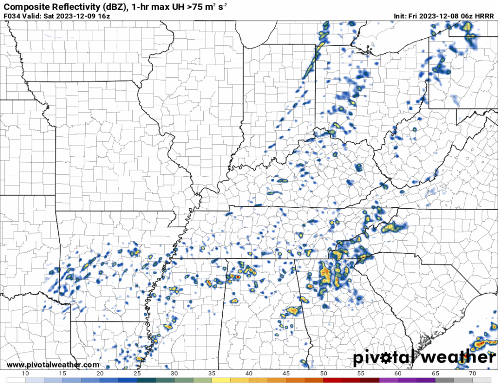
Let me show you a few future-cast radar graphics from the Hrrr model.
12 PM future-cast radar. A few storms over northeast Arkansas and then some across Kentucky and Tennessee.
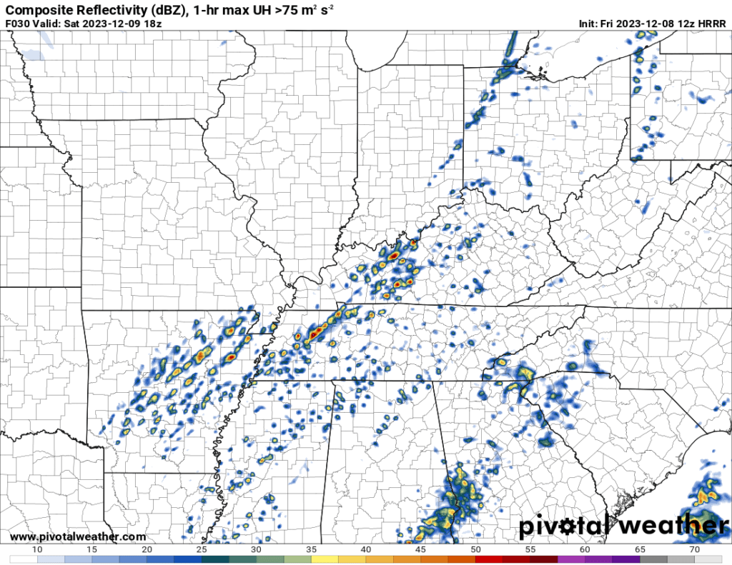
2 PM Saturday. Storms expanding into the area from southwest to northeast.
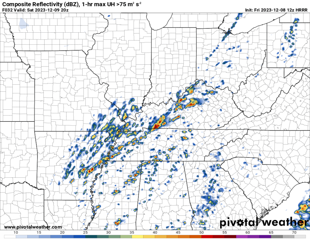
4 PM Saturday. Storms moving east northeast through the area from southwest to northeast.
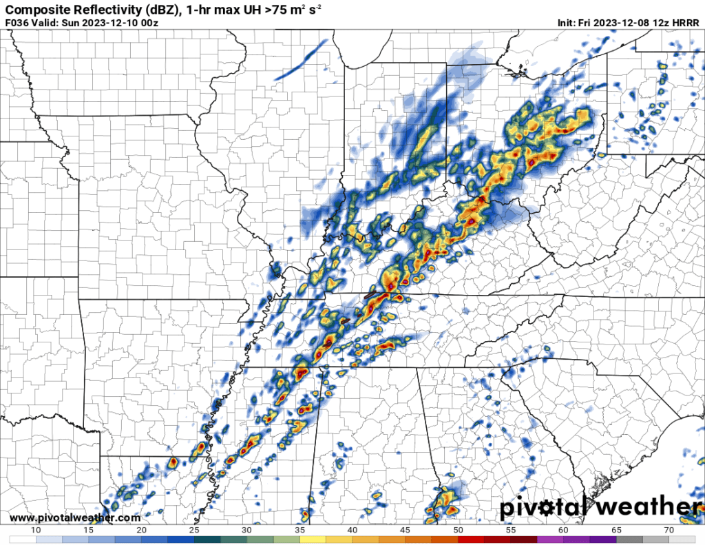
6 PM future-cast radar. Saturday. Storms continue to move eastward across the region. Storms will exit west to east Saturday evening and mid-evening. That will bring an end to the severe weather threat.
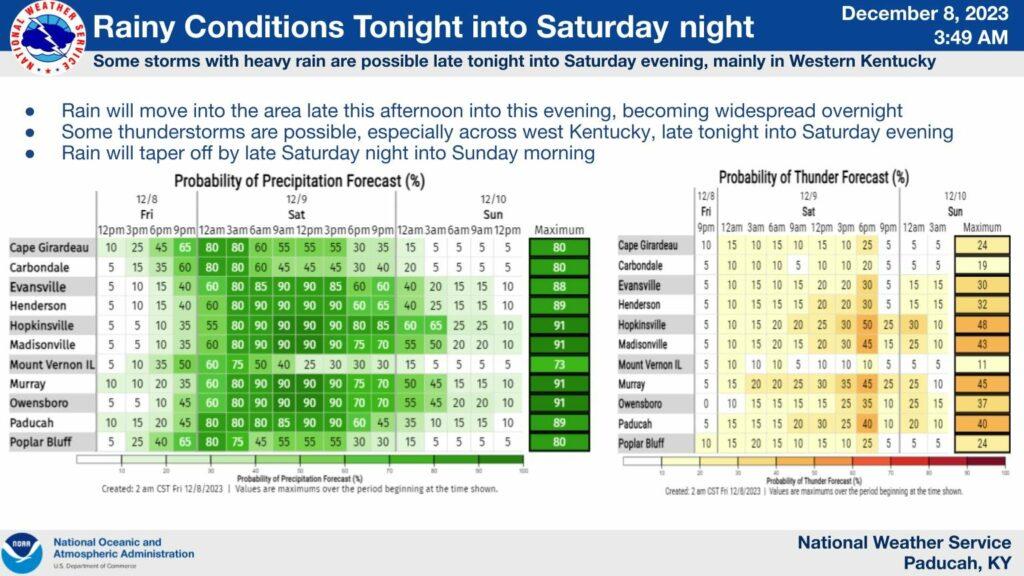
The Paducah, Kentucky NWS put this out for a timeline on the higher rain and storm chances.
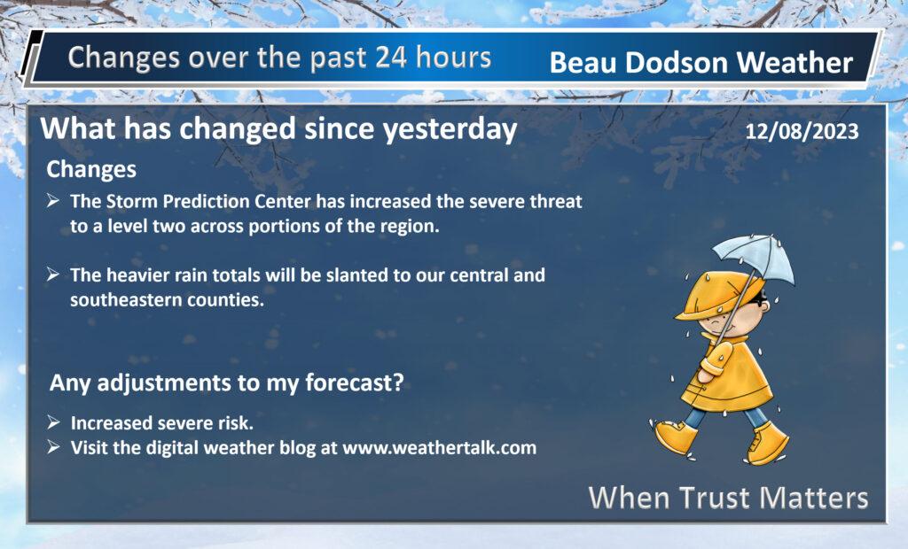
There remain some questions about this event.
This is what we call a conditional severe weather threat. Some of the parameters to produce severe weather are lacking or marginal, at best. If everything doesn’t come together just right, then severe thunderstorms won’t develop.
I call these events babysitting events. They are typical during the winter months. I will have to monitor radar all afternoon and evening (Saturday).
I will be sending out app notifications. Make sure you have the Beau Dodson Weather app. Again, subscribe at www.weathertalk.com and then download the app. Enter your phone number and you will be good to go.
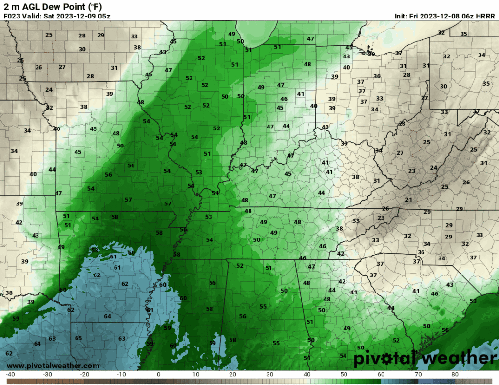
I am watching dew points Saturday. Typically, when I forecast severe weather I am looking for dew points of 58 degrees and above. At least during the winter months. Those numbers are usually higher during the spring and summer.
Here is one models opinion on dew points. Blue is 60 degrees and above (dew points). Again, dew point is moisture that storms tap into. Higher dew points usually mean a higher risk of severe thunderstorms.
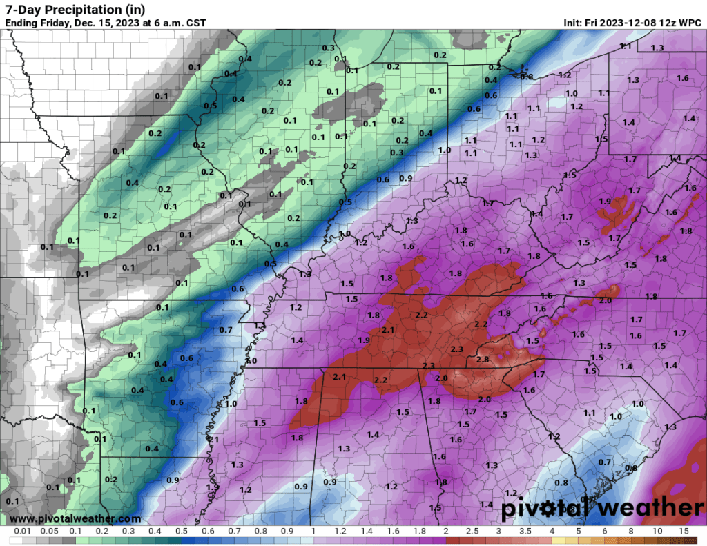
Rainfall totals have been an issue with this event. I tried to stay around one inch throughout my forecast comments over the past week. Other data was showing one to three inches. I kept my forecast low, because I was worried about the primary system going farther south and east.
That appears to be what will happen.
That means lower totals over our northwest counties and higher totals over our southeast counties.
A fairly sharp range of rain totals from northwest to southeast.
Here is the latest WPC NOAA rainfall outlook. You get the idea from this graphic. Heavier southeast vs northwest. Notice the sharp cutoff with lower totals vs higher totals.
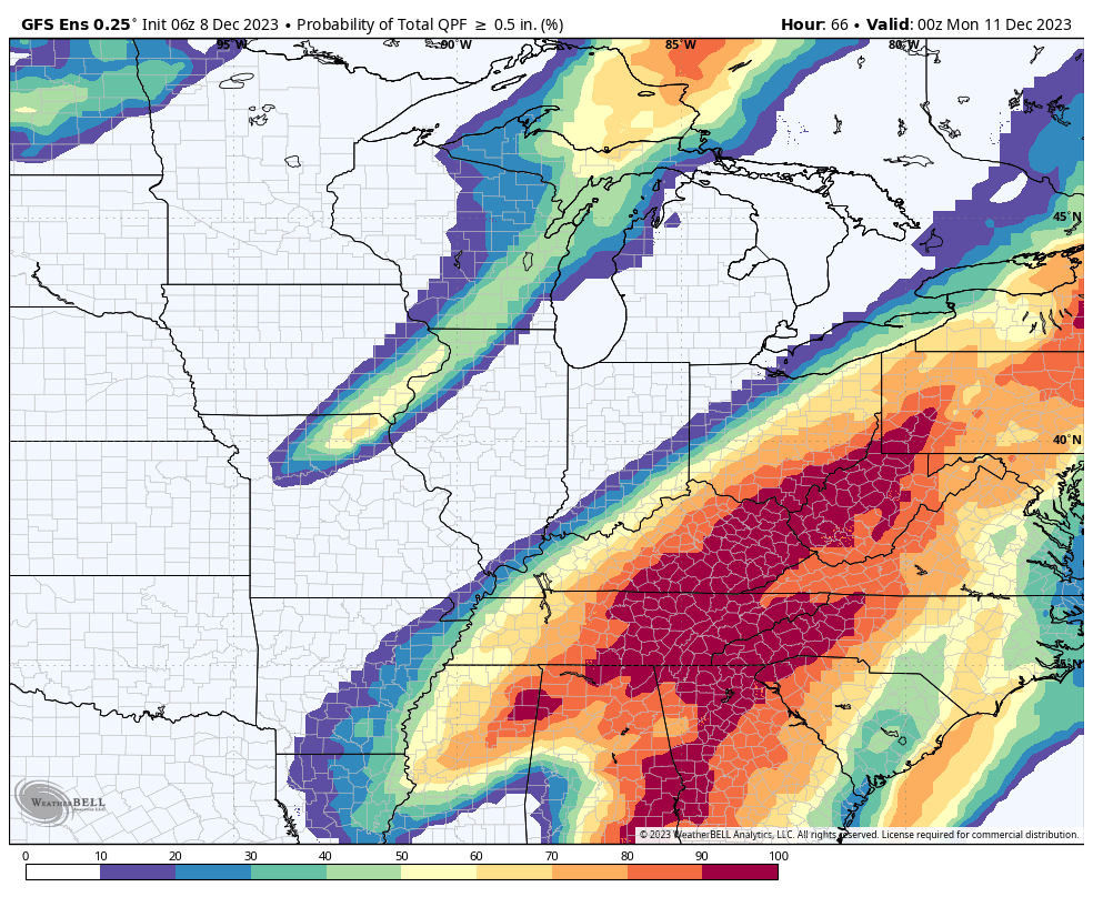
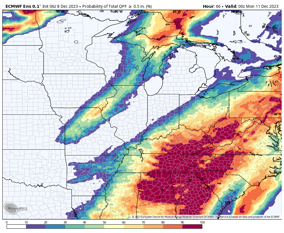
Let me show you the GFS and EC ensembles.
Ensembles are the same model ran over and over again. Up to 100 times! Ensembles give us a better range of ideas when it comes to forecasting what will happen.
These two graphics show the ensemble mean. What is the % chance of 0.50″ of rain or greater? Again, notice how the higher probabilities are skewed over our southeastern counties vs northwestern.
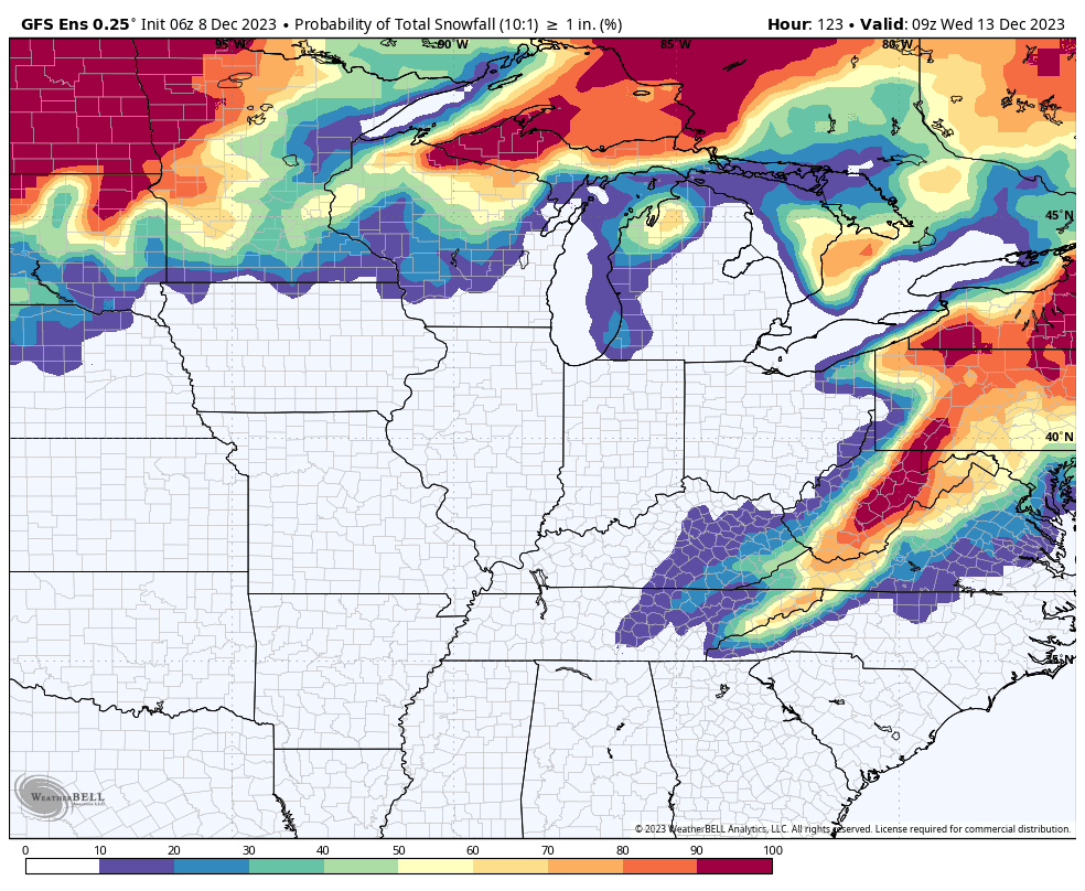
A few showers will remain into Sunday, but the bulk of the event will move east northeast as we move through Sunday morning. The rain could end as a rain snow mix. No accumulation.
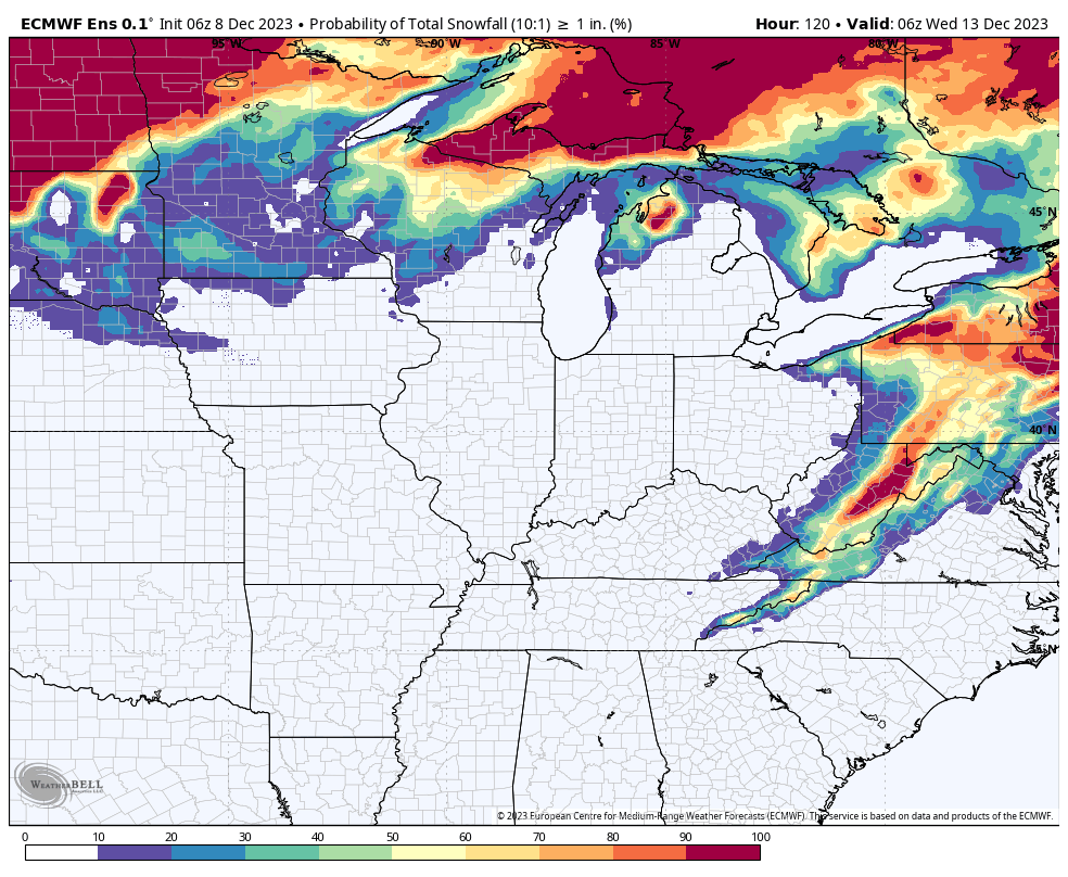
Here is the ensemble mean forecast for one inch of snow. What is the probability of one or more inches of snow?
They show no chance locally.
Gusty winds and colder air will filter into the region Saturday afternoon and night. As a matter of fact, temperatures may actually fall during the day over our western and northwestern counties. We will just have to see how fast the front exits the rest of the region.
Let’s stay weather aware this weekend.