Posted by Meteorologist Beau Dodson
Scroll down for the latest forecast discussion and graphics.
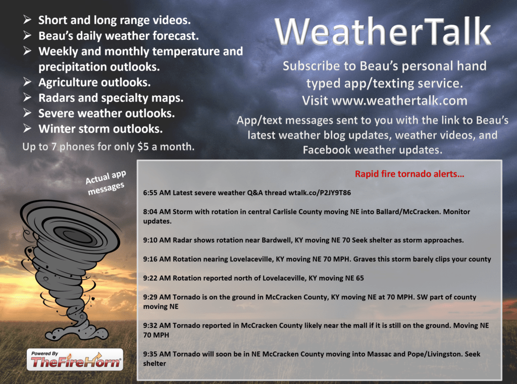
Want to receive more weather information? I provide a service through www.weathertalk.com
You can receive daily weather forecasts, blog updates, special weather statements, severe weather alerts, tornado alerts, ice storm warnings, winter storm alerts, videos, long range videos, long range outlooks, and more!
Subscribe at www.weathertalk.com
Samples of what you will receive. Once you subscribe, download the Beau Dodson Weather App in the app store. Need help? Email me at beaudodson@usawx.com

I will post an updated Christmas forecast a bit later this morning. Check back for that. Active pattern likely the week of Christmas. Several systems to monitor.
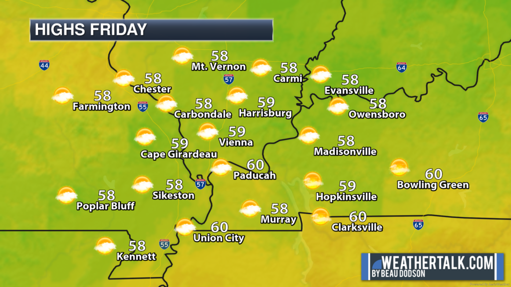
Who ordered the warm weather! Our December forecast was for milder than average conditions. That is certainly being delivered.

Well, I know there are quite a few holiday/Christmas parades tomorrow, but the weather may not be ideal.
If you have outdoor events, then the best advice is to monitor the radars and plan accordingly.
Widespread rain will be knocking our door late tonight into early Saturday morning. That rain will then track eastward across the region as we move through the day (Saturday).
Saturday afternoon will offer up widespread showers. That will continue into Saturday night. It will then taper off west to east late Saturday night into Sunday morning.
A few lingering showers Sunday morning over our eastern counties.
Rainfall totals will likely range from 0.05″ to 0.30″ across southeast Missouri and southwest Illinois. Rain totals over the rest of the region will range from 0.30″ to 0.60″. Locally higher over our far eastern counties (Pennyrile area of western Kentucky).
No severe thunderstorms. No tornadoes. Thankfully. We had enough of those last weekend.
Here is the latest WPC/NOAA/NWS rainfall map. Most of this will fall Saturday and Saturday night.

Here is some timing information. These are rain probabilities with different timestamps. The time is located on the top of the graphic. The rain % chance in green.
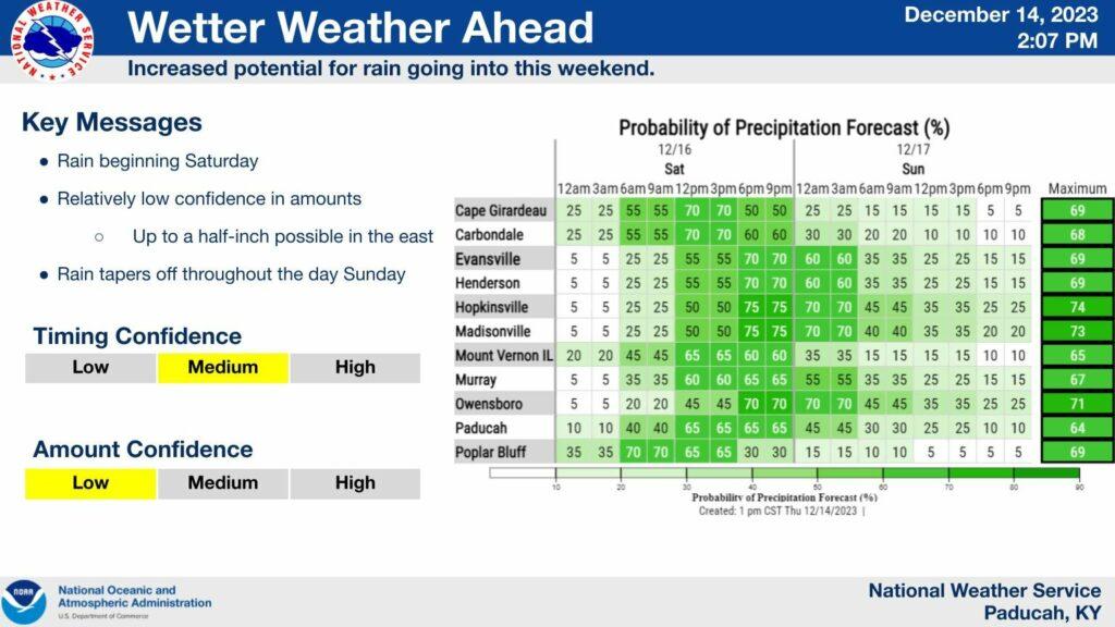
Let’s look at the Hrrr model. A high resolution model. Timestamp upper left.

Again, the rain will taper off late Saturday night into Sunday morning.
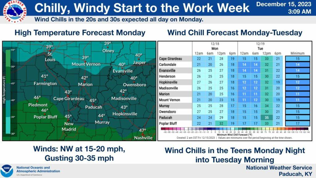
It will turn colder behind this system. Windy conditions will develop Sunday and Monday. Wind gusts of 15 to 30 mph are likely. Possibly a bit higher, at times.
That means wind chill values Sunday night into Tuesday morning will dip into the teens and twenties. The coldest readings will be Monday night.
Have a great Friday!