Posted by Meteorologist Beau Dodson
A brief round of winter weather will impact the region over the coming 72 hours. Now, we are not forecasting accumulating snow or ice. Sorry snow lovers.
What we will have is winter cold. Temperatures are going to take a nosedive later today and tonight. That cold air will linger into Tuesday.
Temperatures Monday may actually fall as we move through the day.
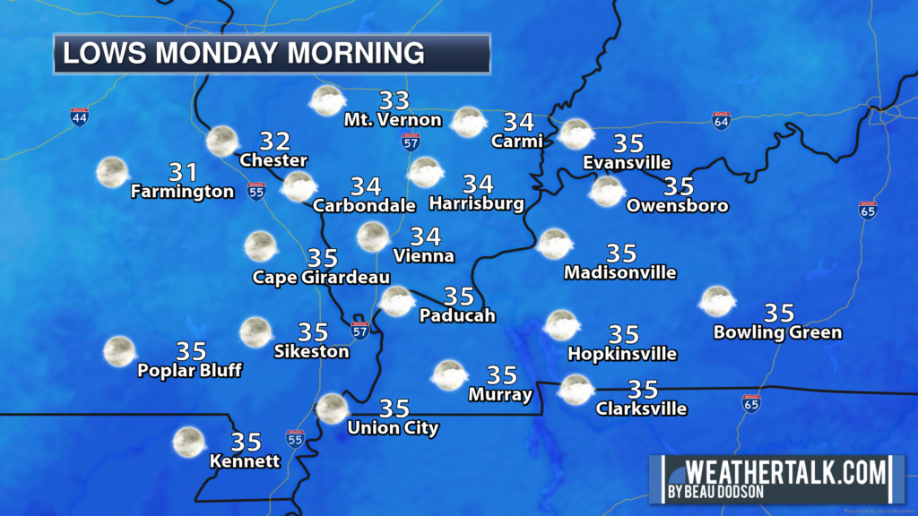
Wind chills should dip well into the teens Monday/Monday night/Tuesday morning. Some of the coldest wind chills since last winter. I can’t rule out a few locations hitting the upper single digits.
Either way, cold.
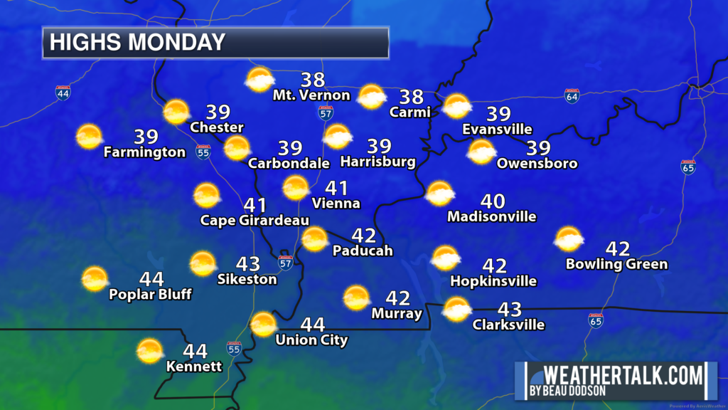
A slow warming trend will begin Wednesday. Nothing crazy, but not as cold as the next couple of days. Temperatures will once again push above average as we move into the mid to late week time period.
Let’s take a look at some forecast numbers.
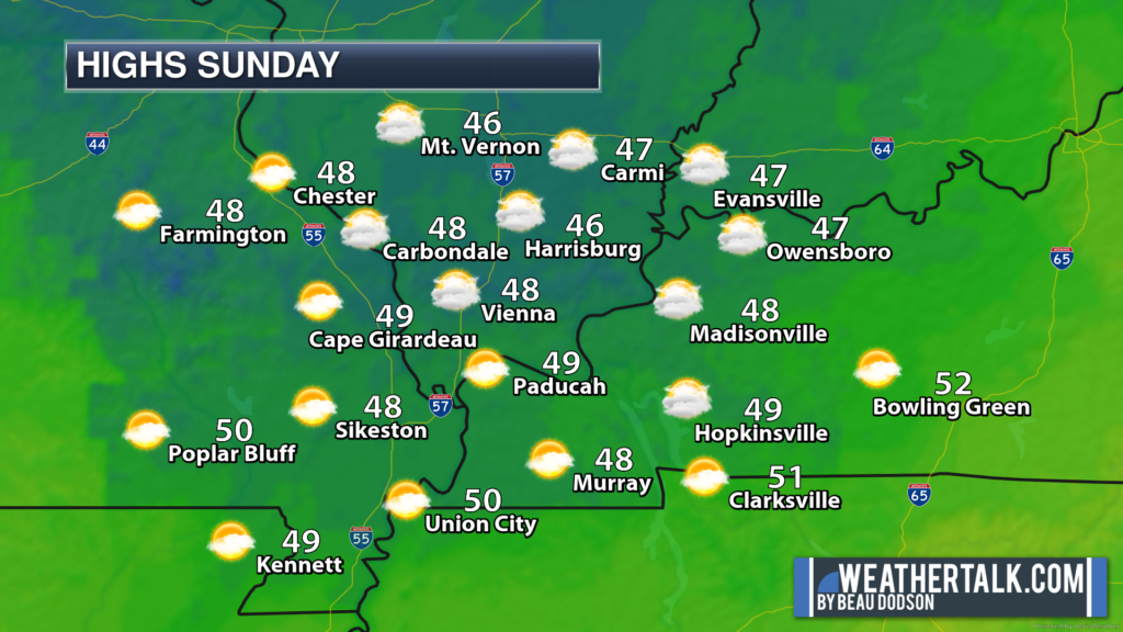
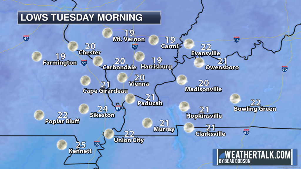
Those are some chilly temperatures. We have not experienced a lot of cold air this winter, thus far. So, this will bite.
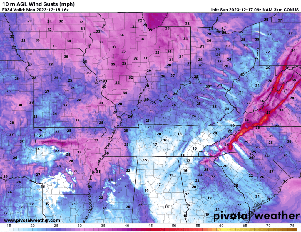
Gusty winds will make it feel even colder. Winds this afternoon and tonight will gust between 20 and 40 mph. These winds will linger into Monday evening before subsiding late Monday night.
Here is the GFS model showing wind gusts Monday morning. These will be northwesterly winds. They will deliver the colder air.
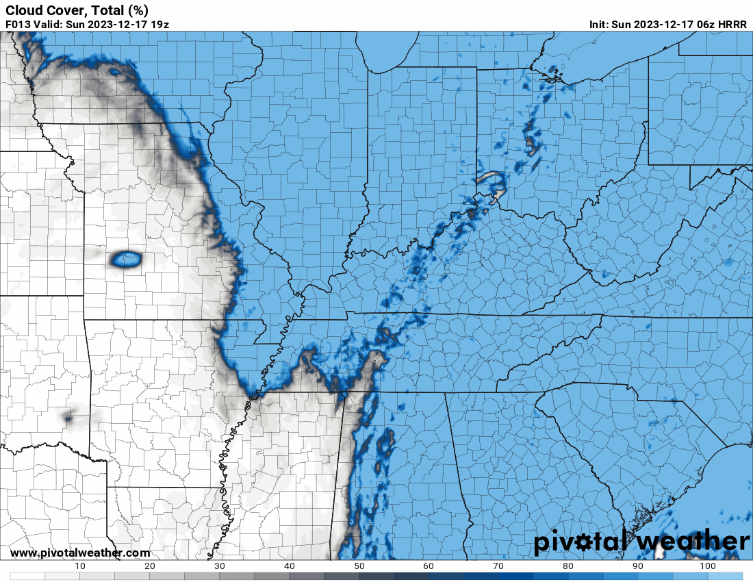
Clouds will linger into tomorrow, as well.
Here is the cloud forecast. Blue represents clouds. Timestamp upper left. It is in Zulu. 12z=6am and 00z=6 pm.
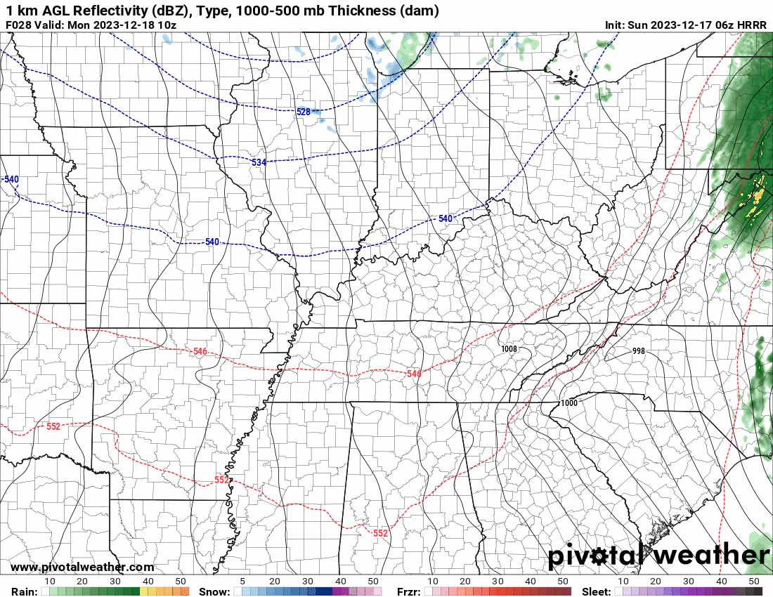
A few rain/snow showers will be possible Monday. I am not anticipating any accumulation or impacts from the rain/snow mix. Novelty flakes, at best.
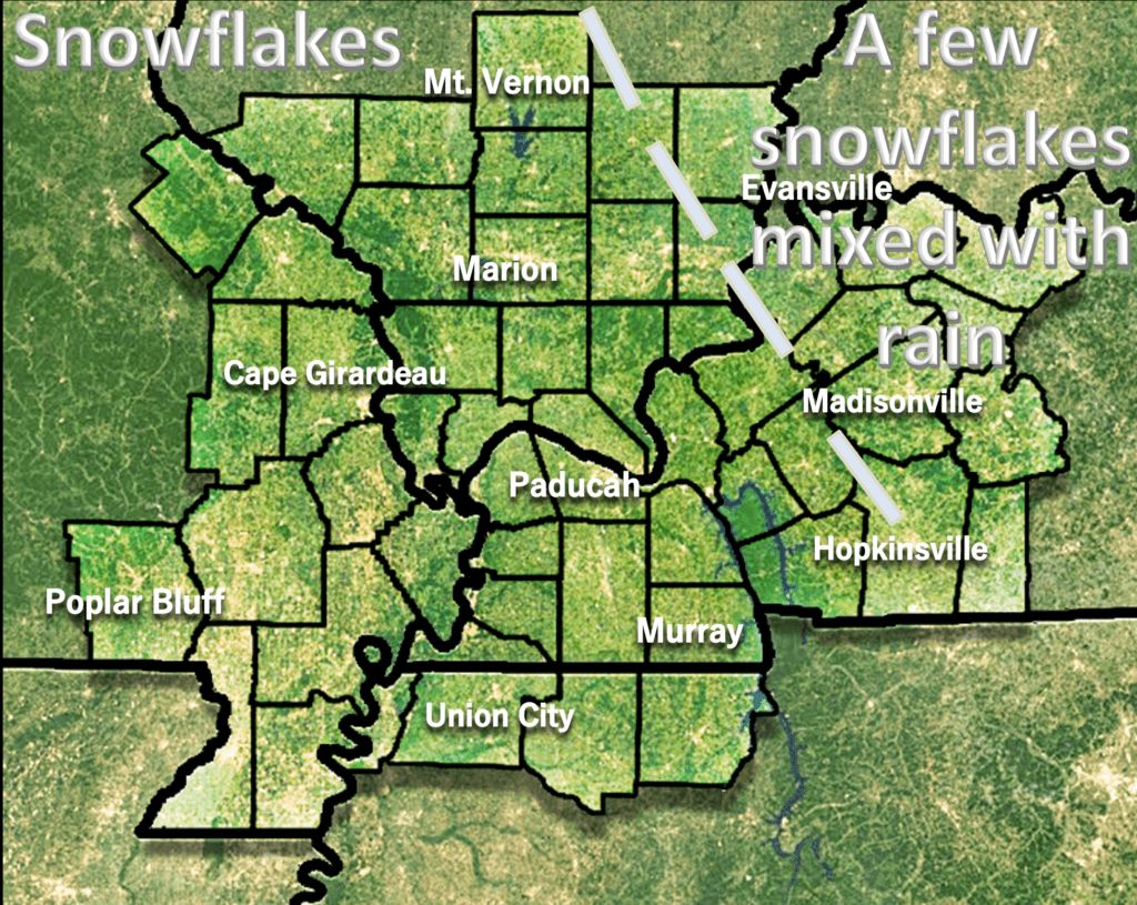
Here is the future-cast radar showing those rain/snow showers. Timestamp upper left. It is in Zulu. 12z=6am and 00z=6 pm. Blue is snow.
Kids will want to bundle up Tuesday morning as they head out to school.

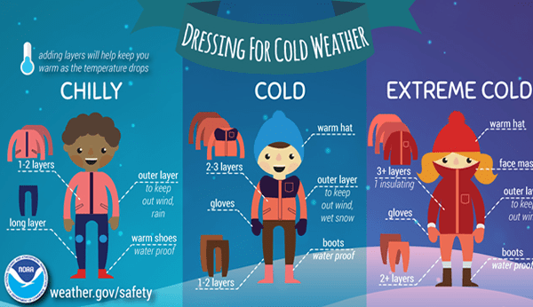
Cold weather safety.
Now, the next question is Christmas. I need to look at all the data today and tomorrow and then I will make a new Christmas forecast update. I posted one a few days ago. Not much has changed.
I am watching multiple precipitation events December 22nd through January 3rd. Mainly above average temperatures from the middle of this week into Christmas.
Perhaps a brief period of colder weather after Christmas.
Most of these storm systems are shaping up to be shower and thunderstorm events. There are hints at one snow event, but confidence in that remains very low.
I will post more tomorrow or Tuesday. I am in Chicago this morning, but driving home this afternoon.
Have a great Sunday and stay warm!