Posted by Meteorologist Beau Dodson
Welcome to winter 2023/2024. Today marks the first day of winter.

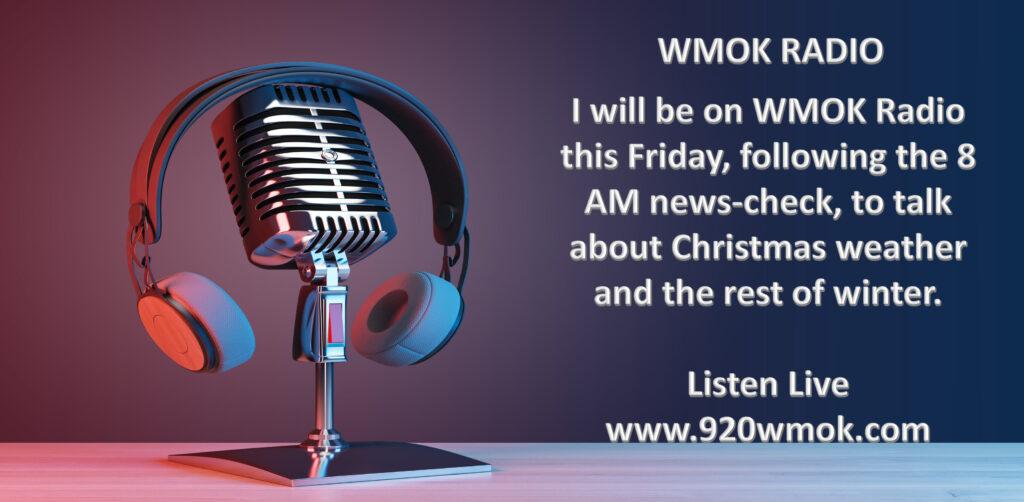
Tomorrow Morning!
I will be on WMOK Friday morning. Be sure and listen in as we will be talking about the rest of winter into spring. I will have a special guest with me! My mom will be joining me. A special treat.
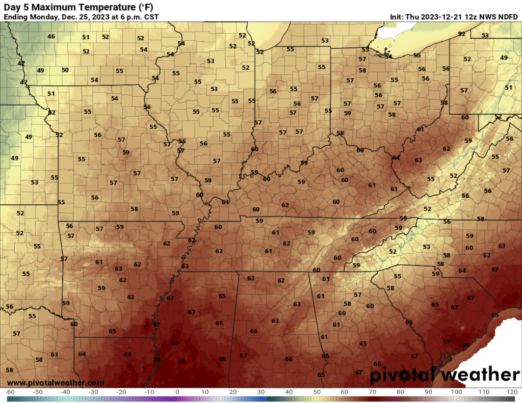
Mild Temperatures.
We have a lot of mild air in the forecast through at least Monday and perhaps Tuesday. As a matter of fact, some locations will hit 60 degrees over the coming days.
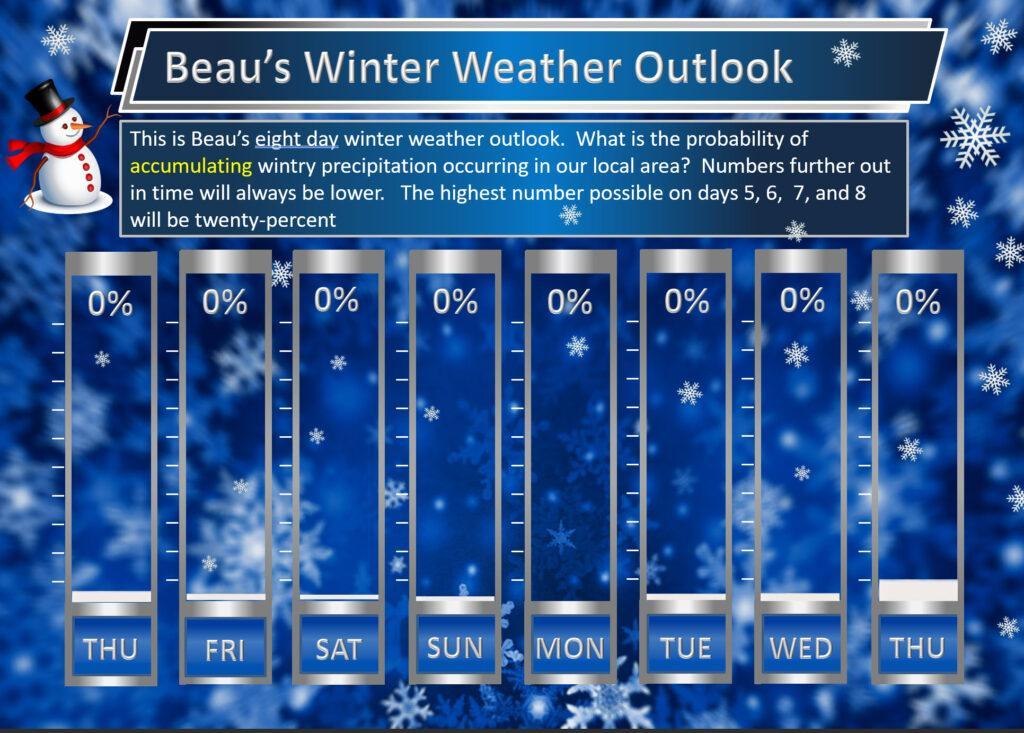
Not ideal for Christmas snowmen.

Speaking of snow. Just not seeing anything, yet. I keep watching after Christmas into the first week of January. Occasionally, the models hint at a chance of snow. Long-shot, but I am monitoring the data.
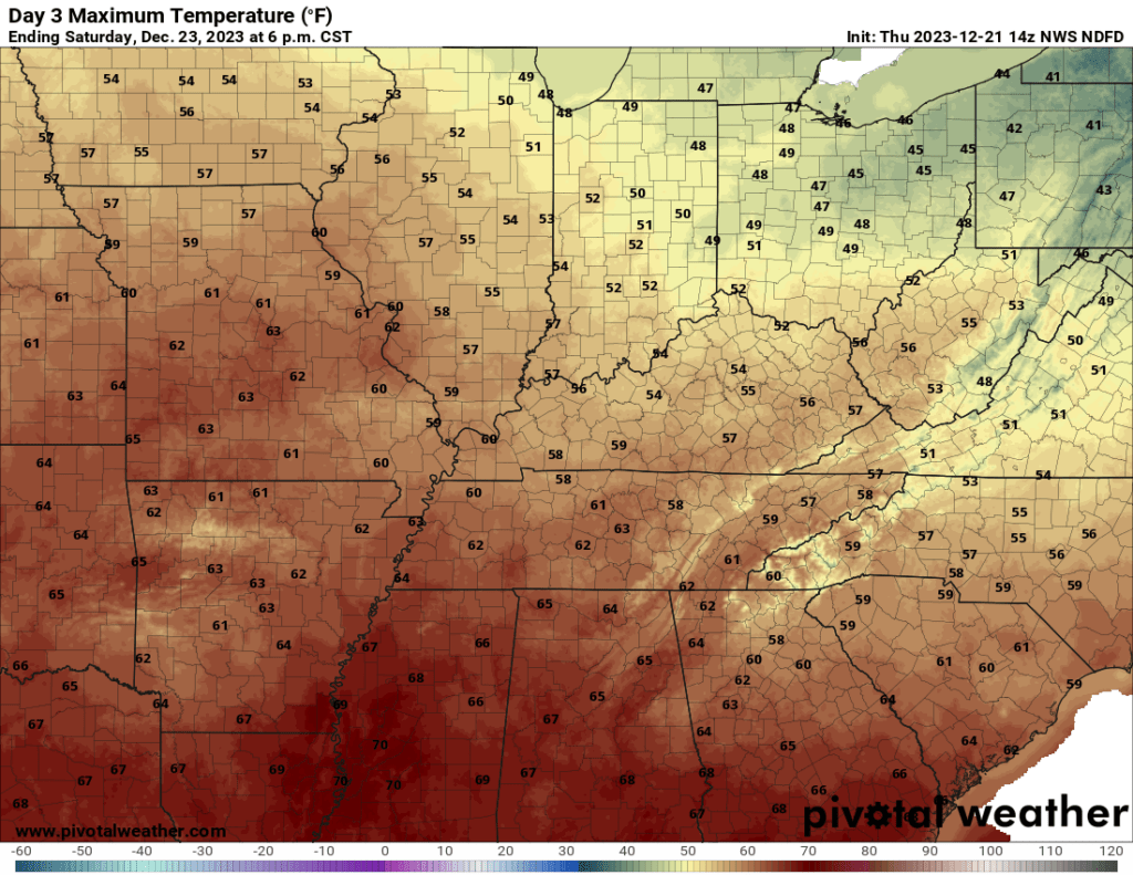
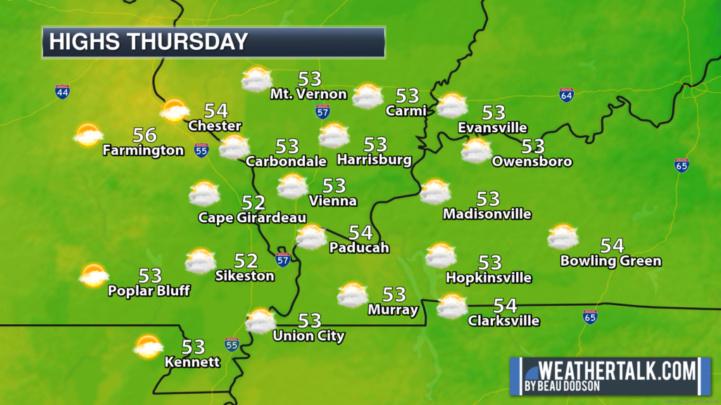
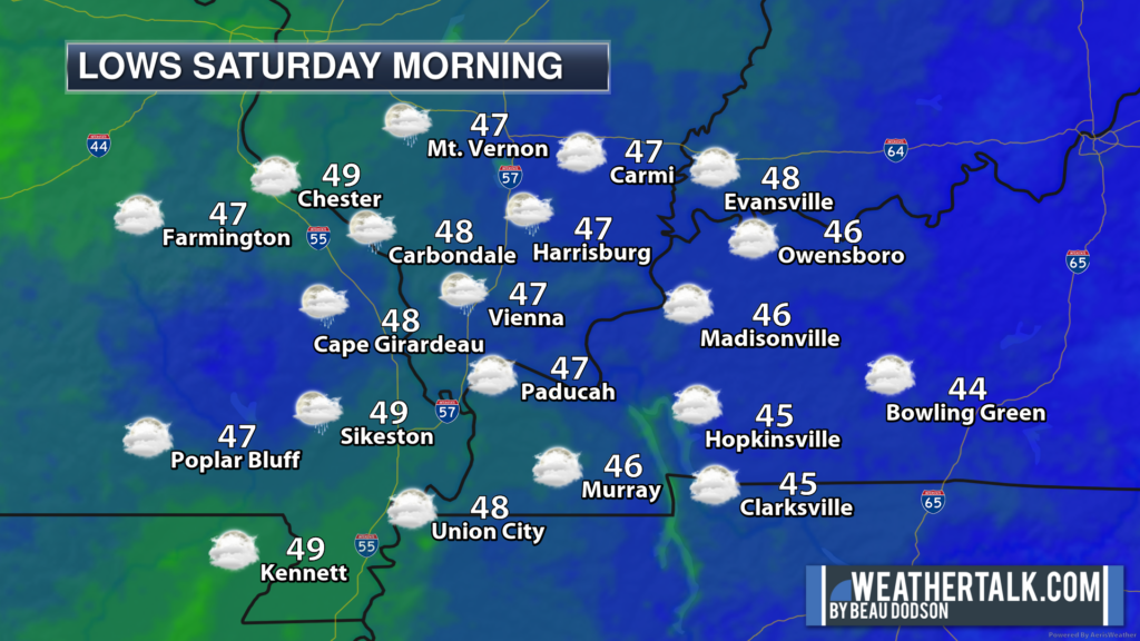
Check out these maps. High temperatures Saturday, Sunday, and Christmas.
Saturday highs
Sunday
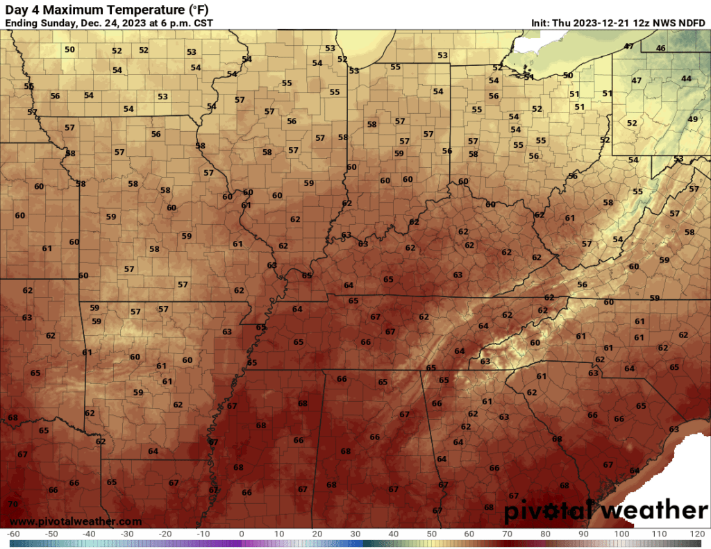
Monday
48-hour outlook.
Looking ahead.
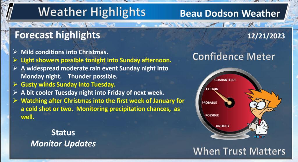
A few light showers are possible tonight into Sunday afternoon. The bulk of the rain, however, will arrive Sunday night into Monday night. This is when a widespread 0.5 to 1.00″ is anticipated. Before then, trace amounts.
There could even be some thunderstorms mixed in. For now, there does not appear to be a severe weather threat.
If you have outdoor plans Sunday or Monday, then you will want to monitor the Beau Dodson Weather radars. Rain is likely.
Interactive local city-view radars. Clickable watches and warnings.
https://beaudodsonweather.com/weather-radars/
Backup radar site in case the above one is not working.
https://weathertalk.com/morani
Regional Radar
https://imagery.weathertalk.com/prx/RadarLoop.mp4
*NEW* Zoom interactive radar (with storm chaser streams)
https://wtalk.co/AVWG7GM7
Real time lightning tracker system two.https://map.blitzortung.org/#5.02/37.95/-86.99
Lightning Data (zoom in and out of your local area)
https://wtalk.co/WJ3SN5UZ
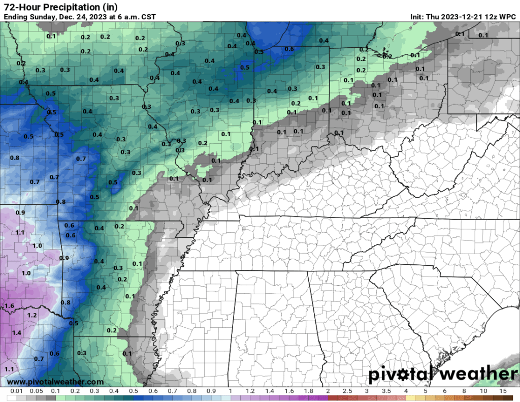
Rainfall forecast through Sunday morning. Light totals.
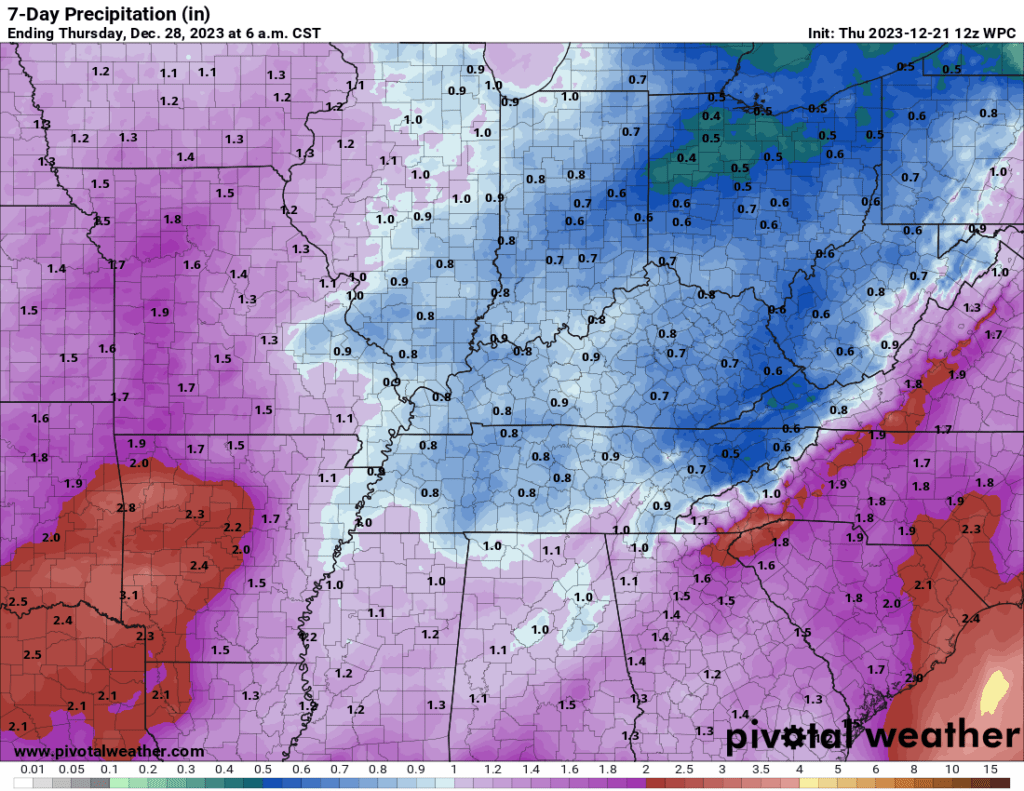
When we add in Sunday night into Tuesday, we come up with these amounts.
The last few rain events have produced lower totals than forecast. For most areas, at least. We still need rain. We are in drought.
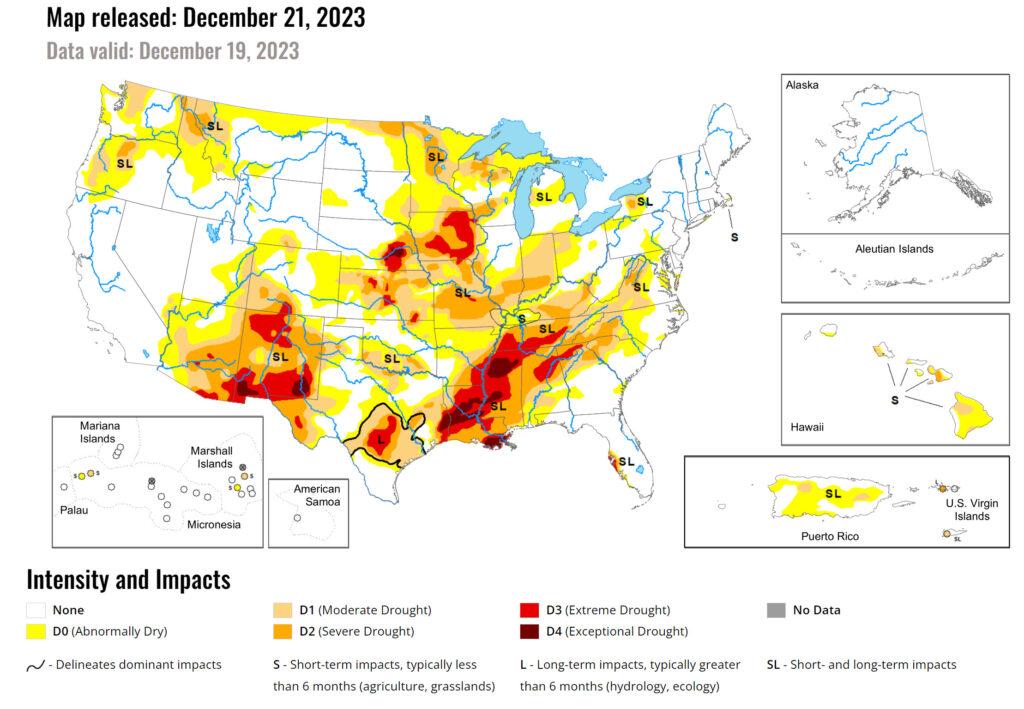
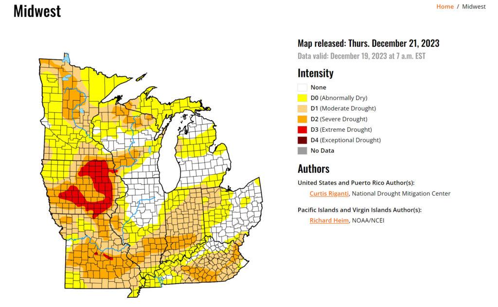
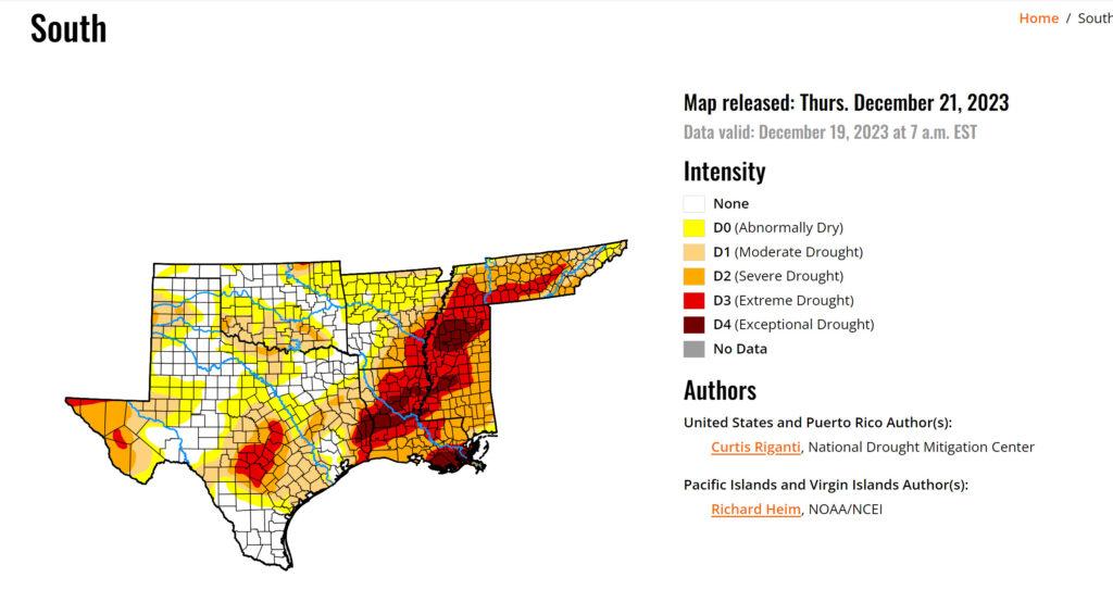
Drought Conditions. Updated maps.
Here are the latest drought monitor maps.
We need several widespread soaking rain events to break this drought.
I have concerns about the rest of winter into spring. There are signals for drier than normal conditions. I don’t like to enter spring in drought.
Let’s look at some maps.
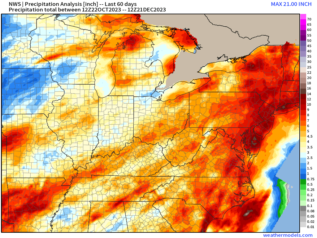
How much rain has fallen over the past 60 days? Here is the radar estimated total.
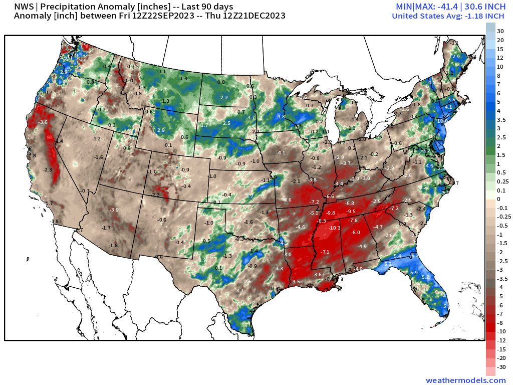
90-day precipitation anomaly (inches). A large area of red. Well below average precipitation. Many inches below average. A far cry from our summer floods.
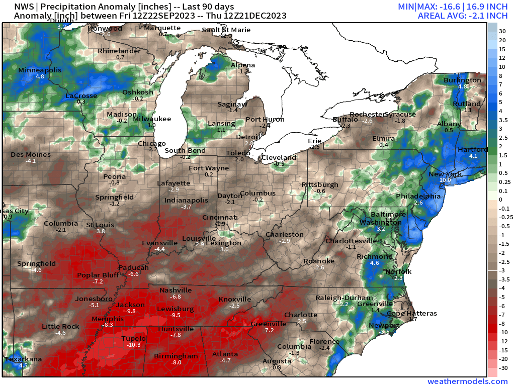
Let’s zoom in.
The 90-day precipitation anomaly map (inches).
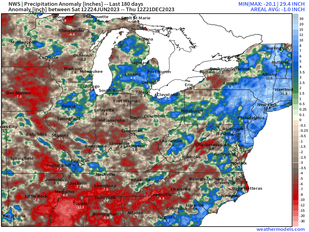
If we go back 180 days, you can see the summer floods. The blue stripe from southeast Missouri into Kentucky and Tennessee is where very heavy rain fell. Some areas experienced 20 inches of rain in just a few short days.
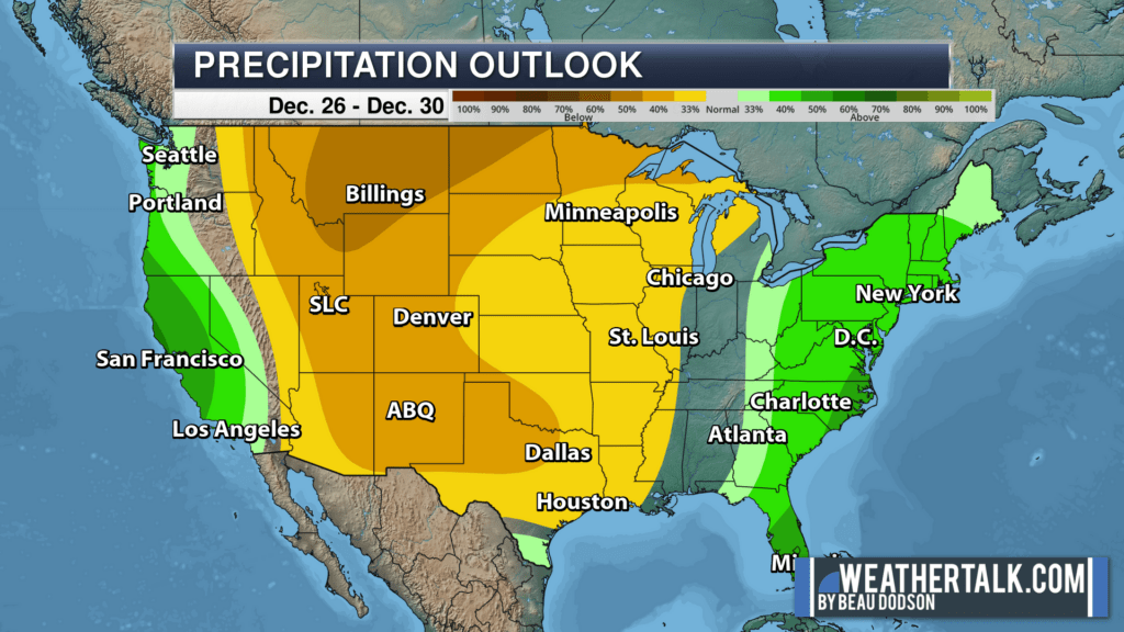
The latest six-to-ten and eight-to-fourteen-day outlooks are not encouraging. We do have a rain event tonight into Tuesday. After that, however, we may struggle to see above average precipitation.
Six-to-ten-day precipitation outlook. December 26th through December 30th.
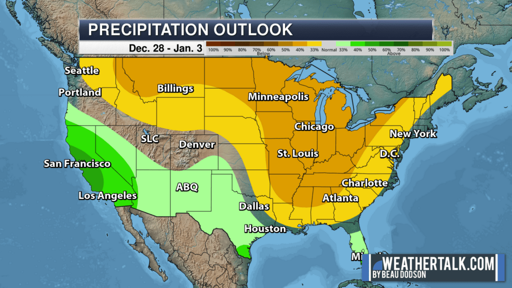
Eight-to-fourteen day precipitation outlook. December 28th through January 3rd.
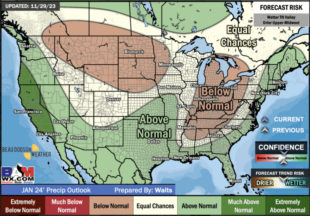
The January Precipitation Outlook is not encouraging.
Occasionally, models show a bigger system the first week of January. There are wild fluctuations on how the models are handling energy coming off the Pacific Ocean.
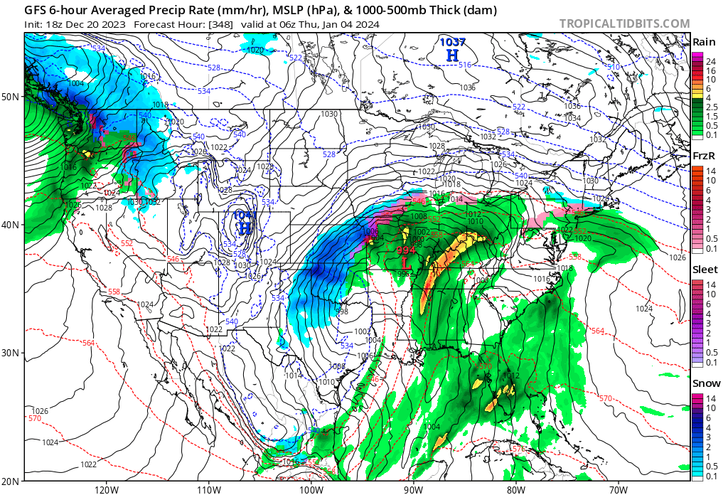
For example, this is what the GFS model showed yesterday for January 4th. A powerful winter storm/blizzard moving through the Central United States.
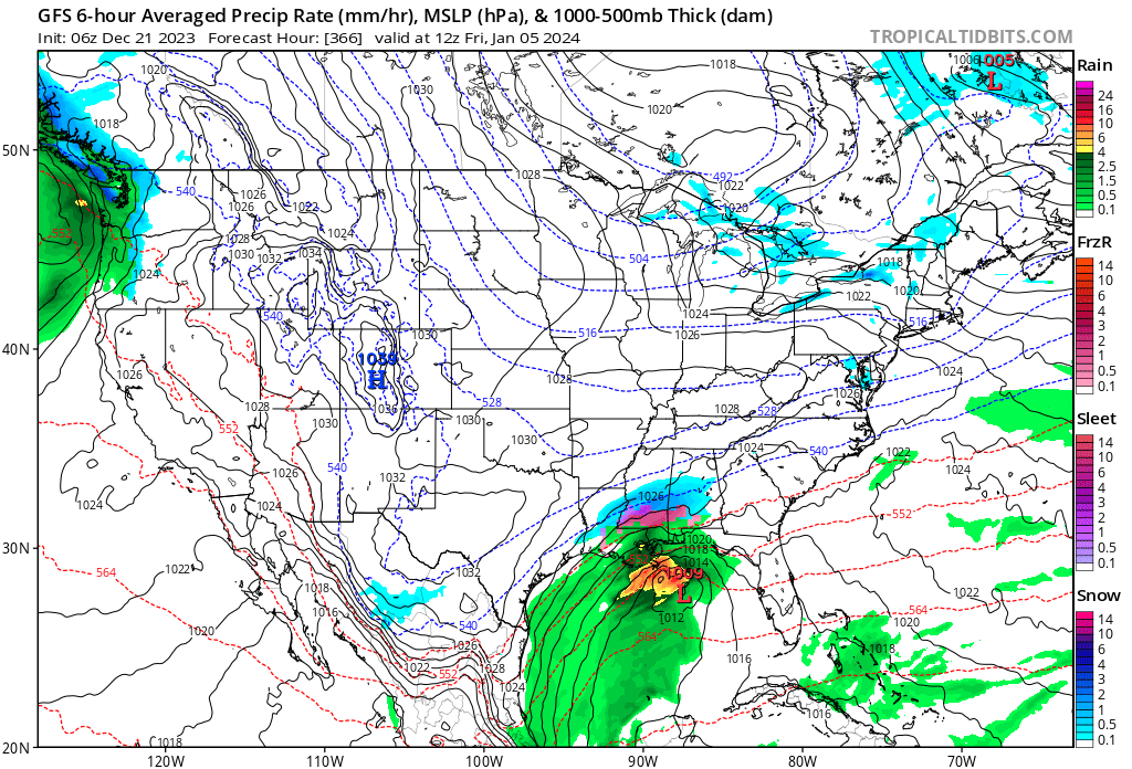
Then, the same model showed this in this morning’s update (it runs four time a day).
The system is way south of us with this update. I suspect we will continue to see swings in the data. It may be several days until we know if there will be a storm system the first frew days of January.
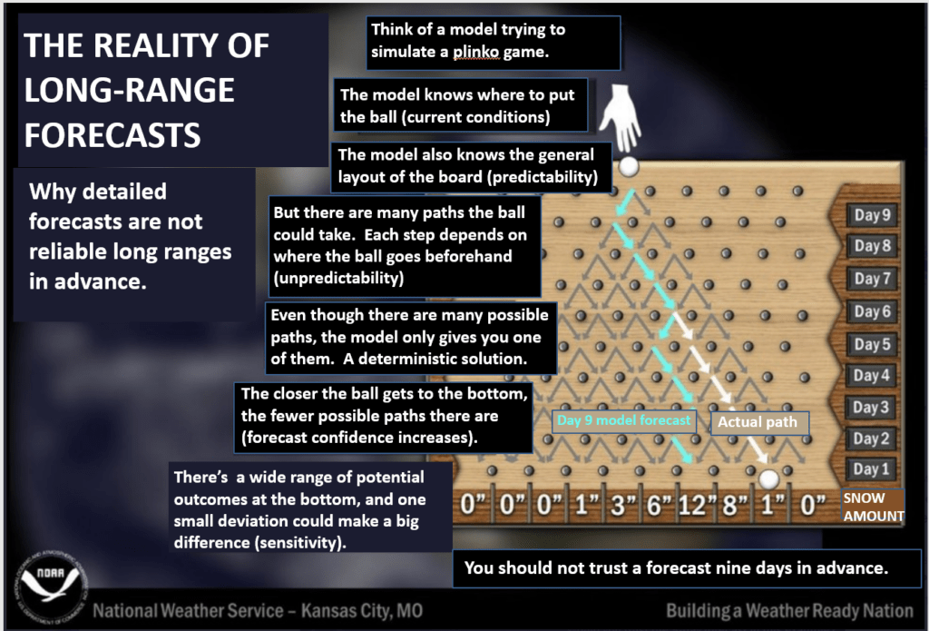
Models are horrible in the long range. Especially during a fast jet-stream pattern. We will have to monitor trends. Plenty of time to watch.
This is a great graphic showing you how models handle the long range poorly.
As always, I will be keeping an eye on the charts for winter weather. Or other!
Want to receive more weather information? I provide a service through www.weathertalk.com
Subscribe at www.weathertalk.com and then download the Beau Dodson Weather app from the app stores!
Apple users: Beau Dodson Weather App
https://wtalk.co/9EZYG8A8
Android users: Beau Dodson Weather App
https://wtalk.co/ZEWYU8ME
Need help? Email me at beaudodson@usawx.com
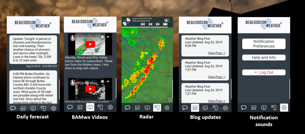
* Daily weather forecasts
* My personal weather blog with all sorts of weather information!
* Special weather statements sent to the Beau Dodson Weather app.
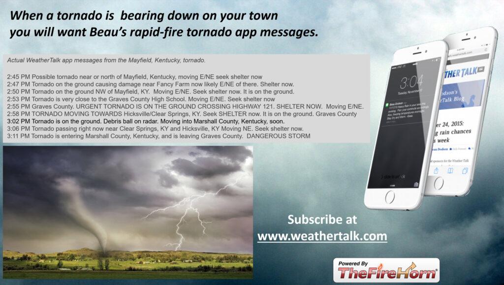
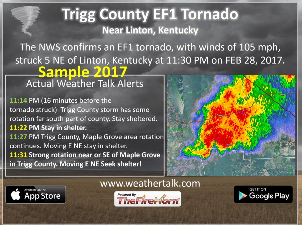
* Rapid fire tornado alerts.
* Severe weather alerts and forecasts.
* Severe weather updates throughout the day (when severe weather is occurring)
* Ice storm alerts and forecasts.
* Winter storm alerts and forecasts.
* Winter storm updates throughout the event.
* Regional weather videos.
* Long range weather videos.
* A daily forecast that I hand type for your county. Sent out every afternoon.
* Long range outlooks. Including week one, two, three, four, and monthly outlooks. Seasonal outlooks.
* App messages to alert you when I have updated the weather blogs and Facebook.
* And more!
Here are some examples of what people receive when they subscribe to www.weathertalk.com