Posted by Meteorologist Beau Dodson
Merry Christmas, everyone and happy 2024.
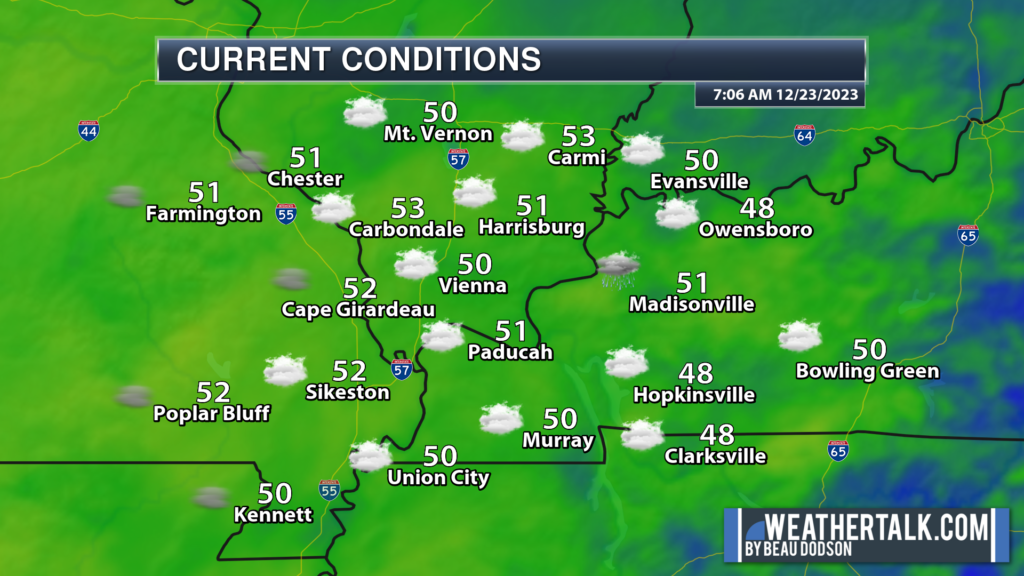
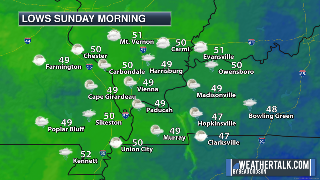
We are waking up to mild temperatures. By December standards, at least. Our 6 am temperatures are actually above where our normal highs are for this time of the year!
We are in the home stretch and the holidays are upon us. If you were dreaming of a white Christmas, then it may not be too late to go online and purchase an airline ticket to Anchorage, Alaska.
One of my meteorology friends posted this! Wow. That is a lot of snow.
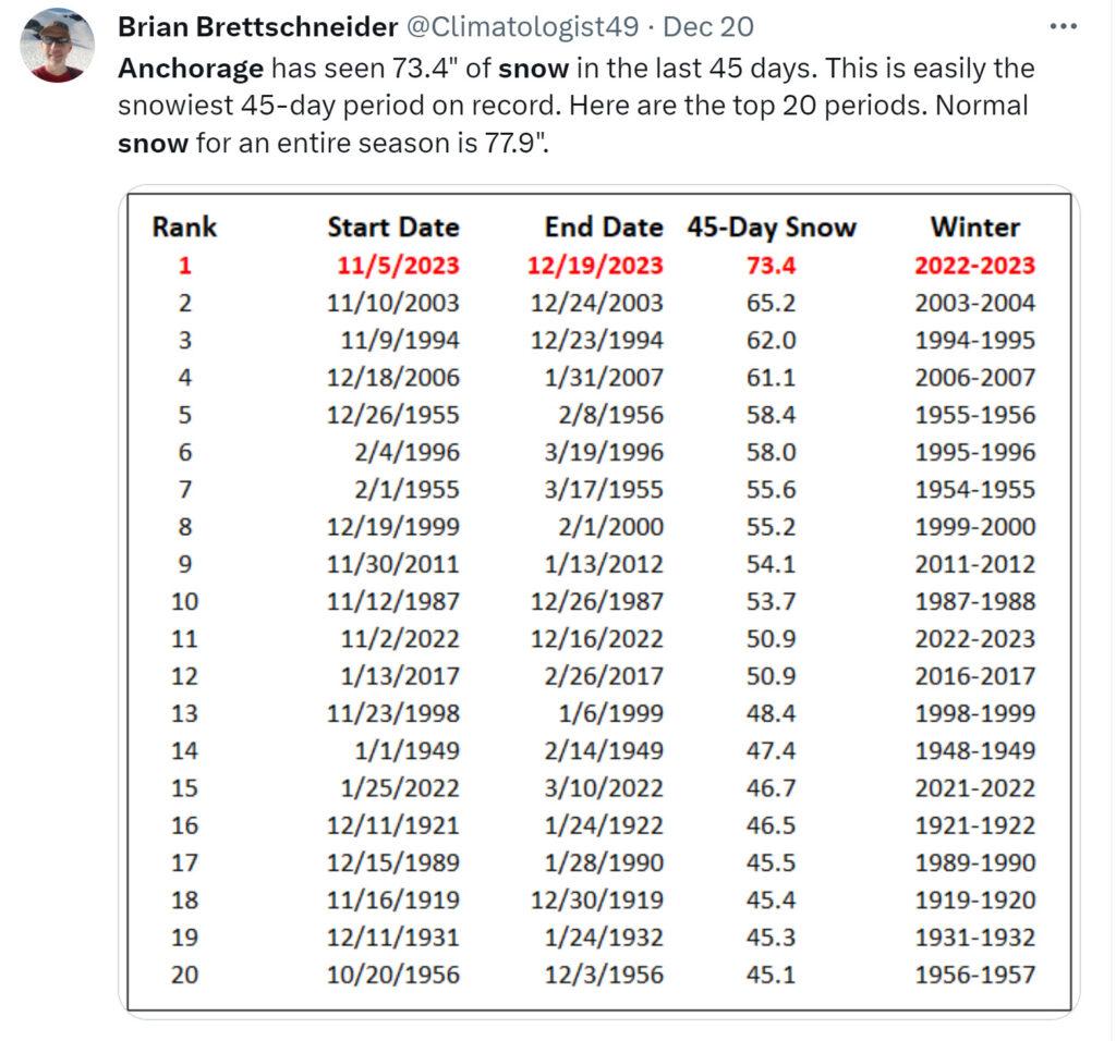
No snow for us. Sorry snow fans. I did my best! Nature had other ideas.
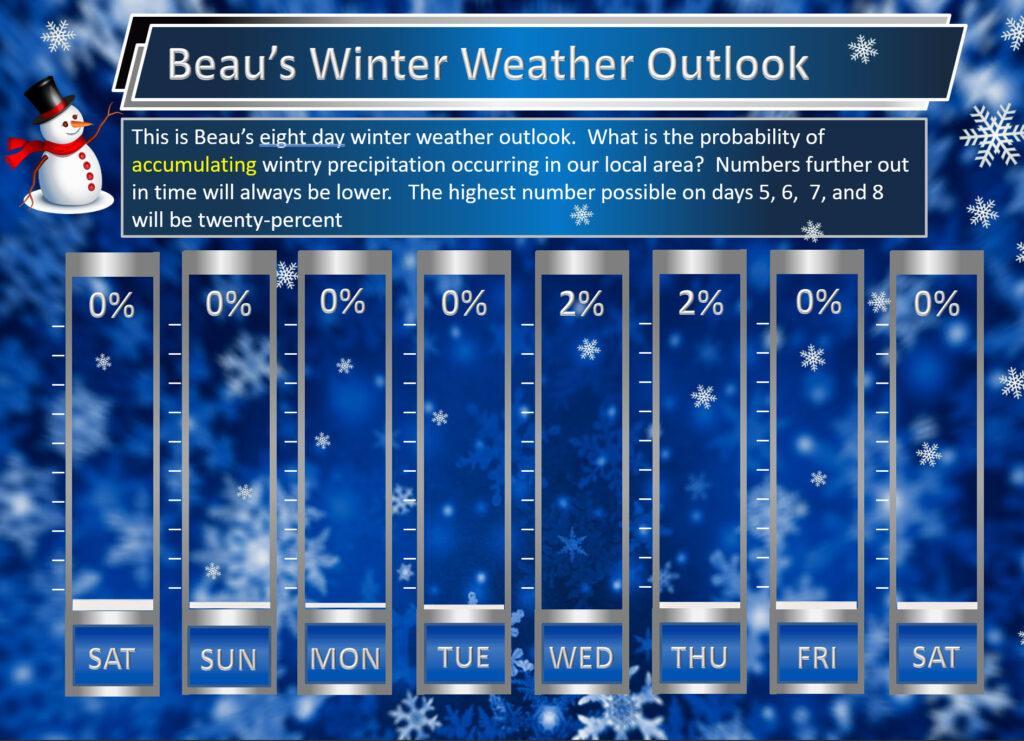
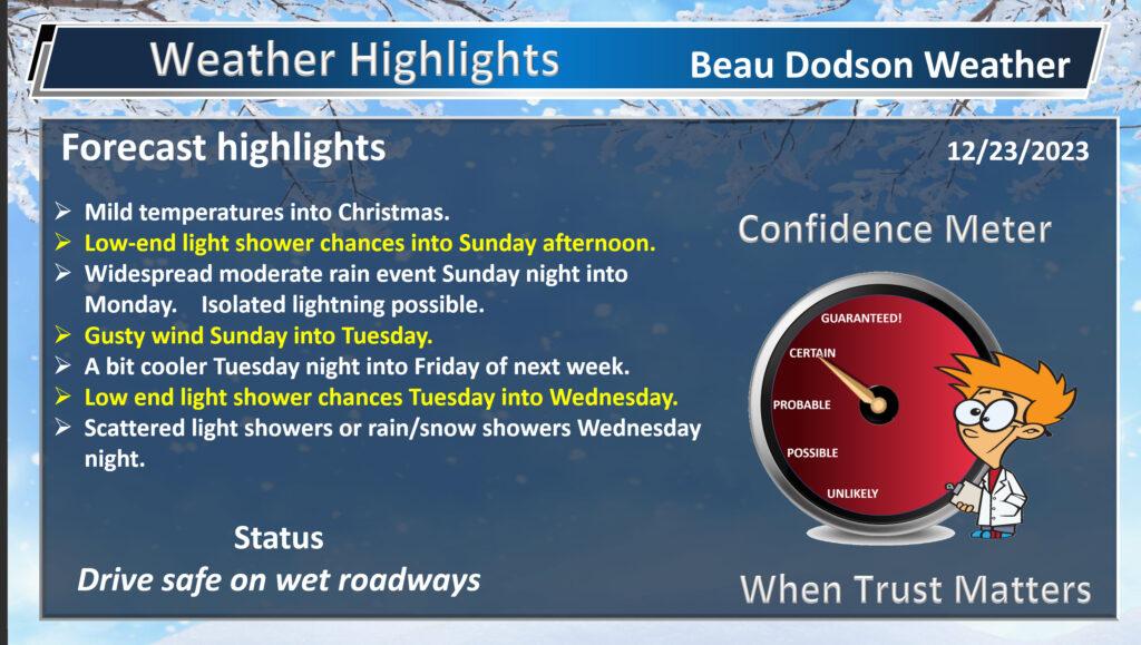
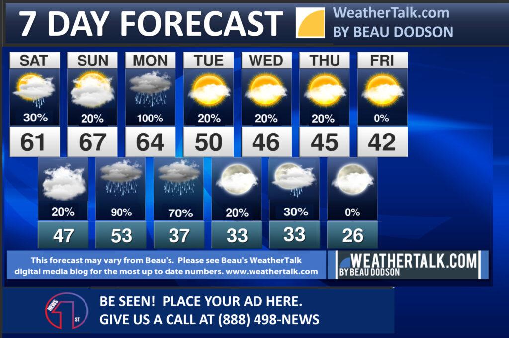
For over two months we have been predicting active weather around Christmas. Temperatures were the only question.
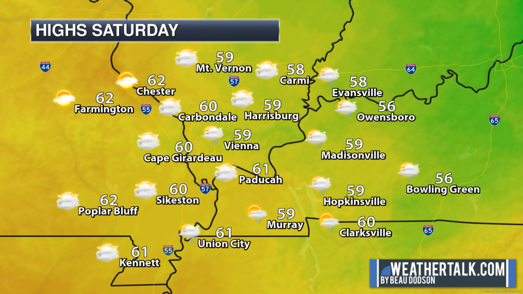
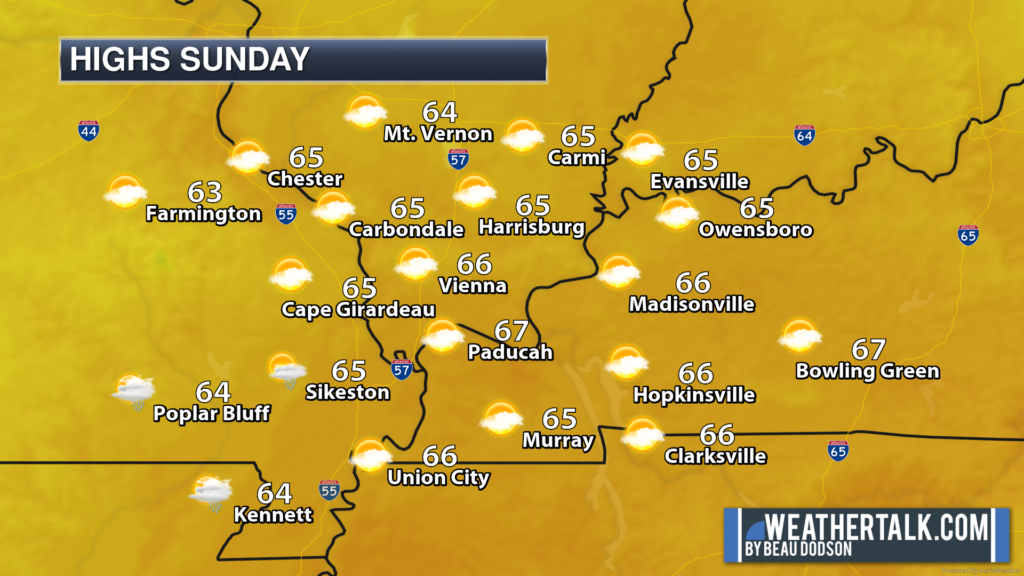
It is going to be mild. Well above seasonal temperatures. Normal highs, for this time of the year, are around 48 degrees. Highs today, tomorrow, and Christmas will be in the upper 50s to middle 60s.
The mildest day will be tomorrow (Sunday). Widespread low to middle 60s. I can’t rule out upper 60s in a few locations.
Check out the temperature anomaly maps.
Today (how many degrees above average will temperatures be)
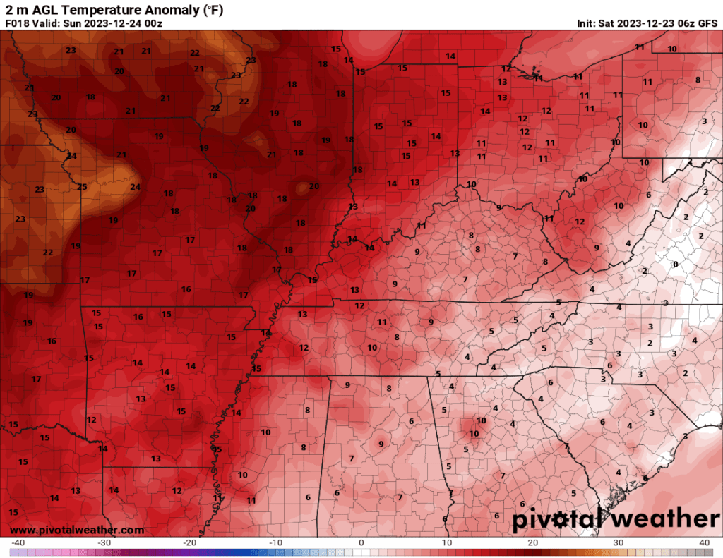
Christmas Eve
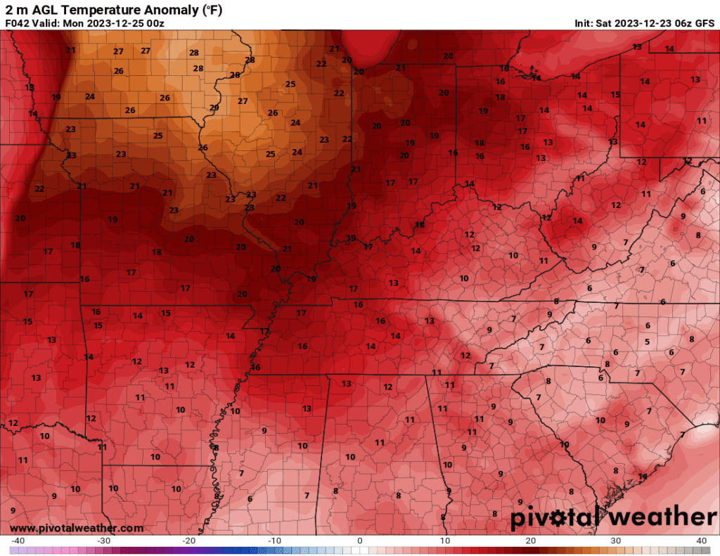
Christmas Day
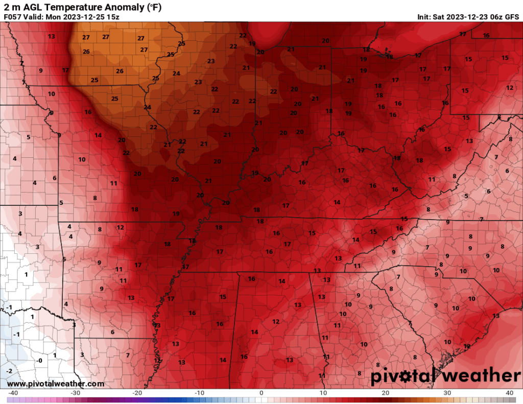
Today
Tonight
Tomorrow
Tomorrow night
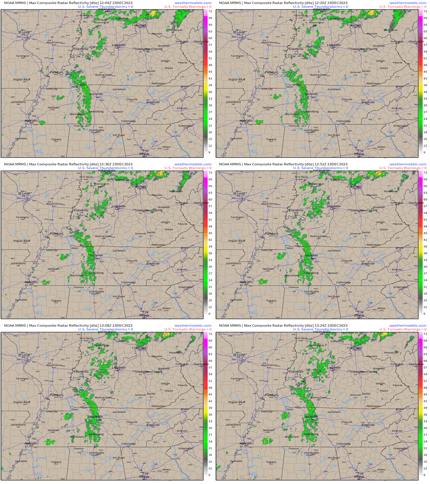
We did have some rain showers overnight. Those did not amount to much. Trace amounts to 0.15″. About what was expected.
Here was the 6 AM radar loop. See the Beau Dodson live radars for the most up to date radar scans.
Interactive local city-view radars. Clickable watches and warnings.
https://beaudodsonweather.com/weather-radars/
Backup radar site in case the above one is not working.
https://weathertalk.com/morani
Regional Radar
https://imagery.weathertalk.com/prx/RadarLoop.mp4
*NEW* Zoom interactive radar (with storm chaser streams)
https://wtalk.co/AVWG7GM7
Real time lightning tracker system two.https://map.blitzortung.org/#5.02/37.95/-86.99
Lightning Data (zoom in and out of your local area)
https://wtalk.co/WJ3SN5UZ
The rest of today and tonight.
Any remaining showers will push off to the east over the coming hours. That will leave us with a mostly dry day. Mild temperatures. Intervals of clouds.
An isolated shower is possible tonight, but most of the region will remain dry.
Sunday into Monday night
A couple of showers will be possible Sunday. Mainly during the afternoon hours over southeast Missouri. The bulk of the region will be dry and mild. Intervals of clouds and gusty southerly winds.
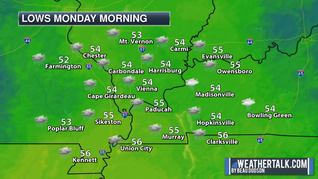
The bulk of this rain event was forecast to arrive Sunday night into Monday. That is right on track. No changes to the forecast.
Let’s look at some future-cast radars. What radar might look like.
This is in Zulu time. 12z=6 am. 18z=12 pm. 00z=6 pm. 06z=12 am.
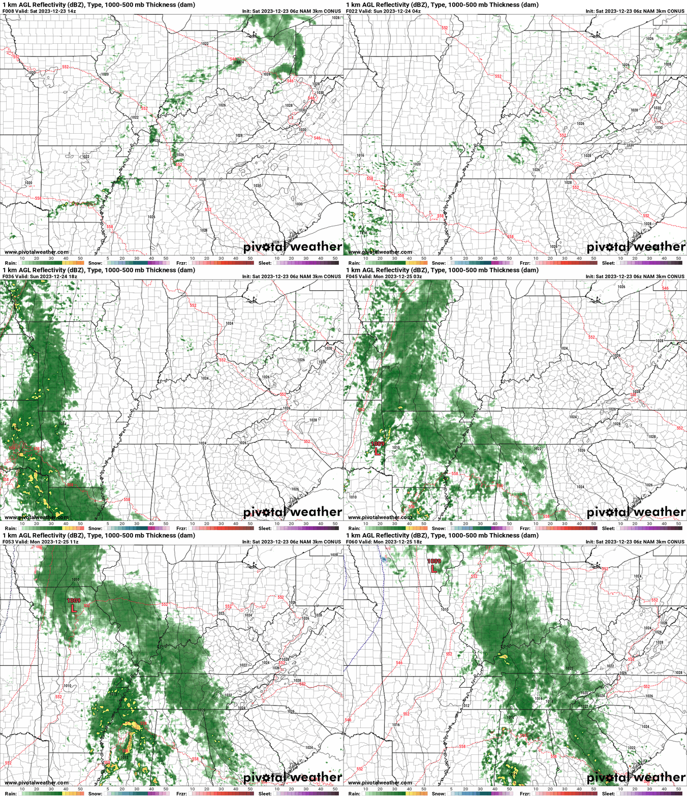
Sunday night, widespread showers will overspread the region from west southwest to east northeast. Santa will need an umbrella and raincoat!
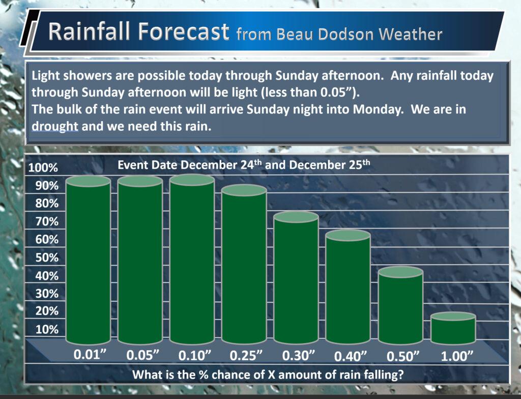
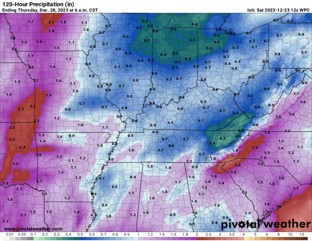
Generally, I am expecting rain totals of 0.5″ to 1.00″ area wide.
Here is the latest WPC rainfall forecast. Again, most of this will fall Sunday night into Monday.
You can expect gusty winds Sunday into Tuesday. Occasional gusts above 30 mph will be possible.
Extended outlook.
A mix of sun and clouds Tuesday through Friday. A couple of light showers will be possible Tuesday into Wednesday night. I capped the chances in the 20% to 30% range, for now.
It may be cold enough Wednesday night for a rain or rain/snow mix. Especially over southeast Missouri and southern Illinois. This appears to be a light precipitation event. I will monitor trends in the guidance.
Lows Thursday morning will likely dip into the low to middle 30s.
Occasionally, the models show a snowstorm the first week of January. The overnight models lost that event. They seem to lose it and bring it back. That means the models are not consistent in what they are showing. Thus, confidence in any one outcome is low.
Monitor updates and have a very Merry Christmas and happy holidays.
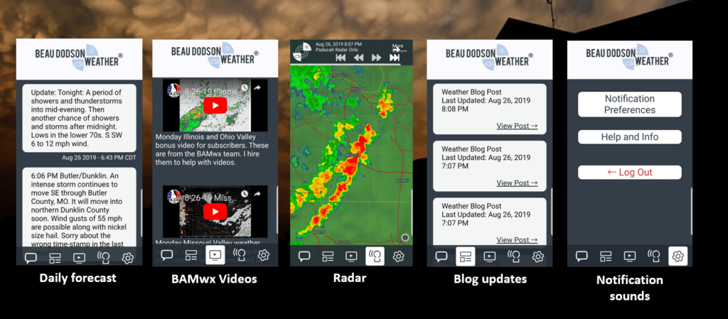
Want to receive more weather information? I provide a service through www.weathertalk.com
Subscribe at www.weathertalk.com and then download the Beau Dodson Weather app from the app stores!
Apple users: Beau Dodson Weather App
https://wtalk.co/9EZYG8A8
Android users: Beau Dodson Weather App
https://wtalk.co/ZEWYU8ME
Need help? Email me at beaudodson@usawx.com
* Daily weather forecasts
* My personal weather blog with all sorts of weather information!
* Special weather statements sent to the Beau Dodson Weather app.
* Rapid fire tornado alerts.
* Severe weather alerts and forecasts.
* Severe weather updates throughout the day (when severe weather is occurring)
* Ice storm alerts and forecasts.
* Winter storm alerts and forecasts.
* Winter storm updates throughout the event.
* Regional weather videos.
* Long range weather videos.
* A daily forecast that I hand type for your county. Sent out every afternoon.
* Long range outlooks. Including week one, two, three, four, and monthly outlooks. Seasonal outlooks.
* App messages to alert you when I have updated the weather blogs and Facebook.
* And more!
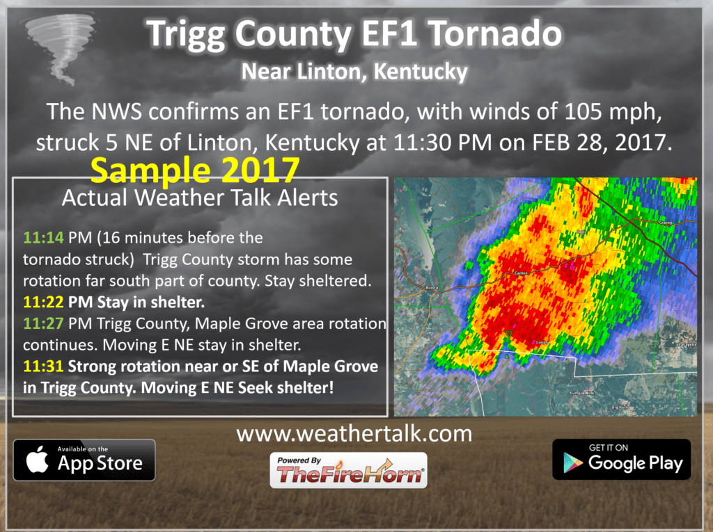
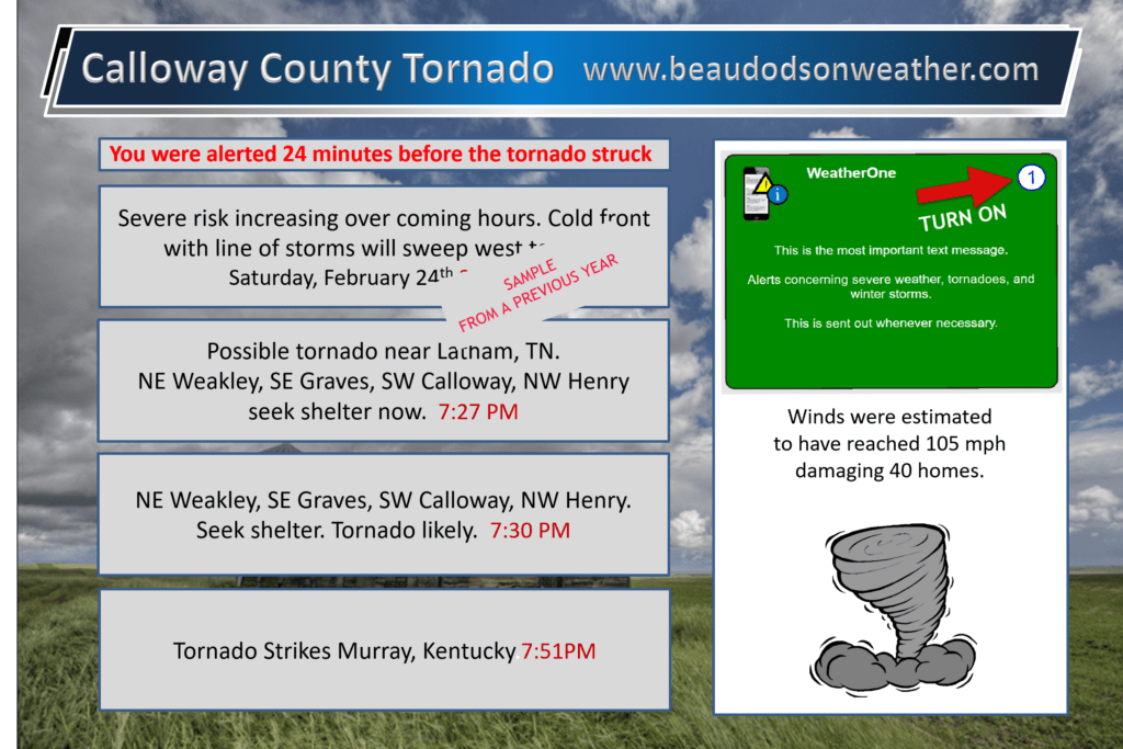
Here are some examples of what people receive when they subscribe to www.weathertalk.com
