Posted by Meteorologist Beau Dodson
MERRY CHRISTMAS!
Merry Christmas, everyone. I want to wish you and your family a very merry Christmas and happy holidays. I hope you have a wonderful and peaceful year ahead. It is hard to believe that is 2024!
Forecast Update
For the last two months, I have told everyone to watch around Christmas and then into the first week of January for unsettled weather conditions and perhaps one or two shots of colder air.
The forecast is on track. Widespread rain is in the forecast. Some rain and snow showers are in the forecast. A couple of cold shots of air are in the forecast.
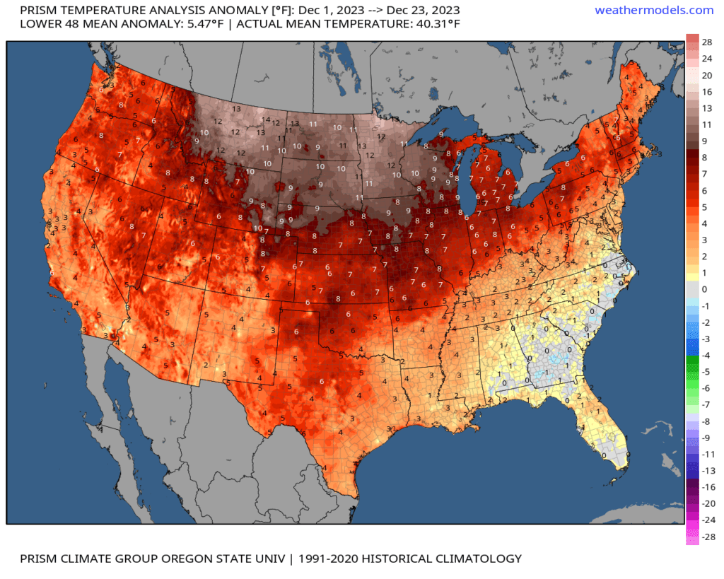
We also forecasted a top 5 warmest December’s for the country as a whole. We still have several days left, but this is where temperature anomalies have landed, thus far.
This shows you how many degrees above average temperatures have been from December 1st through December 23rd. Check out the northern United States. WELL above average temperatures. Where will December 2023 land in the record books? Time will tell.
Beau’s Weather Highlights
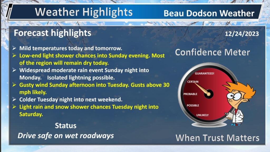
Gusty Winds.
We will have gusty winds today into tomorrow night. Winds of 10 to 25 mph will develop. Occasional gusts to 35 mph are possible. Holiday decorations may not appreciate the wind forest.

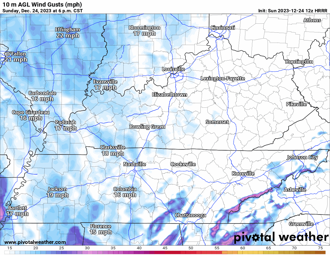
Here is the Hrrr model wind gust forecast. Timestamp upper left. Peak winds will be tonight into tomorrow morning.
Christmas Forecast
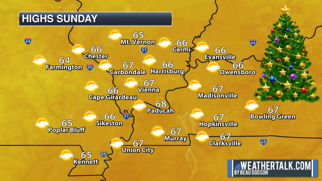
We have a mild Christmas Eve ahead of us. Last year, at this time, temperatures were below zero. This year, we will be approaching record high territory!
Sorry, Frosty. This just isn’t your year!

Let’s look at some maps.
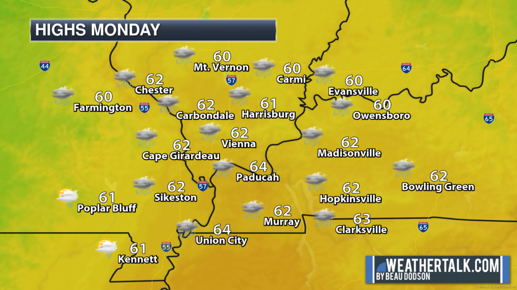
Check out those high temperatures! Wow.
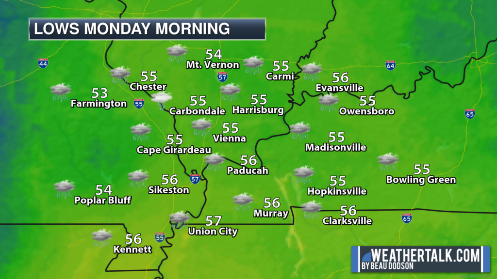
Lows tonight may approach record high levels (for lows).
The above graphics cover the next 48 hours. Mild and damp. Although today should be mostly dry with just a mix of sun and clouds. The bulk of our rain event won’t arrive until tonight and tomorrow.
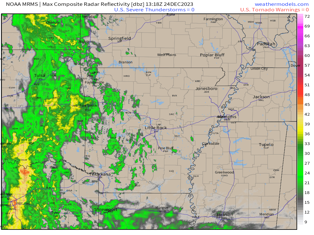
Let’s look at the 10 am radar (see the live radar links below). This is centered on Arkansas. The bulk of the rain is still west of our area. That is where it will remain until tonight and tomorrow.
Conditions go downhill tonight and Christmas Day. Widespread showers and thunderstorms will overspread the region. Peaking late tonight and tomorrow morning, then ending or tapering west to east tomorrow late morning into the afternoon hours.
Beau’s Live Radars and Lightning Trackers
Interactive local city-view radars. Clickable watches and warnings.
https://beaudodsonweather.com/weather-radars/
Backup radar site in case the above one is not working.
https://weathertalk.com/morani
Regional Radar
https://imagery.weathertalk.com/prx/RadarLoop.mp4
*NEW* Zoom interactive radar (with storm chaser streams)
https://wtalk.co/AVWG7GM7
Real time lightning tracker system two.https://map.blitzortung.org/#5.02/37.95/-86.99
Lightning Data (zoom in and out of your local area)
https://wtalk.co/WJ3SN5UZ
This will likely be a solid shield of rain. You will want to take your umbrella and rain jacket to your family holiday get-togethers. Again, the bulk of this event is late tonight into tomorrow.
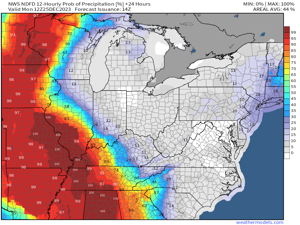
This graphic shows you the rain probabilities through midnight tonight. As you can see, the rain probabilities are much higher over western Missouri and Arkansas today and this evening. Our region will remain dry or mostly dry (I can’t rule out a stray light shower into this evening).
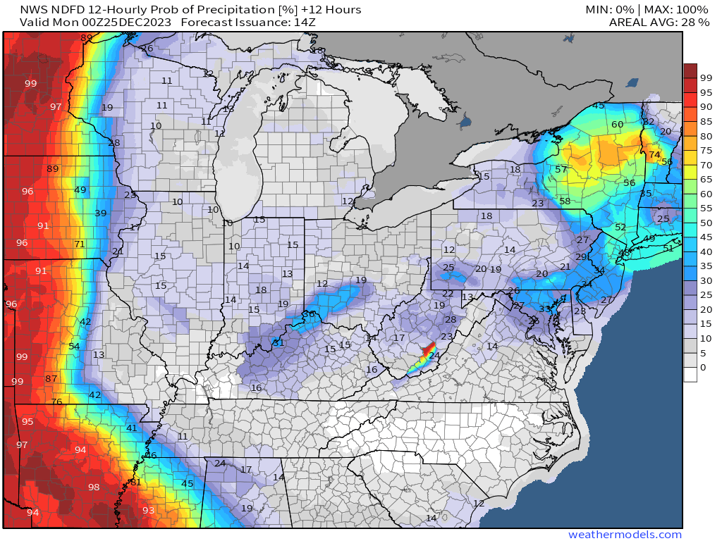
This graphic shows you rain probabilities late tonight into Monday. As you can see, we are pegged out. Widespread showers and perhaps even some thunderstorms. No severe concerns.
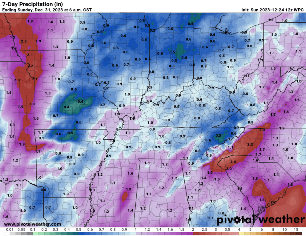
Rain totals of 0.5 to 1.00 are likely with this event. The last few events have underperformed for many areas. Let’s see how this one goes.
Here is the rainfall outlook. Most of this will fall tonight into tomorrow.
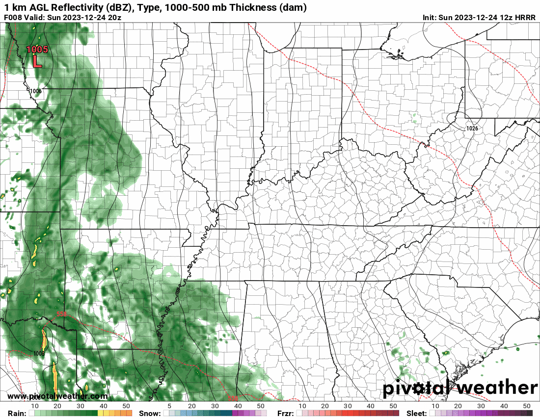
Let’s look at the future-cast radars. What radar might look like tonight into tomorrow.
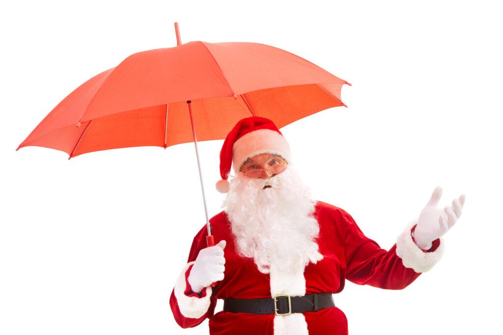
Umbrella weather for Santa!
The Hrrr model. Future-cast radar.
This is in Zulu time. 12z=6 am. 18z=12 pm. 00z=6 pm. 06z=12 am.
You can see the solid band of raining moving southwest to northeast across our region tonight and tomorrow. Scattered showers will be possible behind the primary band of rain.
The Week Ahead.
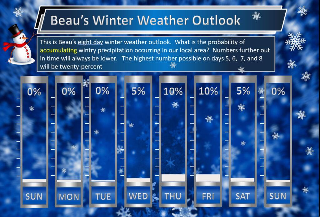
Beau’s exclusive seven-day snow forecast.
As we move through the week, a pesky upper-level low will develop over the Missouri and Ohio Valleys.
Upper-level lows are tricky to forecast. They usually end up cutting themselves off from the jet stream. They tend to move in erratic directions. Models do not handle upper-level lows all that well.
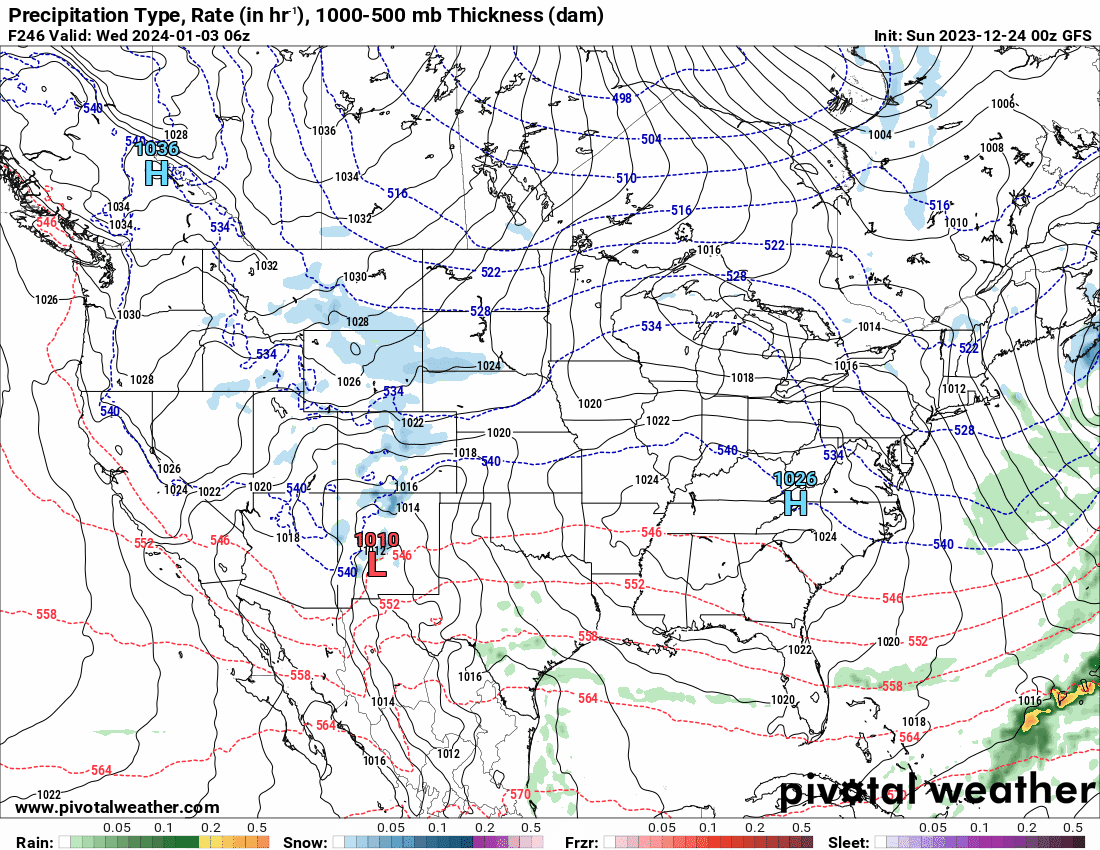
You can see that upper-level low on the GFS 500 mb map. Looking tens of thousands of feet aloft. This is upper-level energy rotating through the region. It will spark scattered showers and snow showers later this week.
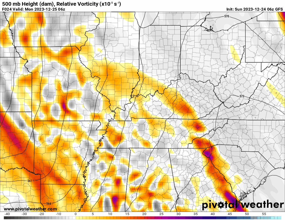
The GFS model shows the upper-level low in our region Tuesday through Friday. Perhaps even Saturday. There remain quite a few questions about how fast or slow this system exits the region.
Light showers and snow showers will accompany the upper level low. I can’t rule out some snow accumulation, but if that occurs it would be light. A dusting or so.
If some counties have snow, then that would most likely occur Wednesday night, Thursday night, and Friday night. Temperatures during the day will rise above freezing and that would diminish snow chances.
In other words, some snow showers at night and then it would change to rain* during the day.
*There is a chance that there could be some daytime snow showers, as well. That might be more likely over Missouri and Illinois vs Kentucky and Tennessee.
I will need to fine-tune that portion of the forecast.
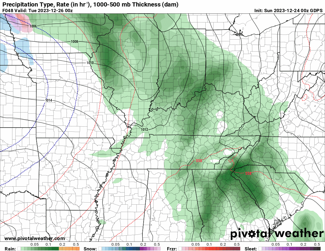
Green is rain. Blue is snow. Gusty winds may accompany the upper level low, as well.
The GFS model even shows accumulating snow in our region Wednesday into Thursday night. I will monitor the data. For now, I can’t rule out some light accumulation. A dusting or so.
Looking Ahead.
I will post this, because I know some of you want snow. You have been asking me about the long-range charts. Are they showing any snow? Are they showing any hope for team snow?
Now, I fully understand some of you hate winter. You hate snow. You hate the cold.
We can’t change the weather. We can’t wish winter away. It is part of living in our region. I love the four seasons. I enjoy the warm months and I enjoy the cold months.
I continue to watch the first week of January for a bigger snowstorm. Models occasionally show a snow event. Other times they do not.
Models do not handle features all that well in the long range. Thus, confidence in this event is low.
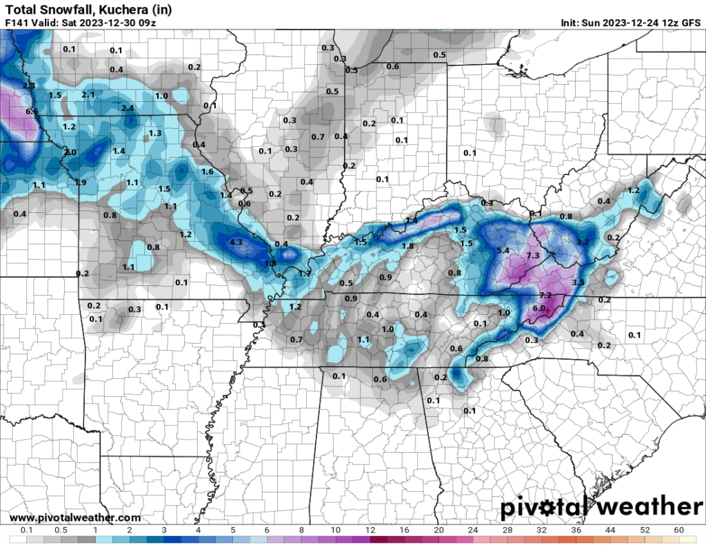
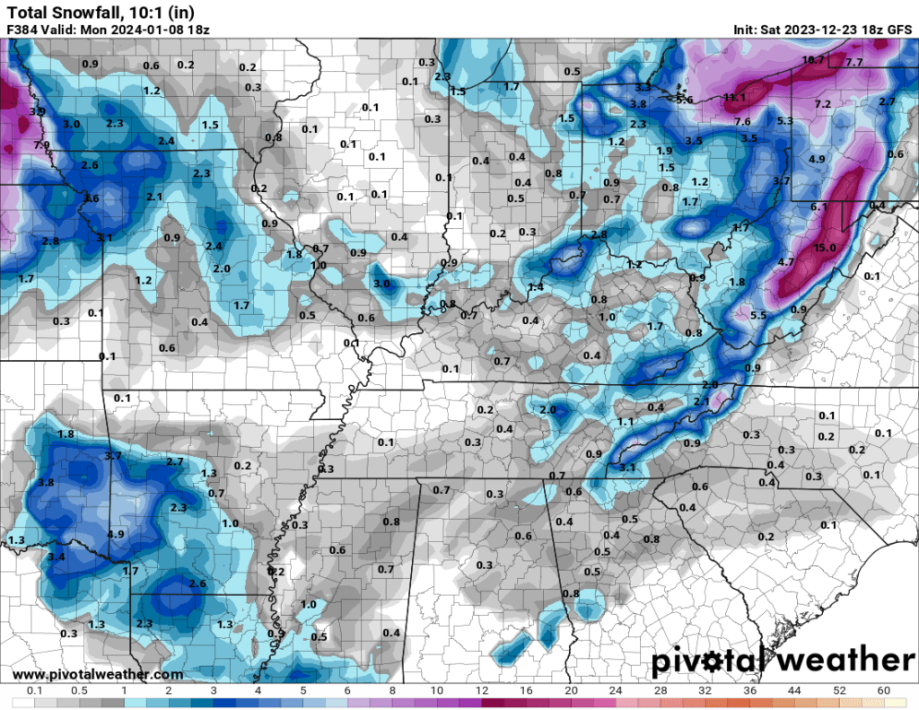
For example, check this run of the GFS model out. This is the model run from Saturday night. It shows a major winter storm in our region around January 4th.
The model runs four times each day.
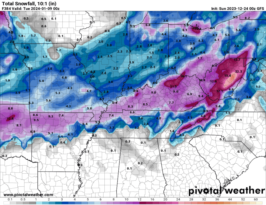
Look at the same model six hours later. Nothing. It lost the system. No snow or wintry mix.
Will the next run of the model bring it back? I will be monitoring the data.

Here is what the snowfall maps look like. Wild swings.
Here is one run that shows very little in the way of snow.
Another run of the same model. Again, wild swings!
Of course, it is way too early to make a snow forecast. I would be throwing darts if I told you it was going to snow five inches the first week of January!

If you have lived around here, for any amount of time at all, then you know how difficult snow forecasting 24 to 48 hours out. Let alone a week or two in advance.
It is not meteorologically possible to forecast snowstorms that far out in time. All we can do is monitor the data and watch for trends.
I will be on top of it, as always.
SUBSCRIBE TO www.weathertalk.com TO RECEIVE NOTIFICATIONS WHEN I UPDATE THE WEATHER BLOG, VIDEOS, AND MORE!
Want to receive more weather information? I provide a service through www.weathertalk.com
Subscribe at www.weathertalk.com and then download the Beau Dodson Weather app from the app stores!
Apple users: Beau Dodson Weather App
https://wtalk.co/9EZYG8A8
Android users: Beau Dodson Weather App
https://wtalk.co/ZEWYU8ME
Need help? Email me at beaudodson@usawx.com
* Daily weather forecasts
* My personal weather blog with all sorts of weather information!
* Special weather statements sent to the Beau Dodson Weather app.
* Rapid fire tornado alerts.
* Severe weather alerts and forecasts.
* Severe weather updates throughout the day (when severe weather is occurring)
* Ice storm alerts and forecasts.
* Winter storm alerts and forecasts.
* Winter storm updates throughout the event.
* Regional weather videos.
* Long range weather videos.
* A daily forecast that I hand type for your county. Sent out every afternoon.
* Long range outlooks. Including week one, two, three, four, and monthly outlooks. Seasonal outlooks.
* App messages to alert you when I have updated the weather blogs and Facebook.
* And more!
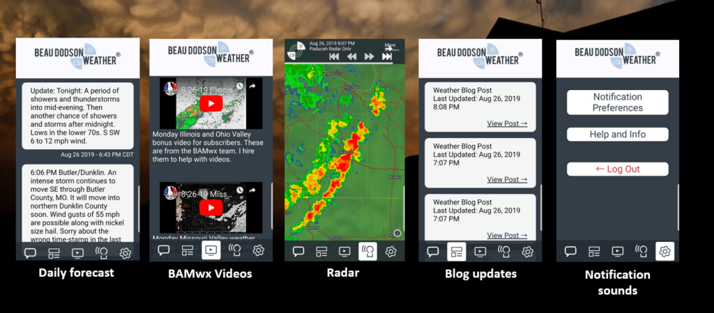
Here are some examples of what people receive when they subscribe to www.weathertalk.com
Have a very merry Christmas! Happy holidays.