Posted by Meteorologist Beau Dodson
Merry Christmas, everyone. I hope you had a nice day. The weather wasn’t the best, but it could have been worse.
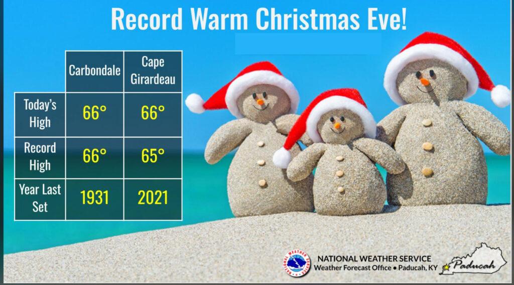
Yesterday was quite warm with record highs!
I am thankful that we did not have to deal with severe thunderstorms or tornadoes. With such warm temperatures, it certainly could have been an issue. We did not have CAPE to work with. Dew points were not quite high enough for concerns, as well.
CAPE is energy that thunderstorms tap into.
FORECAST
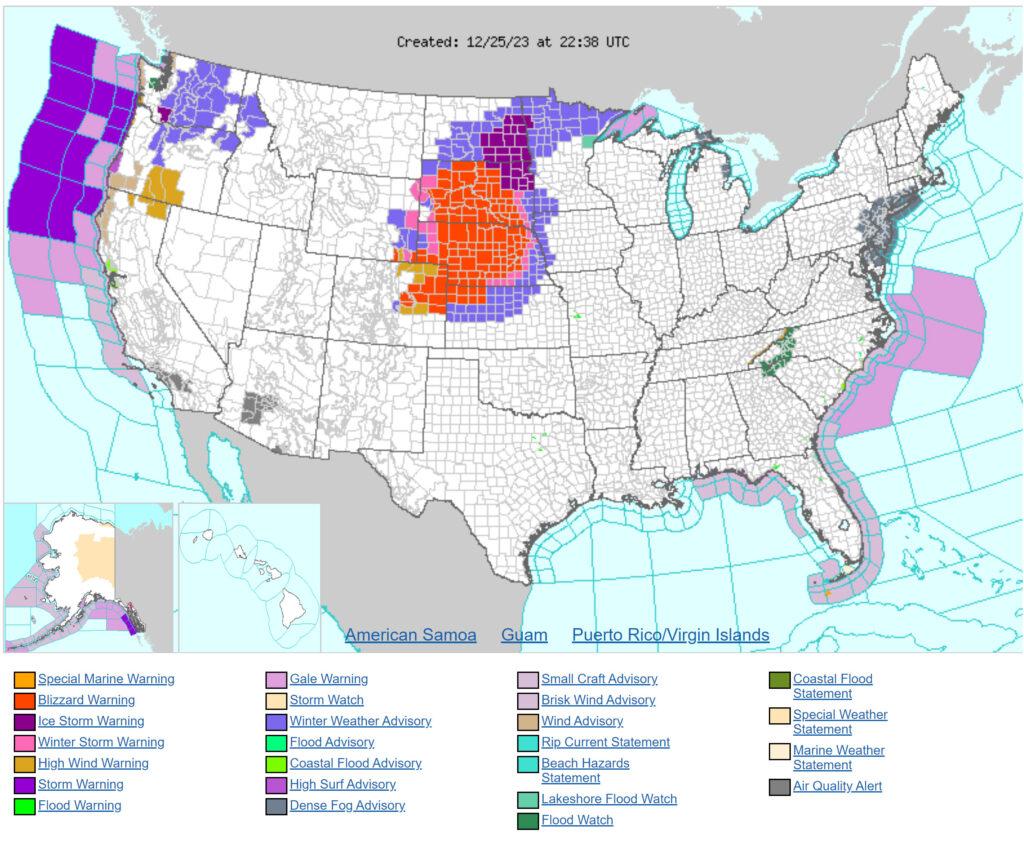
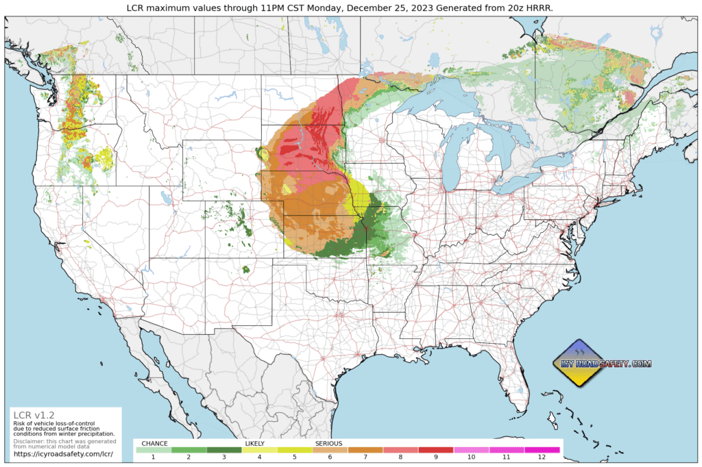
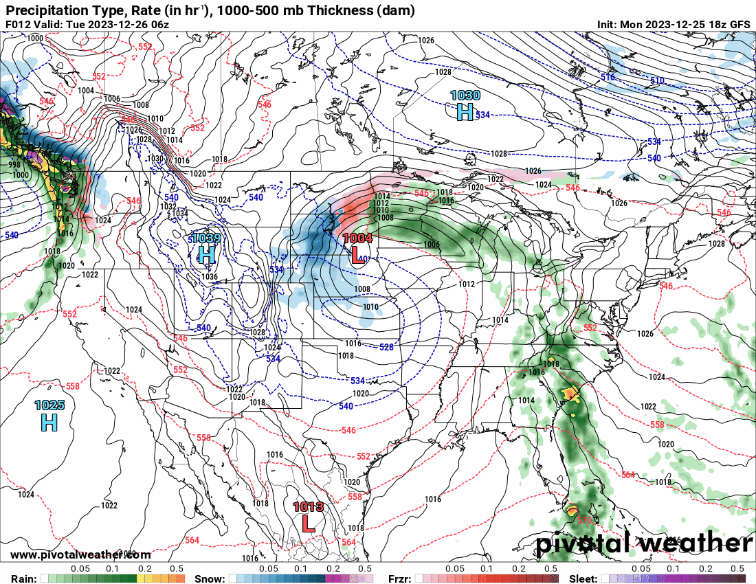
A blizzard is raging across portions of the central United States. That red zone is the blizzard warning.
That system will be moving our way over the next few days. Don’t get too excited, it won’t be a blizzard when it arrives in our region!
Icy road map shows widespread issues tonight from North Dakota to Kansas. Icy Road Map. Click here.
Some scenes from that area.
Rainfall totals in our region ranged from 0.40″ to around 1.00″ across the region. I will have some final numbers tomorrow. It was a widespread precipitation event.
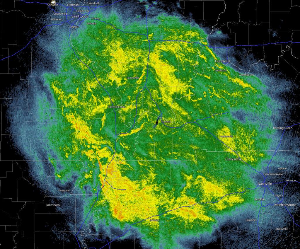
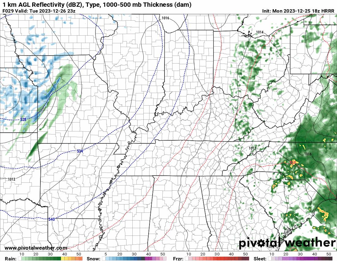
When I woke up this morning radar was completely covered in rain!
This was the 5 AM radar. This would have made for a nice snowstorm! Nature had other ideas. Sorry snow fans. That is Paducah in the middle of the graphic. Hard to see because of all the rain.
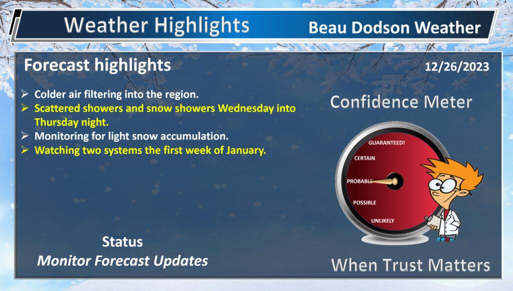
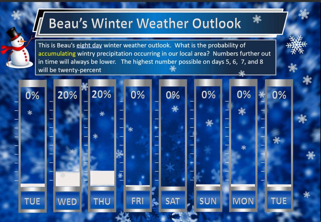
The Week Ahead.
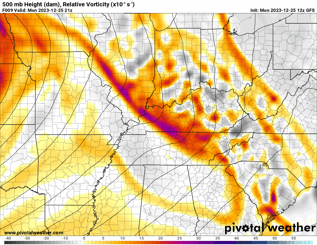
A large upper-level low will rotate into the region over the next couple of days. These upper-level lows bring very cold air aloft and are often accompanied by scattered rain and snow showers. Occasionally, they even produce low-topped thunderstorms with graupel or small hail.
This is the 500 mb map. That is upper-level energy in orange and red.
This upper-level low is going to bring colder temperatures, clouds, rain showers, and snow showers to our area. Gusty winds, as well.
Tuesday will be dry. A low-end chance of rain snow mix Tuesday night over northern portions of southeast Missouri.
Precipitation chances ramp up Wednesday into Thursday. Perhaps lingering into Thursday night.
I can’t rule out snow accumulation, but it is a bit problematic. Ground temperatures are warm. Temperatures during the day will be well above freezing. The rate of precipitation will mostly be light. All of this will hinder snow accumulation.
Temperatures at night, however, will dip below freezing in some counties. This is when the snow could accumulate. The odds are a bit higher of Missouri and Illinois vs Kentucky and Tennessee.
With that said, we will have to see where the upper-level low tracks. There is typically a heavier band of precipitation associated with these events. We call this a deformation zone.
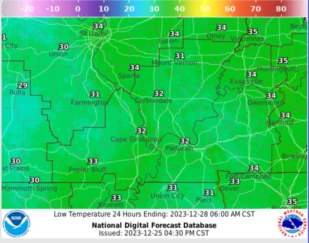
We will need to monitor precipitation and temperatures Wednesday night and Thursday night. This is when temperatures will fall below freezing.
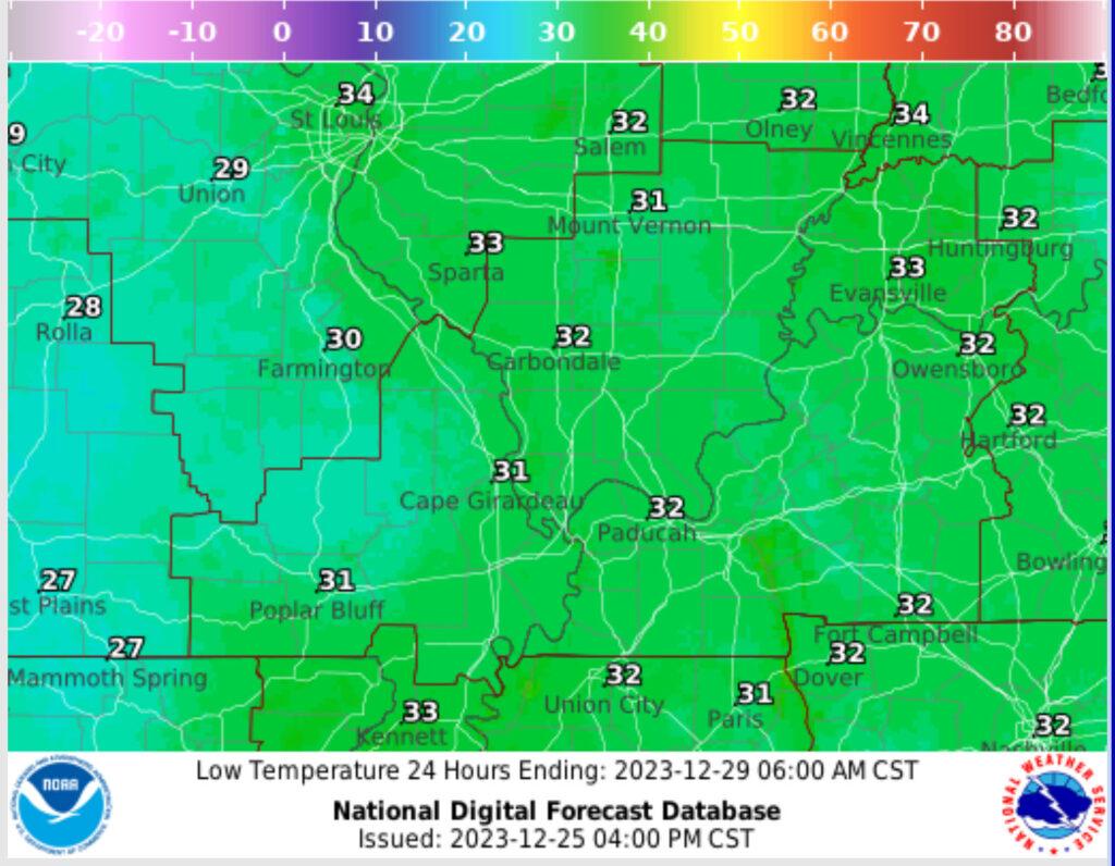
Wednesday night lows. Marginal for snow accumulation.
Thursday night lows. Marginal for snow accumulation.
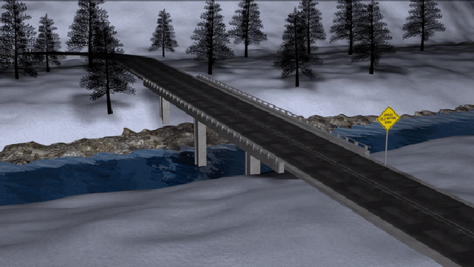
Remember, bridges and overpasses freeze first. Elevated surfaces freeze faster, as well (decks and porches).
Watch the red L. It rotates into our region. Green is rain. Blue is snow.
Timestamp upper left.
Here is the Hrrr model that shows the upper-level low rotating into our region.
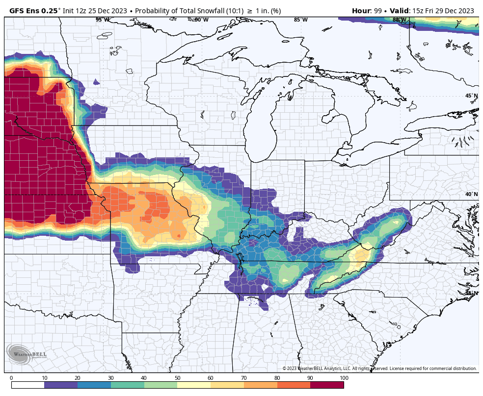
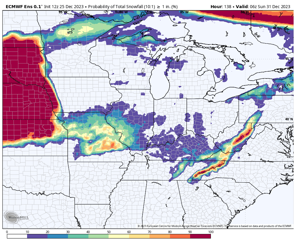
Let’s look at some ensembles.
What is the probability of one inch of snow. Two models. You can see the odds are higher over Missouri and Illinois. Lower chances as you move into Kentucky and Tennessee.
]
So, that is it! Let’s see how this week unfolds. Maybe a surprise for a few counties. I guess it isn’t a total surprise since we are talking about it!
I continue to watch the first week or so of January for a bigger winter storm event. This remains a low confidence forecast.
Data continues to paint one or two winter storms that week across the eastern United States. I will be monitoring and updating over the coming days!
Have a great night.
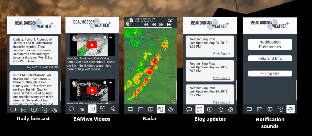
Want to receive more weather information? I provide a service through www.weathertalk.com
Subscribe at www.weathertalk.com and then download the Beau Dodson Weather app from the app stores!
Apple users: Beau Dodson Weather App
https://wtalk.co/9EZYG8A8
Android users: Beau Dodson Weather App
https://wtalk.co/ZEWYU8ME
Need help? Email me at beaudodson@usawx.com
* Daily weather forecasts
* My personal weather blog with all sorts of weather information!
* Special weather statements sent to the Beau Dodson Weather app.
* Rapid fire tornado alerts.
* Severe weather alerts and forecasts.
* Severe weather updates throughout the day (when severe weather is occurring)
* Ice storm alerts and forecasts.
* Winter storm alerts and forecasts.
* Winter storm updates throughout the event.
* Regional weather videos.
* Long range weather videos.
* A daily forecast that I hand type for your county. Sent out every afternoon.
* Long range outlooks. Including week one, two, three, four, and monthly outlooks. Seasonal outlooks.
* App messages to alert you when I have updated the weather blogs and Facebook.
* And more!
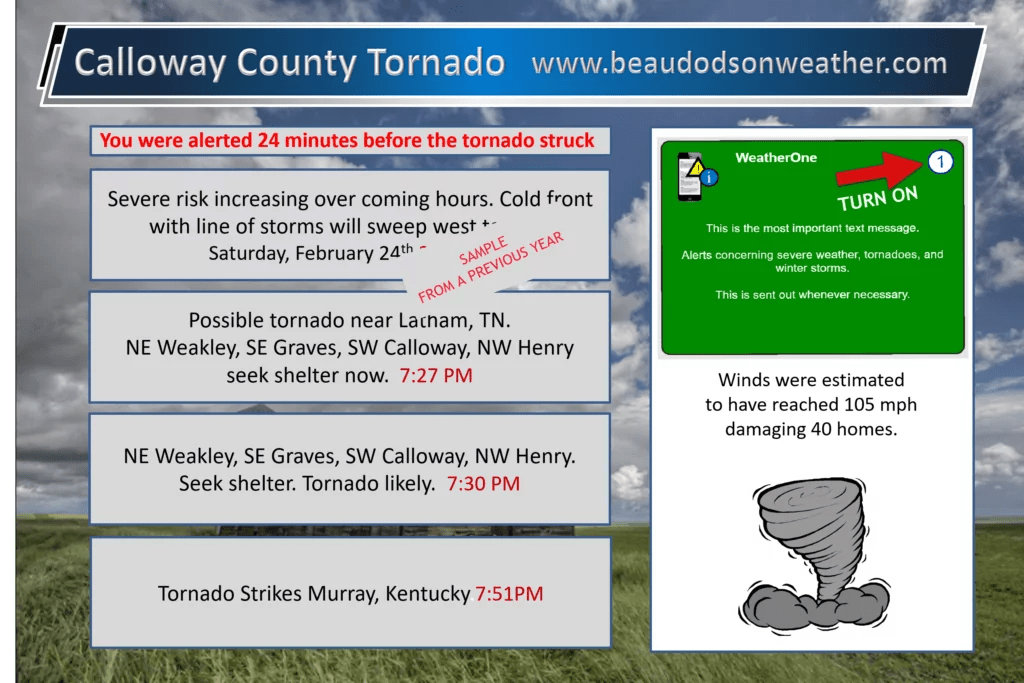
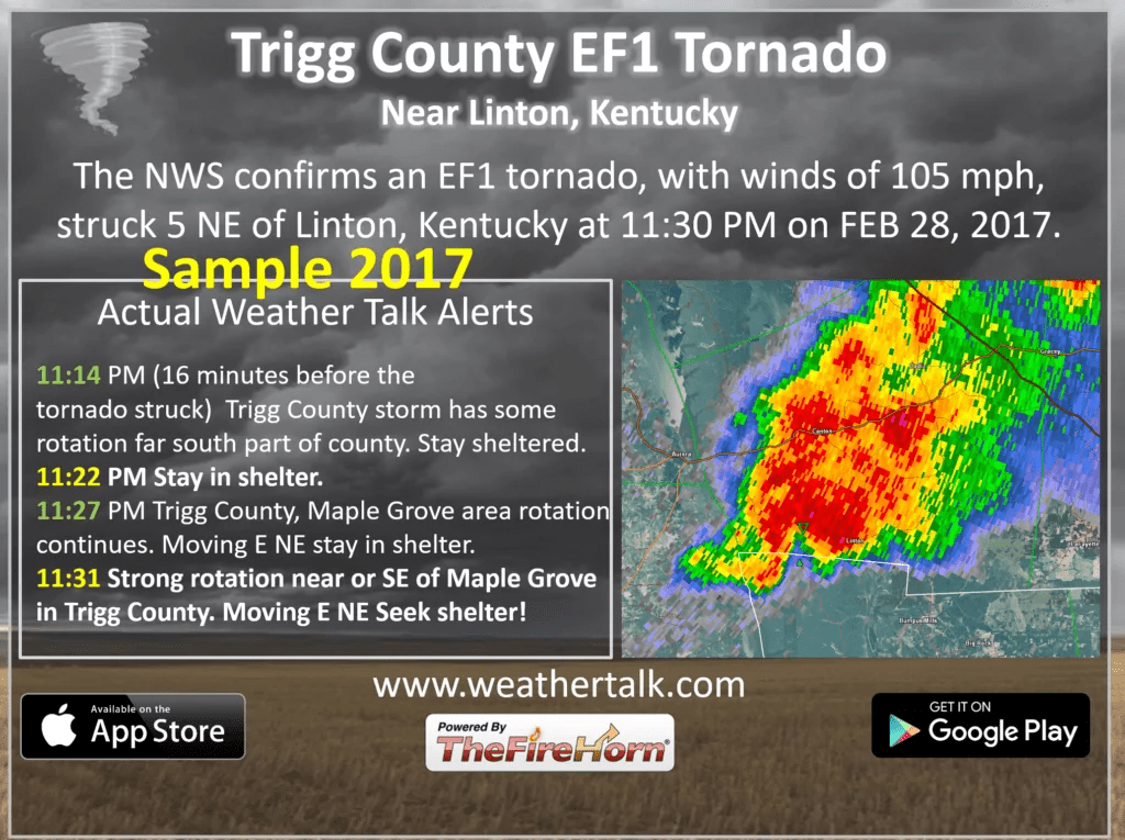
Here are some examples of what people receive when they subscribe to www.weathertalk.com