Posted by Meteorologist Beau Dodson
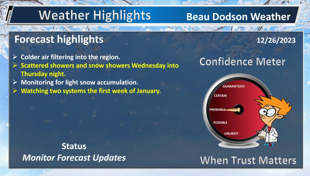
Well, we have several days of unsettled weather ahead of us.
Yesterday’s Rain Event
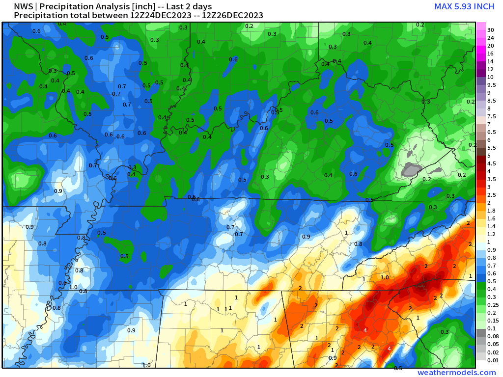
Widespread rain impacted the area yesterday. Rain totals were mainly in the 0.4 to 0.8″ range, but some locations did receive less and some more. As is usually the case. It is difficult to see uniform rain totals over a four-state area.
Here are the radar estimated rain totals.
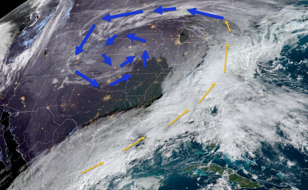
A large upper-level low will spiral across our region today into Friday. This slow moving upper-level low will bring a chance of rain and snow showers to the region. That rain and rain/snow will develop late tonight over northern portions of southeast Missouri and will then spread southeast into the rest of the region.
You can see the upper-level low on this morning’s satellite. Satellite shows clouds.
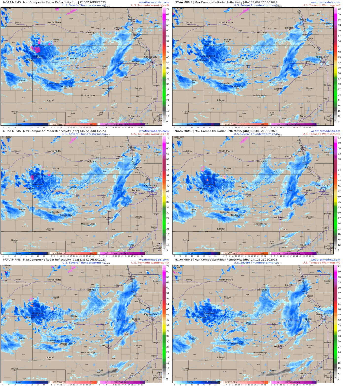
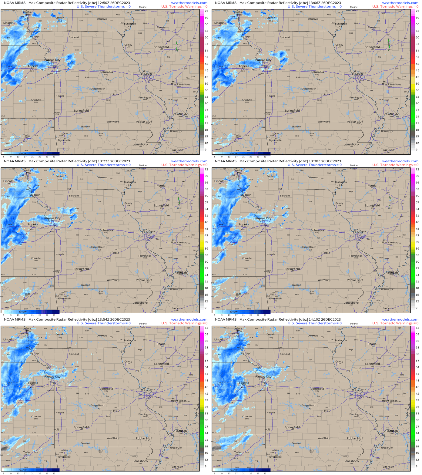
You can see the sprial on the Kansas and Missouri radars. This was taken a 9 am. Blue is snow.
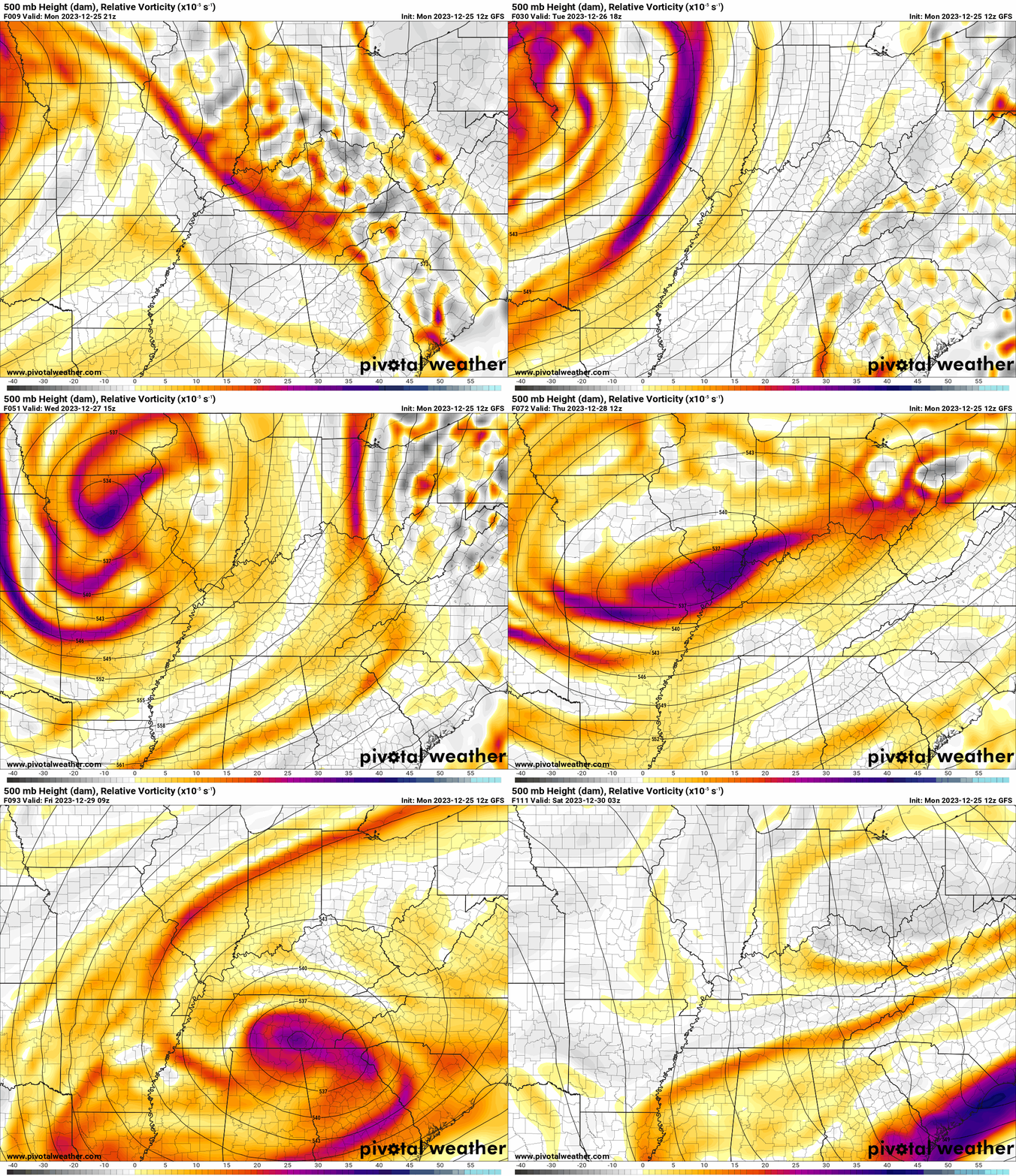
500 MB Upper-Level Map
You can see the spiral of the low on this 500 mb map. The orange and red colors are energy/lift. Vorticity.
Gusty winds will accompany it, as well. It will be a bit raw from time to time. Chilly temperatures.
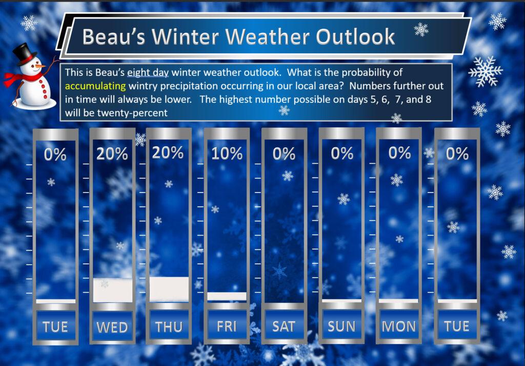
Accumulating snow will be hard to come by, but some locations could pick up a dusting to an inch or so on grassy and elevated surfaces.
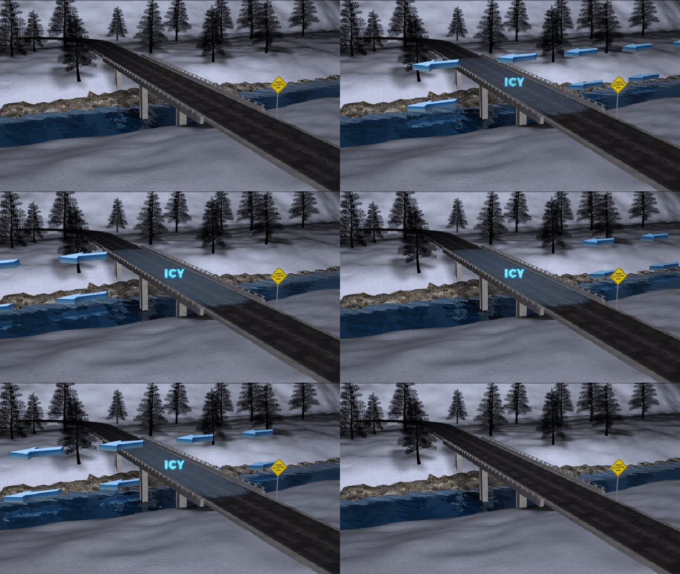
If temperatures are cold enough during the overnight hours, then we would need to watch bridges and overpasses. They tend to freeze before everything else.
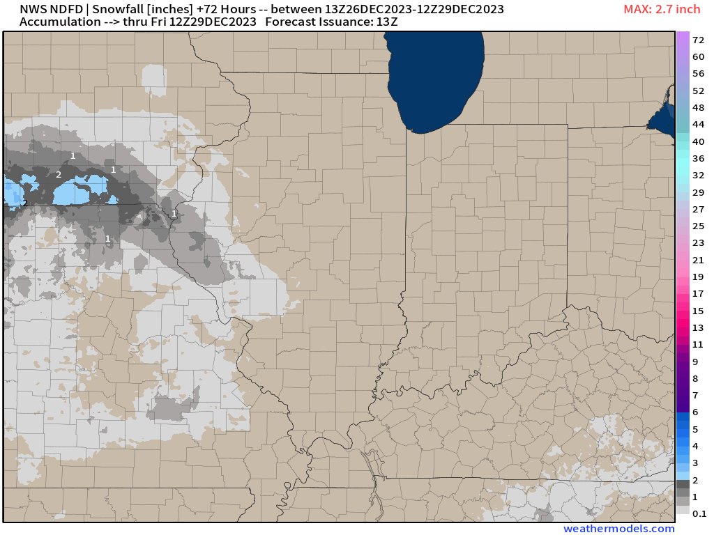
The official NOAA snowfall map shows very little chance of accumulating snow locally. With that said, I do think some areas pick up a dusting to an inch of snow. I would extend that farther southeast.
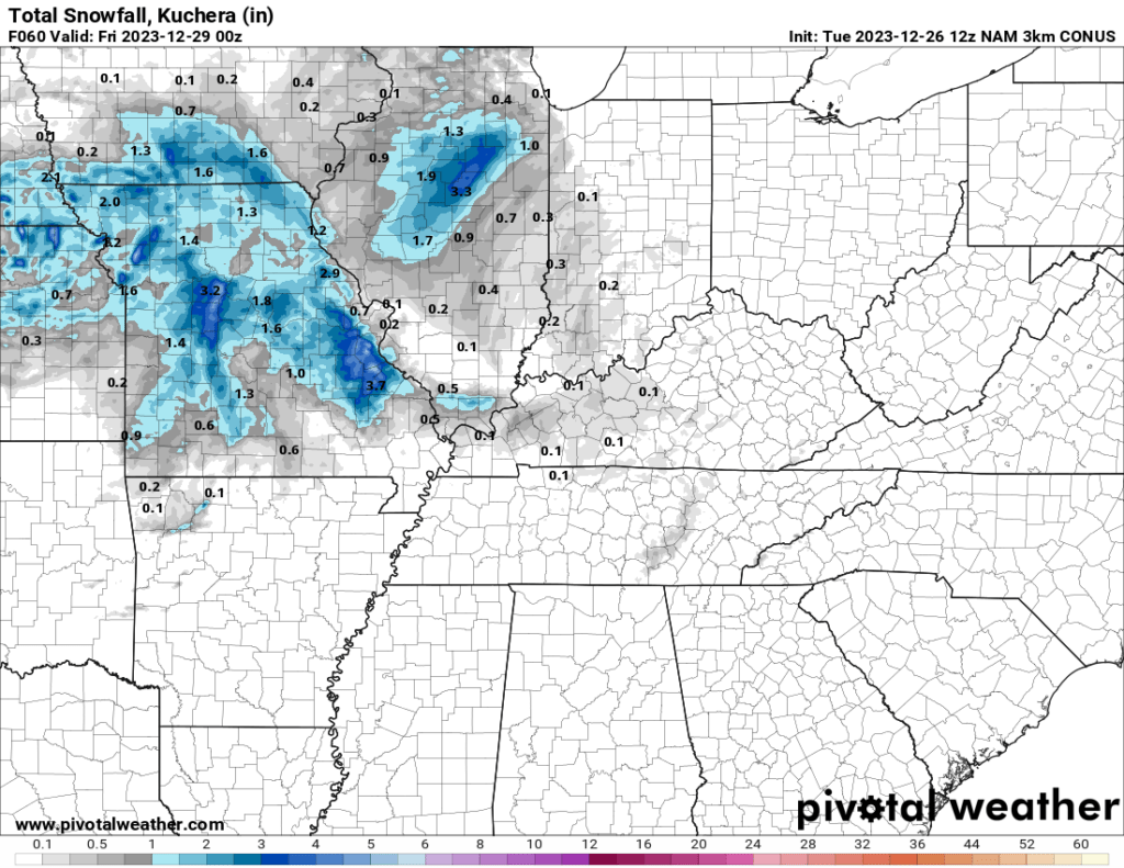
Here are three models. This is what they are forecasting for snow totals. Keep in mind, this does not take into account ground temperatures and other factors. This is a marginal snow accumulating event. Meaning. it will be difficult for snow to accumulate.
Hrrr model
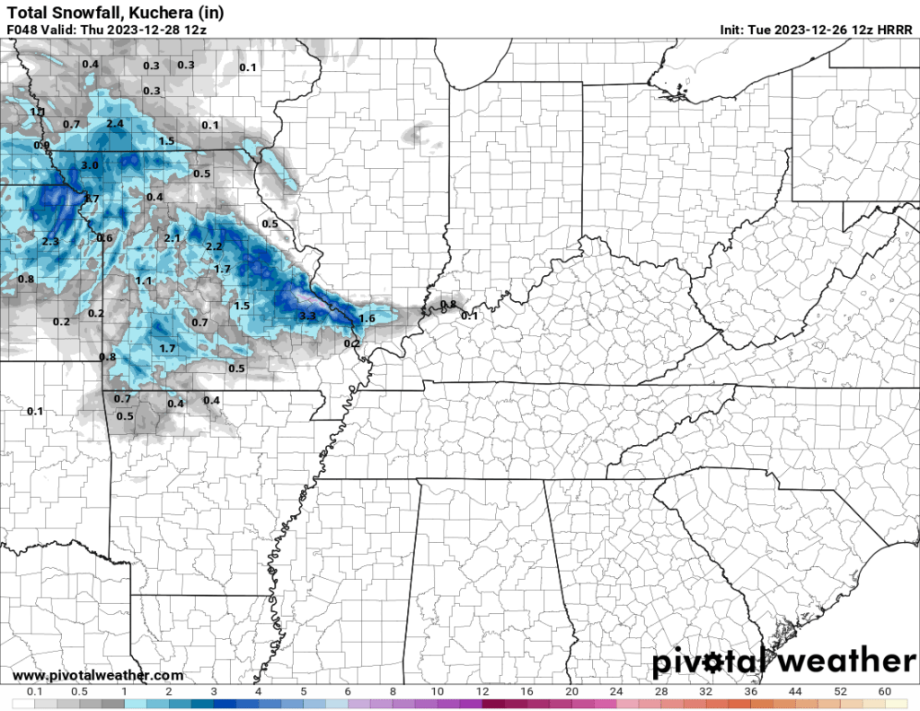
NAM model

NAM 3K model
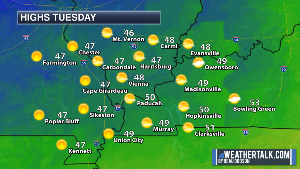
Today will be quiet. No weather concerns. Temperatures will be near seasonal levels.
Clouds will increase tonight with a chance of rain and snow over far northern portions of southeast Missouri.
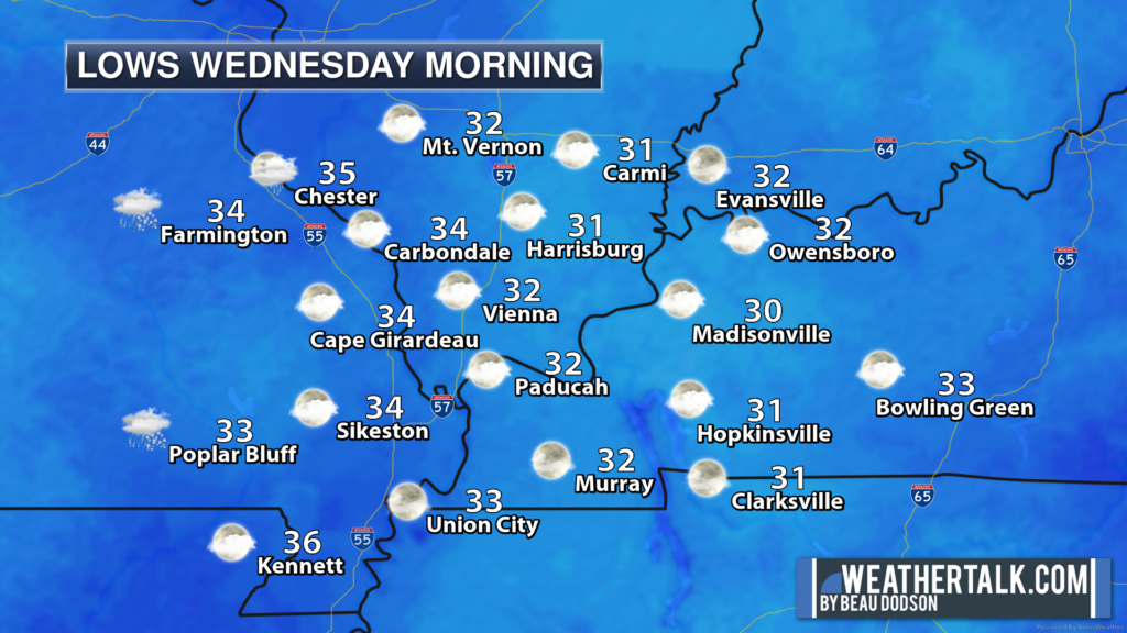
Rain and rain/snow chances will increase over the region tomorrow and tomorrow night. Any morning snow would change to all rain as temperatures rise above freezing Wednesday, Thursday, and Friday.
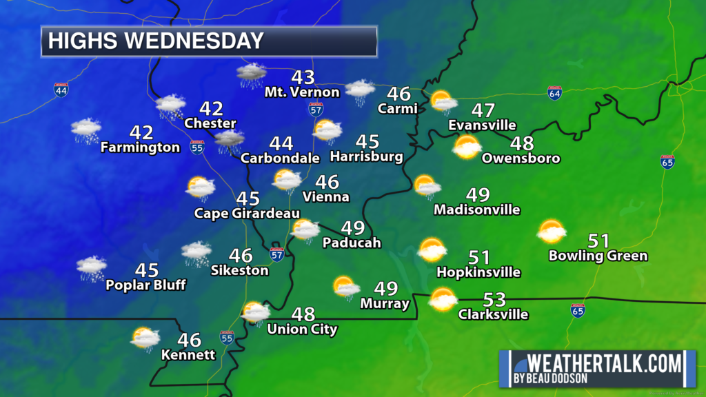
Wednesday and Thursday night temperatures will fall to near or below freezing. There will be scattered showers in the region. Rain may change to snow, as well. Again, any accumulation would be light. Monitor updates.
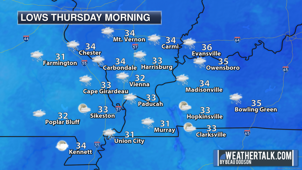
The highest chance of snow accumulating will be across southeast Missouri and southern Illinois. Perhaps northwest Kentucky, as well. Lower chances elsewhere.
These upper-level systems often offer up some surprises. They can produce bands of heavier precipitation. Even convection (lightning). It will be very cold aloft under this system.
Any convective showers would produce small hail and graupel, as well.
Here is the NAM model future-cast radar. Green is rain. Blue is snow. You can see it pivoting into the area. Moving from the northwest to the southeast.
Timestamp is Zulu time. 12z=6 AM. 18z=1 PM. 00z=6 PM. 06z=12 AM.
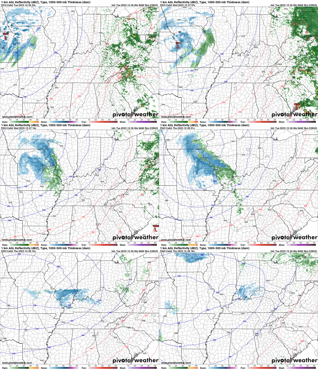
The bulk of this system will push across the region tomorrow and tomorrow night, but lingering rain and snow showers will likely continue into at least Thursday night and some data shows into Friday. We will have to see how fast it pushes off to the east southeast.
Let’s look at some ensemble model data.
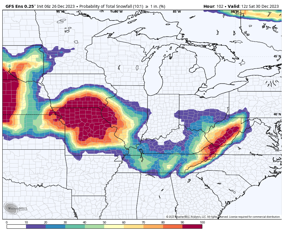
What is the chance of one inch of snow between now and Friday? Here is what the GFS model shows. You can see the higher chances will be to our northwest. But there is at least a chance for some of our counties.
Whatever falls would melt during the day. Temperatures will rise above freezing each day this week. The primary concern would be late at night and early in the morning when temperatures are a bit colder.
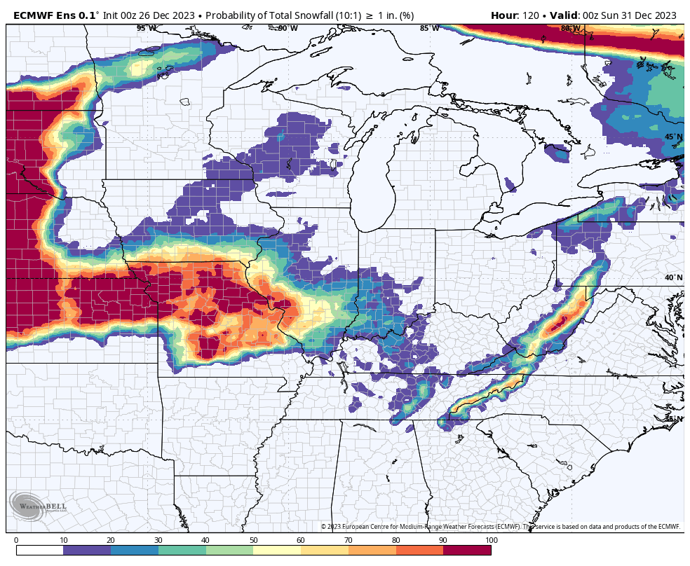
The EC model. What is the probability of one inch of snow. Again, you can see that it places the highest chances to our northwest.
Dry conditions are likely Saturday into Monday.
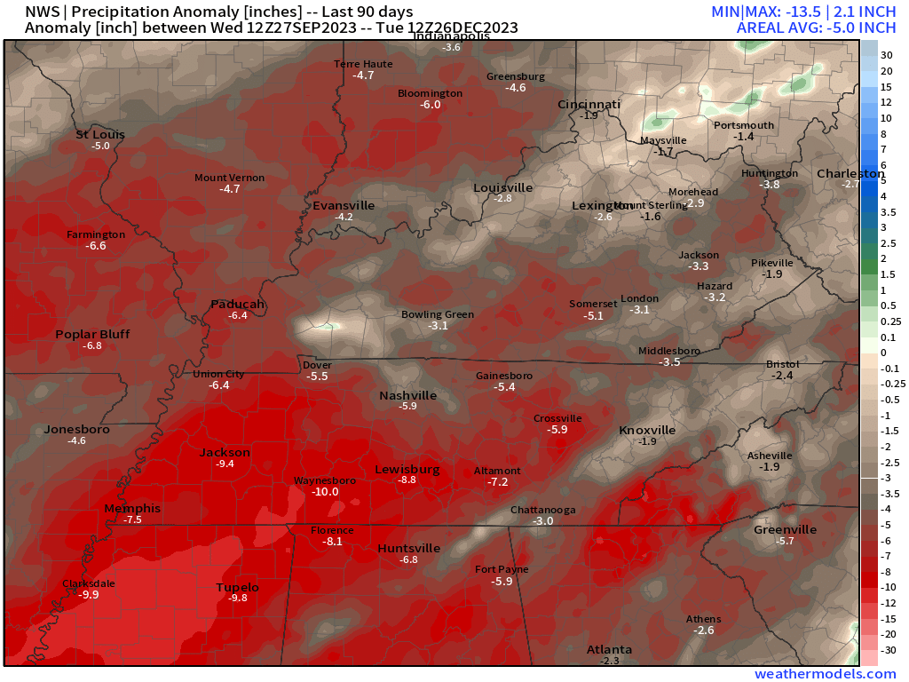
Speaking of dry, let’s look at the last 90 days of precipitation. This map shows you the rainfall anomaly in inches. We are well below average in the rainfall department. This is why we are in drought.

What about extended snow chances?
And yes, I continue to watch the first week or so of January for one or more systems. It is still too early to know if snow will be a concern.
Models are experiencing wild swings. At times showing a heavy snow event. Other times showing dry conditions. I am hoping to know more by Friday.
Have a great day.
Want to receive more weather information? I provide a service through www.weathertalk.com
Subscribe at www.weathertalk.com and then download the Beau Dodson Weather app from the app stores!
Apple users: Beau Dodson Weather App
https://wtalk.co/9EZYG8A8
Android users: Beau Dodson Weather App
https://wtalk.co/ZEWYU8ME
Need help? Email me at beaudodson@usawx.com
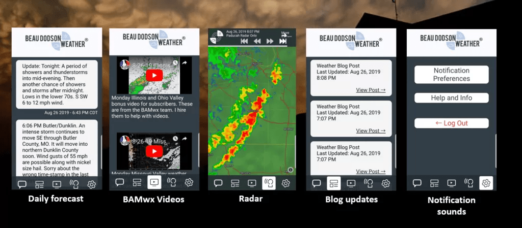
* Daily weather forecasts
* My personal weather blog with all sorts of weather information!
* Special weather statements sent to the Beau Dodson Weather app.
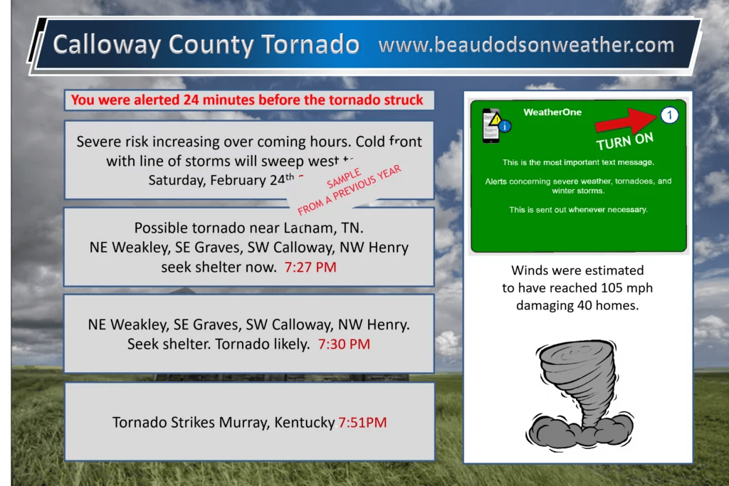
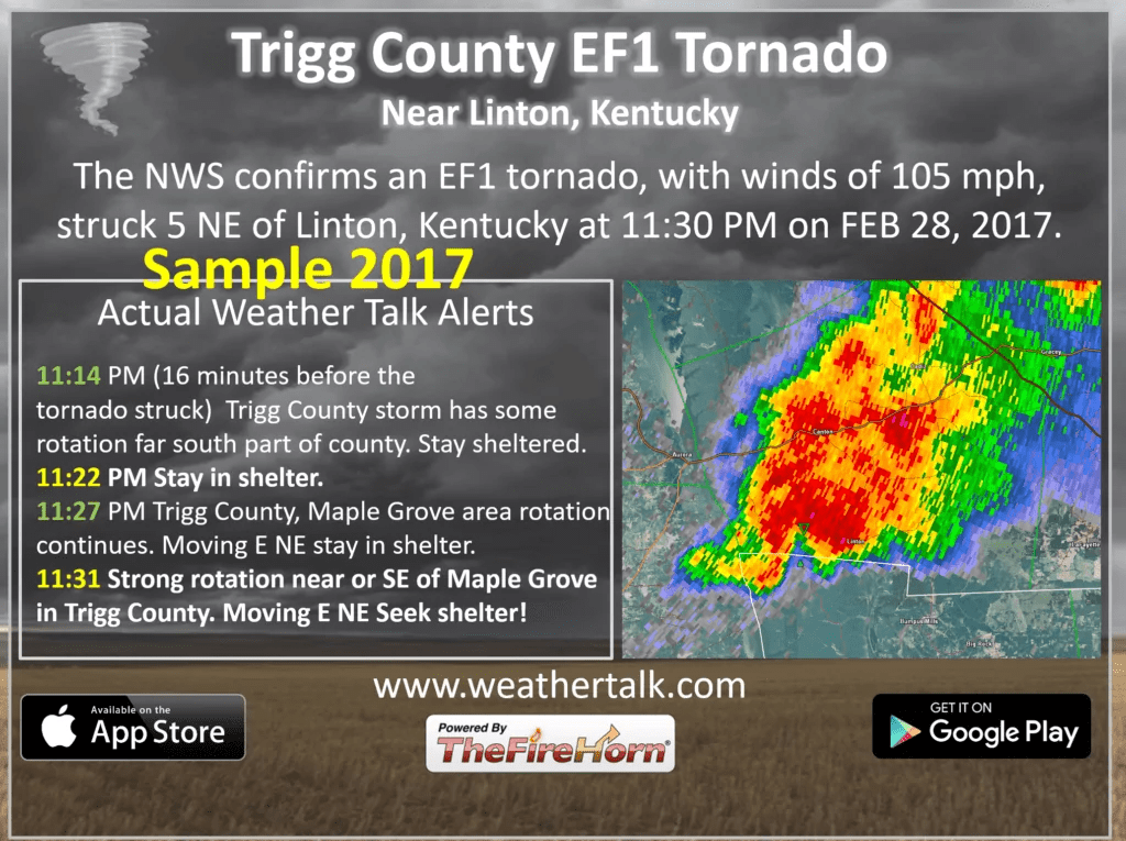
* Rapid fire tornado alerts.
* Severe weather alerts and forecasts.
* Severe weather updates throughout the day (when severe weather is occurring)
* Ice storm alerts and forecasts.
* Winter storm alerts and forecasts.
* Winter storm updates throughout the event.
* Regional weather videos.
* Long range weather videos.
* A daily forecast that I hand type for your county. Sent out every afternoon.
* Long range outlooks. Including week one, two, three, four, and monthly outlooks. Seasonal outlooks.
* App messages to alert you when I have updated the weather blogs and Facebook.
* And more!
Here are some examples of what people receive when they subscribe to www.weathertalk.com
