Posted by Meteorologist Beau Dodson
Special Weather Statement
Confidence in the overall forecast? Medium.
What? Scattered showers and snow showers.
When? Today through Friday.
Where? Higher precipitation coverage across Missouri and Illinois with somewhat lesser coverage as you move towards the Bootheel and northwest Tennessee. Kentucky will experience on and off scattered showers. At night and during the morning there could be snow showers mixed in, as well.
Impacts? Minimal impacts are anticipated from this event. I encourage you to monitor air temperatures late at night and during the morning hours. If they dip below freezing then be careful on bridges, overpasses, decks, and porches. Elevated surfaces could briefly freeze. Road temperatures are fairly warm. This will help prevent impacts. The road department, in some areas, will be salting, as well.
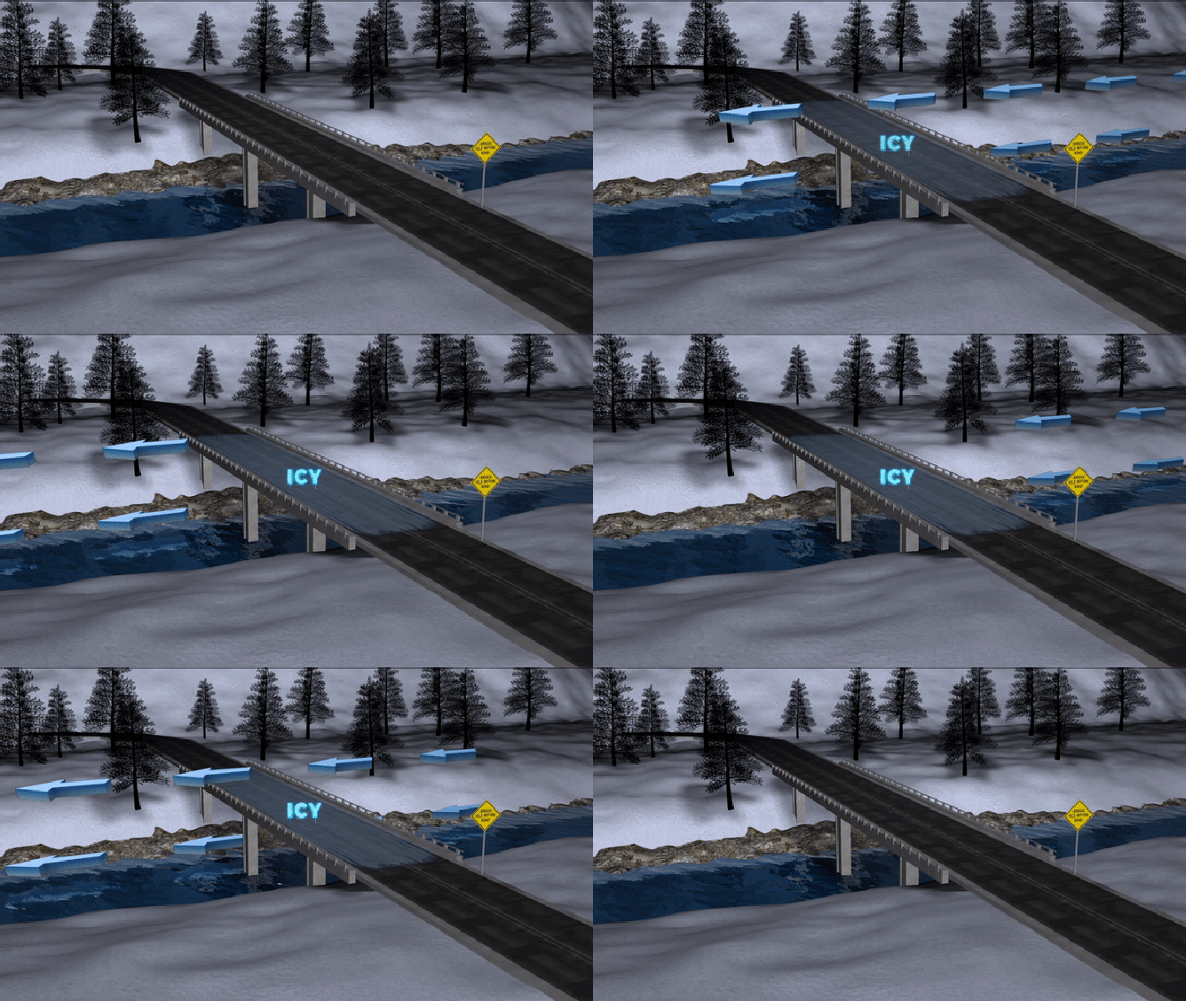
Do I need to worry? Minimal impacts are anticipated with this event. Occasionally, these upper-level lows can overproduce in spots. That would most likely occur across eastern Missouri and southwest Illinois. My main concern is elevated surfaces if temperatures fall into the upper 20s or around 30 degrees.
Temperatures are marginal for this event to produce much in the way of impacts.
Uncertainties? There are questions about Friday’s forecast. Some of the data shows a second upper-level low moving across the region. That would bring additional precipitation.
FORECAST
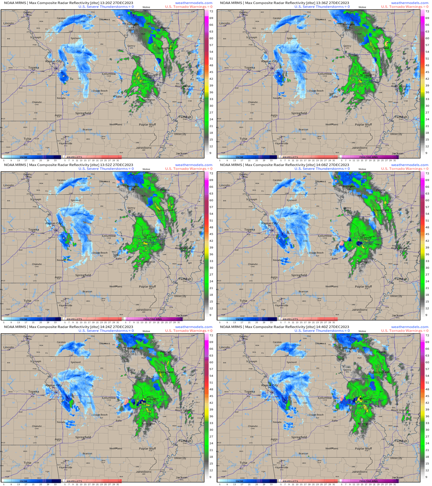
9 AM radar shows the upper-level low rotating counterclockwise across Missouri. You can clearly see the spin.
Low pressure rotates counterclockwise.
See out exclusive live radar links below this animation. Don’t forget on the local city-view radars to click the WINTERIZE button to see precipitation type.
BEAU’S EXCLUSIVE LIVE LOCAL CITY-VIEW RADARS
Interactive local city-view radars. Clickable watches and warnings.
https://beaudodsonweather.com/weather-radars/
Backup radar site in case the above one is not working.
https://weathertalk.com/morani
Regional Radar
https://imagery.weathertalk.com/prx/RadarLoop.mp4
A large upper-level low will bring scattered showers and snow showers to the area today into Friday.
This will be a light precipitation event. Rainfall totals of a trace to 0.25″ are expected. Locally higher in banding.
Banding is enhanced areas of precipitation that move over the same area repeatedly.
There will be periods of time where temperatures will be cold enough for a rain/snow mix or all snow. This is most likely to occur at night and during the morning hours.
Light snow accumulation is possible on grassy surfaces. Elevated surfaces, as well. A trace to a solid dusting of snow is the going forecast. Not everyone will experience that. That is more likely over Missouri and Illinois.
Let’s look at some maps.
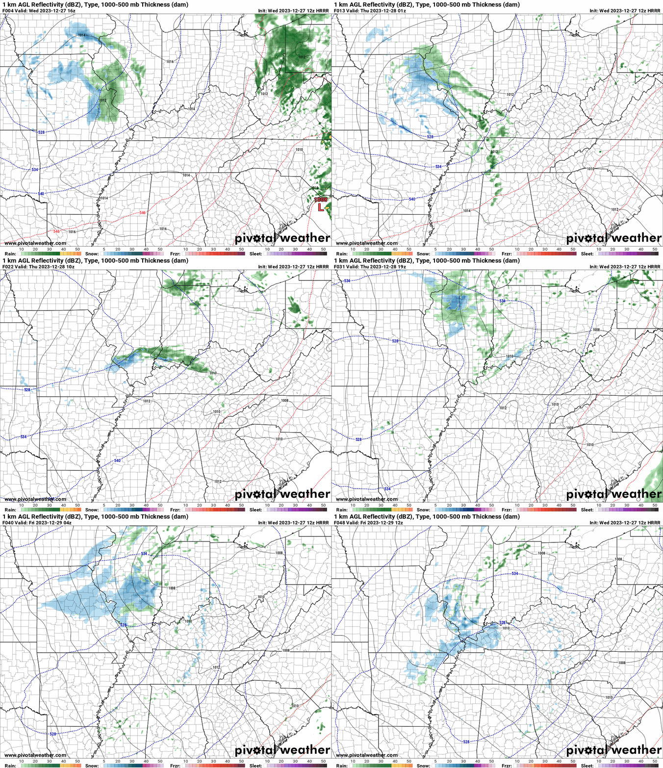
Here is the high resolution Hrrr model. Future-cast radar. Zulu time. 12z=6 am. 18z=12 pm. 00z=6 pm. 06z=12 am.
What radar might look like. Blue is snow. Green is rain.
Paducah, Kentucky NWS Hazardous Weather Outlook
This Hazardous Weather Outlook is for portions of southern Illinois, southwest Indiana, western Kentucky, and southeast Missouri. .
DAY ONE. Today and Tonight
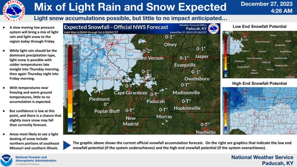
Light snow may produce a dusting, mainly on grassy surfaces or elevated areas for portions of southeast Missouri and southern Illinois, especially late tonight. .
DAYS TWO THROUGH SEVEN. Thursday through Tuesday
Light snow with a minor dusting is possible Thursday through Friday. This will be mainly for grassy surfaces or elevated areas across southern Illinois, spreading eastward into and across southwest Indiana and portions of western Kentucky. .
SPOTTER INFORMATION STATEMENT
Spotter activation will not be needed.
This graphic is from the Paducah, Kentucky NWS. As you can see the primary area with snow accumulation potential is across Missouri and Illinois. Lower chances across Kentucky and Tennessee.
These graphics are from the St Louis, Missouri, NWS
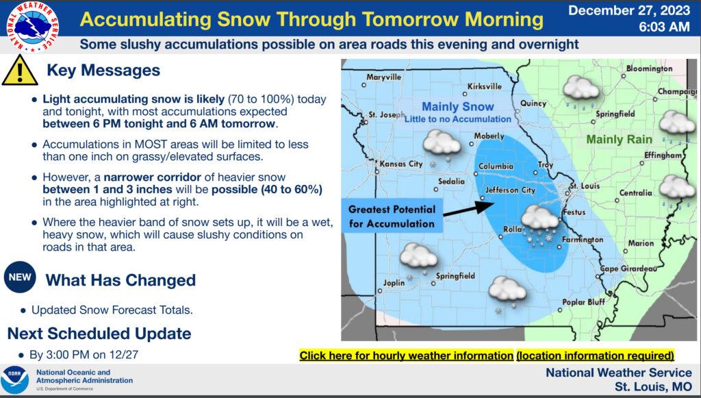
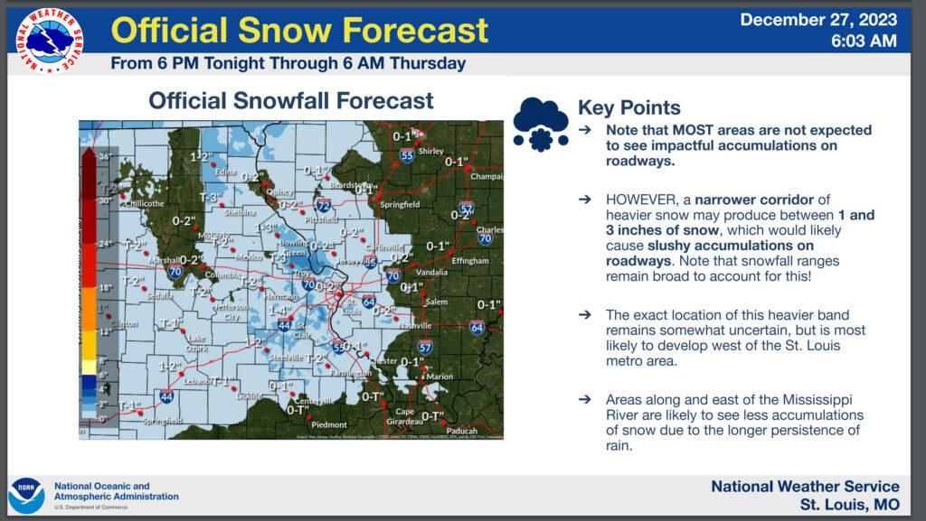
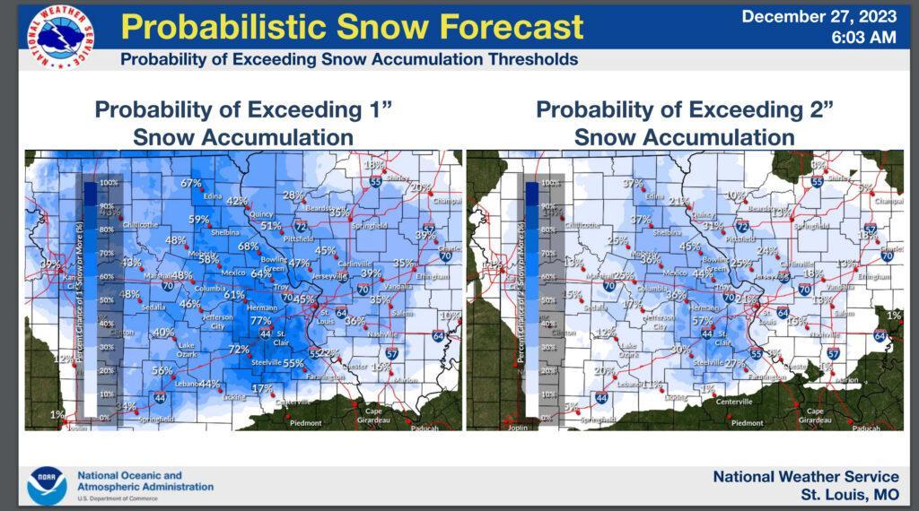
Here is a weather briefing from the St Louis, Missouri, National Weather Service
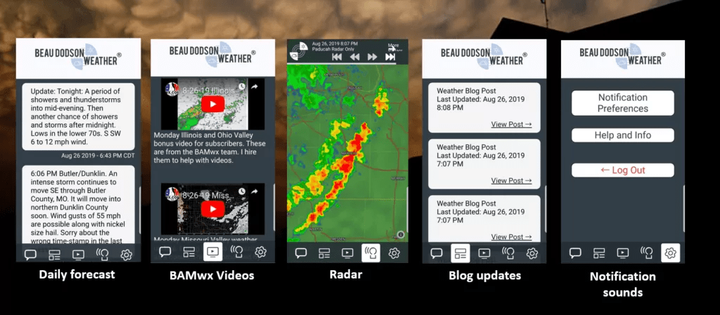
Want to receive more weather information? I provide a service through www.weathertalk.com
Subscribe at www.weathertalk.com and then download the Beau Dodson Weather app from the app stores!
Apple users: Beau Dodson Weather App
https://wtalk.co/9EZYG8A8
Android users: Beau Dodson Weather App
https://wtalk.co/ZEWYU8ME
Need help? Email me at beaudodson@usawx.com
* Daily weather forecasts
* My personal weather blog with all sorts of weather information!
* Special weather statements sent to the Beau Dodson Weather app.
* Rapid fire tornado alerts.
* Severe weather alerts and forecasts.
* Severe weather updates throughout the day (when severe weather is occurring)
* Ice storm alerts and forecasts.
* Winter storm alerts and forecasts.
* Winter storm updates throughout the event.
* Regional weather videos.
* Long range weather videos.
* A daily forecast that I hand type for your county. Sent out every afternoon.
* Long range outlooks. Including week one, two, three, four, and monthly outlooks. Seasonal outlooks.
* App messages to alert you when I have updated the weather blogs and Facebook.
* And more!
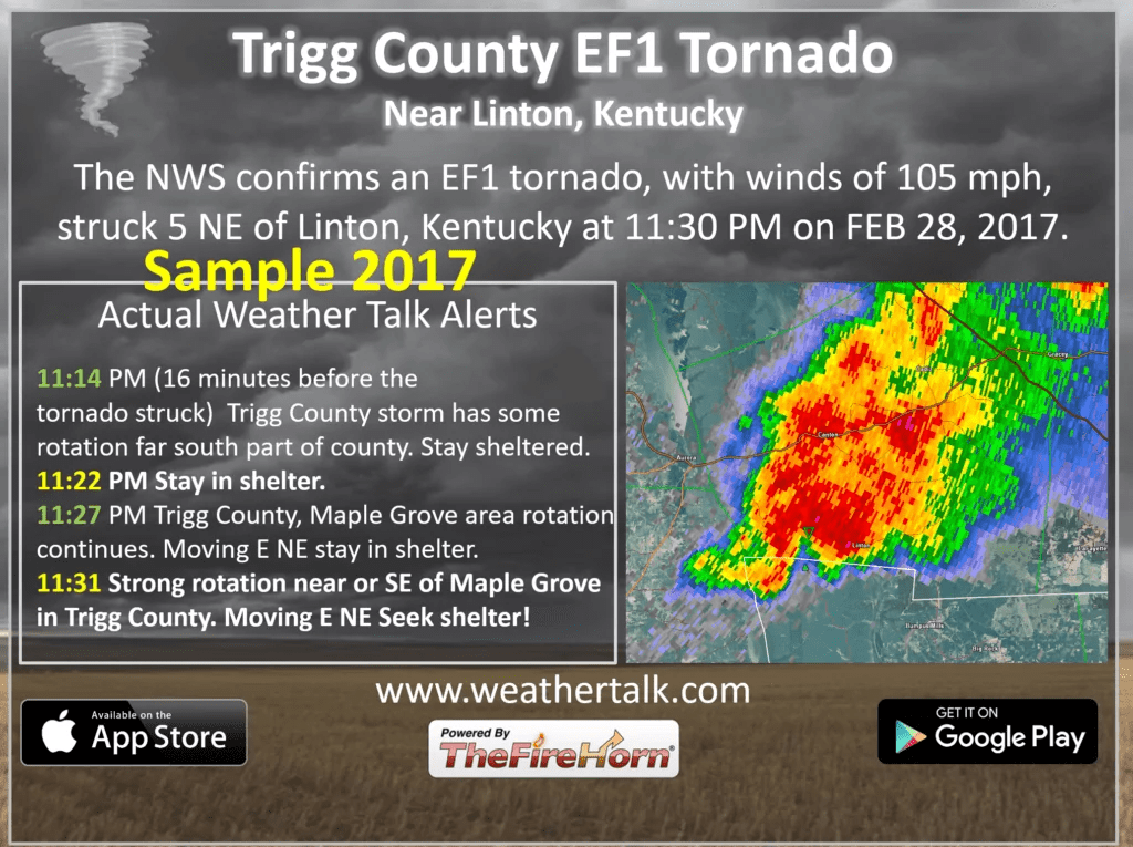
Here are some examples of what people receive when they subscribe to www.weathertalk.com
