Posted by Meteorologist Beau Dodson
Good day, everyone. I hope you and your family had a nice holiday season.
No weather concerns today into Friday afternoon. Calm weather. Cool temperatures. On and off clouds.
Our next storm system arrives Friday night into Saturday night with rain showers. Confidence in the overall forecast is increasing. I will know quite a bit more tomorrow.
All signs point to a few showers Friday night into Saturday night. It could be cold enough for a wintry mix, but accumulation will be difficult to come by.
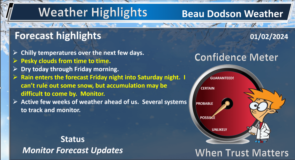
There had been some questions about accumulating snow, but with time it is becoming more evident that temperatures will be marginal for accumulating snow or wintry mix. Ground temperatures are fairly warm, as well.
I will continue to monitor trends in the guidance. The storm system is still four days away, so adjustments are still possible.
For now, this looks like mostly a rain event.
I just don’t see a path to this one being a winter storm event for our local area. To our east, it will likely bring a heavier round of winter precipitation.
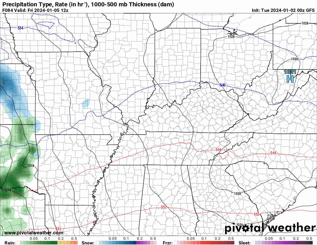
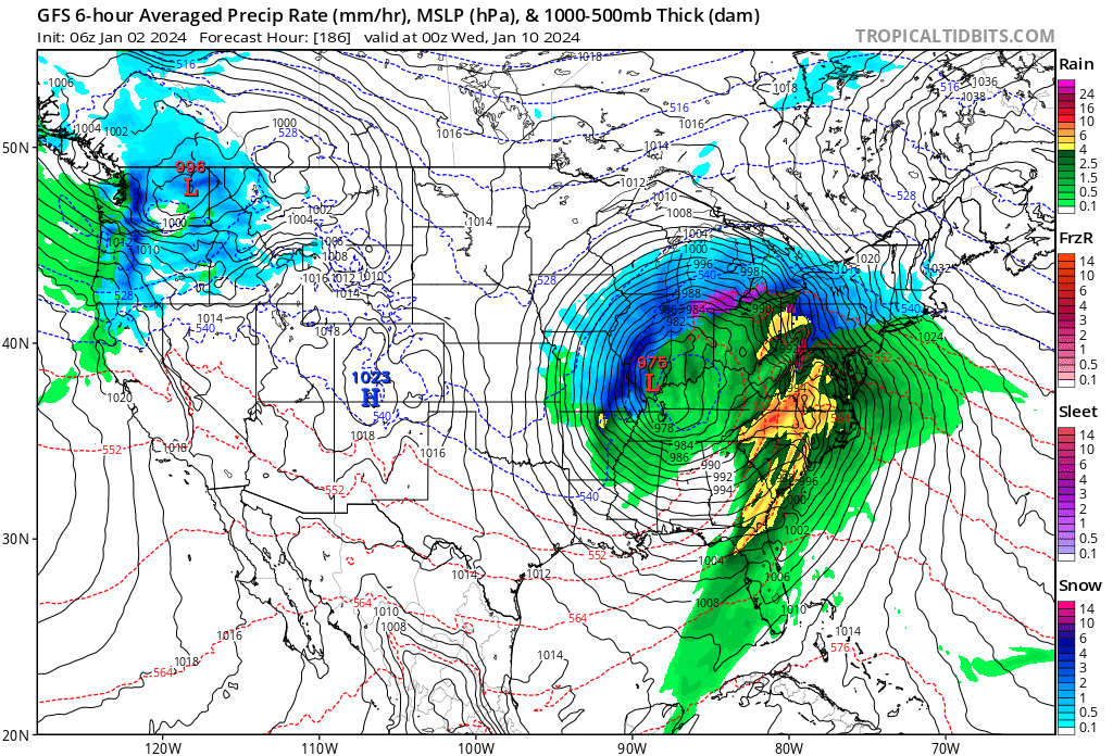
Couple of model animations. Green is rain. Blue is snow. Dark blue is heavier snow. Purple is a wintry mix. Yellow and orange are heavier rain.
Again, this is the Friday night into Saturday night system.

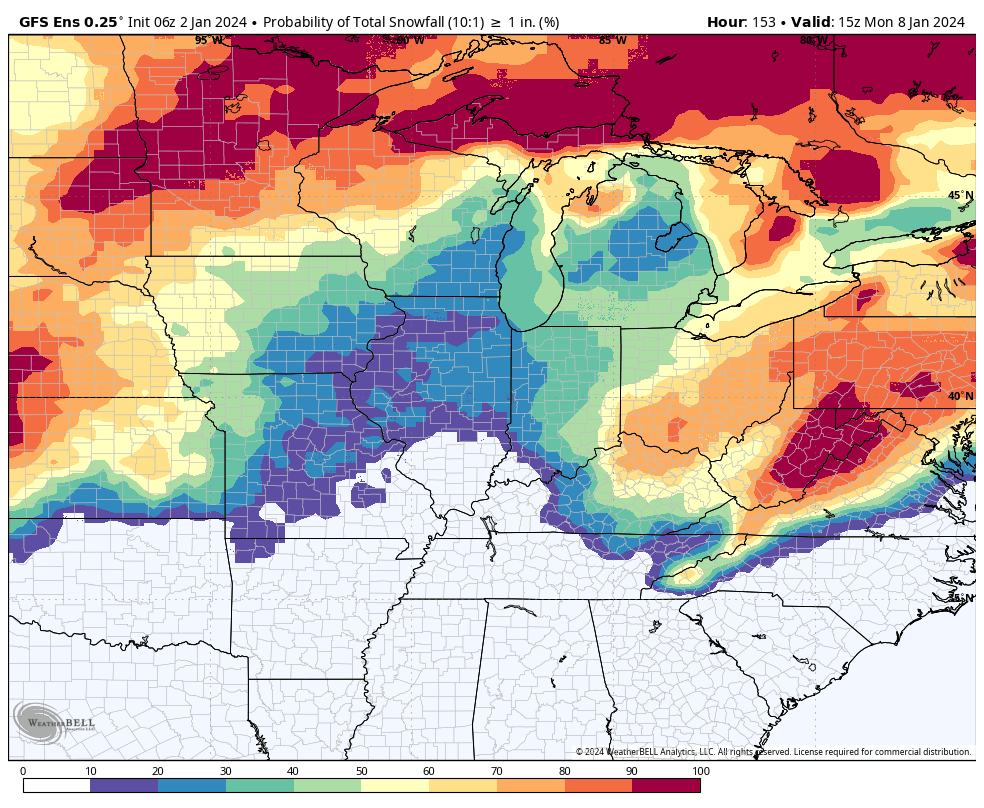
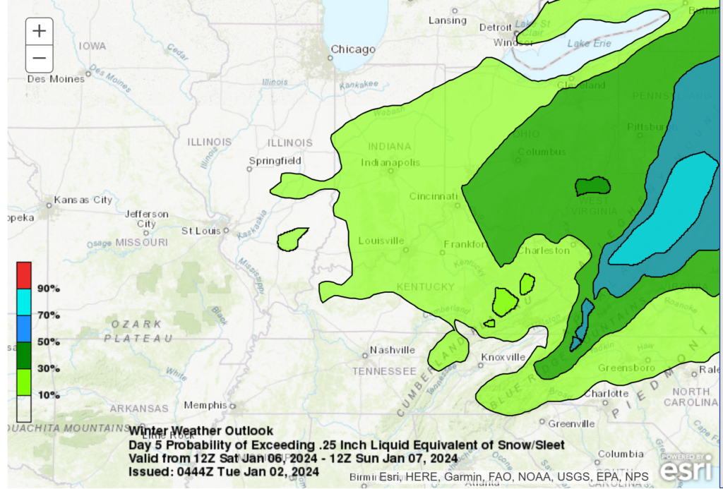
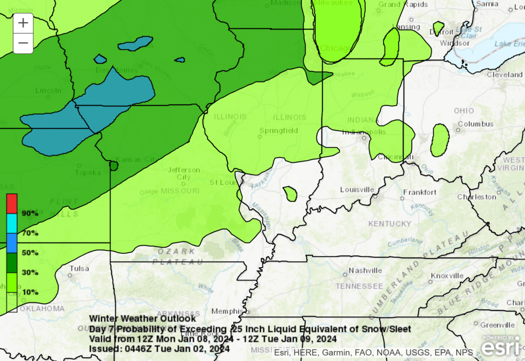
Here are some snowfall probability maps.
The GFS probability of one inch or more of snow. This takes us to Monday morning. As you can see, the chances are mainly north and east of our forecast counties.
What is the probability of 0.25″ liquid? Meaning, melted frozen precipitation totals 0.25″. Typically, 0.25″ would be two to three inches of snow.
For the first event
For the second event (MON TUE). For now, the WPC has the second event clipping our region. This needs to be closely monitored in case the low shifts south and east. That would bring colder air into the region.
Our next system arrives Monday into Tuesday. This one is a beast on some of the model guidance. I would not be surprised if this is a winter storm for portions of the Missouri Valley. Severe thunderstorms are possible on the southeast side of the low. Wind driven heavy wet snow on the northwest side of the low.
Models are showing a deep low moving from Oklahoma and Texas into the Missouri Valley.
There is once again a lack of cold air. If the low is deep enough and the precipitation is heavy enough, then dynamic cooling would occur. This would create the cold air needed for snow. A wet snow perhaps. The question is where? It is still too early to know the answer to that question. Keep monitoring updates.
At this time, it appears the low could move right over our region. That would keep the snow across Missouri and Illinois. Widespread rain. Gusty winds. Perhaps a few storms in Kentucky and Tennessee.
The severe weather should stay to our south, as well. With that said, we need to closely monitor this one.
Stay tuned.
Want to receive more weather information? I provide a service through www.weathertalk.com
Subscribe at www.weathertalk.com and then download the Beau Dodson Weather app from the app stores!
Apple users: Beau Dodson Weather App
https://wtalk.co/9EZYG8A8
Android users: Beau Dodson Weather App
https://wtalk.co/ZEWYU8ME
Need help? Email me at beaudodson@usawx.com
* Daily weather forecasts
* My personal weather blog with all sorts of weather information!
* Special weather statements sent to the Beau Dodson Weather app.
* Rapid fire tornado alerts.
* Severe weather alerts and forecasts.
* Severe weather updates throughout the day (when severe weather is occurring)
* Ice storm alerts and forecasts.
* Winter storm alerts and forecasts.
* Winter storm updates throughout the event.
* Regional weather videos.
* Long range weather videos.
* A daily forecast that I hand type for your county. Sent out every afternoon.
* Long range outlooks. Including week one, two, three, four, and monthly outlooks. Seasonal outlooks.
* App messages to alert you when I have updated the weather blogs and Facebook.
* And more!
Here are some examples of what people receive when they subscribe to www.weathertalk.com