Posted by Meteorologist Beau Dodson
Want to receive more weather information? I provide a service through www.weathertalk.com
Subscribe at www.weathertalk.com and then download the Beau Dodson Weather app from the app stores!
Apple users: Beau Dodson Weather App
https://wtalk.co/9EZYG8A8
Android users: Beau Dodson Weather App
https://wtalk.co/ZEWYU8ME
Good morning, everyone. Did you sleep through the rain and snow? Many did!
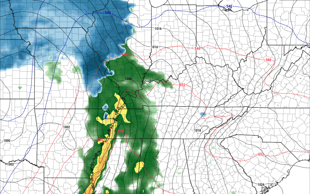
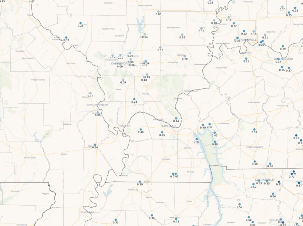
Here are the rain totals from the past 12 to 18 hours. A bit more than expected over portions of Kentucky and Tennessee. No complaints. We needed it!
There were reports of slushy snow accumulation over portions of southeast Missouri and southern Illinois.
Rainfall totals
That system continues to push off to the east. That leaves us with cool temperatures and clouds. Those clouds will linger into the afternoon hours. It may be difficult, once again, to shake the clouds. Not unusual for winter. Winter is known for stubborn clouds.
A fast-moving weak system will bring additional spotty light showers later today and tonight. Perhaps mixed with wet non-accumulating snowflakes.
Here is the Hrrr future-cast radar. You can see the light showers moving west to east. Additional rain totals of a trace to 0.10″ can be expected from this system.
Time stamp upper left. A nuisance precipitation event. Don’t expect much.

All eyes now turn to the next storm. We have been watching this one for more than a month!
This one will be a big winter storm for some and quite a bit of rain for others. There could even be some thunderstorms mixed in.
The biggest question has been the storm track. Where will the low track? Areas north and west of the low will receive heavy wind driven snow. Areas south and east of the low will pick up rain and storms.
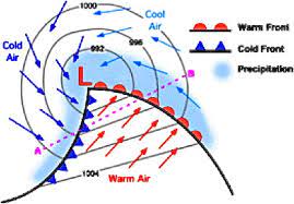
This is what a storm system looks like on a weather map. Cold air on the backside of the low. Warmer south and east of the low. If you want snow, then you want to be north northwest of the low.
All week we have been monitoring forecast trends. Amazingly, the models have been steady for over a week. That is unusual but does increase our confidence in the final forecast.
As is usually the case, our region finds itself caught in the middle.
The going forecast has been for mostly rain in our region, but with at least a chance for a change-over to snow towards the end of the system over at least Missouri and Illinois. That still appears to be the case. The only question that remains is will the snow accumulate.
Model data has come into better agreement over the past 24 hours as to where the low will track. There could still be small adjustments, but it appears the low will track through Missouri and Illinois. Placing most of our region in the rain sector. Even some lightning.
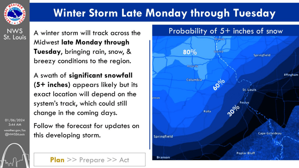
I expect winter storm warnings from Kansas into central and northern Missouri, Iowa, and central and northern Illinois. That would be for 3 to 6 inches, locally higher, of snow. Wind driven snow. This could be a wet snow, which would limit drifting.
Not sure the NWS issues blizzard warnings for portions of the Kansas/Missouri Valley, but I can’t rule it out.
Again, mostly rain locally.
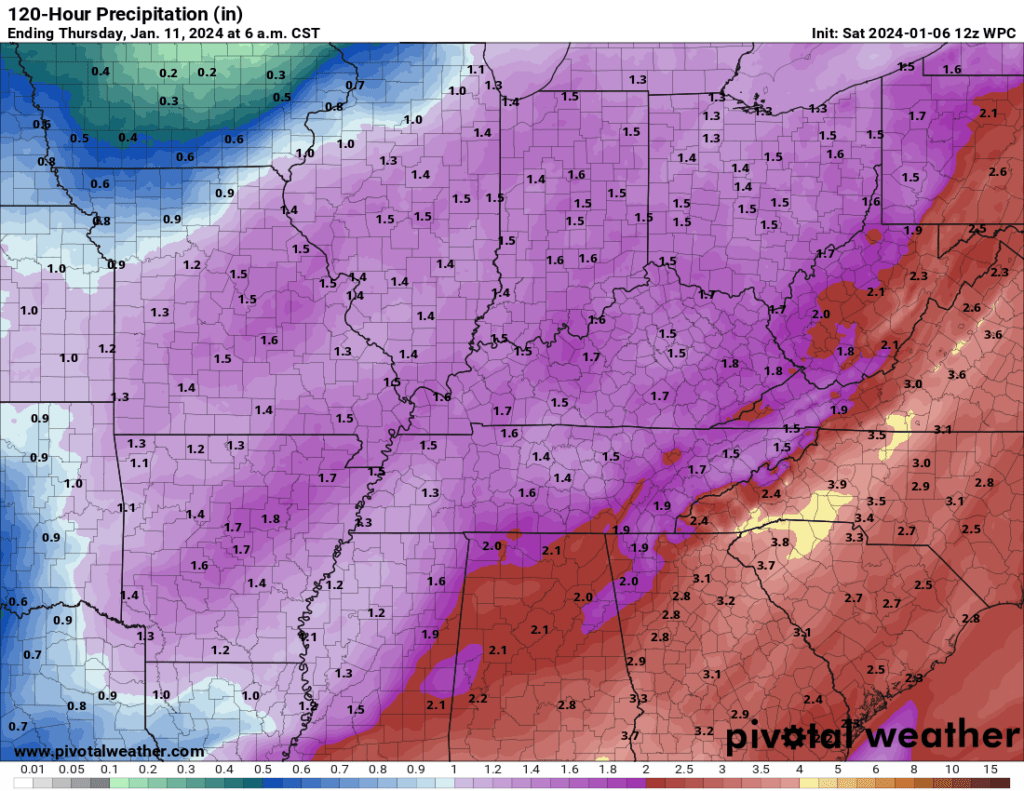
Rain totals for our region will range from 0.75″ to 1.50″. Locally higher totals can’t be ruled out. This is a widespread precipitation event. We are in drought. We need this rain!
Expected rain totals. This is a large precipitation shield.
Severe thunderstorms are going to remain south of my forecast counties. That is the good news.
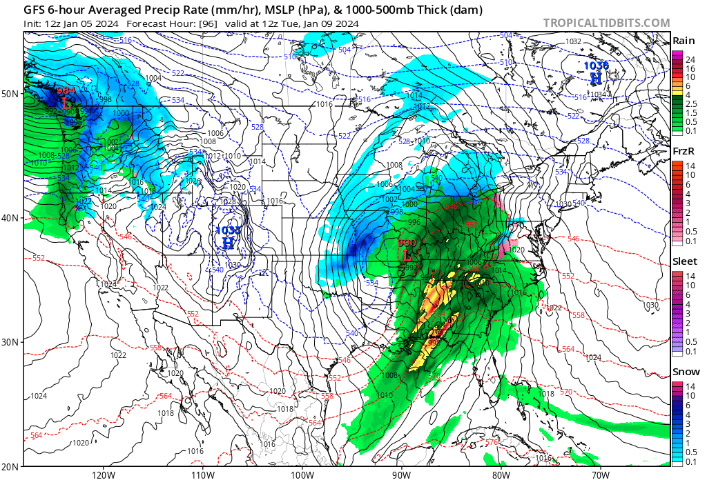
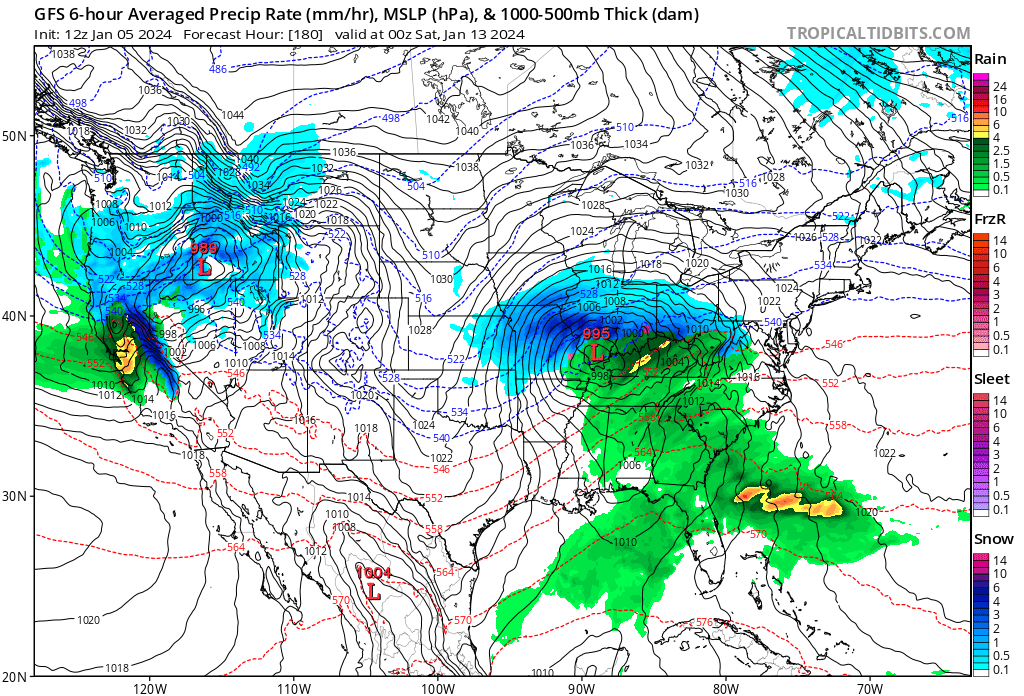
This is quite the area of low pressure. Look at how wound up it is on the model charts. You can see the red L over southeast Missouri on the GFS model. That is the center of low pressure.
Now quite a record low pressure center (like we had last March), but still a big system. Tightly packed isobars (those black squiggly lines) will produce strong and gusty winds Monday into Wednesday. Occasional gusts above 40 mph will be possible.
Here is where winter weather is likely.
You are looking at a map of Missouri and Illinois. Sort of hard to see the lines, but it is there.
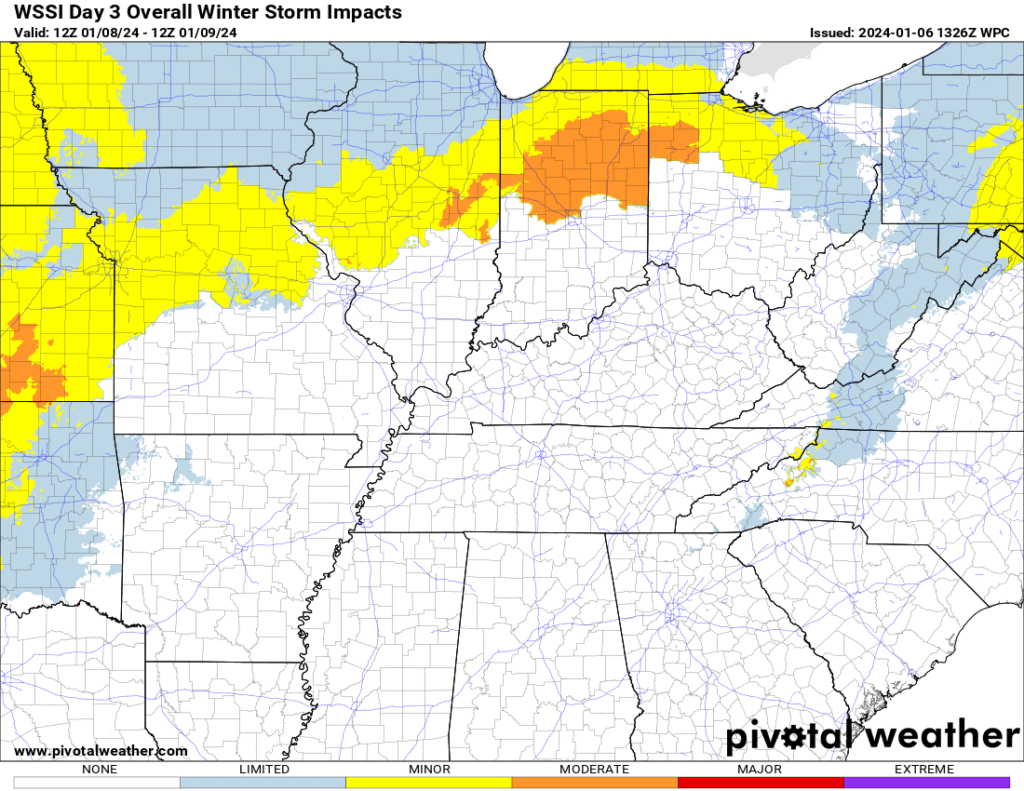
The WPC winter storm outlook graphic. This shows you where travel impacts are expected. I am sure there will be some small adjustments in this graphic, but overall, I agree with it.
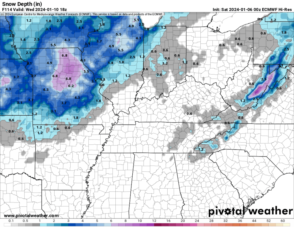
Let’s look at some model guidance. This is the EC model snowfall forecast. As you can see, the heaviest snow will likely fall north and west of my forecast area.
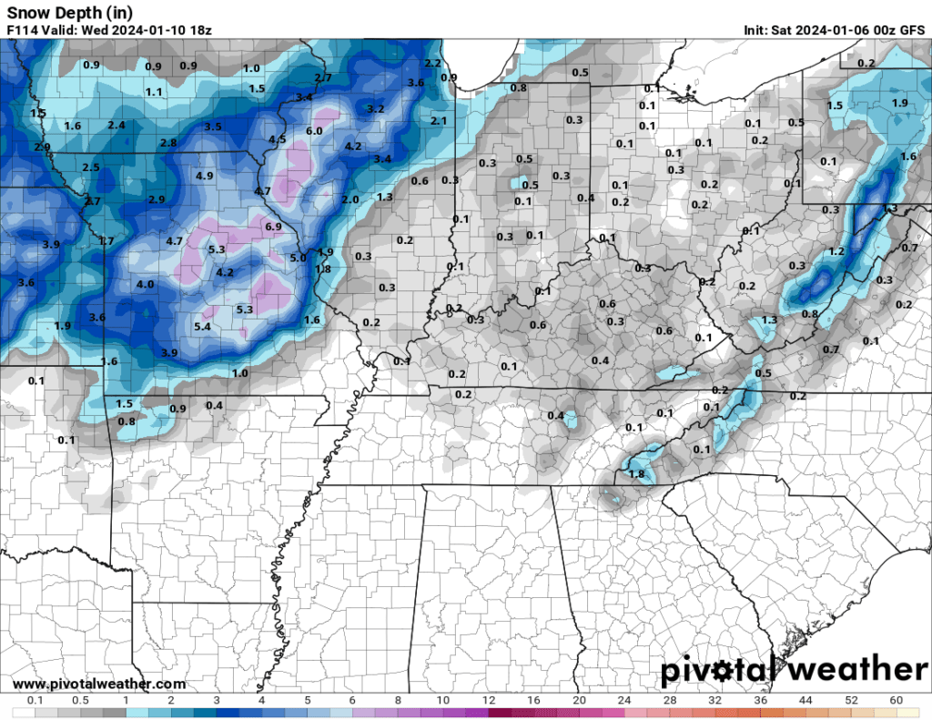
Here is what the GFS model shows. The two models are similar.
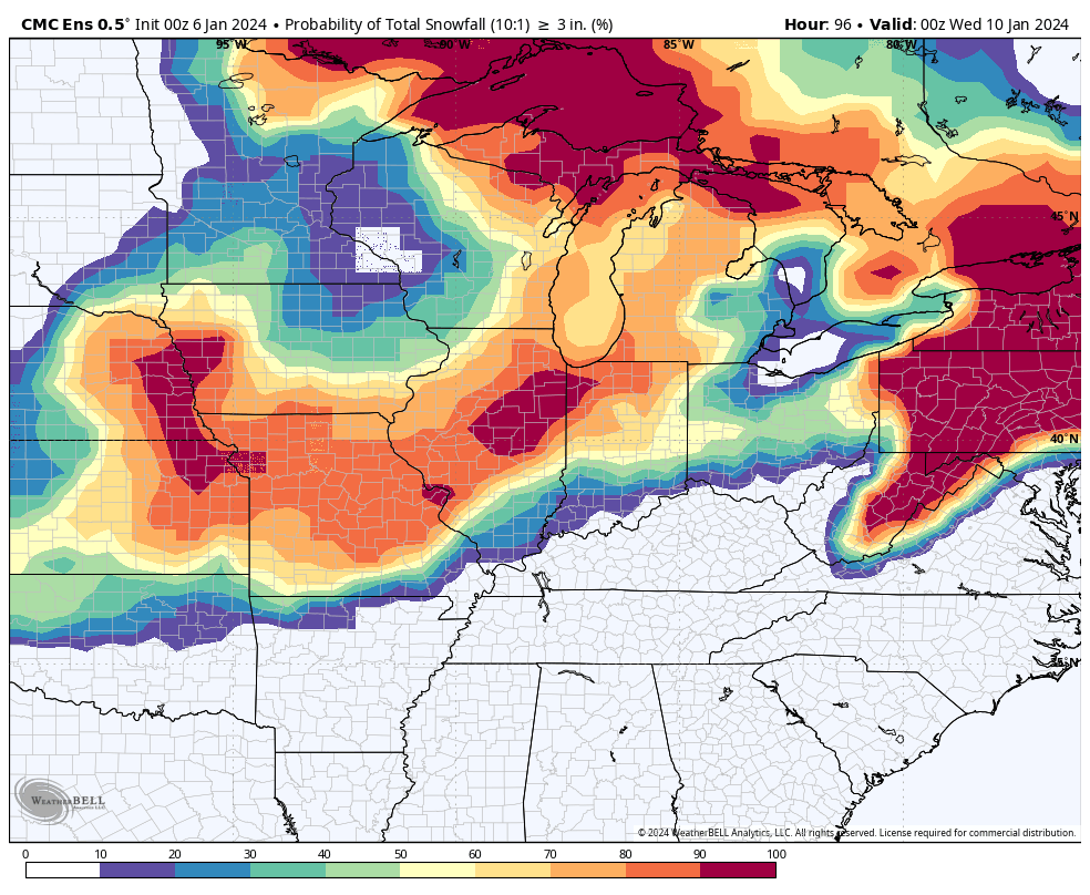
Let’s look at some ensembles.
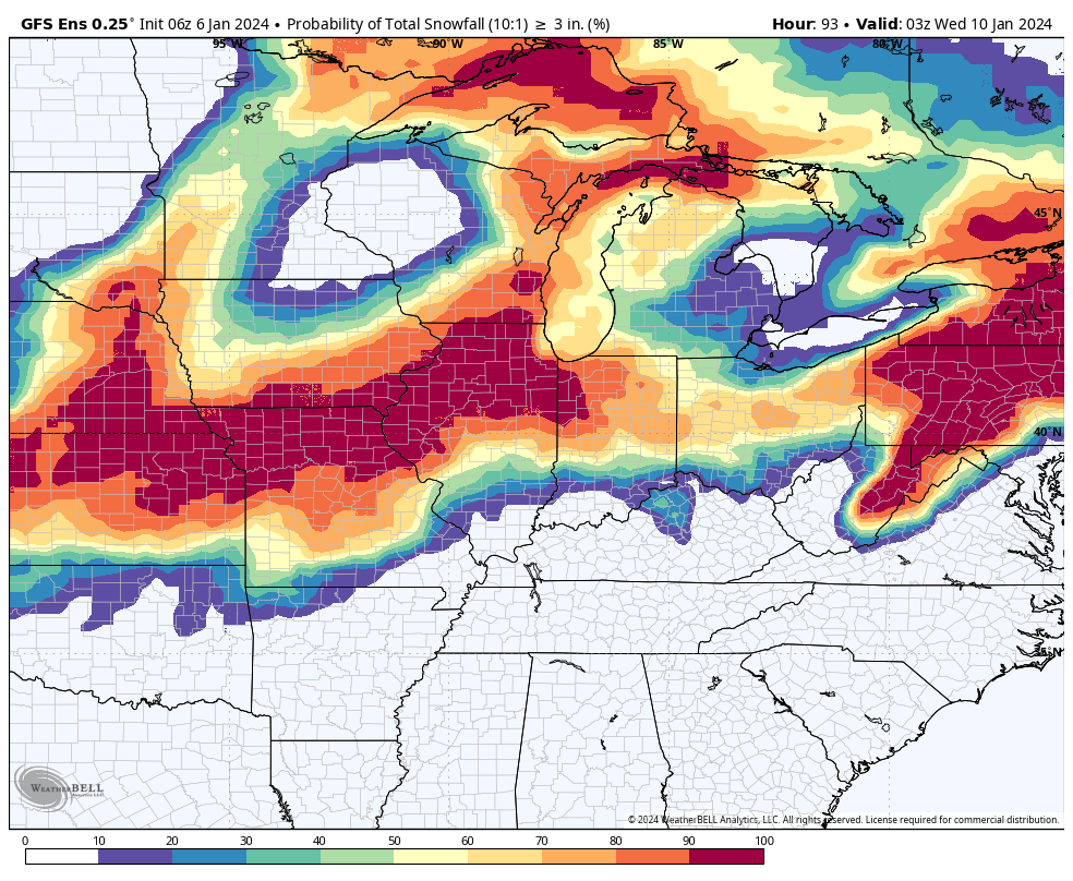
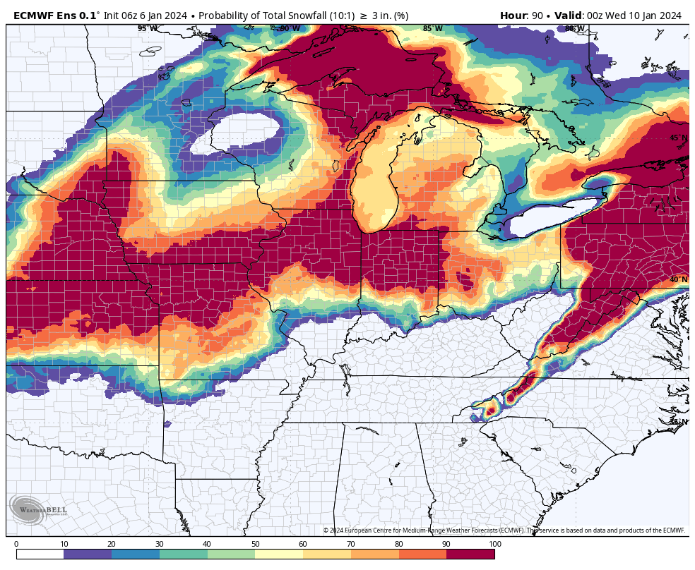
What is the probability of 3 or more inches of snow?
The Canadian model is a bit farther south and east than the other models. For now, it is the outlier. I will monitor today and tomorrow’s data to see if the other models adjust.
The GFS model. What is the probability of 3 or more inches of snow?
The EC model. What is the probability of three or more inches of snow?
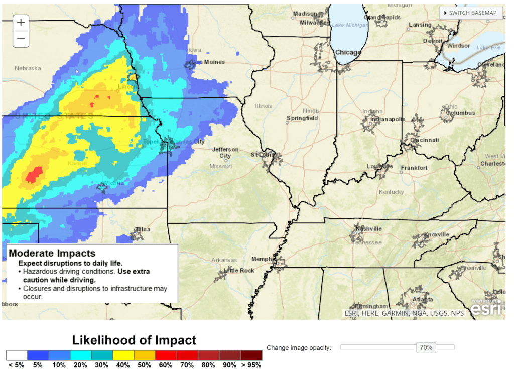
Where will there likely be moderate impacts from this winter storm? Here is the Monday night into Tuesday night graphic.
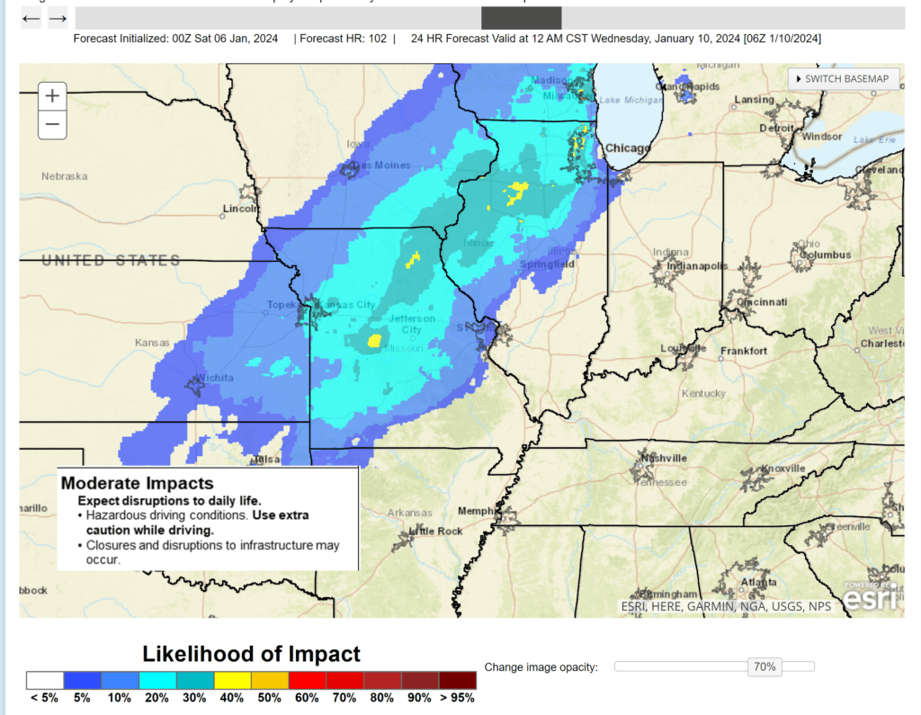
Tuesday night into Wednesday
Again, confidence continues to increase that this is mostly a rain event for our local area.
My going www.weathertalk.com forecast has been for the rain to change to snow over portions of southeast Missouri and southern Illinois Tuesday night. There could even be some light accumulation.
Sometimes these big storms can produce surprises, so let’s continue to monitor updates.
Some snowflakes are possible, at the end of the system, over just about anywhere in the region. We will need to watch temperatures as the precipitation exits. If they fall into the 20s, then I can’t rule out a flash freeze. Gusty winds, however, may help dry most surfaces. That would limit impacts.
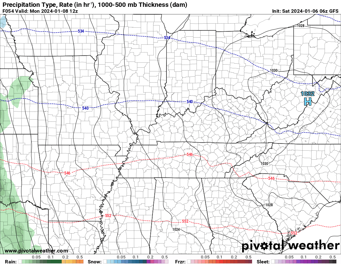
Let’s look at some future-cast radars. What radar might look like Monday into Tuesday.
The NAM is a quick hitter with precipitation moving rapidly west to east across the region. Then, not much behind the main line.
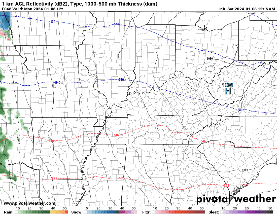
The GFS model is showing something similar but longer lasting precipitation. I believe the NAM is too fast. The NAM is likely too far north with the low, as well. The GFS has a lot more support and looks good to me.
Here it is. Green is rain. Yellow and orange are moderate to heavy rain. Blue is snow. Pink is heavy snow. Red is a wintry mix.
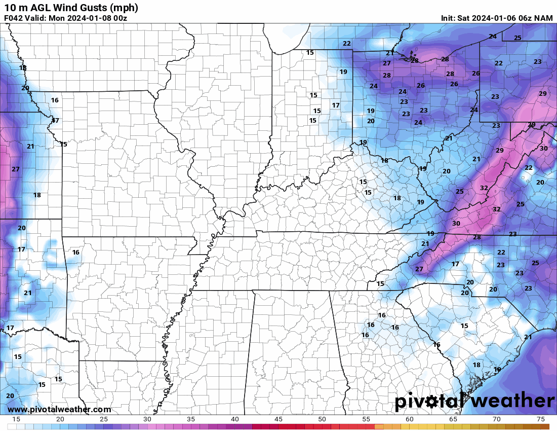
Gusty wind will accompany the system. Winds will begin to increase Sunday afternoon and night. Peaking Tuesday night. Winds of 20 to 40 mph are likely. Here is the NAM model wind gust animation.
Time is Zulu. 12z=6 am. 18z=12 pm. 00z=6 pm. 06z=12 am.
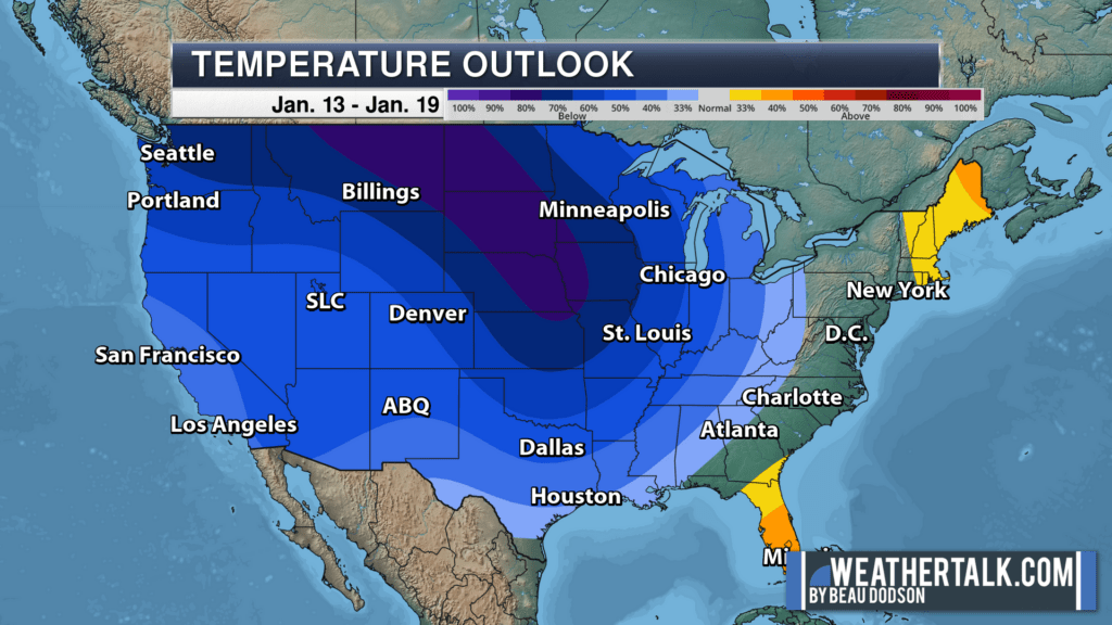
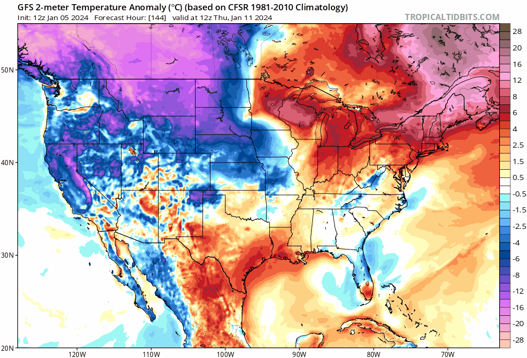
Our forecast, from the past few months, has been for some colder air to arrive mid to late January. That still appears to be on track with multiple shots of cold air.
The latest eight-to-fourteen-day outlook shows that nicely. The blue indicates odds favoring below average temperatures. Deep blue is a higher risk of that occurring.
The GFS is quite bullish on cold air. This graphic below shows you temperature anomalies.
The red, with pink color embedded within the red, represent above average temps. You can see those are the beginning of the loop.
The blue with pink inside the blue represents below to much below average temperatures. There are a lot of analogs that support these cold shots of air. Whether we have snow is the bigger question.
We will have several storm systems to track late next week into the following two weeks. The risk of snow and/or wintry mix will increase as the cold air filters into the region.
I am watching another big system next weekend. That one looks quite similar to the one that will impact our region Monday/Tuesday. Once again, the storm track is key to snow vs rain.
If the Monday/Tuesday system drops a decent snowpack, to our north, then the late week system could track a bit farther south and east. Time will tell.
Stay tuned. If you have been wishing for cold and snow, then the pattern is becoming increasingly favorable for that.

Want to receive more weather information? I provide a service through www.weathertalk.com
Subscribe at www.weathertalk.com and then download the Beau Dodson Weather app from the app stores!
Apple users: Beau Dodson Weather App
https://wtalk.co/9EZYG8A8
Android users: Beau Dodson Weather App
https://wtalk.co/ZEWYU8ME
Need help? Email me at beaudodson@usawx.com
* Daily weather forecasts
* My personal weather blog with all sorts of weather information!
* Special weather statements sent to the Beau Dodson Weather app.
* Rapid fire tornado alerts.
* Severe weather alerts and forecasts.
* Severe weather updates throughout the day (when severe weather is occurring)
* Ice storm alerts and forecasts.
* Winter storm alerts and forecasts.
* Winter storm updates throughout the event.
* Regional weather videos.
* Long range weather videos.
* A daily forecast that I hand type for your county. Sent out every afternoon.
* Long range outlooks. Including week one, two, three, four, and monthly outlooks. Seasonal outlooks.
* App messages to alert you when I have updated the weather blogs and Facebook.
* And more!
Here are some examples of what people receive when they subscribe to www.weathertalk.com