
Posted by Meteorologist Beau Dodson
Want to receive more weather information? I provide a service through www.weathertalk.com
Subscribe at www.weathertalk.com and then download the Beau Dodson Weather app from the app stores!
Apple users: Beau Dodson Weather App
https://wtalk.co/9EZYG8A8
Android users: Beau Dodson Weather App
https://wtalk.co/ZEWYU8ME
Need help? Email me at beaudodson@usawx.com
Good day, everyone!
We have been watching this blizzard for weeks. It is finally about to arrive. For our region, it will be wet not white. Quite a bit of rain.
We need rain, because we are in drought.
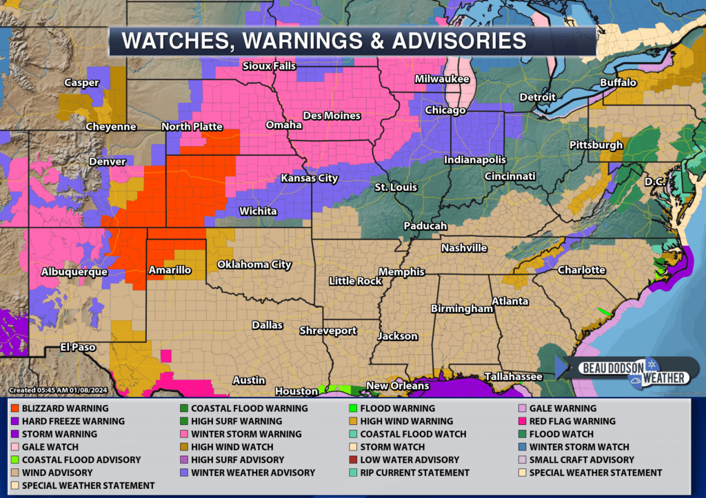
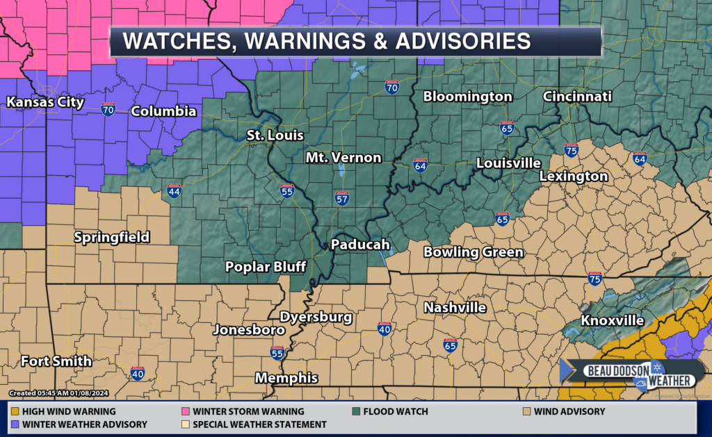
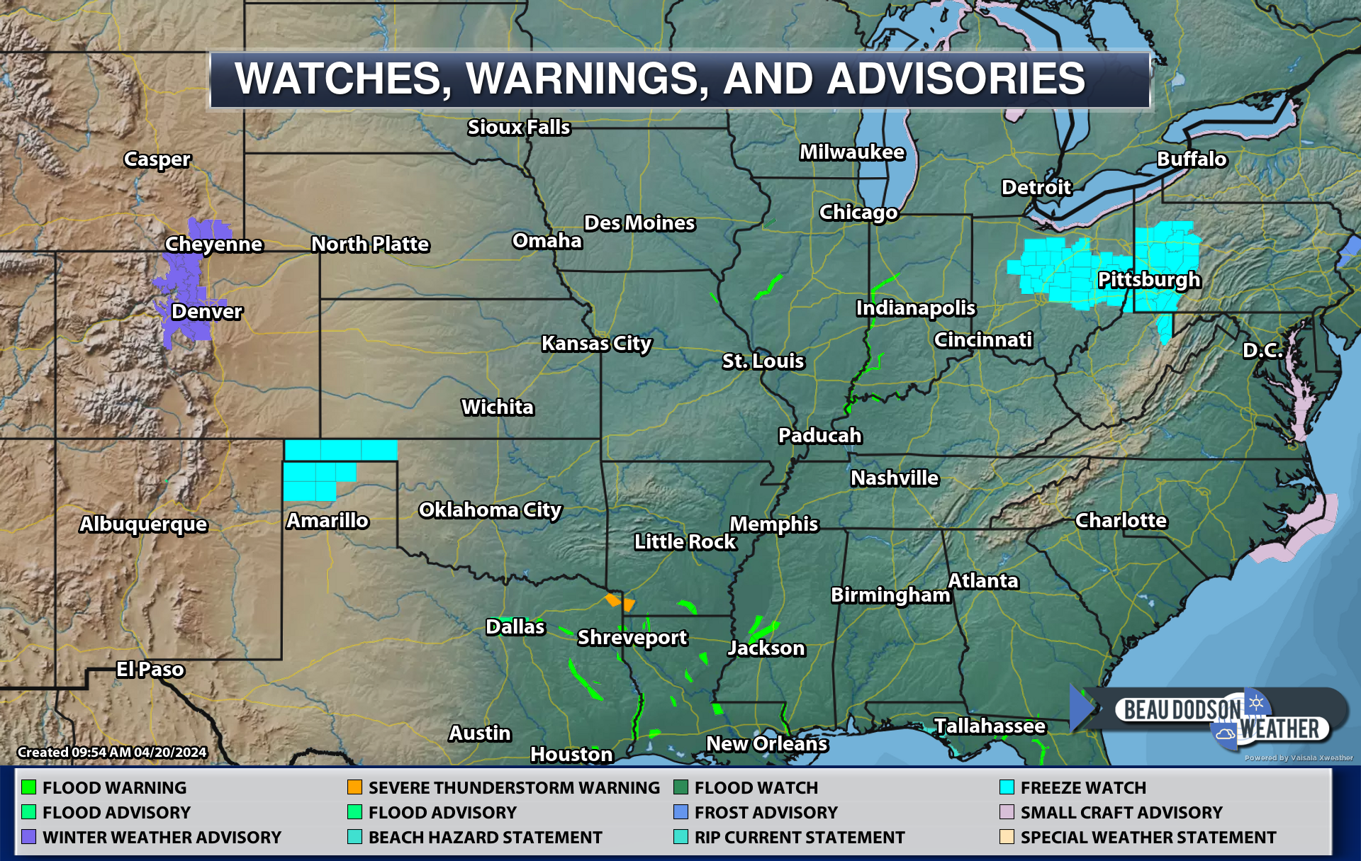
First, let’s take a look at the national watch and warning map. It is quite colorful today! This is a change from recent weeks (it has been a fairly quiet weather pattern).
Link to the watch, warning, and advisory graphic
https://imagery.weathertalk.com/prx/Region_Wider_Alerts.png
The red colors in Nebraska, Kansas, Oklahoma, Texas, Colorado, and New Mexico are blizzard warnings. Way away from us! No blizzard concerns locally.
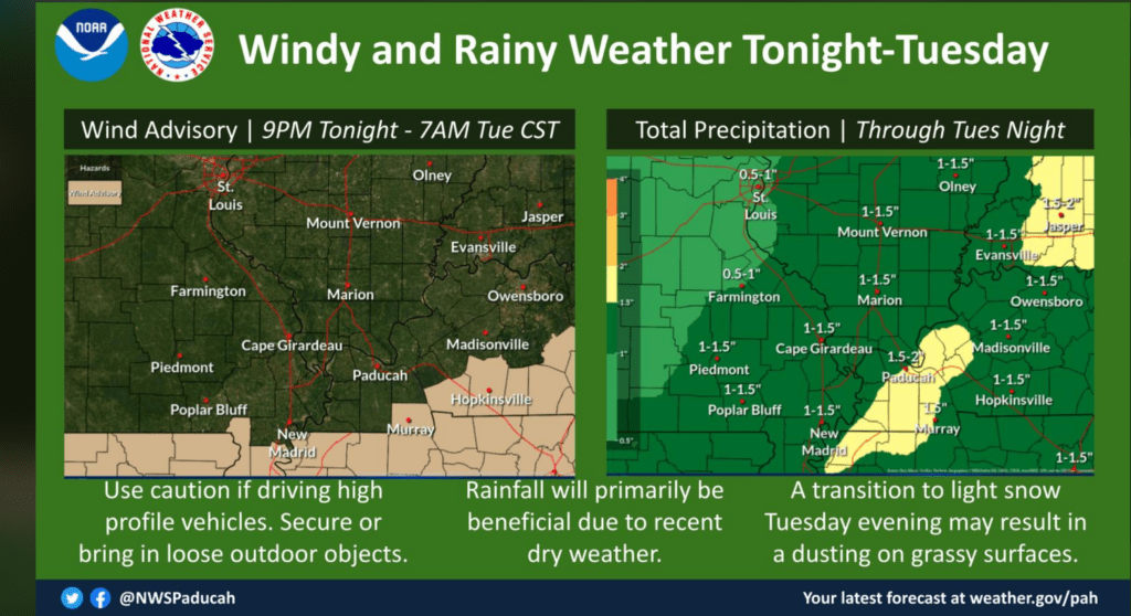
A wind advisory has been issued for our southern counties. Gusty winds are likely tonight into Tuesday night. Peak wind gusts will be tonight and tomorrow night. Some gusts to 40 mph are likely.
The bulk of our rain event will arrive tonight into early Tuesday morning. Then, tapering shower chances tomorrow late morning into the afternoon hours.
Temperatures will fall Tuesday afternoon into the 40s on gusty westerly winds. A few snow showers are possible Tuesday night, but nothing to write home about. Just a reminded that it is winter.
More rain arrives Thursday into Friday evening.
I have seen several non-meteorologists posting snow accumulation maps for Friday’s system.
The forecast for Friday is rain. It may end as snow showers Friday night as much colder air arrives. Any accumulation Friday night would be light. The heavier snow will be to our north and west. Similar to this event. It would take a MAJOR shift south and east to bring that heavy snow into our region.
As always, keep checking back. Don’t walk away with one forecast for an entire week and think that it won’t change or need adjusting. There are always adjustments made as an event draws closer.
Now, if you want snow, then let’s keep an eye on next Sunday and Monday. Colder air will be in place (something we have been lacking all winter).
Another precipitation event is possible in or near our region. Some data takes it to our south. That is a possibility. It does, however, provide us with the best chance of frozen precipitation over the next eight days.
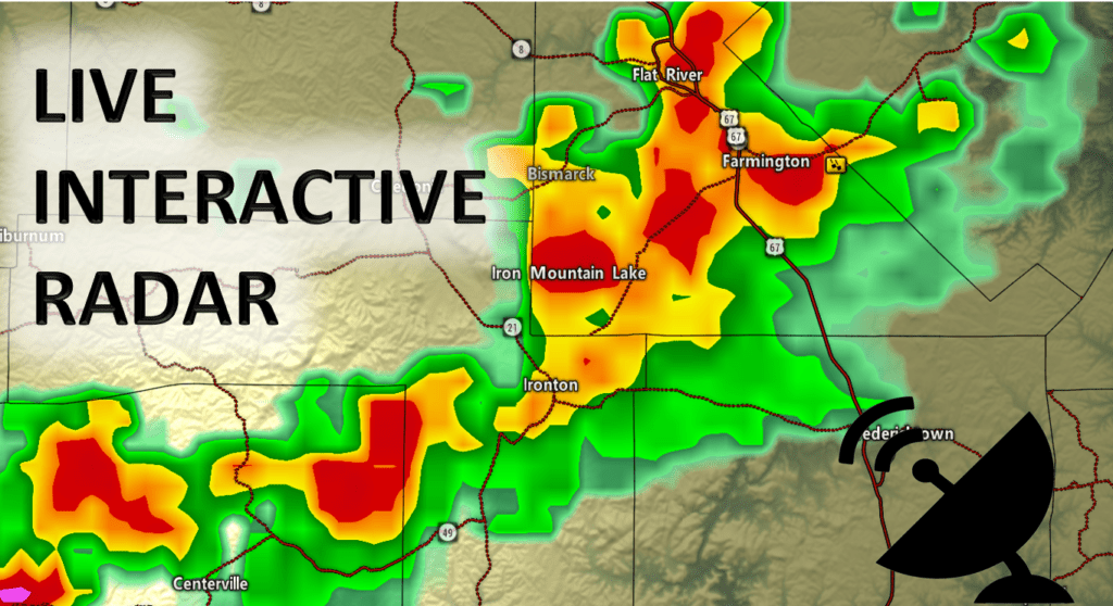
Beau Dodson Weather Radars and Lightning Data
Click the winterize button on the local city view radars to see precipitation type.
Interactive local city-view radars. Clickable watches and warnings. Winterize button.
https://beaudodsonweather.com/weather-radars/
Backup radar site in case the above one is not working.
https://weathertalk.com/morani
Regional Radar
https://imagery.weathertalk.com/prx/RadarLoop.mp4
*NEW* Zoom interactive radar (with storm chaser streams)
https://wtalk.co/AVWG7GM7
Real time lightning tracker system two.https://map.blitzortung.org/#5.02/37.95/-86.99
Lightning Data (zoom in and out of your local area)
https://wtalk.co/WJ3SN5UZ
Want to receive more weather information? I provide a service through www.weathertalk.com
Subscribe at www.weathertalk.com and then download the Beau Dodson Weather app from the app stores!
Apple users: Beau Dodson Weather App
https://wtalk.co/9EZYG8A8
Android users: Beau Dodson Weather App
https://wtalk.co/ZEWYU8ME
Need help? Email me at beaudodson@usawx.com
* Daily weather forecasts
* My personal weather blog with all sorts of weather information!
* Special weather statements sent to the Beau Dodson Weather app.
* Rapid fire tornado alerts.
* Severe weather alerts and forecasts.
* Severe weather updates throughout the day (when severe weather is occurring)
* Ice storm alerts and forecasts.
* Winter storm alerts and forecasts.
* Winter storm updates throughout the event.
* Regional weather videos.
* Long range weather videos.
* A daily forecast that I hand type for your county. Sent out every afternoon.
* Long range outlooks. Including week one, two, three, four, and monthly outlooks. Seasonal outlooks.
* App messages to alert you when I have updated the weather blogs and Facebook.
* And more!
Here are some examples of what people receive when they subscribe to www.weathertalk.com


