Posted by Meteorologist Beau Dodson
Winter is about to burst into the region. Unfortunately, it is going to bring dangerously low air and wind chill temperatures.
The cold air will arrive Friday night and will linger into much of next week. Gusty winds will make it feel even colder.
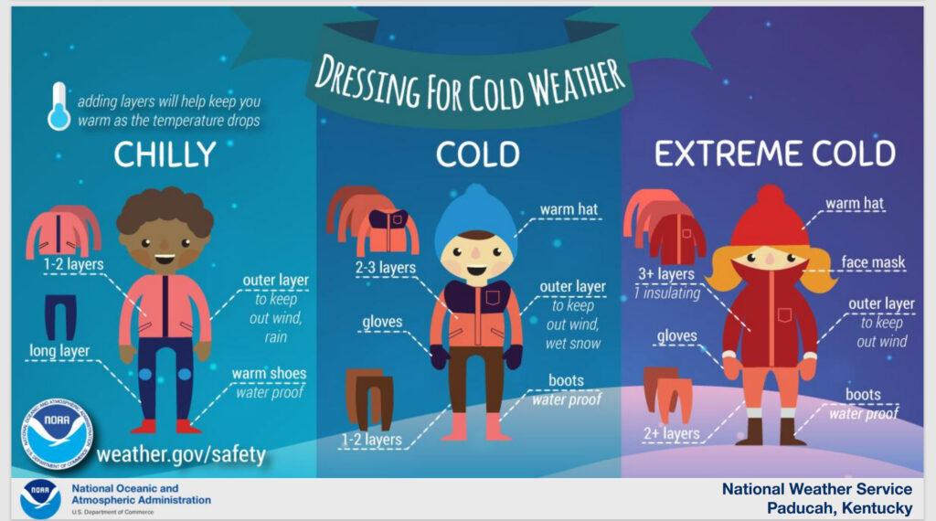
The coldest nights will be Saturday, Sunday, Monday, and Tuesday. That is when single digit to teens is anticipated.
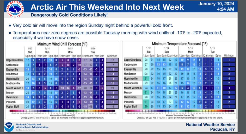
Gusty winds will bring wind chill values down into the 0 to -20 range. This is dangerously cold. Frost bite can occur in a matter of minutes with those temperatures.
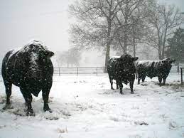
This event will be difficult on livestock and outdoor animals. Snow and moisture will enhance the issues for outdoor animals.
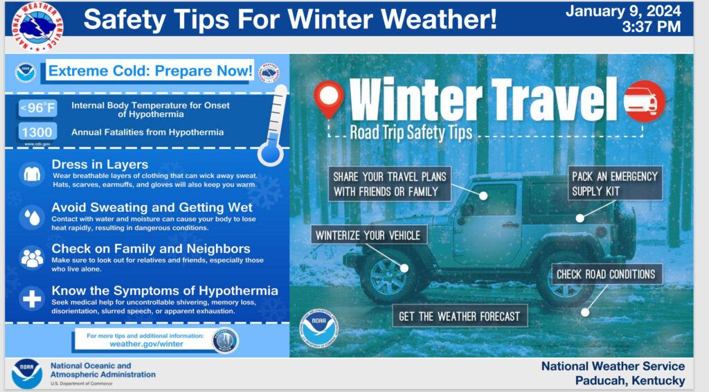
Today and tomorrow will be the time to prepare.
Pipe busting cold is forecast to last for several days.
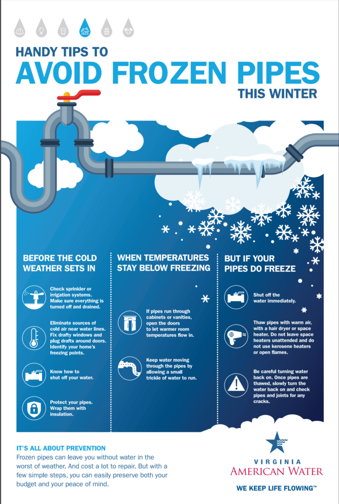
If you have experienced frozen pipes in the past, then this event could impact you. It will be similar to the December 2022 cold event.
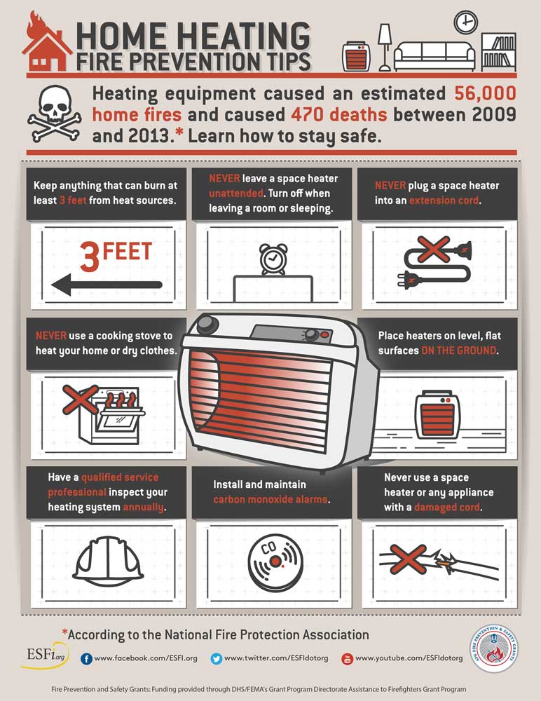
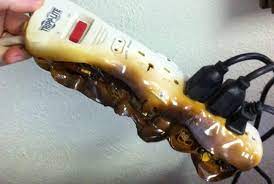
Avoid using extension cords with space heaters. This can lead to a house fire.
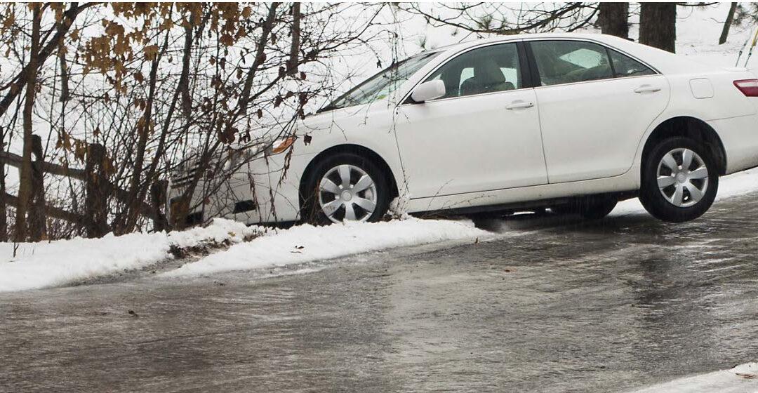
Snow is in the forecast Sunday and Monday. At this time, it appears that one to four inches of snow will be possible. This will be a dry snow.
If the snow forecast holds, then expect icy road conditions Sunday PM into at least Wednesday. Especially secondary or non-treated roadways.
The event is still five days out. Thus, monitor for updated forecasts. Don’t walk away with one forecast five days out and assume it won’t change.
Want to receive more weather information? I provide a service through www.weathertalk.com
Subscribe at www.weathertalk.com and then download the Beau Dodson Weather app from the app stores!
Apple users: Beau Dodson Weather App
https://wtalk.co/9EZYG8A8
Android users: Beau Dodson Weather App
https://wtalk.co/ZEWYU8ME
Need help? Email me at beaudodson@usawx.com
* Daily weather forecasts
* My personal weather blog with all sorts of weather information!
* Special weather statements sent to the Beau Dodson Weather app.
* Rapid fire tornado alerts.
* Severe weather alerts and forecasts.
* Severe weather updates throughout the day (when severe weather is occurring)
* Ice storm alerts and forecasts.
* Winter storm alerts and forecasts.
* Winter storm updates throughout the event.
* Regional weather videos.
* Long range weather videos.
* A daily forecast that I hand type for your county. Sent out every afternoon.
* Long range outlooks. Including week one, two, three, four, and monthly outlooks. Seasonal outlooks.
* App messages to alert you when I have updated the weather blogs and Facebook.
* And more!
Here are some examples of what people receive when they subscribe to www.weathertalk.com