Posted by Meteorologist Beau Dodson
Want to receive more weather information? I provide a service through www.weathertalk.com
Subscribe at www.weathertalk.com and then download the Beau Dodson Weather app from the app stores!
Apple users: Beau Dodson Weather App
https://wtalk.co/9EZYG8A8
Android users: Beau Dodson Weather App
https://wtalk.co/ZEWYU8ME
Need help? Email me at beaudodson@usawx.com
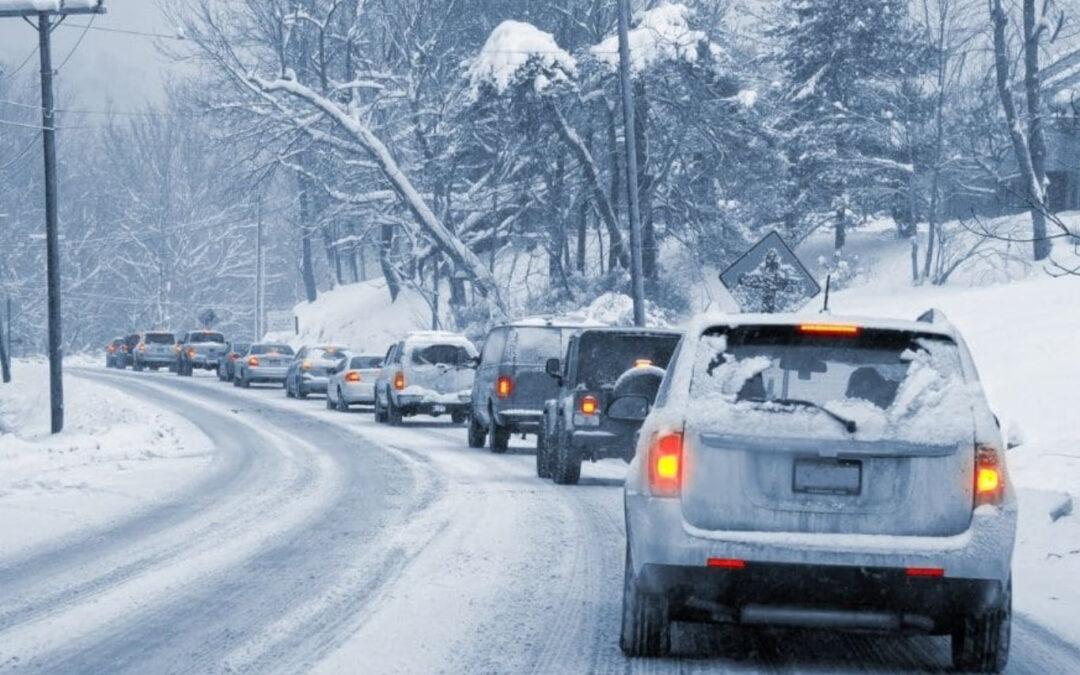
Well, those wishing for winter weather are about to receive a dose of it. Major weather changes are on the way.

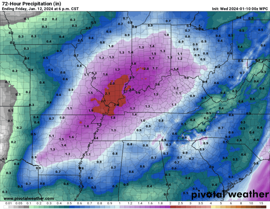
Today and tomorrow will be the days to prepare. Widespread rain arrives Thursday night into Friday. This will be a soaker with one to two inches of rain anticipated area wide.
Expected rain totals. There could be some low-land and stream flooding Friday. Lightning is also possible Thursday night/Friday.
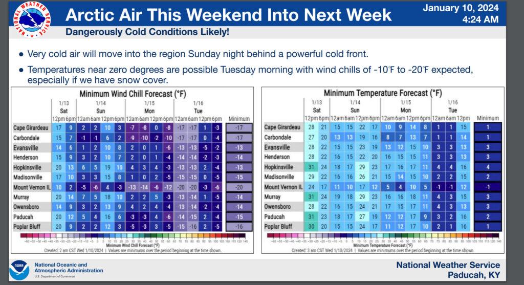
Temperatures will crash Friday afternoon and night. Rapidly falling into the teens and twenties with strong and gusty winds. Wind chill values will dip down into the -10 to 0 range Friday night into Saturday morning.
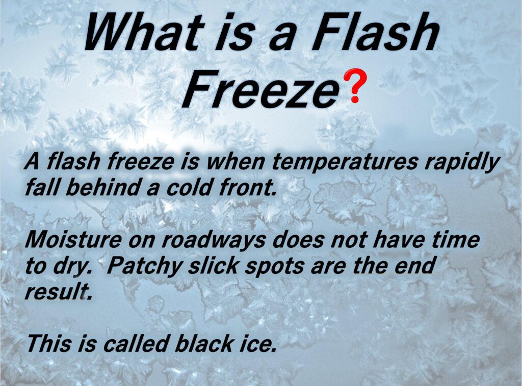
The rain will change to scattered snow showers Friday night. Watch for black ice. A flash freeze is possible.
Snow showers could drop a dusting in some areas.
Saturday will be cold. Perhaps a stray snow flurry, but no accumulation.
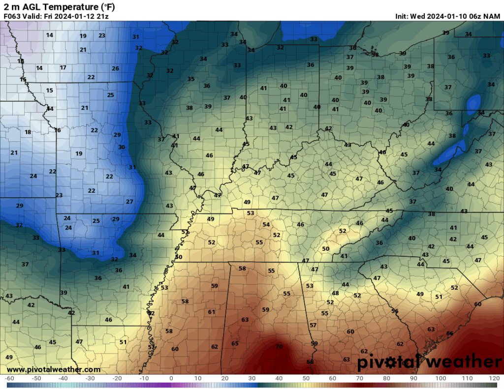
Friday afternoon temperatures. You can see the warm air ahead of the cold front. Cold behind it. The cold air will rapidly dive into our area.
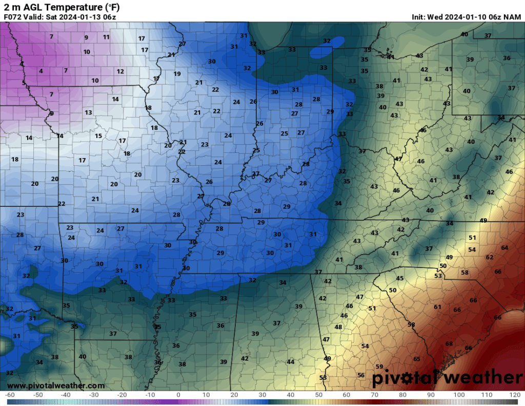
By 12 AM Saturday the cold air will have arrived area-wide.
Saturday night/Sunday morning temperatures will be brrrr.
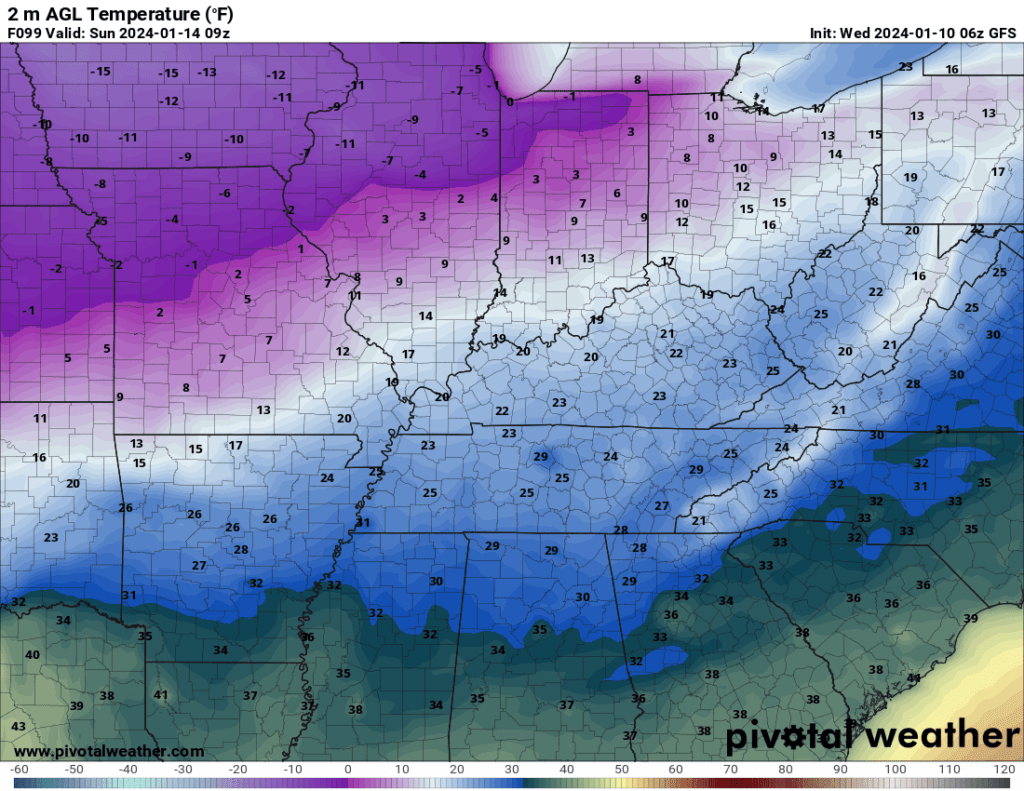
Monday morning wind chill values will dip below zero. The GFS goes ALL IN with -20 wind chill values. Not sure how widespread that will be, but -10 to 0 is a good bet.
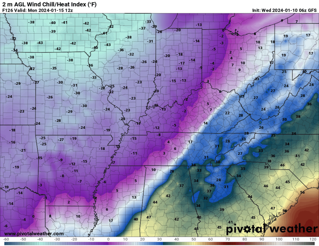
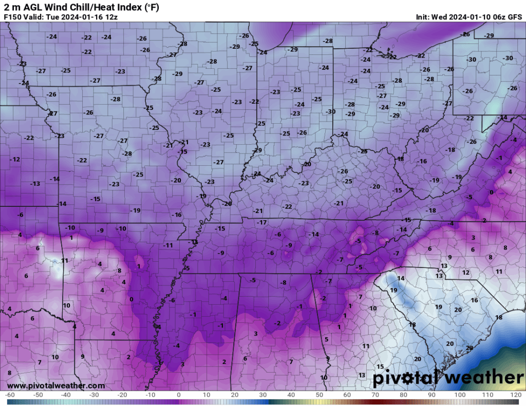
Same for Tuesday morning. Brrr and double brrr.
Snow Chances Are Increasing
The main weather focus is on the cold temperatures. Secondary focus is the potential snow.
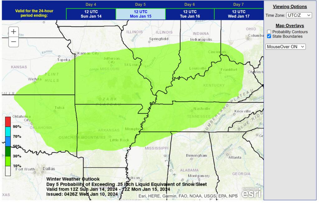
A potential snow event will take shape Sunday into Monday. This event is still five days out, thus confidence in the exact timing of the system and snow amounts remains a question. The system could miss us to the south. That is a concern.
Typically, an accurate snow forecast is made 24 to 48 hours in advance.
There is a risk that the system trends farther south and east. That would lower totals over at least our northern counties. It could also mean that it misses us to the south. That is a possibility.
This will be a dry fluffy snow. Since it is going to be so cold, the snow will be dry. This would make plowing easier.
It is going to be bitterly cold with the snow. That means whatever falls will stick and likely stick around into the middle of next week.
With all of that said, we are still five days out from this event.
This is the zone that NOAA is monitoring for a few inches of snow.
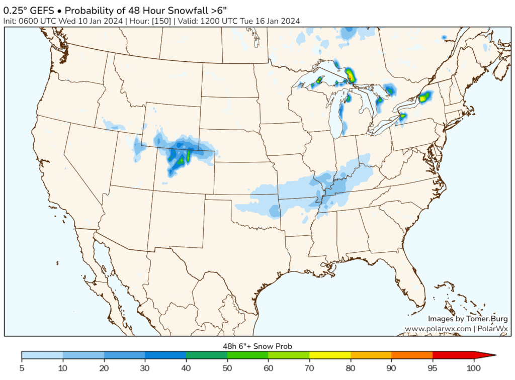
The GEFS model has backed off a bit on its probability of six or more inches of snow.
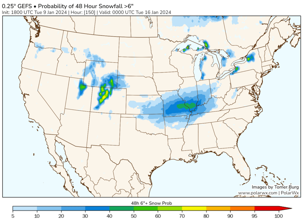
Here was one of the previous runs. You can see the probabilities are lower on the map above. I will be monitoring this data over the next few days.
Strong and gusty winds will redevelop Thursday night into Saturday. Occasional gusts above 40 mph will be possible. That is going to add insult to injury when it comes to being outside for any given amount of time.
Try and stay warm!
Want to receive more weather information? I provide a service through www.weathertalk.com
Subscribe at www.weathertalk.com and then download the Beau Dodson Weather app from the app stores!
Apple users: Beau Dodson Weather App
https://wtalk.co/9EZYG8A8
Android users: Beau Dodson Weather App
https://wtalk.co/ZEWYU8ME
Need help? Email me at beaudodson@usawx.com
* Daily weather forecasts
* My personal weather blog with all sorts of weather information!
* Special weather statements sent to the Beau Dodson Weather app.
* Rapid fire tornado alerts.
* Severe weather alerts and forecasts.
* Severe weather updates throughout the day (when severe weather is occurring)
* Ice storm alerts and forecasts.
* Winter storm alerts and forecasts.
* Winter storm updates throughout the event.
* Regional weather videos.
* Long range weather videos.
* A daily forecast that I hand type for your county. Sent out every afternoon.
* Long range outlooks. Including week one, two, three, four, and monthly outlooks. Seasonal outlooks.
* App messages to alert you when I have updated the weather blogs and Facebook.
* And more!
Here are some examples of what people receive when they subscribe to www.weathertalk.com