Posted by Meteorologist Beau Dodson
Want to receive more weather information? I provide a service through www.weathertalk.com
Subscribe at www.weathertalk.com and then download the Beau Dodson Weather app from the app stores!
Apple users: Beau Dodson Weather App
https://wtalk.co/9EZYG8A8
Android users: Beau Dodson Weather App
https://wtalk.co/ZEWYU8ME
Need help? Email me at beaudodson@usawx.com
The National Weather Service has issued a high wind warning for portions of southeast Missouri, southern Illinois, and western Kentucky.
Strong and gusty winds will develop late tonight into tomorrow night. Winds could top 60 mph. This is quite similar to the high wind event we had in Marich of 2023.
The reason for the wind is a deep area of low pressure that will pass through and north of our region tomorrow. The tight pressure gradient will cause high winds.
Power outages and tree damage will be possible from this wind event.
Locally heavy rain is also a concern tonight and tomorrow. This will saturate the ground. That could cause trees to be uprooted during the high winds.
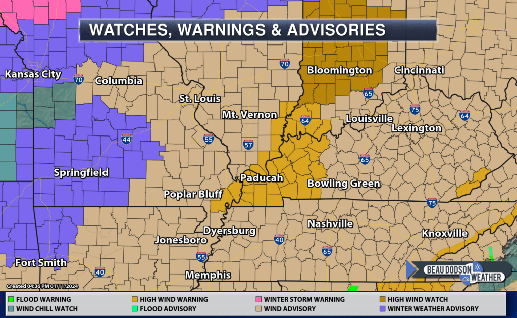
HIGH WIND WARNING IN EFFECT FROM MIDNIGHT TONIGHT TO MIDNIGHT FRIDAY NIGHT.
* WHAT…South to southwest winds 20 to 30 mph with gusts up to 60 mph expected.
* WHERE…Portions of southeast Illinois, southwest Indiana, western Kentucky, and far southeast Missouri.
* WHEN…From midnight CST /1 AM EST/ tonight to midnight CST /1 AM EST/ Friday night.
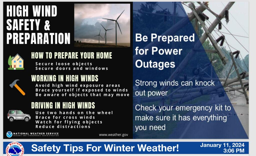
* IMPACTS…Damaging winds will blow down trees and power lines. Power outages are expected. Travel will be difficult, especially for high profile vehicles.
* ADDITIONAL DETAILS…The chance for gusts up to 50 mph is high, and there is potential for gusts to 60 mph or greater. The effective impact of these high wind gusts cannot be understated, especially as they occur over saturated grounds where trees will be more easily uprooted.
PRECAUTIONARY/PREPAREDNESS ACTIONS… People should avoid being outside in forested areas and around trees and branches. If possible, remain in the lower levels of your home during the windstorm, and avoid windows.
Use caution if you must drive.
Want to receive more weather information? I provide a service through www.weathertalk.com
Subscribe at www.weathertalk.com and then download the Beau Dodson Weather app from the app stores!
Apple users: Beau Dodson Weather App
https://wtalk.co/9EZYG8A8
Android users: Beau Dodson Weather App
https://wtalk.co/ZEWYU8ME
Need help? Email me at beaudodson@usawx.com
* Daily weather forecasts
* My personal weather blog with all sorts of weather information!
* Special weather statements sent to the Beau Dodson Weather app.
* Rapid fire tornado alerts.
* Severe weather alerts and forecasts.
* Severe weather updates throughout the day (when severe weather is occurring)
* Ice storm alerts and forecasts.
* Winter storm alerts and forecasts.
* Winter storm updates throughout the event.
* Regional weather videos.
* Long range weather videos.
* A daily forecast that I hand type for your county. Sent out every afternoon.
* Long range outlooks. Including week one, two, three, four, and monthly outlooks. Seasonal outlooks.
* App messages to alert you when I have updated the weather blogs and Facebook.
* And more!
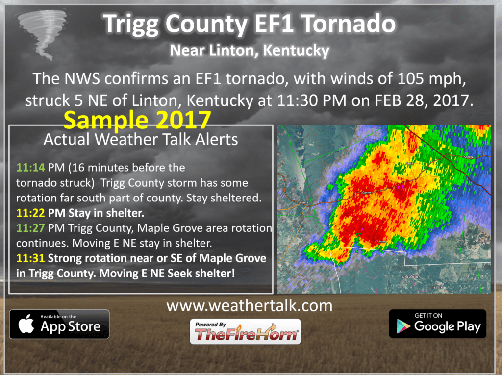
Here are some examples of what people receive when they subscribe to www.weathertalk.com