Posted by Meteorologist Beau Dodson
Want to receive more weather information? I provide a service through www.weathertalk.com
Subscribe at www.weathertalk.com and then download the Beau Dodson Weather app from the app stores!
Apple users: Beau Dodson Weather App
https://wtalk.co/9EZYG8A8
Android users: Beau Dodson Weather App
https://wtalk.co/ZEWYU8ME
Need help? Email me at beaudodson@usawx.com
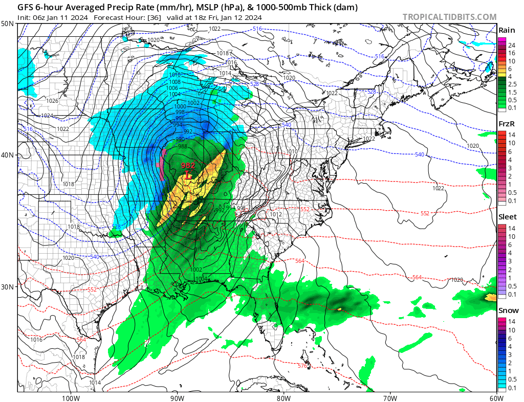
A deep area of pressure will pass through the region tomorrow. This will cause rapidly falling and rising barometric pressure.
Gradient winds will top 50 mph. This could be similar to the March 2023 wind event. That event produced widespread 40 to 55 mph wind gusts.
Highest wind gusts may end up being across Kentucky and Tennessee. Missouri and Illinois will have strong winds, as well.
Gradient winds are not thunderstorm winds. Gradient winds are caused by tight isobars. Isobars are equal lines of pressure. You can see those tightly packed black lines on this map.
The NAM model shows the potential wind. The calm area is where the low pressure will track. As it pulls away those calm areas will become windy, as well.
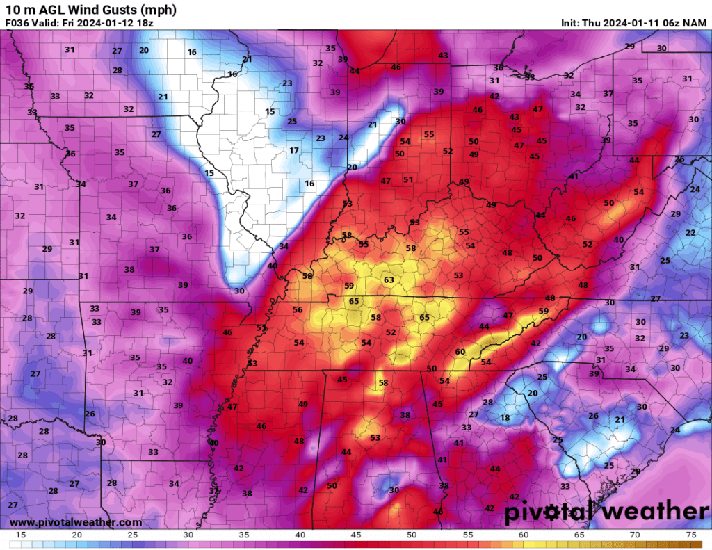
Here is the animation of the NAM model. You can see the wind moving through the region tonight into tomorrow night.
Peak wind will be tomorrow (Friday) and tomorrow night.