Posted by Meteorologist Beau Dodson
Want to receive more weather information? I provide a service through www.weathertalk.com
Subscribe at www.weathertalk.com and then download the Beau Dodson Weather app from the app stores!
Apple users: Beau Dodson Weather App
https://wtalk.co/9EZYG8A8
Android users: Beau Dodson Weather App
https://wtalk.co/ZEWYU8ME
Need help? Email me at beaudodson@usawx.com
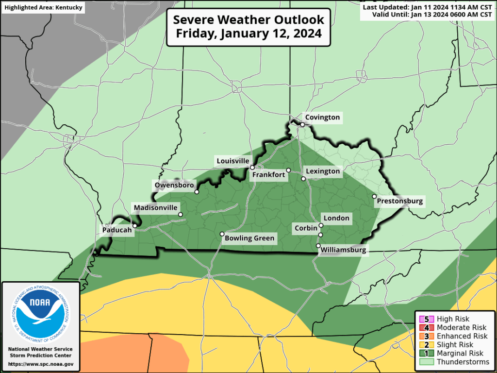
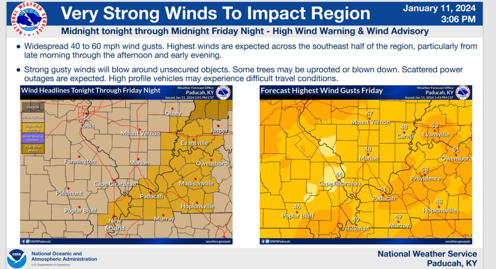
The Storm Prediction Center has upgraded our region to a level one severe weather risk tonight and Friday.
The light green zone is where lightning is possible. The dark green zone is a level one/marginal severe weather risk. The primary concern will be damaging wind and hail. A short-lived tornado can’t be ruled out.
The primary concern will be after midnight tonight into early tomorrow afternoon.
Rainfall totals of one to two inches will likely occur with this rain event. Locally higher.
These rain totals could cause some low land flooding, stream flooding, and roadway flooding.
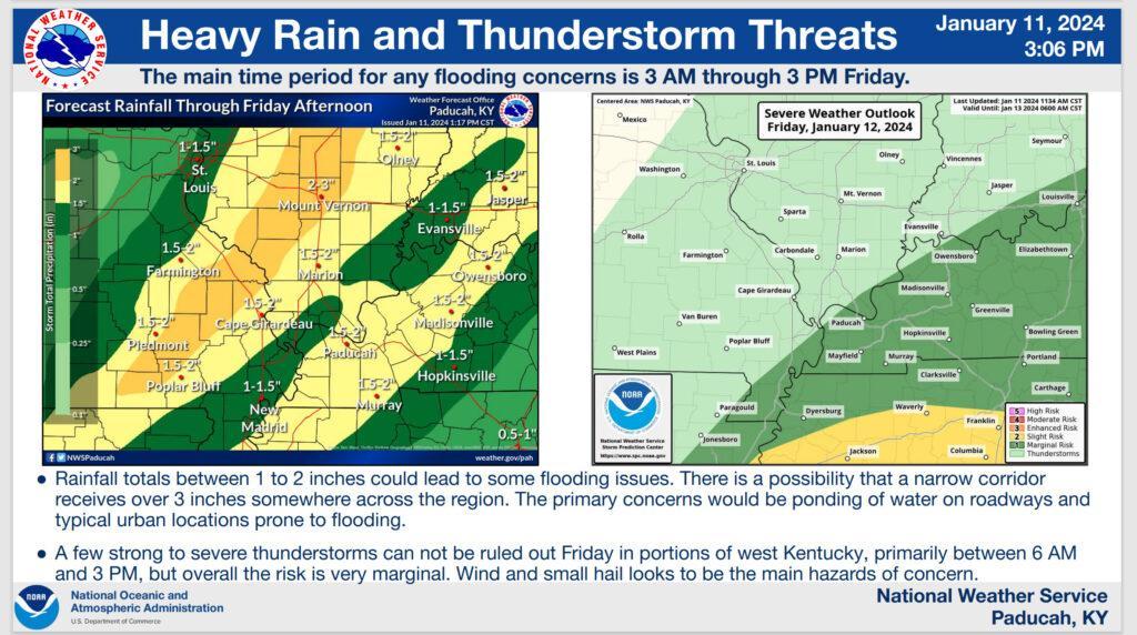
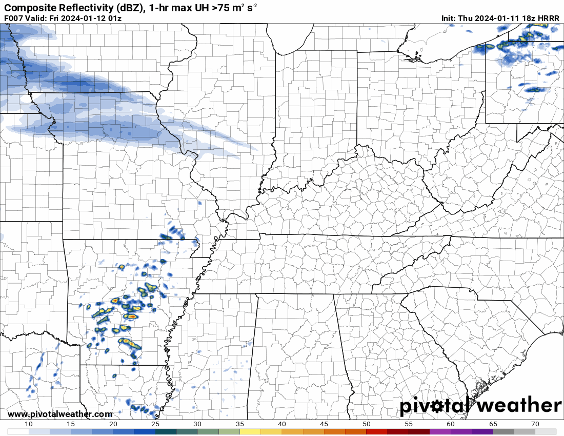
The Hrrr model shows showers and thunderstorms advancing into the region tonight and continuing through tomorrow.
Time stamp upper left. Zulu time. 12z=6 am. 18z-12 pm. 0z=6 pm.
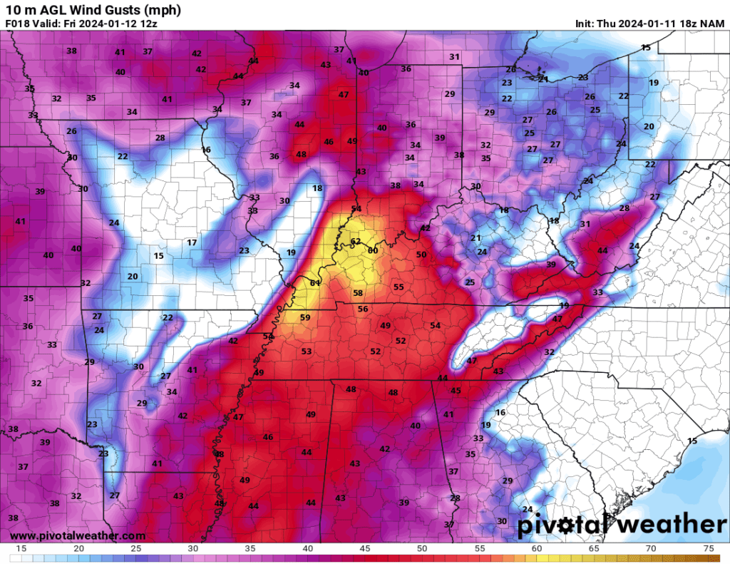
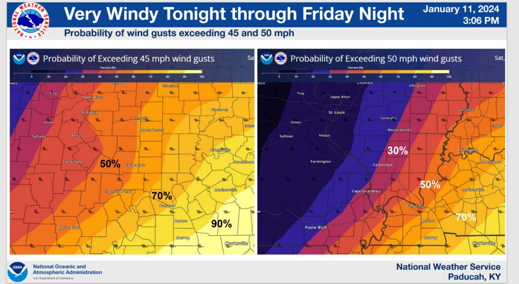
In addition to the severe weather risk. there will be a chance of damaging gradient winds (non-thunderstorm winds)
The NAM model shows this well.
Want to receive more weather information? I provide a service through www.weathertalk.com
Subscribe at www.weathertalk.com and then download the Beau Dodson Weather app from the app stores!
Apple users: Beau Dodson Weather App
https://wtalk.co/9EZYG8A8
Android users: Beau Dodson Weather App
https://wtalk.co/ZEWYU8ME
Need help? Email me at beaudodson@usawx.com
* Daily weather forecasts
* My personal weather blog with all sorts of weather information!
* Special weather statements sent to the Beau Dodson Weather app.
* Rapid fire tornado alerts.
* Severe weather alerts and forecasts.
* Severe weather updates throughout the day (when severe weather is occurring)
* Ice storm alerts and forecasts.
* Winter storm alerts and forecasts.
* Winter storm updates throughout the event.
* Regional weather videos.
* Long range weather videos.
* A daily forecast that I hand type for your county. Sent out every afternoon.
* Long range outlooks. Including week one, two, three, four, and monthly outlooks. Seasonal outlooks.
* App messages to alert you when I have updated the weather blogs and Facebook.
* And more!
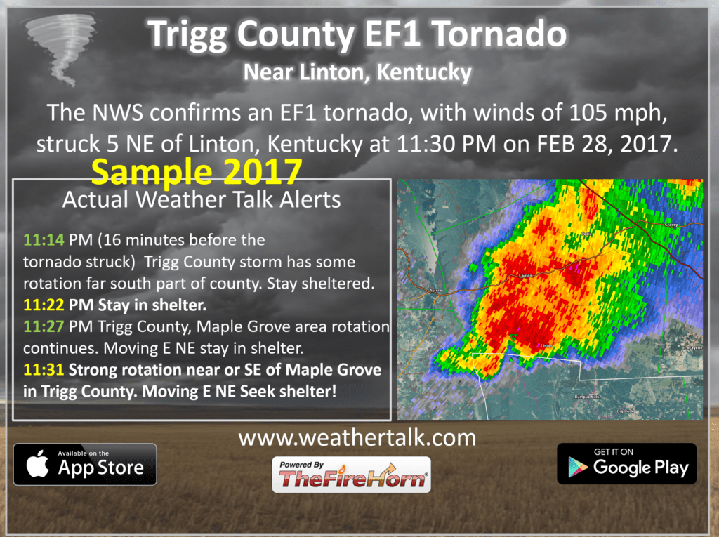
Here are some examples of what people receive when they subscribe to www.weathertalk.com