Posted by Meteorologist Beau Dodson
Want to receive more weather information? I provide a service through www.weathertalk.com
Subscribe at www.weathertalk.com and then download the Beau Dodson Weather app from the app stores!
Apple users: Beau Dodson Weather App
https://wtalk.co/9EZYG8A8
Android users: Beau Dodson Weather App
https://wtalk.co/ZEWYU8ME
Need help? Email me at beaudodson@usawx.com
————————————————————————————————————————–
WHAT? Bitterly cold air. Pipe busting cold.
Where? Area-wide.
When? Beginning Friday afternoon/night and lasting into at least next weekend (perhaps beyond). Some moderation in temperatures THU/FRI before another wave of cold air.
The stage is set for bitterly cold air to push into the region. The cold air will arrive Friday night and continue into next weekend. Perhaps beyond. Some data shows three or four waves of cold air.
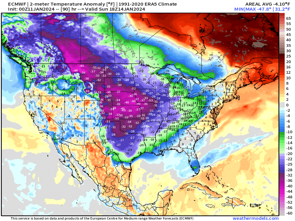
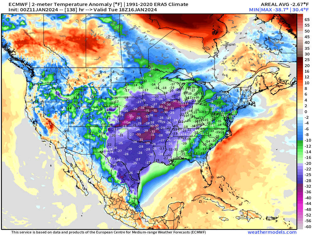
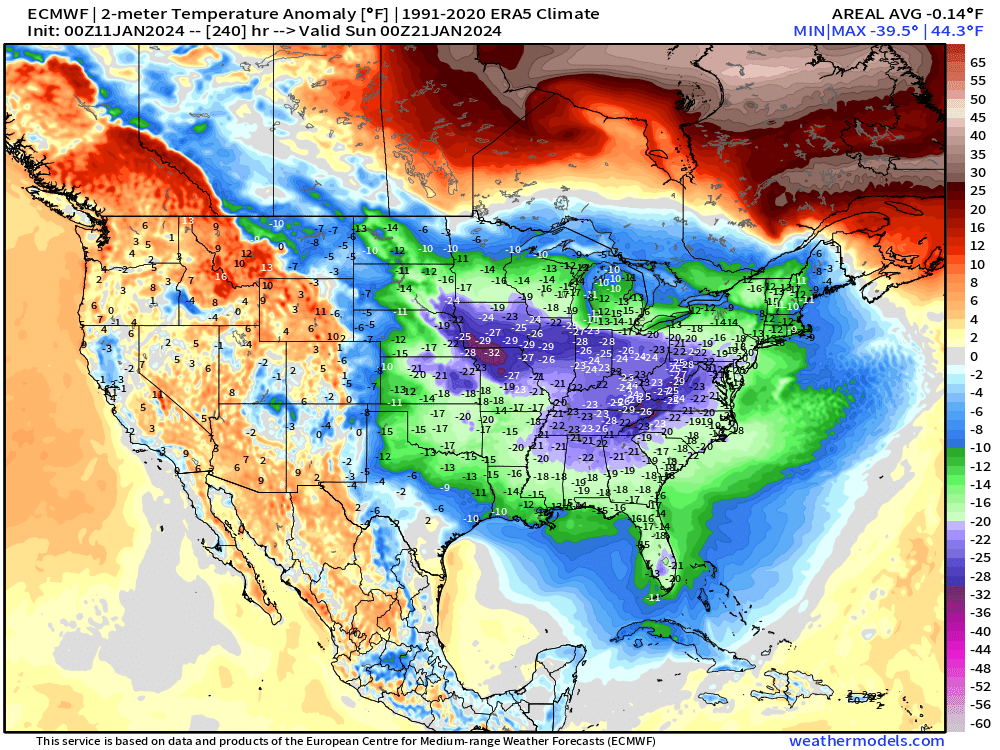
Here is the temperature anomaly maps. How many degrees above or below average will temperatures be? These are NOT the actual temperatures. These are anomalies (temperature departures).
Watch wave after wave of cold air push into the region. The GFS goes all in on the cold weather. This would be quite unusual to see several cold outbreaks back to back. It has been awhile since we have seen anything like that.
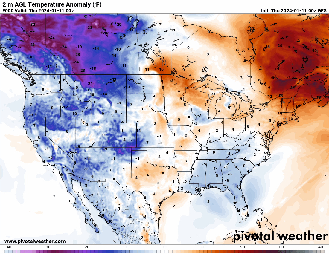
Look at the warm air surging ahead of the cold front Friday. All the way to Canada! Look at the cold air to the northwest. That air is coming in from the arctic circle.
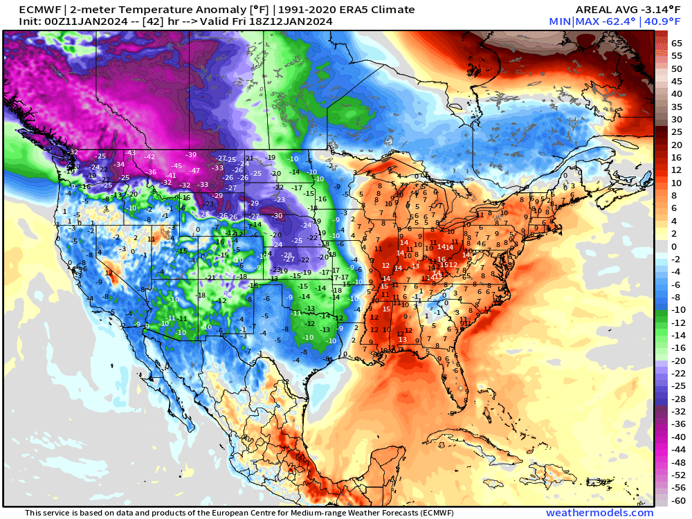
Now, look at the Sunday morning map. That is quite the surge of cold air. We call this an arctic cold outbreak. WELL below average temperatures. Normal highs for this time of the year are in the 40s. Normal lows are in the 20s.
Looking at the Tuesday map. Folks, that is bitterly cold air.
Models are showing another wave of cold air next weekend. Again, these are temperature departures (how many degrees above or below average).
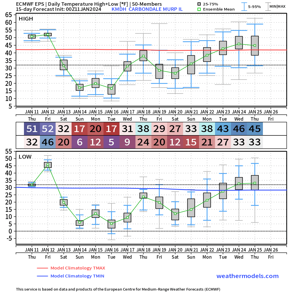
Here is what the EC model is showing for temperatures in Carbondale, Illinois.
Here is what the EC model is showing for Paducah, Kentucky.
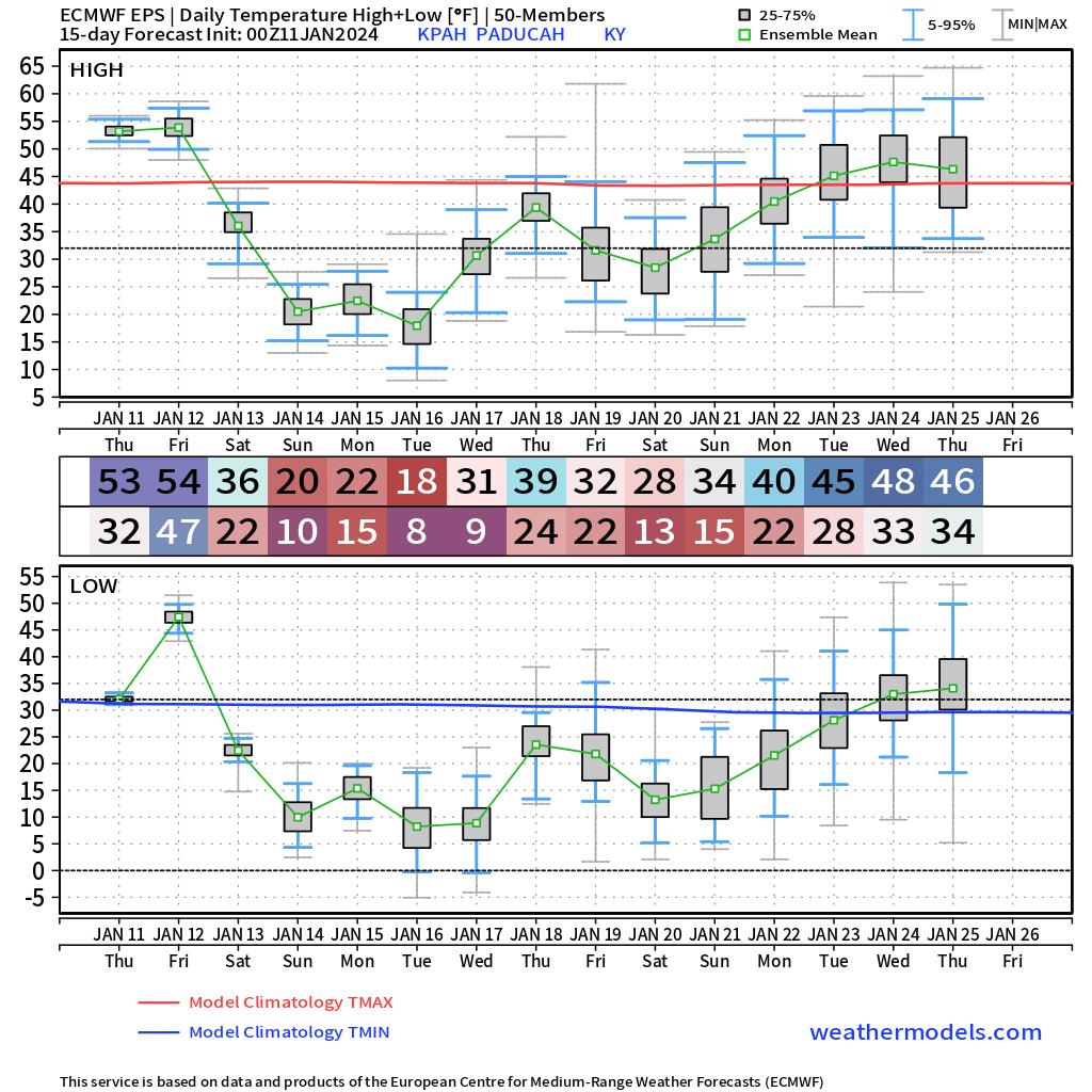
There are signs that a second wave of cold air may impact the region next weekend. That would prolong this cold event.
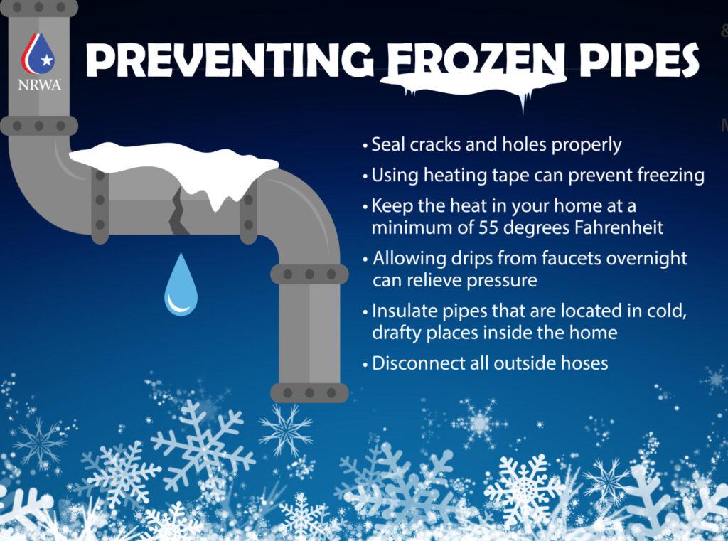
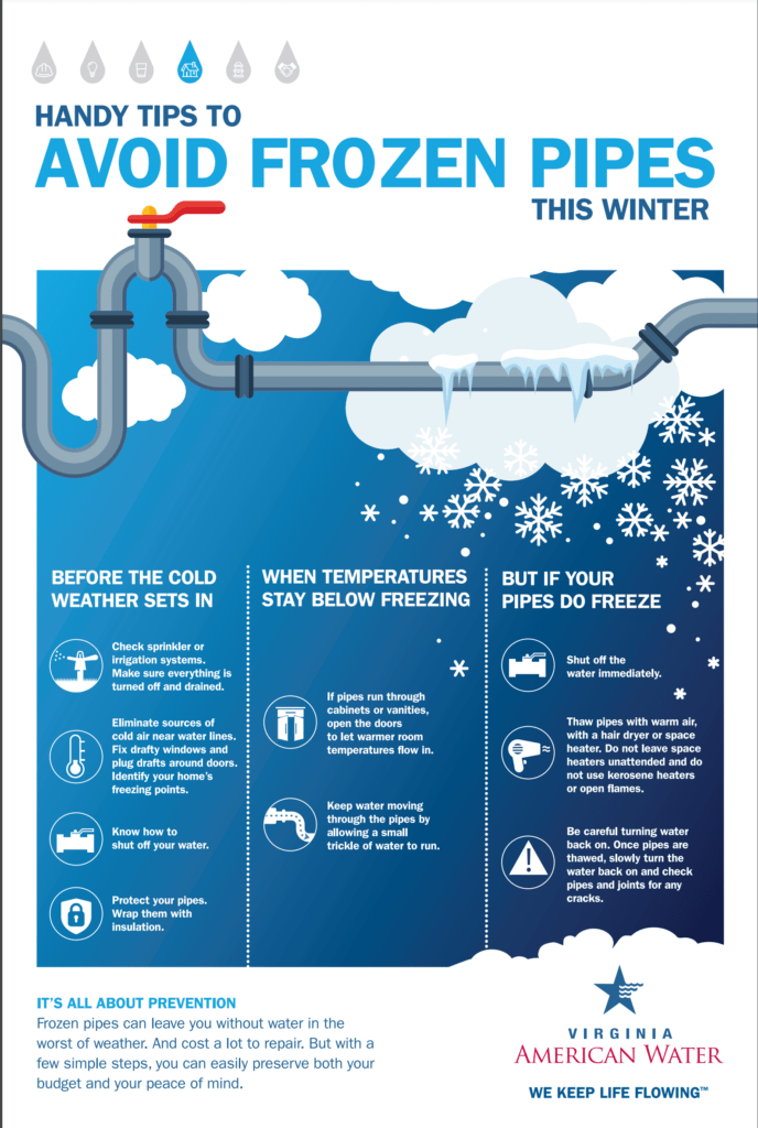
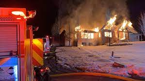
The prolonged nature of this cold air could cause damage to pipes and infrastructure.
Today is the best day to prepare.
The coldest nights will likely be Saturday, Sunday, Monday, and Tuesday. If we have a snowpack, then temperatures will be even colder.
Numerous nights will have lows dipping into the single digits and teens. If we have a snowpack, then some areas could go below zero.
Widespread rain arrives tonight and tomorrow. Thus, today is the best day to prepare.
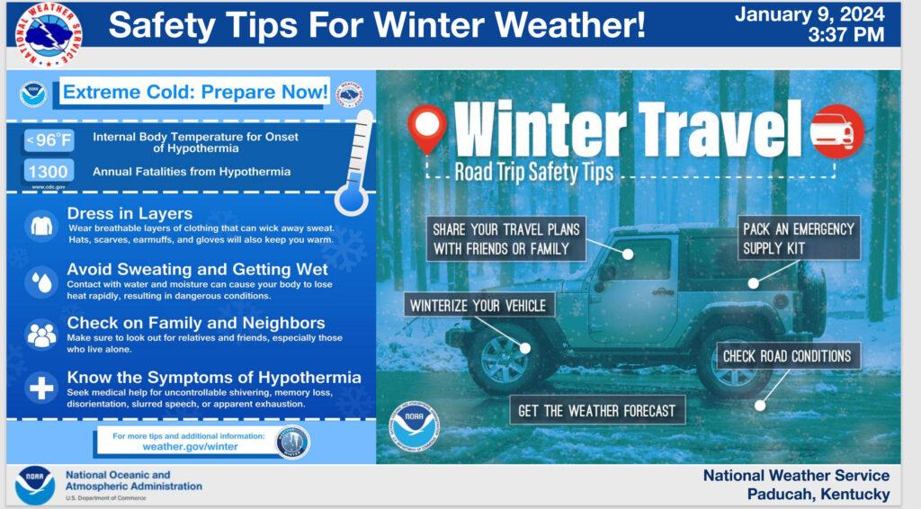
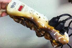
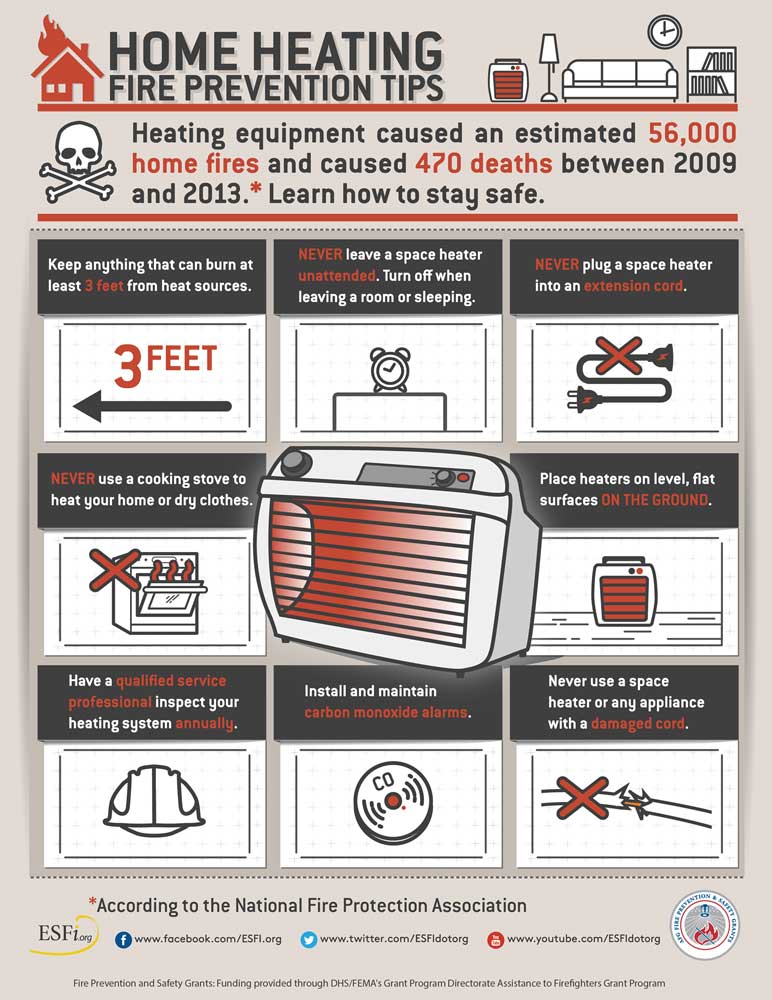
As a reminder, avoid using extension cords with space heaters. This can lead to house fires.
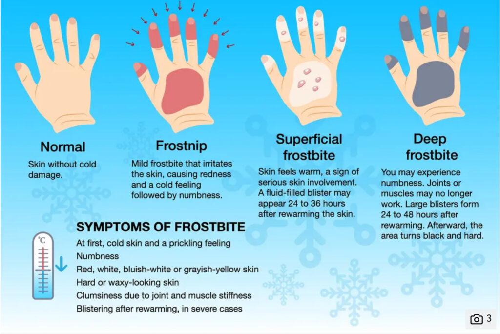
Portions of the region may experience snow Sunday and Monday. You will want to bundle the kids up if they go outside and play int he snow. Frost bite is a concern.
.
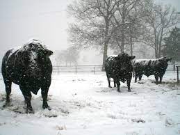
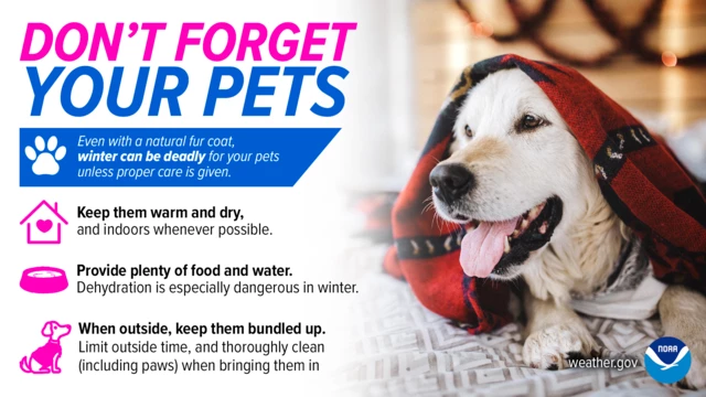
This cold weather will be harsh on outside livestock and pets, as well.
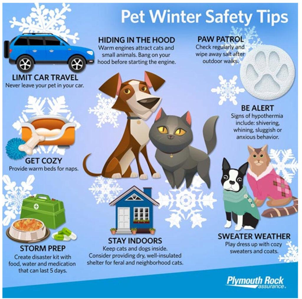
Look Under the Hood
Warm engines can attract cats and other small animals seeking shelter from the cold. Try banging on your hood before starting your engine — you could potentially save a life.
Paw Patrol
Check your pet’s paws after walking them outdoors and wipe away any salt.
Be Alert
Be on the lookout for signs of hypothermia, which include shivering or shaking, whining and sluggish or anxious behavior.
Sweater Weather
Make sure your pets are warm enough outside.
Stay Indoors
Keep cats and dogs inside in extreme cold. If you’re worried about feral and neighborhood cats without home, consider providing dry, well-insulated shelter.
Prep for Storms
Create a pet disaster kit that has food, clean water and any medications to last for about five days.
Get Cozy
Provide warm beds and blankets for naps. Better yet, join your pet for nap time!
Limit Car Travel
Whether the weather is hot, frigid or even mild, it’s never a good idea to leave your pet alone in a car.
Want to receive more weather information? I provide a service through www.weathertalk.com
Subscribe at www.weathertalk.com and then download the Beau Dodson Weather app from the app stores!
Apple users: Beau Dodson Weather App
https://wtalk.co/9EZYG8A8
Android users: Beau Dodson Weather App
https://wtalk.co/ZEWYU8ME
Need help? Email me at beaudodson@usawx.com
* Daily weather forecasts
* My personal weather blog with all sorts of weather information!
* Special weather statements sent to the Beau Dodson Weather app.
* Rapid fire tornado alerts.
* Severe weather alerts and forecasts.
* Severe weather updates throughout the day (when severe weather is occurring)
* Ice storm alerts and forecasts.
* Winter storm alerts and forecasts.
* Winter storm updates throughout the event.
* Regional weather videos.
* Long range weather videos.
* A daily forecast that I hand type for your county. Sent out every afternoon.
* Long range outlooks. Including week one, two, three, four, and monthly outlooks. Seasonal outlooks.
* App messages to alert you when I have updated the weather blogs and Facebook.
* And more!
Here are some examples of what people receive when they subscribe to www.weathertalk.com