Posted by meteorologist Beau Dodson
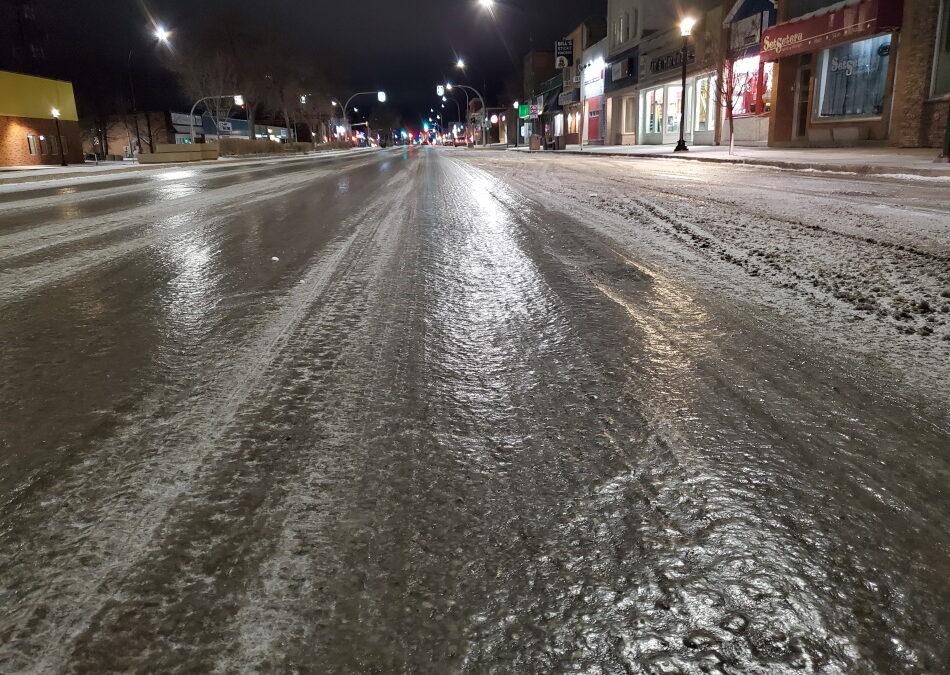
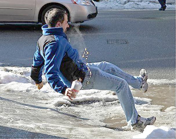
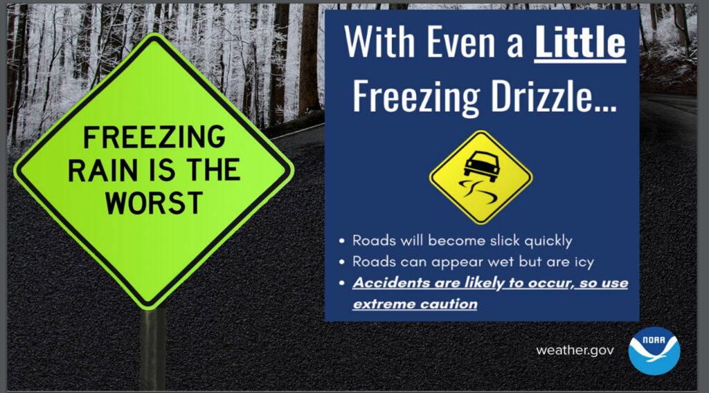
Our deadliest winter storm events are light freezing drizzle and freezing rain events. What looks wet could be pure ice. Be careful.
The NWS will have a Facebook live at 7 PM tonight (Wednesday night)
Link https://wtalk.co/RE6EAM6X
Graphics updated at 4 PM Wednesday.
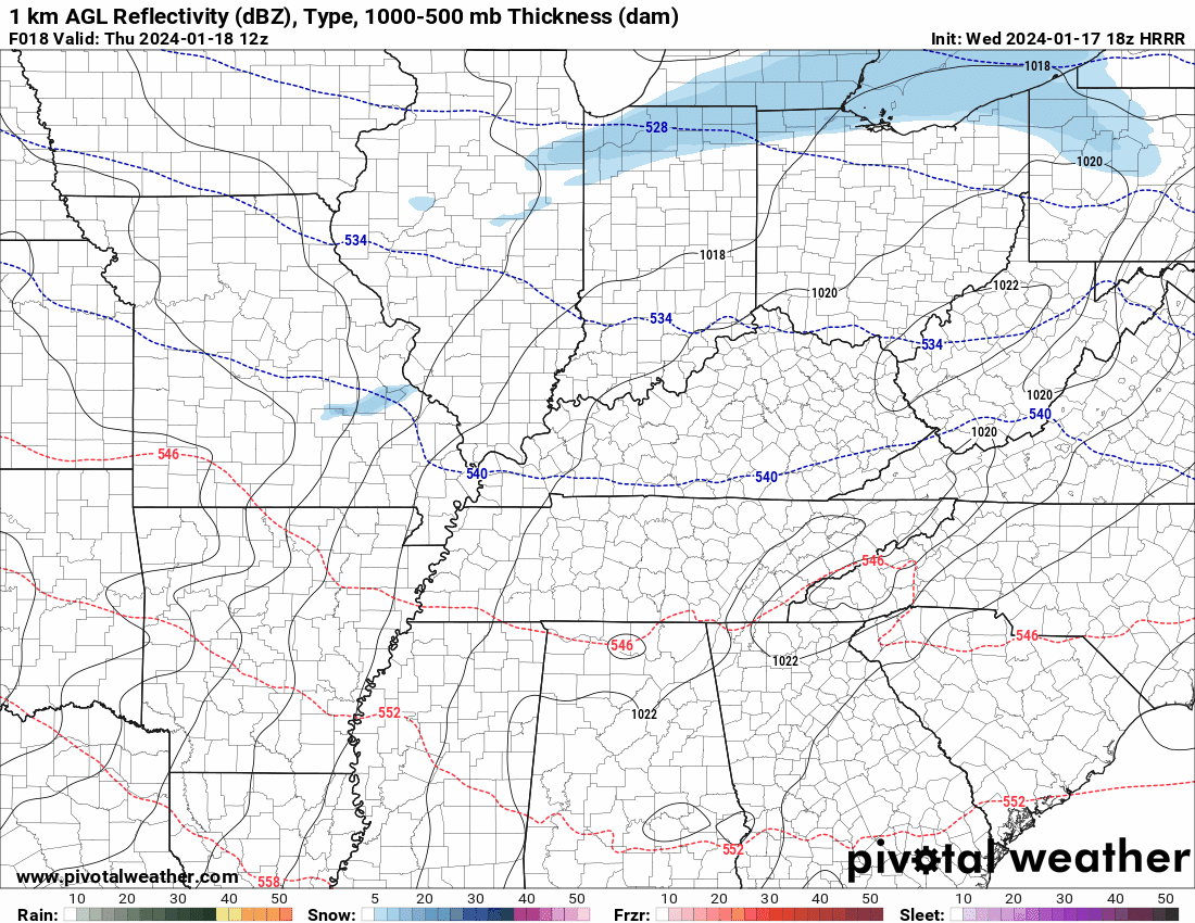
Here is the future-cast radar from the Hrrr model. What radar might look like tomorrow.
Time is Zulu. 12z=6 am. 18z=12 pm. 00z=6 pm. Models don’t pick up on freezing drizzle all that well. Take the general idea from this not specifics.
It could be off a few counties west or east.
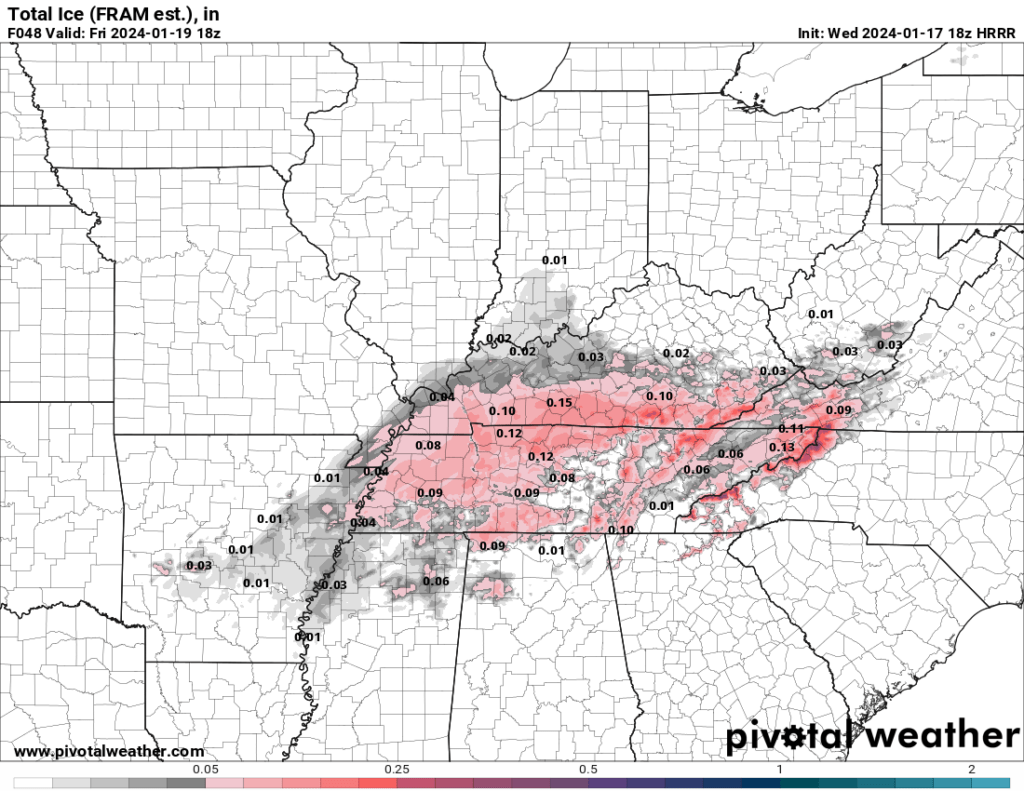
Totals will be light, but focus is not on totals. It is on impact. Icy surfaces. Even a hint of freezing drizzle can cause major traffic issues (and icy surfaces).
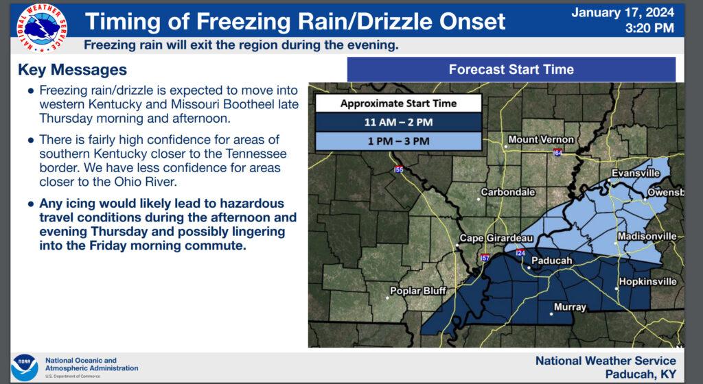
This will be moving in from the south southwest moving northeast.
Again, take the general idea from this. It could be off a county or two either direction.
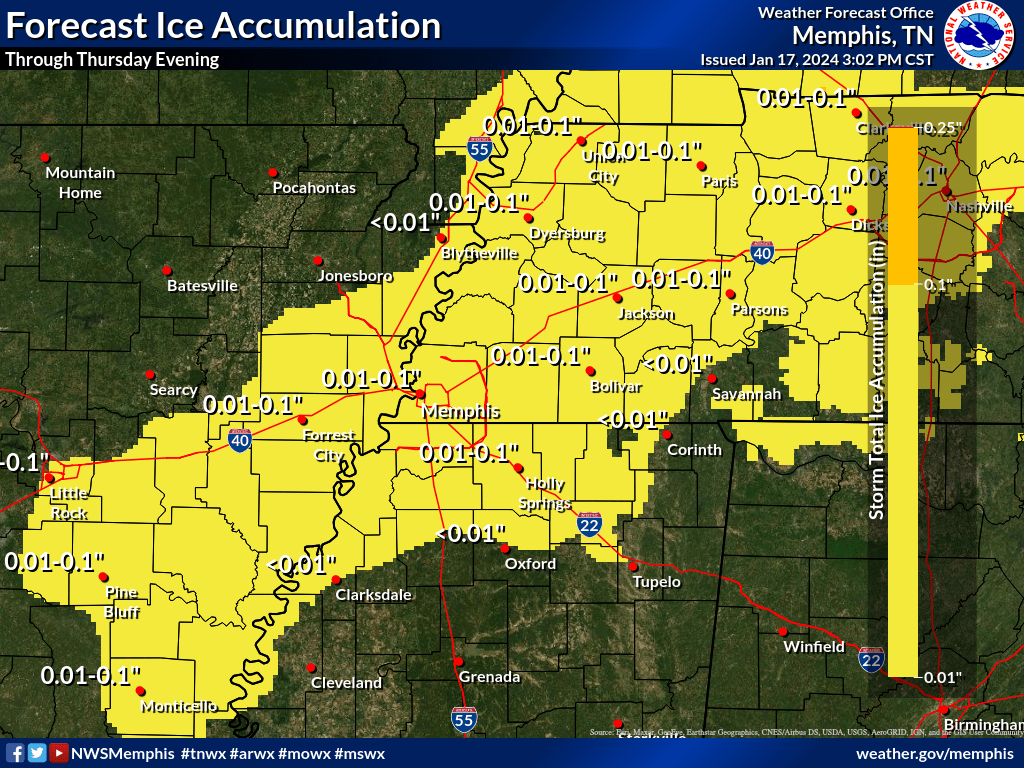
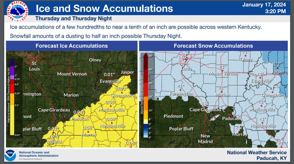
Freezing rain totals.
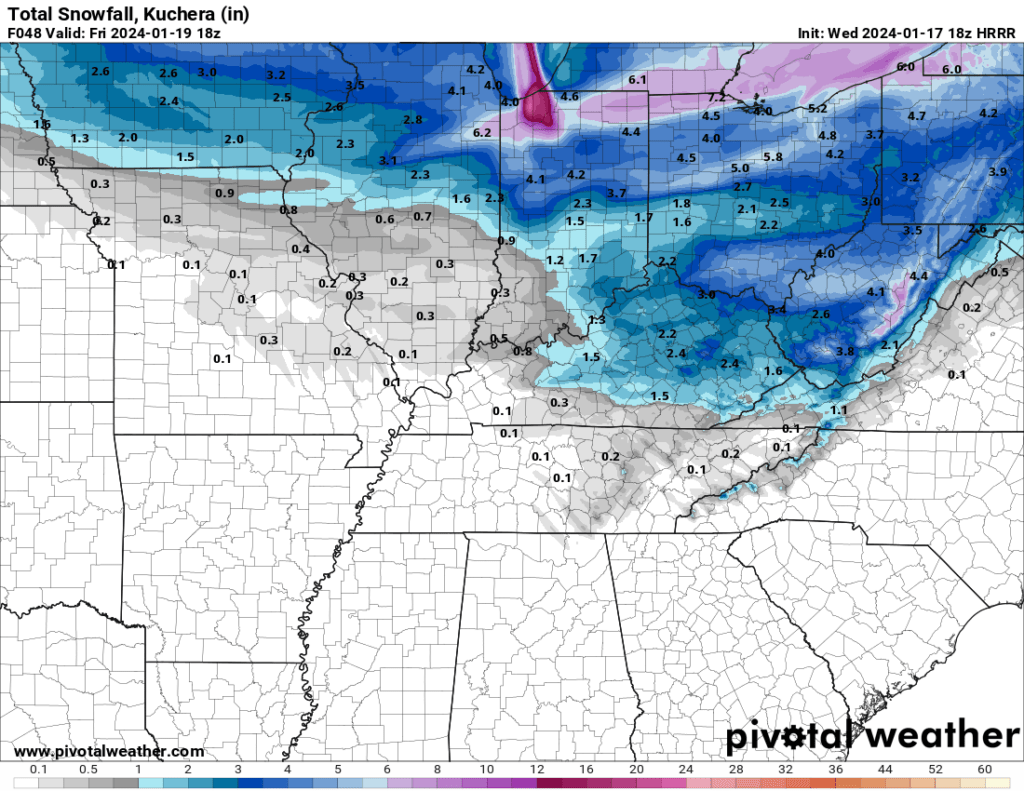
Snow is possible tomorrow afternoon and night moving in from the northwest along an arctic cold front.
This will move in from the northwest and push east southeast.
Snow totals will be light.
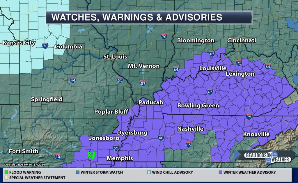
Advisory information
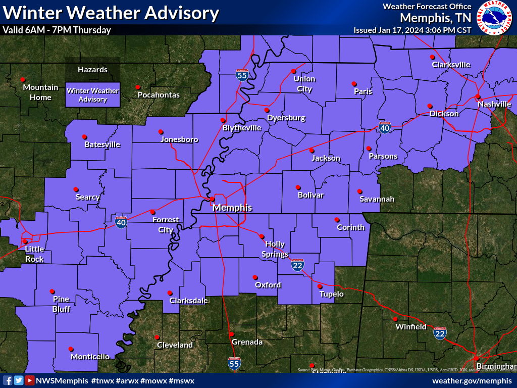
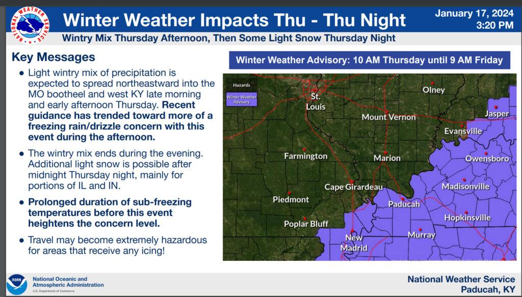
Advisory zone.
Advisory totals. Focus on impacts NOT totals. Any freezing rain could lead to roads becoming a skating rink. Sidewalks and other surfaces, as well. Dangerous conditions.
Approximate timing. GIVE OR TAKE.
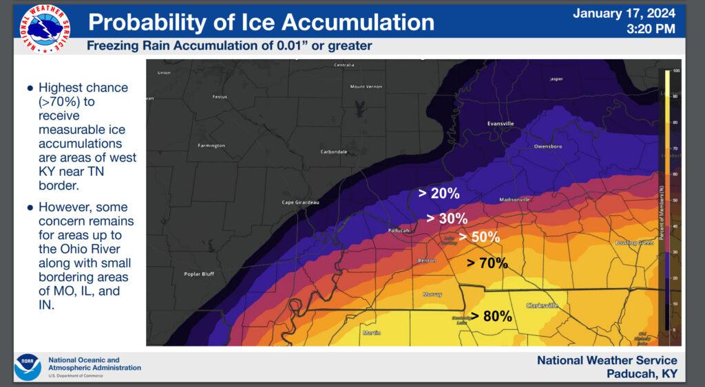
Probability of ice accumulation.
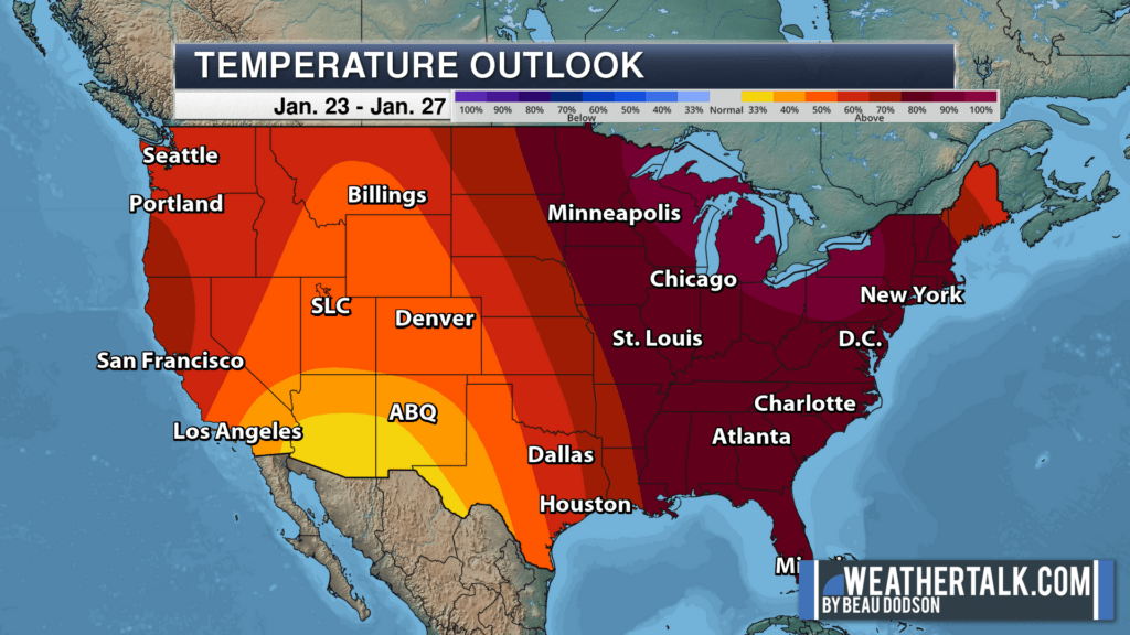
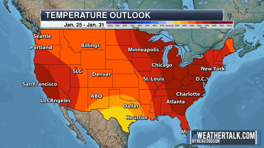
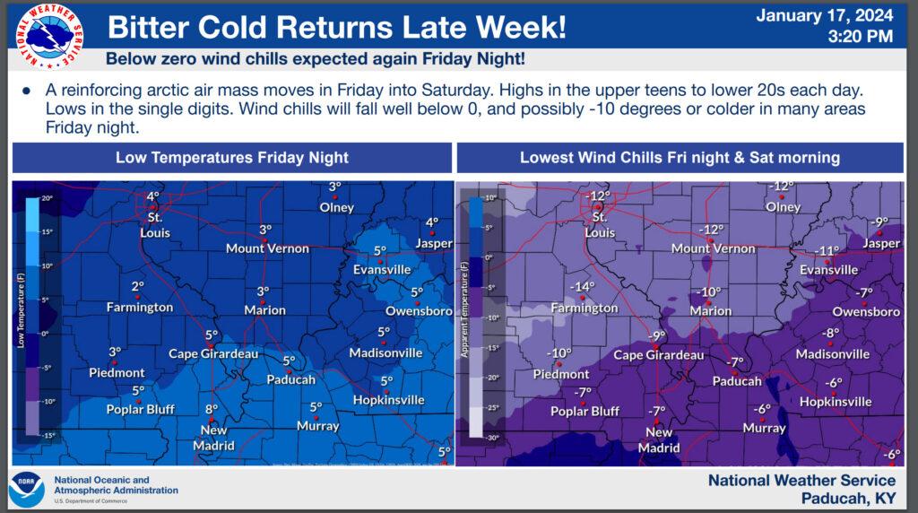
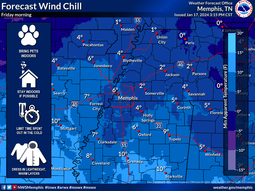
Bitterly cold air to follow.
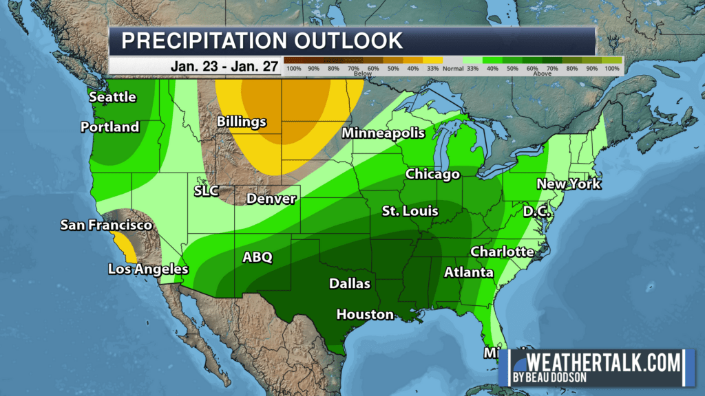
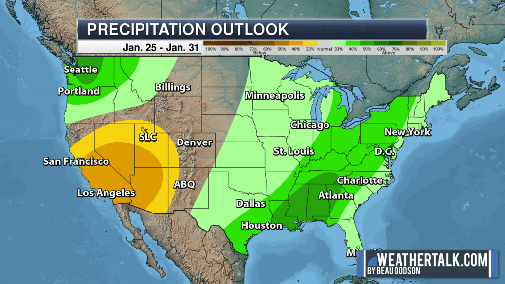
Want warmer and wetter weather? The arrives next week and the week after. Watching second week of February for winter to return.