Posted by Meteorologist Beau Dodson
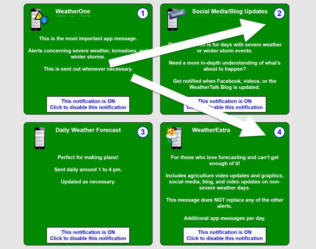
Want to receive an app notification when I post a new Facebook thread or update on the news website/blog?
Subscribe below and then turn on option TWO and FOUR (you will see that once you subscribe). Those are the two social media alert buttons.
Subscribe www.weathertalk.com
Then, download my app
Apple users: Beau Dodson Weather App
https://wtalk.co/9EZYG8A8
Android users: Beau Dodson Weather App
https://wtalk.co/ZEWYU8ME
GREEN IS ON. RED is off. Need help? Email me at beaudodson@usawx.com
Good evening, everyone.
Track the latest advisories at this link
https://imagery.weathertalk.com/prx/Region_Alerts.png
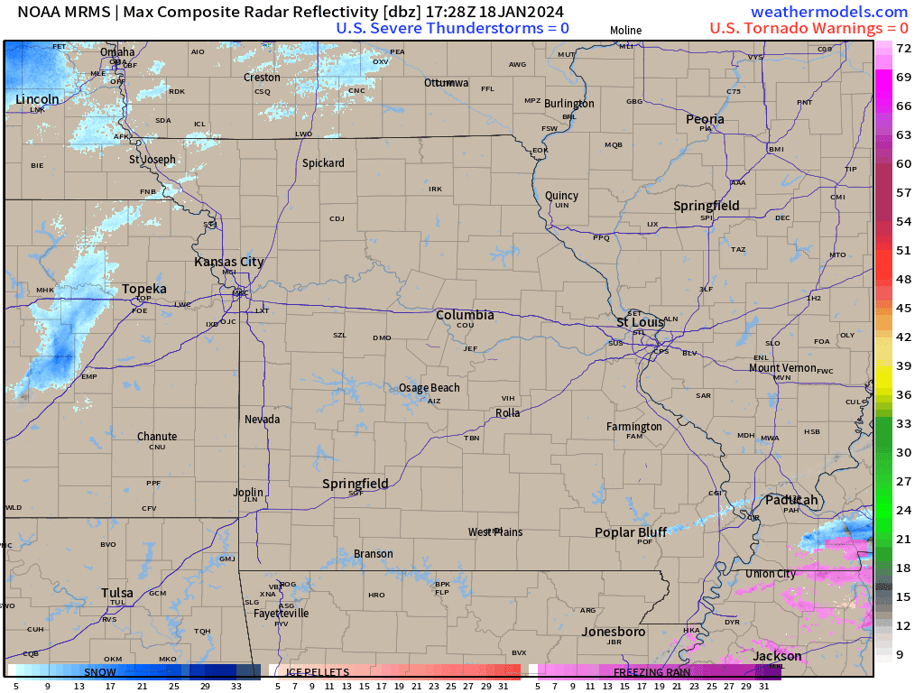
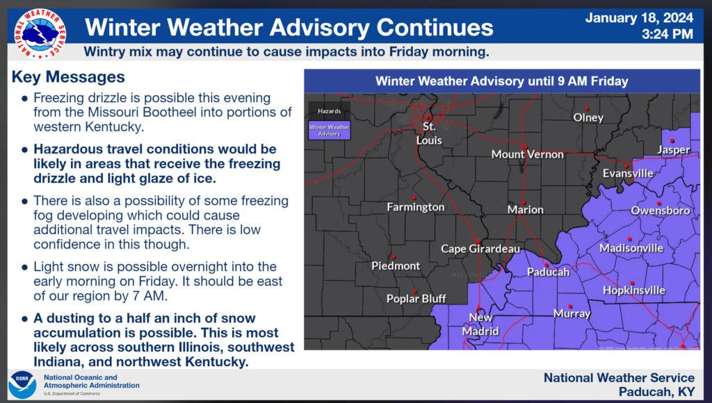
Advisory map as of 4:15 PM Thursday.
Light freezing drizzle, freezing rain, freezing fog, and sleet moved across the Missouri Bootheel, northwest Tennessee, and western Kentucky today. It continues in some areas.
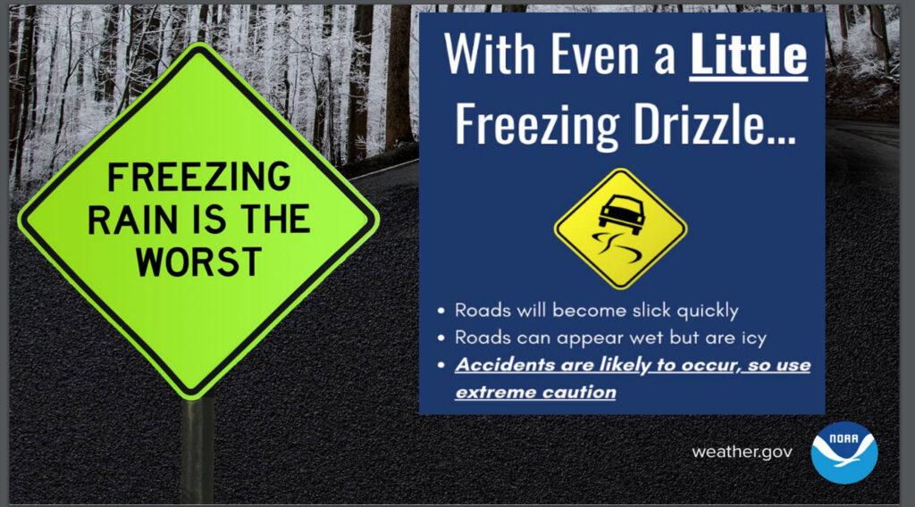
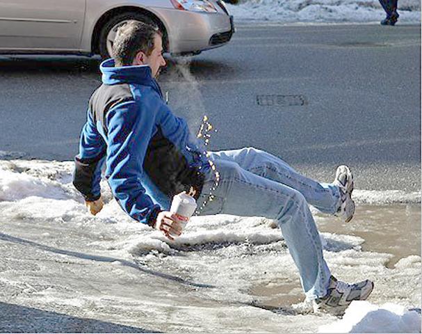
A light glaze has been reported in many areas. Treated roadways have been okay. Untreated roadways have ice on them. Steps and porches are ice coverage in many areas. Use care.
What looks wet could be black ice.
The precipitation will continue into tonight.
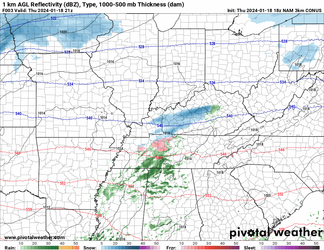
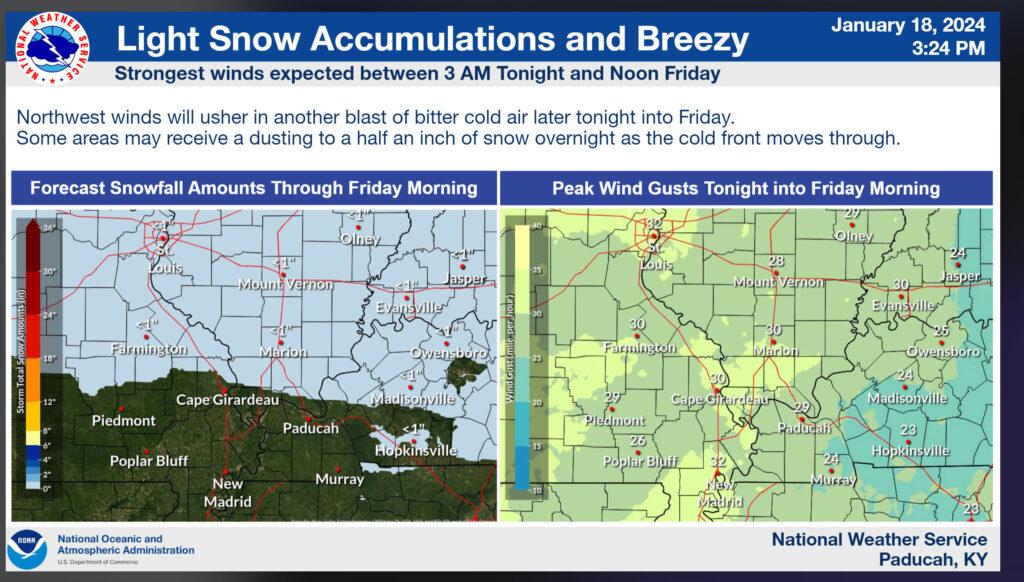
Snow is approaching from the northwest. It is moving east southeast. This is along an arctic cold front.
Light snow is likely tonight across at least the northern half of southeast Missouri, all of southern Illinois, and northwest Kentucky. Snow showers may extend south of there, but not as great of coverage as areas to the north.
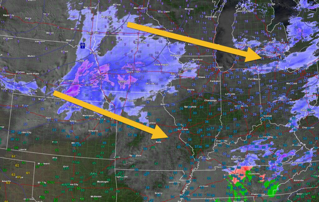
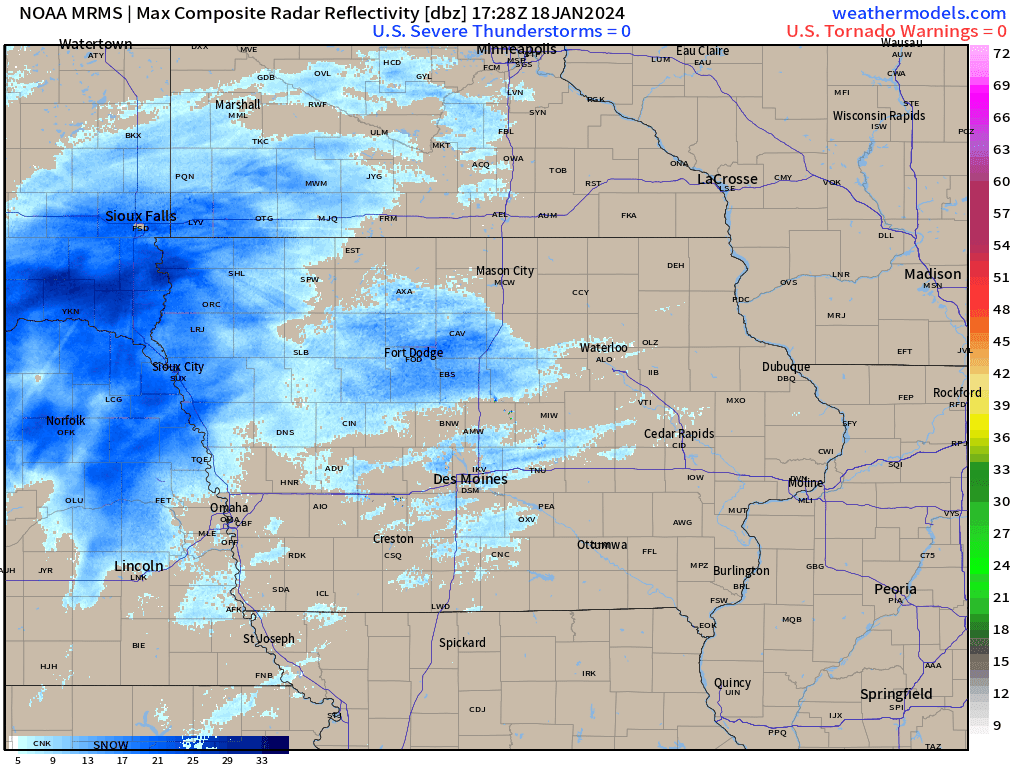
4 PM radar animation (blue is snow)
Click the winterize button on the local city view radars to see precipitation type.
Interactive local city-view radar link.
https://beaudodsonweather.com/weather-radars/
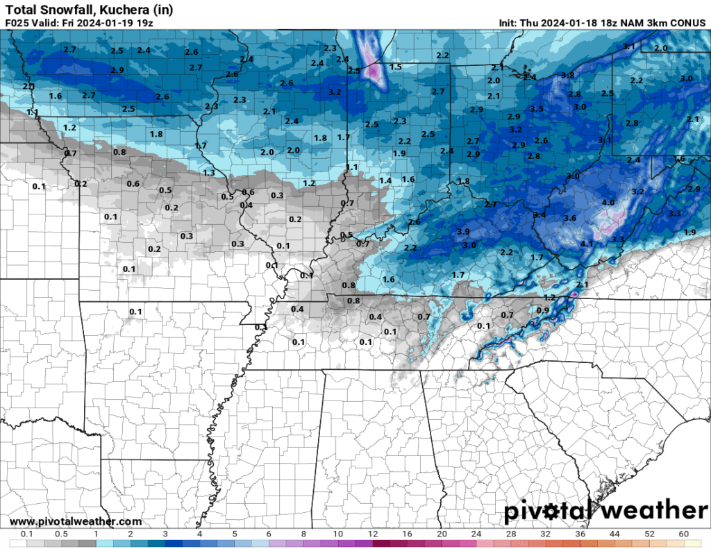
Snow accumulation of 0 to 1″ will be possible tonight. This could cause additional travel issues.
The NAM model shows that potential. Just a model’s opinion. It won’t be exact. You get the general idea.
Here is the NAM model future-cast radar. What radar might look like into tomorrow morning.
Blue is snow.
Time is Zulu. 00z= 6 pm. 06z=6 am. 12z=6 am. 18z=12 pm.
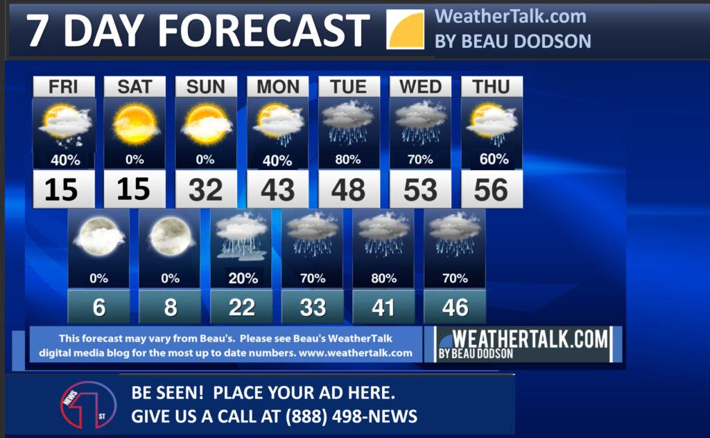
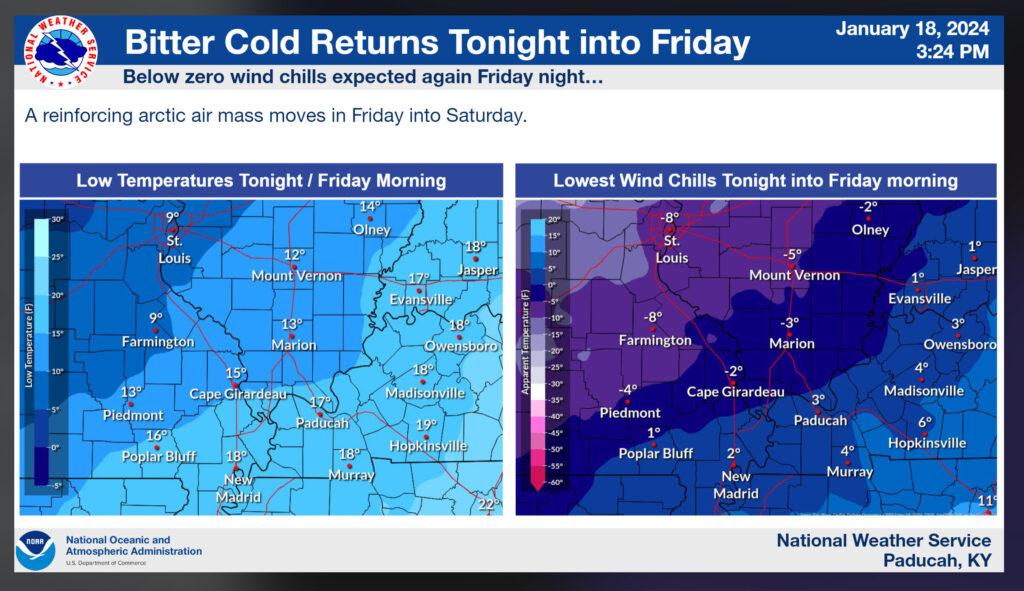
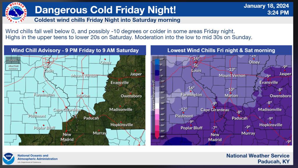
Bitterly cold air returns tonight into Saturday night. Lows will drop into the single digits tomorrow night and Saturday night. Brrr.
Highs tomorrow and Saturday will only reach into the teens.
Precipitation chances increase Sunday night into much of next week. Several rounds of rain. The rain may begin as a wintry mix late Sunday night and Monday morning. I will need to monitor Monday night’s temperatures, as well. They may flirt with freezing.
Widespread rain is likely Monday into the middle of next week. Chances will top 60%.
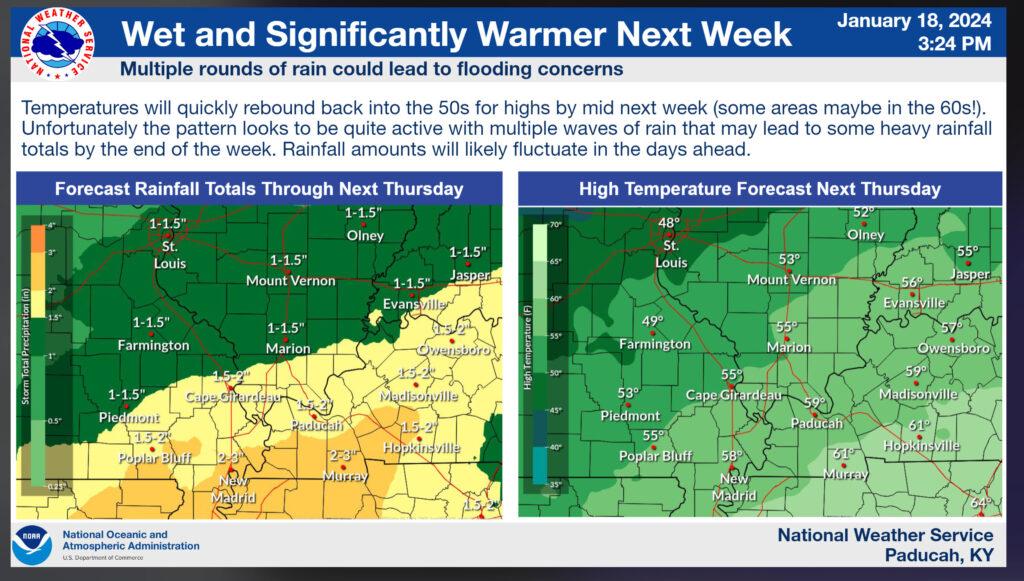
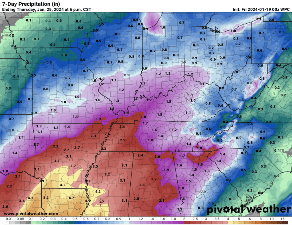
Seven-day rainfall totals. We are still in drought and need rain. Severe weather is not in the forecast. That is also good news.
Want to receive more weather information? I provide a service through www.weathertalk.com
Subscribe at www.weathertalk.com and then download the Beau Dodson Weather app from the app stores!
Apple users: Beau Dodson Weather App
https://wtalk.co/9EZYG8A8
Android users: Beau Dodson Weather App
https://wtalk.co/ZEWYU8ME
Need help? Email me at beaudodson@usawx.com
* Daily weather forecasts
* My personal weather blog with all sorts of weather information!
* Special weather statements sent to the Beau Dodson Weather app.
* Rapid fire tornado alerts.
* Severe weather alerts and forecasts.
* Severe weather updates throughout the day (when severe weather is occurring)
* Ice storm alerts and forecasts.
* Winter storm alerts and forecasts.
* Winter storm updates throughout the event.
* Regional weather videos.
* Long range weather videos.
* A daily forecast that I hand type for your county. Sent out every afternoon.
* Long range outlooks. Including week one, two, three, four, and monthly outlooks. Seasonal outlooks.
* App messages to alert you when I have updated the weather blogs and Facebook.
* And more!
Here are some examples of what people receive when they subscribe to www.weathertalk.com