Posted by Meteorologist Beau Dodson
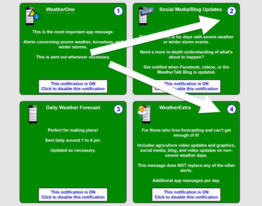
Want to receive an app notification when I post a new Facebook thread or update on the news website and the Beau Dodson Weather blog?
Subscribe below and then turn on option TWO and FOUR (you will see that once you subscribe). Those are the two social media alert buttons.
Subscribe www.weathertalk.com
Then, download my app
Apple users: Beau Dodson Weather App
https://wtalk.co/9EZYG8A8
Android users: Beau Dodson Weather App
https://wtalk.co/ZEWYU8ME
GREEN IS ON. RED is off. Need help? Email me at beaudodson@usawx.com
Weather Forecast Analysis
Well, here we go again. Not that we had much of a break, but a fresh round of bitterly cold air is spreading into the region from the northwest.
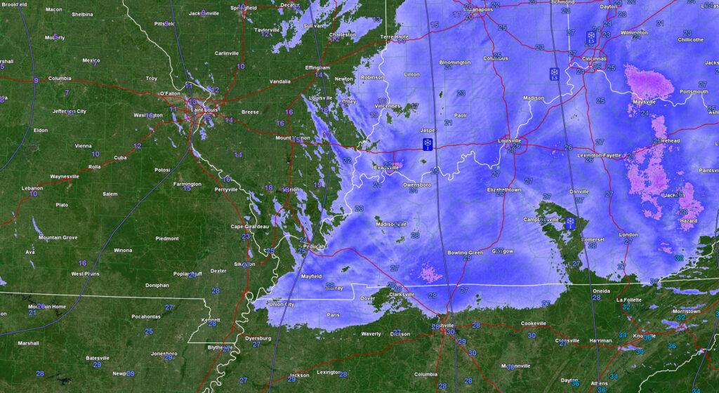
Radar, as of 7 am, showed snow pushing through the region. This is mainly flurries and snow showers. Some freezing fog, as well.
This activity will drop 0″ to 1/2″ of snow. Not much, but it could coat roadways with a thin layer of ice.
This is what radar looked like at 7 am.
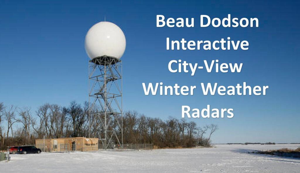
Check out our exclusive live winter weather radars!
Click the winterize button on the local city view radars to see precipitation type. It also picks up on flurries and drizzle.
Interactive local city-view radar link.
https://beaudodsonweather.com/weather-radars/
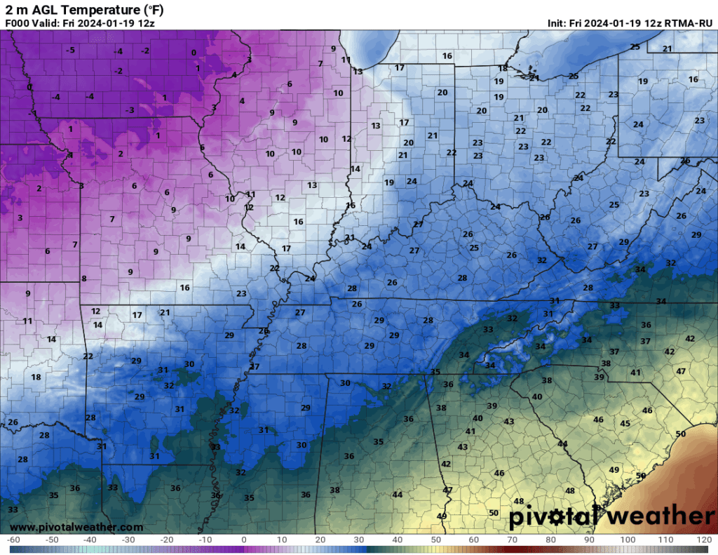
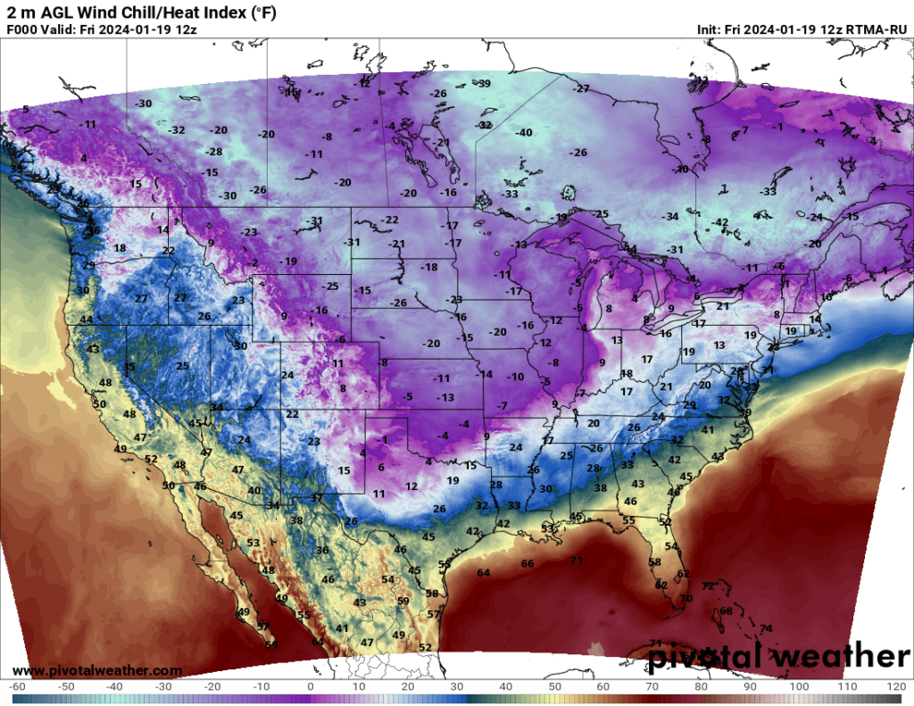
Here were the 7:30 am temperatures. You can see the cold air nudging in from the west northwest. Spreading southeast. This air is coming straight out of Canada. Straight from the Arctic!
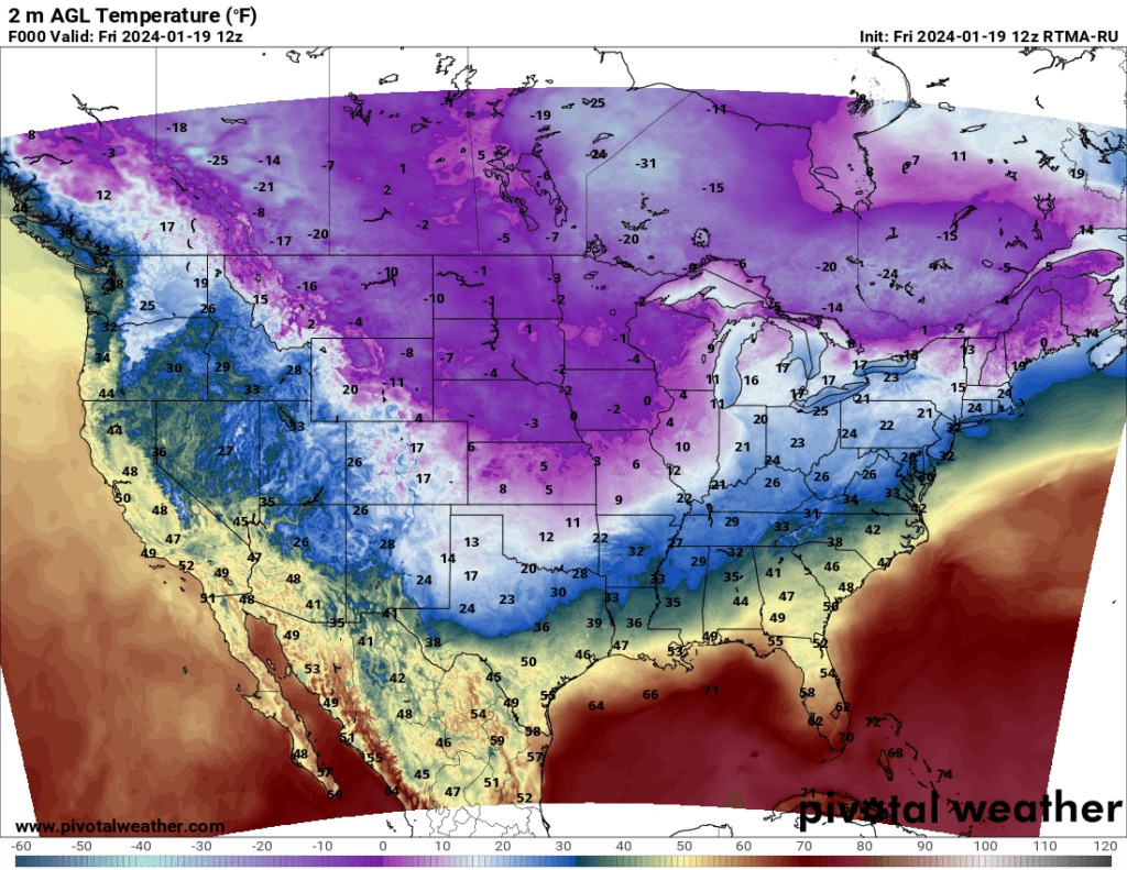
Zoomed in. Temperatures won’t recover today. Cold air will push southeast.
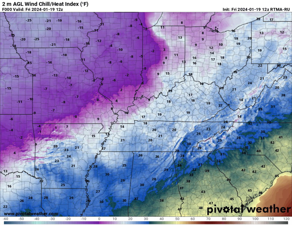
Wind chill values were even colder. This is what your skin responds to. Wind chill values. Similar to heat index values. Your body does not care what the air temperature is. It cares what the wind chill value is.
7:30 AM Wind Chill Temperatures. A shivering map!
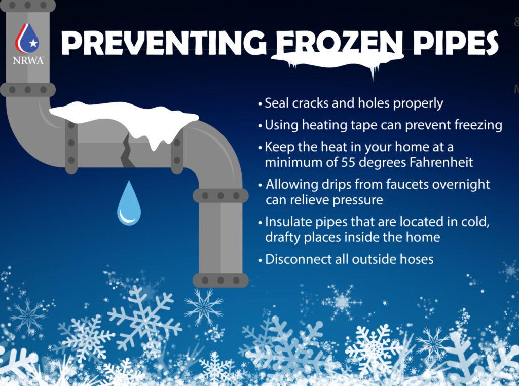
Protect Your Home
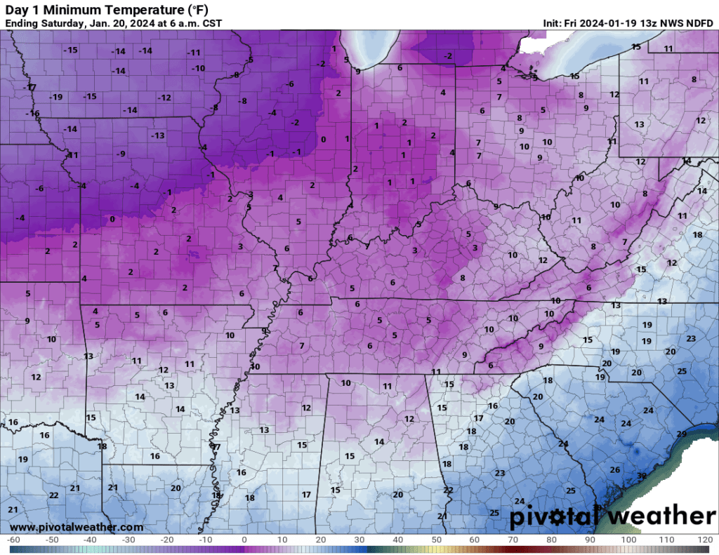
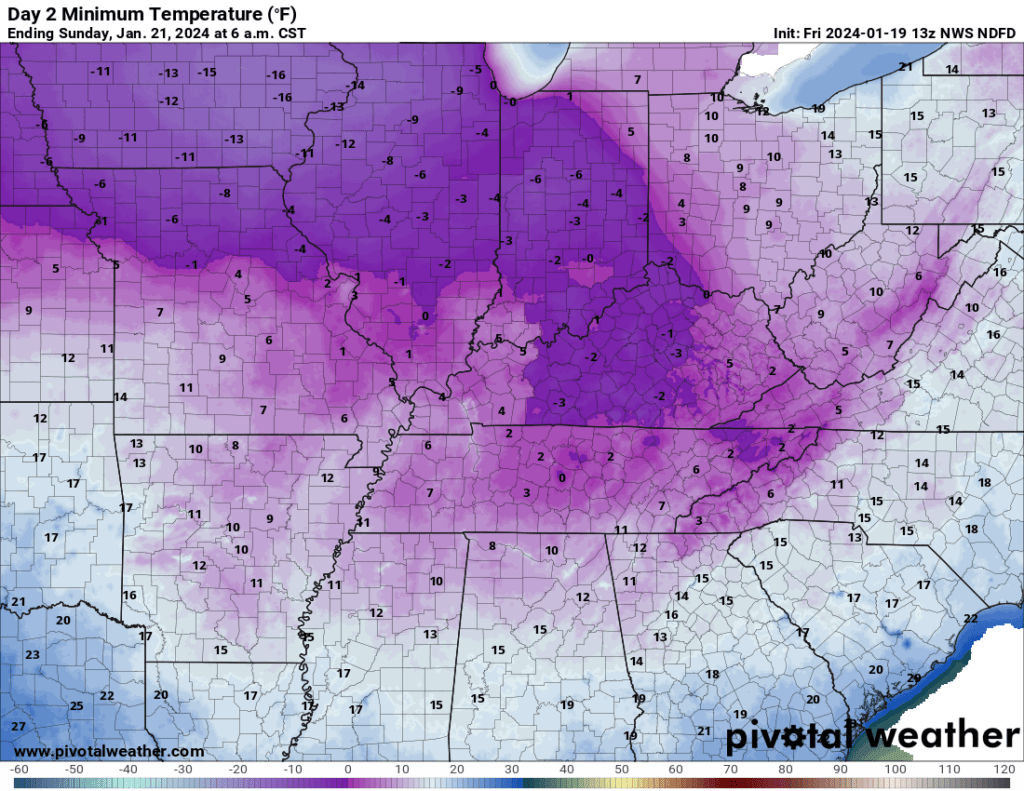
The bad news is that pipe busting cold weather will continue into Sunday. I am forecasting single digits tonight and Saturday night. Sunday night will be cold, but not as cold.
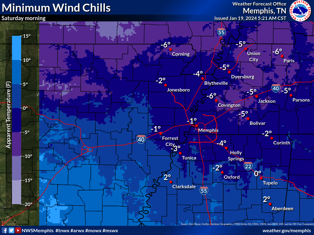
Saturday morning lows
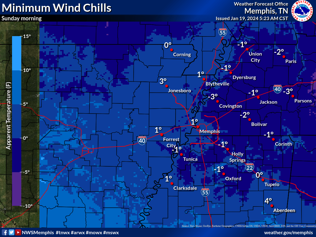
Sunday morning lows
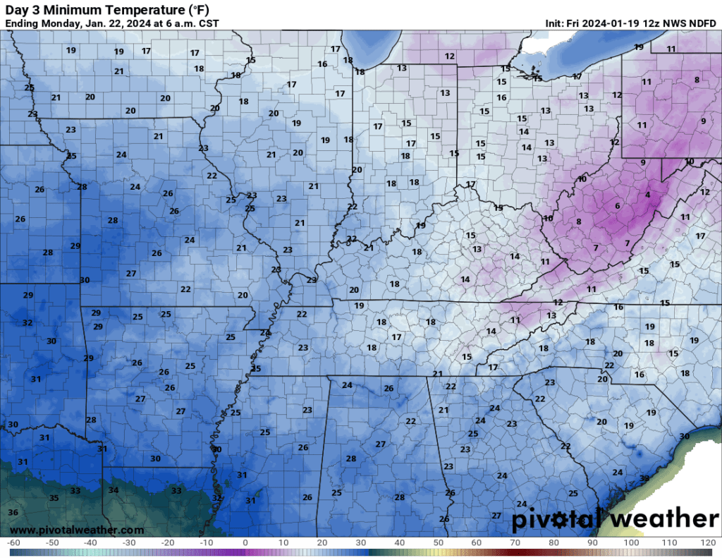
Monday morning lows
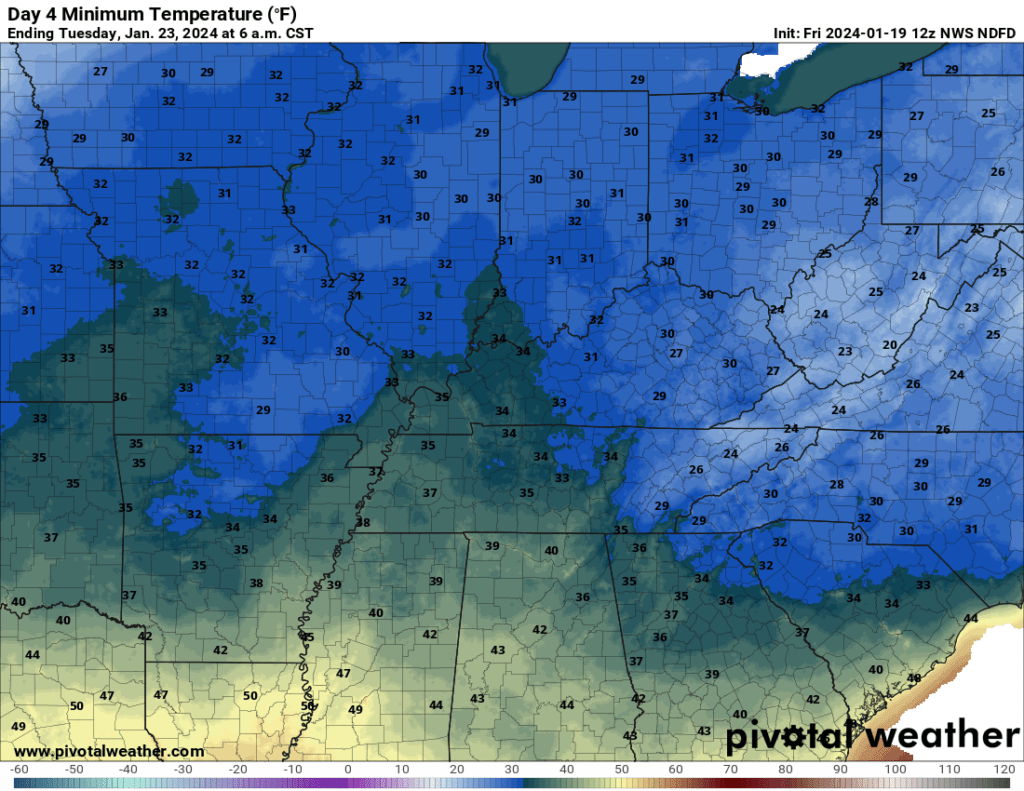
Tuesday morning lows
You will want to protect your pipes today through Sunday. Google how to protect them.
I continue to let my water drip in different faucets throughout the house.
Wind chill values will range from 0 to -15 over the next 48 hours. Bitterly cold dangerous air. Frost bite continues to be a real concern. Hypothermia, as well.
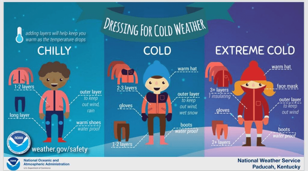
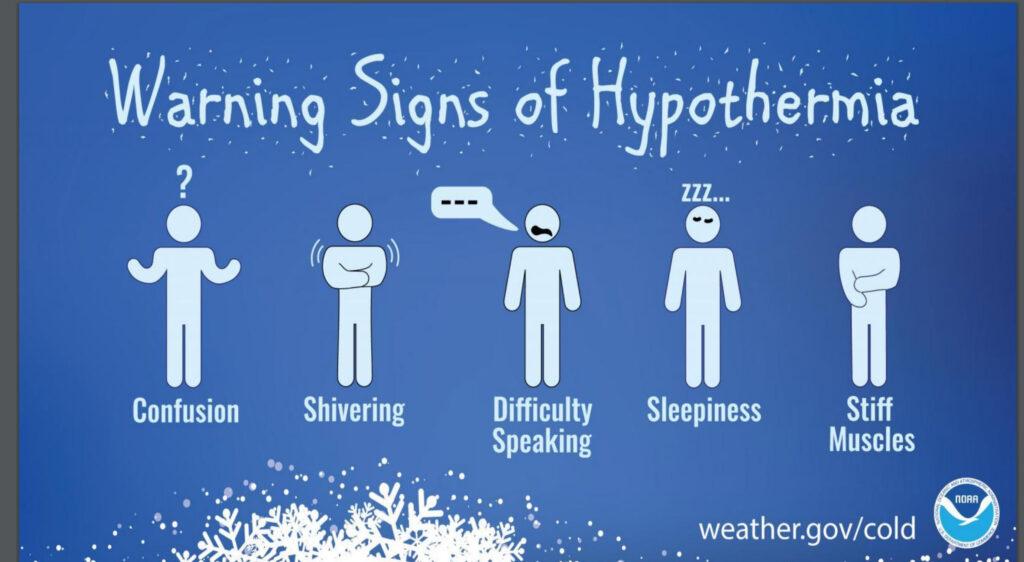
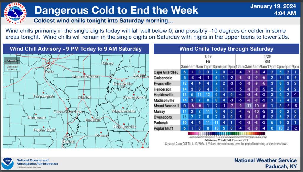
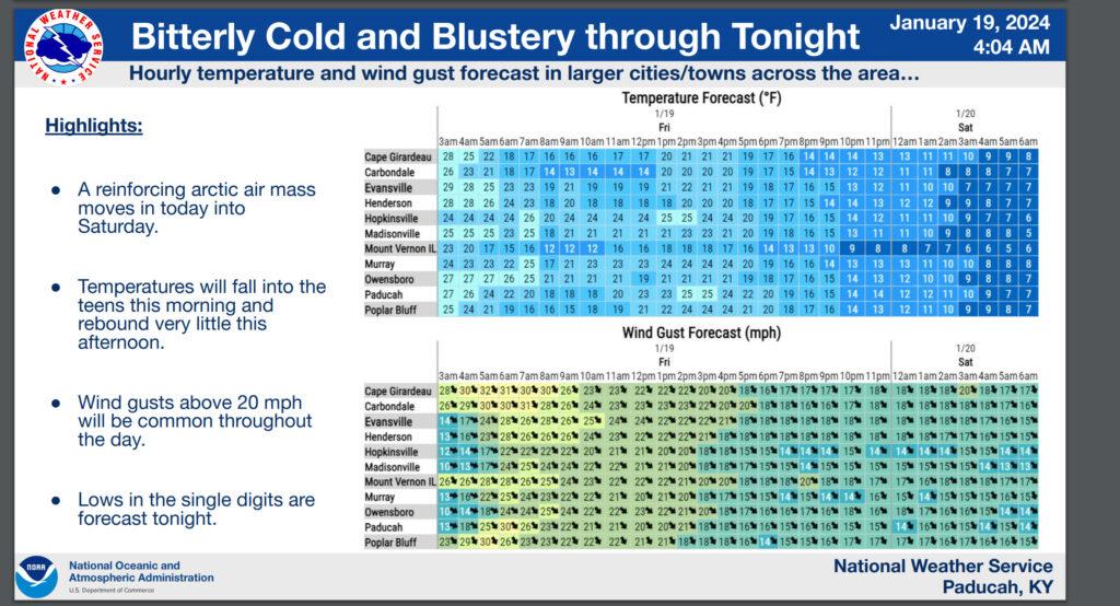
The Paducah, Kentucky NWS posted these two graphics.
The Memphis, Tennessee NWS posted the following two graphics (they didn’t post anything similar to the ones above)
ICY ROADWAYS
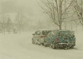
If the cold wasn’t bad enough, as mentioned above, we still have snow and freezing fog in the region (7:30 AM). In some counties, this has caused roadways to become ice covered.
Treated roads aren’t as bad, but even some of those are icy.
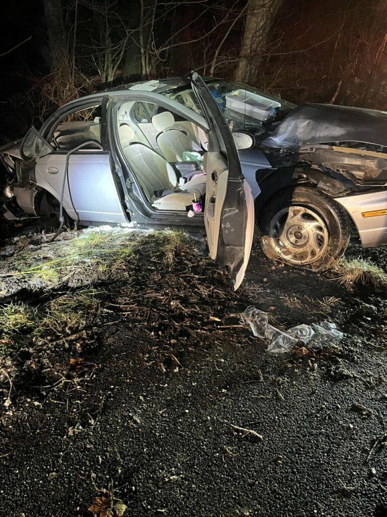
There were numerous car wrecks last night and this morning. Some serious. Please use extreme care. Black ice is an issue. What looks wet could be pure ice.
Watch that first step onto the porch or stairs/sidewalks.
This is one of the Graves County, Kentucky accidents (from last night).
Thankfully, the snow is pushing off to the east. As the cold front dives into the region, the fog will scour out, as well.
Some good news!
A milder and wetter pattern begins Monday.
As the cold air exits, we could see a brief wintry mix late Sunday night and Monday morning. That risk would be a bit higher over southeast Missouri. Rain chances increase area-wide Monday afternoon and night.
All in all, next week is shaping up to be nice compared to the last 14 days. Milder. Wetter.
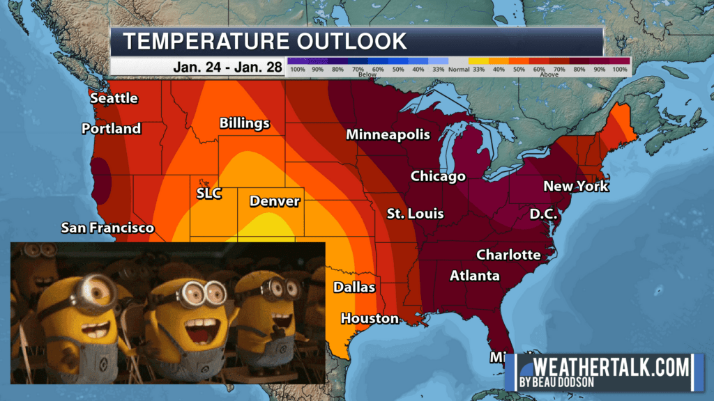
Here is the temperature outlook for January 24th through the 28th. The deep shades represent a higher confidence level in the outcome. The outcome would be above average temperatures.
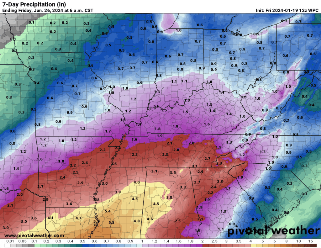
Widespread rain is likely Monday into Wednesday. That could linger into Thursday.
Rain amounts of one to two inches will be possible.
This could cause some low land flooding because of the frozen ground conditions.
Widespread flash flooding is not anticipated. Severe weather is not anticipated, either.
Seven-day rainfall outlook from the WPC.
Want to receive more weather information? I provide a service through www.weathertalk.com
Subscribe at www.weathertalk.com and then download the Beau Dodson Weather app from the app stores!
Apple users: Beau Dodson Weather App
https://wtalk.co/9EZYG8A8
Android users: Beau Dodson Weather App
https://wtalk.co/ZEWYU8ME
Need help? Email me at beaudodson@usawx.com
* Daily weather forecasts
* My personal weather blog with all sorts of weather information!
* Special weather statements sent to the Beau Dodson Weather app.
* Rapid fire tornado alerts.
* Severe weather alerts and forecasts.
* Severe weather updates throughout the day (when severe weather is occurring)
* Ice storm alerts and forecasts.
* Winter storm alerts and forecasts.
* Winter storm updates throughout the event.
* Regional weather videos.
* Long range weather videos.
* A daily forecast that I hand type for your county. Sent out every afternoon.
* Long range outlooks. Including week one, two, three, four, and monthly outlooks. Seasonal outlooks.
* App messages to alert you when I have updated the weather blogs and Facebook.
* And more!
Here are some examples of what people receive when they subscribe to www.weathertalk.com