Posted by Meteorologist Beau Dodson
Want to receive more weather information? I provide a service through www.weathertalk.com
Subscribe at www.weathertalk.com and then download the Beau Dodson Weather app from the app stores!
Apple users: Beau Dodson Weather App
https://wtalk.co/9EZYG8A8
Android users: Beau Dodson Weather App
https://wtalk.co/ZEWYU8ME
Need help? Email me at beaudodson@usawx.com
Well, we made if this far. Let’s keep pushing. I feel like we have been waging war against the elements over the past two weeks. Protecting pipes, houses, vehicles, our pets, and each other.
We have to get through today, tonight, and tomorrow! Then, some relief arrives. Finally.

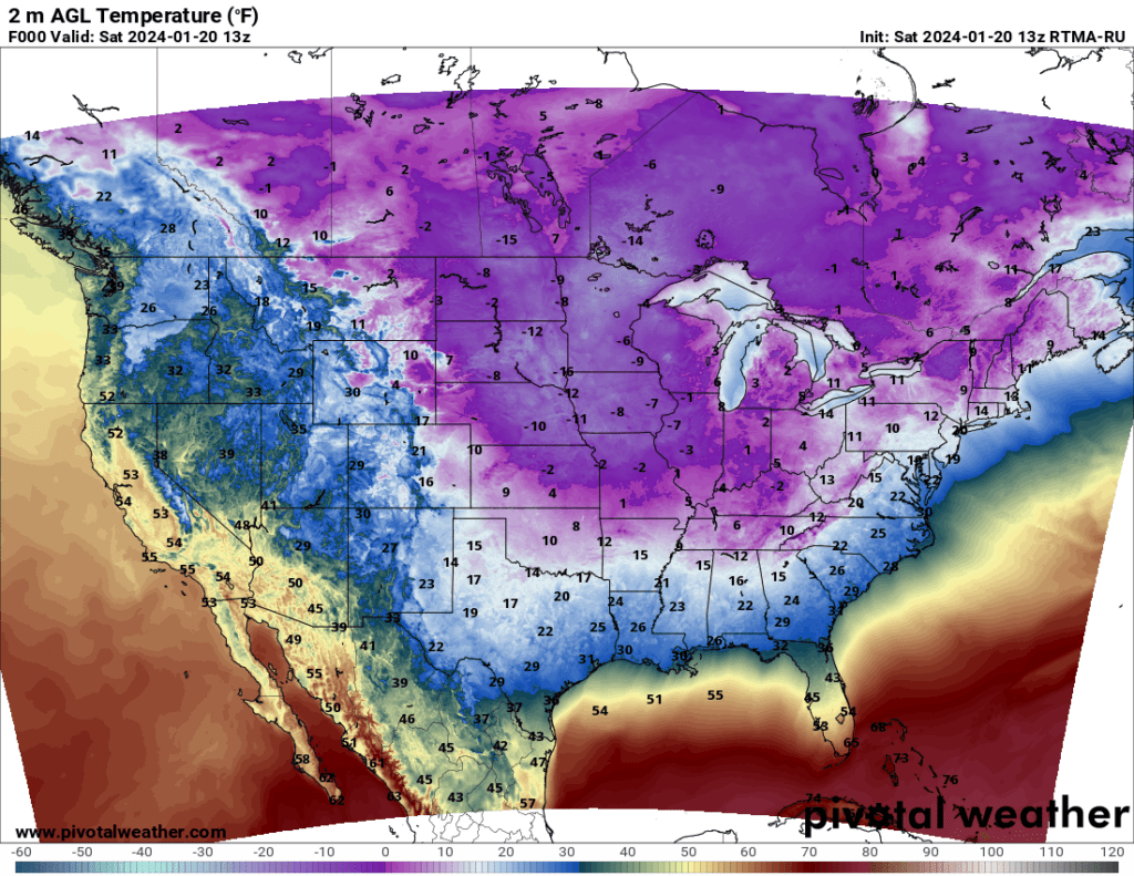
Here were the 7 AM temperatures. We are waking up to bitterly cold air. Wind chill values are even colder.
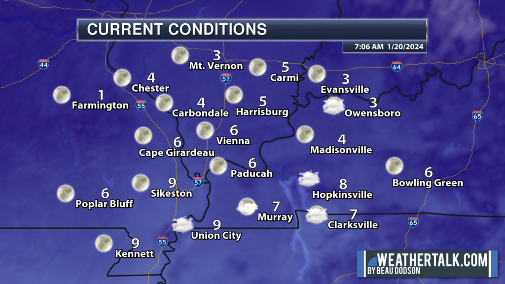
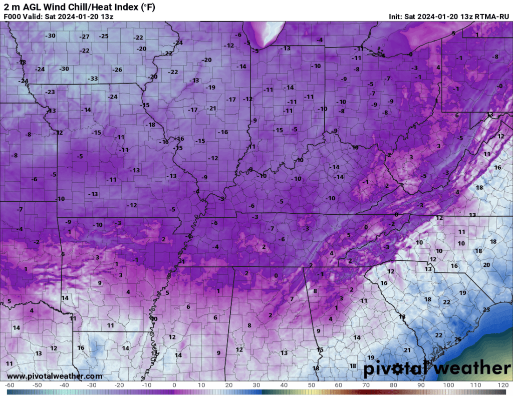
7 AM wind chill values.
7 AM Saturday National temperatures. Cold cold cold. All the way into Florida.
MORE COLD AIR TO COME
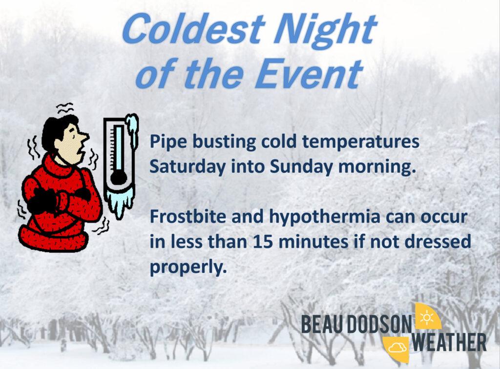
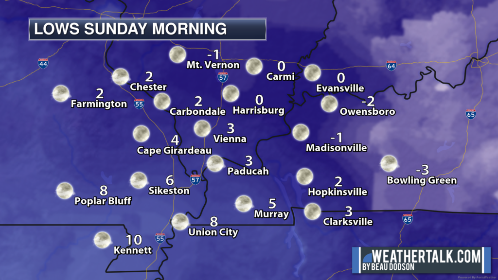
The coldest night of this long string of winter events will likely be tonight (Saturday night/Sunday morning).
I am forecasting tonight’s low temperatures to range from -1 to 10 above. Locally colder in cold favored spots. I would not be surprised to see some -5 readings.
Those are the real temperatures. The wind chill (feels like) values will be even colder, although winds will be light (thankfully).
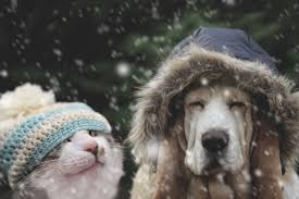
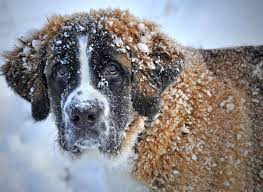
This is going to be harsh on outdoor animals/livestock and pets.
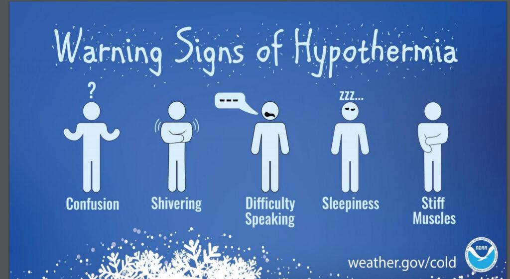
Frost bite is a real concern for first responders and anyone caught outside.
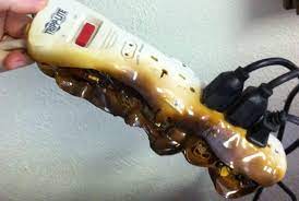
There will continue to be a high risk of house fires.
Avoid using extension cords with space heaters. This can lead to house fires. Use care with kerosine heaters.
You will want to let your water run to protect the pipes.
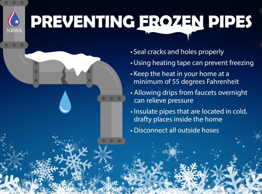
Everything we have been doing over the past two weeks, we will need to continue to do into Sunday.
There have been numerous injuries from car accidents over the last two weeks. Many people have reported frozen and busted pipes. Some cities and businesses are reporting frozen and busted mains.
Numerous house fires have occurred, as well.
Hospitals have reported an increased number of injuries from people falling on the ice and frost bite.
This has been an expensive weather event.
I do have some good news for you. The arctic cold air is about to exit the region. That will begin Sunday night and continue into the new work week.
Yes, let’s cheer that news! We have earned it.

Our last cold night will be Sunday night. Widespread upper teens to middle twenties will be the general rule.
Milder air then pushes into the region from the south southwest.
With the milder air will come increasing rain chances. That rain may begin as a wintry mix Monday morning over southeast Missouri and southwest Illinois. A few sleet pellets elsewhere. Any wintry mix will quickly change to plain old rain Monday afternoon and night.
Rain chances will continue on and off all week. A rather unusual string of damp days. It has been a while since I placed this many rain symbols on the graphic.
Yes, that marks the official beginning of mud season.
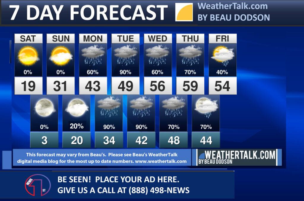
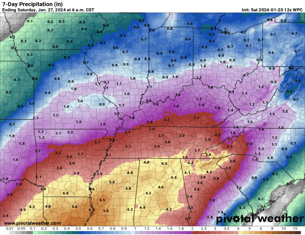
Seven-day rain totals of 1″ to 1.5″ will be common. I can’t rule out locally higher totals. This will be strung out over several days.
Widespread flash flooding appears unlikely. The frozen ground, however, could lead to standing water. Low land flooding, as well.
Rain totals have trended down a bit. Here is the seven-day WPC/NOAA forecast for rain totals.
I am watching the second week of February for potential cold shots. Long way off. See the www.weathertalk.com long range video on your Beau Dodson Weather app.
I doubt we are finished with winter. It is only mid-January.
We still have about eight weeks of potential winter to go. Once we push into the middle of March our snow chances decrease.
Yes, it can still snow in mid to late March and even early April. We are, however, on the downside by then with daily average temperatures increasing. Spring can’t be too far off.
Want to receive more weather information? I provide a service through www.weathertalk.com
Subscribe at www.weathertalk.com and then download the Beau Dodson Weather app from the app stores!
Apple users: Beau Dodson Weather App
https://wtalk.co/9EZYG8A8
Android users: Beau Dodson Weather App
https://wtalk.co/ZEWYU8ME
Need help? Email me at beaudodson@usawx.com
* Daily weather forecasts
* My personal weather blog with all sorts of weather information!
* Special weather statements sent to the Beau Dodson Weather app.
* Rapid fire tornado alerts.
* Severe weather alerts and forecasts.
* Severe weather updates throughout the day (when severe weather is occurring)
* Ice storm alerts and forecasts.
* Winter storm alerts and forecasts.
* Winter storm updates throughout the event.
* Regional weather videos.
* Long range weather videos.
* A daily forecast that I hand type for your county. Sent out every afternoon.
* Long range outlooks. Including week one, two, three, four, and monthly outlooks. Seasonal outlooks.
* App messages to alert you when I have updated the weather blogs and Facebook.
* And more!
Here are some examples of what people receive when they subscribe to www.weathertalk.com