
Posted by Meteorologist Beau Dodson
Want to receive an app notification when I post a new Facebook thread, update the weather blog, post rapid-fire tornado alerts, severe weather alerts, ice storm alerts, winter storm alerts, the daily forecast, and more?
Subscribe to www.weathertalk.com
Then, download the Beau Dodson Weather app
Apple users: Beau Dodson Weather App
https://wtalk.co/9EZYG8A8
Android users: Beau Dodson Weather App
https://wtalk.co/ZEWYU8ME
Well, as our winter weather exits it is being replaced by springish weather. Wet wet wet.
Widespread rain has already fallen across the region over the past 24 hours. We have several days of rain to go. Between now and Saturday night, a widespread one to two inches of rain will have fallen. Locally two to three inches.
Scattered thunderstorms tomorrow and Thursday will enhance rain totals.
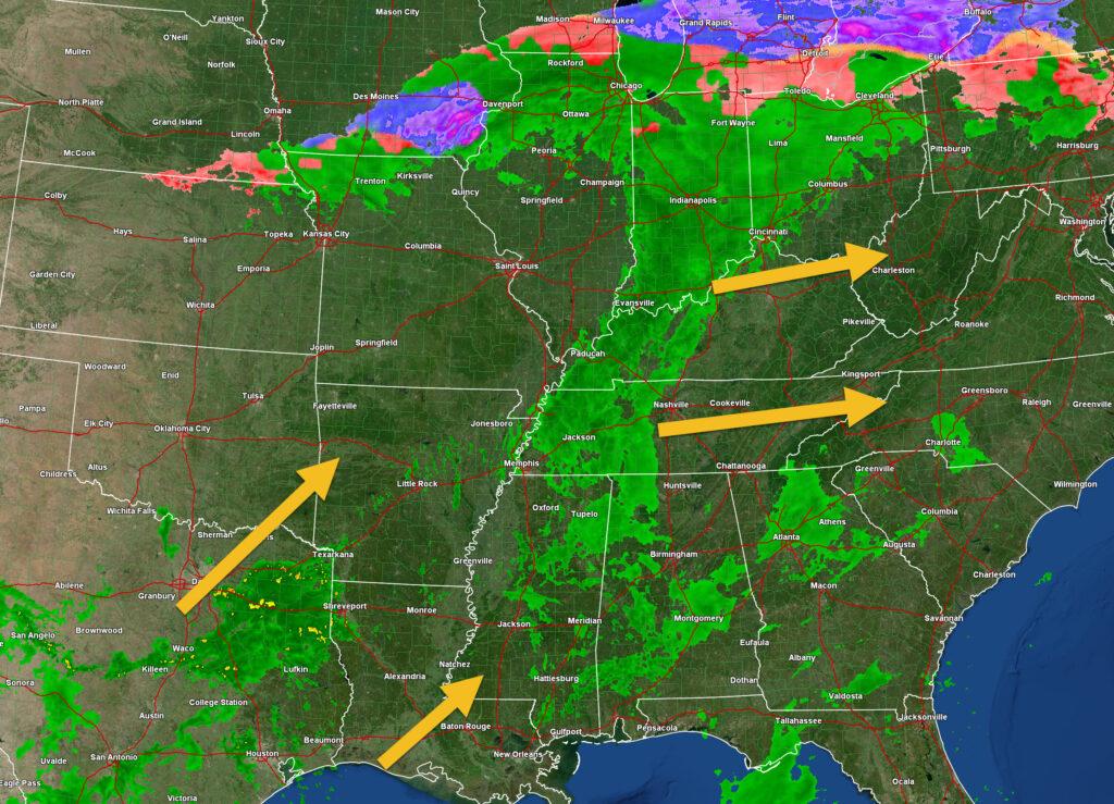
This morning’s radar shows widespread rain in our region. This will exit off to the east northeast over the coming hours.
Look to the southwest. That is the next system. It will spread rain back into the region tonight and tomorrow.
This is what radar looked like at 7 AM.
Rain totals through Saturday night. As you can see, we are forecasting quite a bit of rain. The good news is that it won’t be snow or ice. Temperatures will remain above average into Saturday.
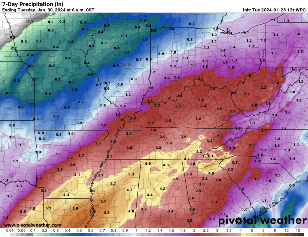
Some ponding of water is likely over the coming days.
The ground is frozen. Low-land flooding will be a concern. Some streams may rise to baneful. There is a low-level risk of flash flooding. Especially where thunderstorms occur.
No snow or ice in the forecast.
Beau Dodson Weather Radars and Lightning Data
Interactive local city-view radars. Clickable watches and warnings. Winterize button.
https://beaudodsonweather.com/weather-radars/
Backup radar site in case the above one is not working.
https://weathertalk.com/morani
Regional Radar
https://imagery.weathertalk.com/prx/RadarLoop.mp4
*NEW* Zoom interactive radar (with storm chaser streams)
https://wtalk.co/AVWG7GM7
Real time lightning tracker system two.
https://map.blitzortung.org/#5.02/37.95/-86.99
Lightning Data (zoom in and out of your local area)
https://wtalk.co/WJ3SN5UZ