Posted by Meteorologist Beau Dodson
Well, it rained! A bit of an overachiever for portions of the region.
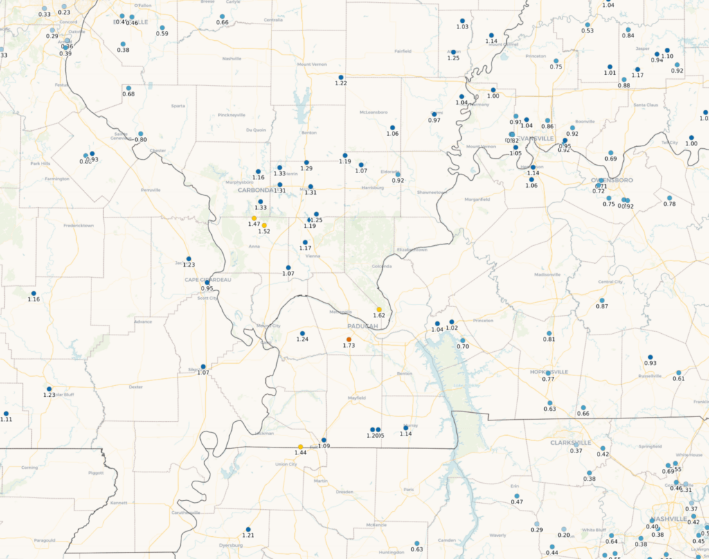
Rain totals across portions of southeast Missouri and southern Illinois were higher than expected. Many counties saw more than an inch of rain.
We are still in drought. We needed the rain. We have entered mud season. The January thaw, as some would call it.
A few showers/mist will linger into this afternoon. Clouds will linger. Chilly temperatures. A bit of a dreary Sunday.
A weak cold front will push through the region Tuesday. I can’t rule out a brief shower with the front. Nothing to write home about.
Otherwise, this week will be polar opposite of last week. Dry through Friday evening.
A backdoor cold front will push into the region Friday night and Saturday. I will monitor it closely. The cold front could bring light showers with it. Cooler temperatures behind it.
A backdoor cold front is one that approaches from the east northeast and moves west southwest.
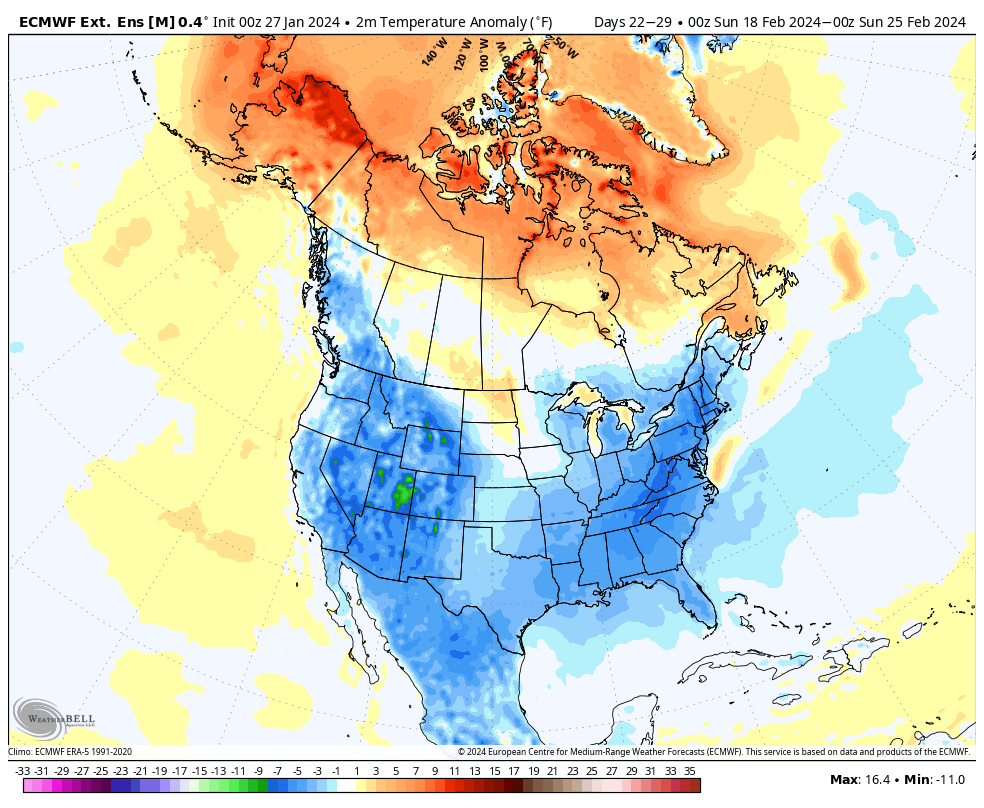
I continue to monitor colder temperatures as we move into mid to late February.
The EC model shows that. Blue is colder air. This is mid-month. Whether that ends up being arctic air is questionable. Colder? Yes. How cold? That is the question.
Whether a storm system interacts with that cold air is also a question. Stay tuned!