

Posted by Meteorologist Beau Dodson
It has been a busy three weeks of weather. Arctic outbreaks of cold air, snow, ice, heavy rain, flooding, and even some thunderstorms!
Today will deliver calm weather. No weather concerns.
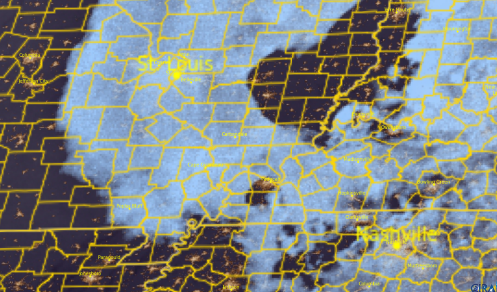
There will be a wide range of temperatures. Temperatures will depend on cloud cover. Areas with more clouds will stay colder. Highs in the forties. Areas with more sunshine will experience temperatures in the middle fifties!
You can see the clouds on this satellite view. Taken at 7 am.
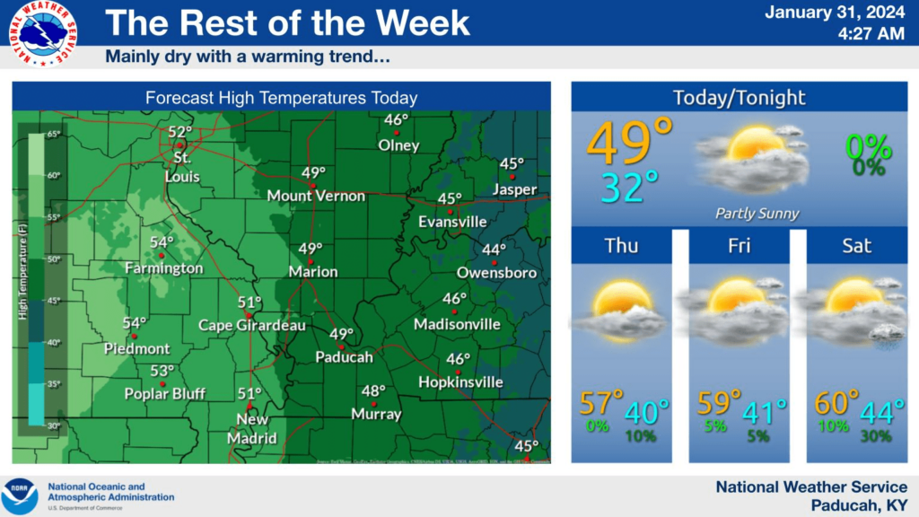
A fast-moving weak cold front will push through the region Thursday afternoon and night. This will bring increasing clouds and spotty light showers. I capped rain chances at 10% to 20%.
Calm weather Friday and Saturday. Mild temperatures. Some counties will hit sixty degrees!
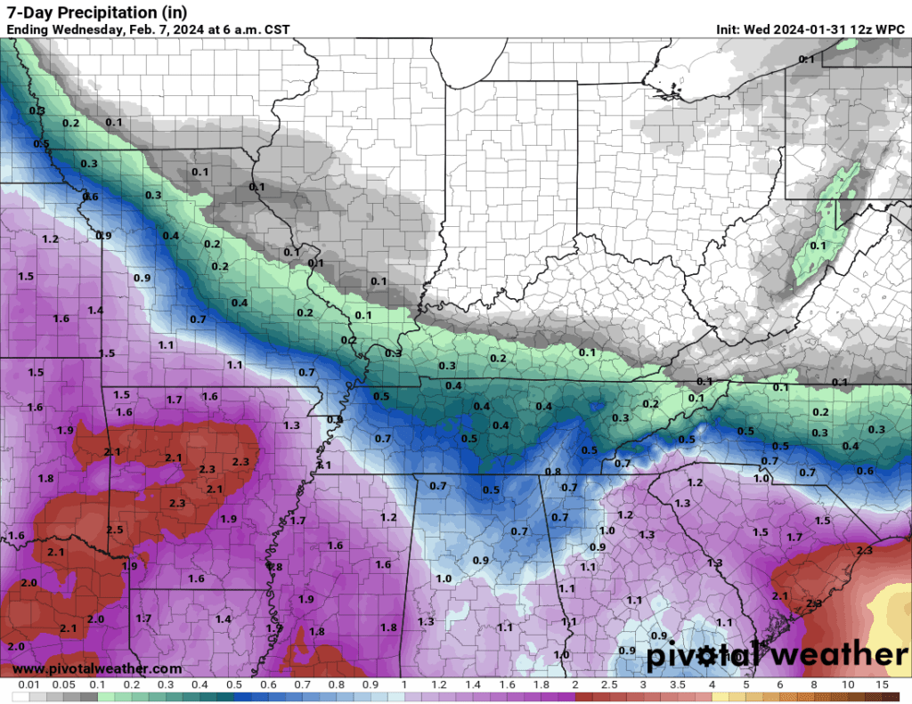
A strong southern system will brush our area Saturday night into Sunday night. This will bring increasing rain chances. Higher chances south vs north.
Rain totals will vary. If the system is slightly farther north than expected, then rain totals will increase. For now, this is the going forecast for rain totals.
I am watching mid to late February for colder air and perhaps some wintry precipitation.


