
Posted by Meteorologist Beau Dodson
PADUCAH, KENTUCKY (NewsFirst) — The Paducah, Kentucky, NWS has upgraded their local radars.
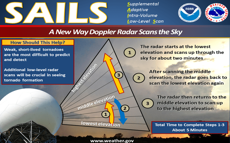
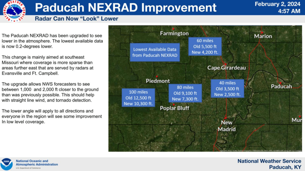
The NEXRAD doppler radar used by the National Weather Service examines storms in “slices.” After a slice the radar tilts upward slightly to take a new slice of data, and that process continues until much of the atmosphere is sampled. The Paducah NEXRAD has been upgraded to start scanning very slightly lower than it has previously.
This will give us better low-level coverage across the entire area, but it is expected to be most noticeable in southeast Missouri where there is less overall radar coverage compared to eastern parts of the Quad-State region which are served by radars at Evansville at Ft. Campbell.
This upgrade should improve our ability to detect tornadoes and damaging thunderstorm winds closer to the ground. The heights given are the approximate location where the center of the radar beam will be above each location.

The radar sites and original concept are almost 30 years old now, but constant hardware and software improvements like this one mean we have a remarkably different system than what was introduced in 1995.
By design, Doppler radar systems can provide information regarding the movement of targets as well as their position. When the NEXRAD (Next Generation Radar) WSR-88D (Weather Surveillance Radar, 1988, Doppler) transmits pulses of radio waves, the system keeps track of the phase (shape, position, and form) of those pulses.
By measuring the shift (or change) in phase between a transmitted pulse and a received echo, the target’s movement directly toward or away from the radar is calculated. This provides a velocity along the direction the radar is pointing, called radial velocity. A positive phase shift implies motion toward the radar and a negative shift indicates motion away from the radar.
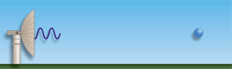
Doppler radar sends the energy in pulses and listens for any returned signal.
The phase shift effect is similar to the “Doppler Shift” (or the “Doppler Effect”) observed with sound waves. With the Doppler Shift, the sound pitch of an object moving toward your location is higher due to compression (a change in the phase) of sound waves. As an object moves away from your location, sound waves are stretched resulting in a lower frequency. An animation illustrating how the Doppler effect causes a car engine or siren to sound higher in pitch when it is approaching than when it is receding. The red circles represent sound waves. Another example of this would be an emergency vehicle or train. As the vehicle or train passes your location, the siren or whistle’s pitch lowers as the object passes by.
Doppler radar pulses have an average transmitted power of about 700,000 watts. By comparison, a typical home microwave oven will generate about 1,000 watts of energy. Yet, each pulse only lasts about 0.00000157 seconds (1.57×10⁻⁶), with a 0.00099843 second (998.43×10⁻⁶) “listening period” in between. Therefore, the total time the radar is actually transmitting a signal (when the duration of transmission of all pulses, each hour, are added together), is for a little over 7 seconds each hour. The remaining 59 minutes and 53 seconds are spent listening for any returned signals. The number of WSR-88D’s in the nation, to include Guam and Puerto Rico, is 155. The WSR-88D can detect most precipitation within approximately 80 miles of the radar, and intense precipitation can be picked up within around 140 miles. Sometimes echoes from intense precipitation or very tall cloud heights in the distance can begin showing up “weakly” as far away as around 200 miles.
Improvements over the years has sped up the radar. Meteorologists can receive the most up to date information faster.


