

Posted by Meteorologist Beau Dodson
Good day, everyone.
Monitor weather updates in case there are adjustments in Friday’s rain and snow/sleet forecast.
Another nice day on tap for the region with highs in the 50s! Some locations could hit the 60-degree mark. Got to love this weather. Certainly not winter like.
February has been very warm.
Just how warm has it been? Where you see the number one is where it has been the warmest February, thus far, since 1893. Mild mild mild.
A strong cold front will push into the region Friday and Friday night. The front will be accompanied by rain and falling temperatures. Gusty winds, as well.
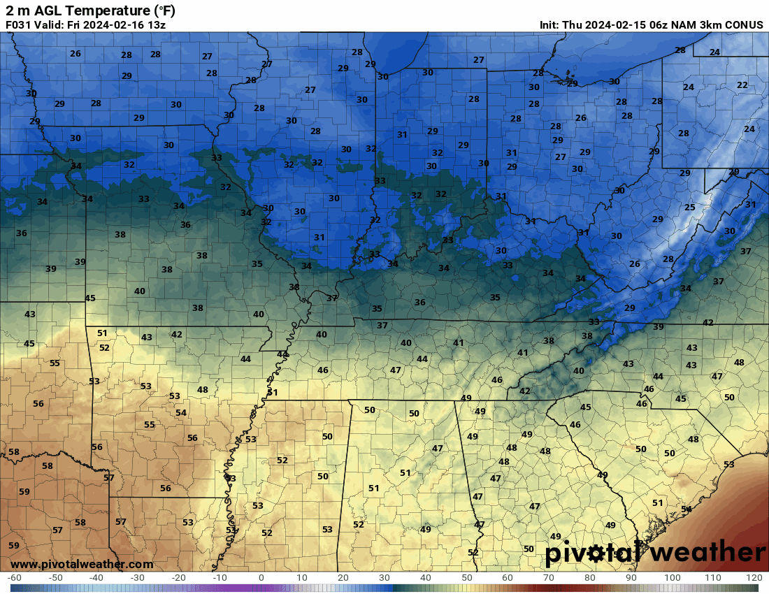
You can see those temperatures falling on this animation. This is in Zulu time. 12z=6 am. 18z=12 PM. 00z=6 PM.
Precipitation will break out tonight well to our north. That precipitation will push into our region tomorrow morning into tomorrow evening.
At first, it will be rain. As temperatures fall, however, the rain will change to snow and sleet. Mainly from late morning into the afternoon and evening hours.
Some light accumulation of snow and sleet will be possible over at least the northern half of the region. That becomes more questionable as you move farther south.
Here is the NAM model future-cast radar. What radar might look like Friday. Again, the time is in Zulu. This is in Zulu time. 12z=6 am. 18z=12 PM. 00z=6 PM.
Blue is snow. Pink and purple are a wintry mix. Green is rain.
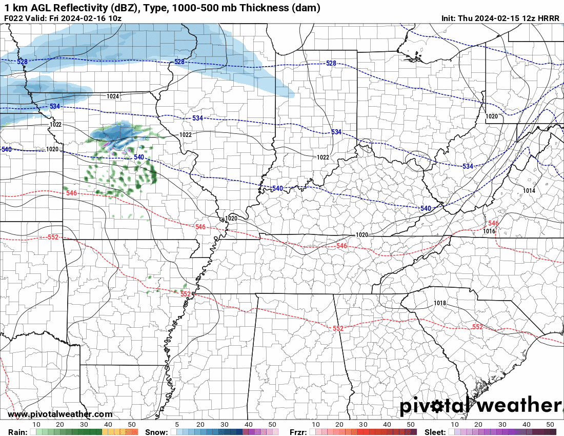
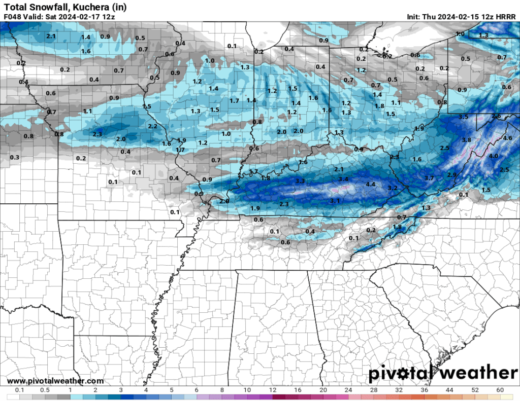
This morning’s Hrrr model came in a bit heavier farther south and east. We will need to monitor it.
Let’s look at some more graphics.
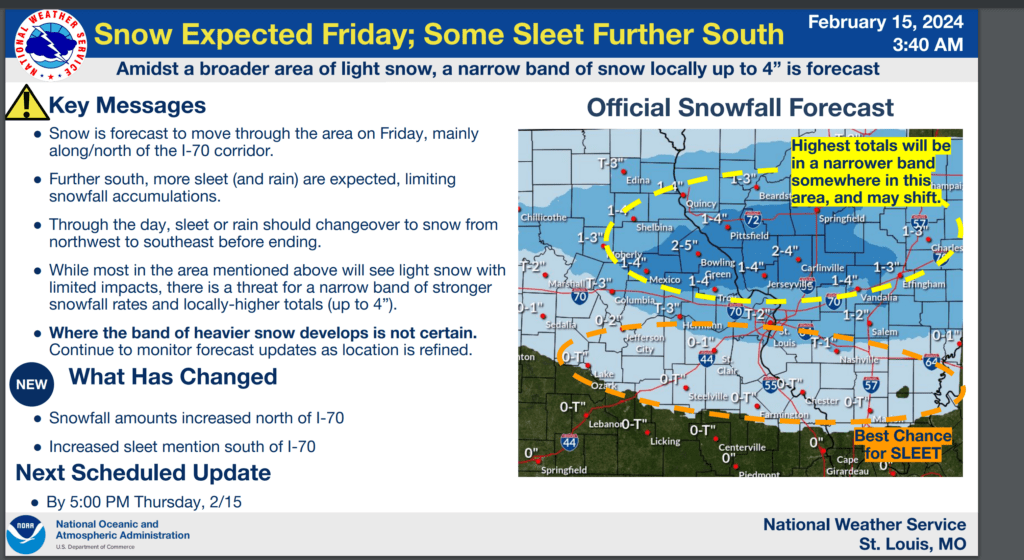
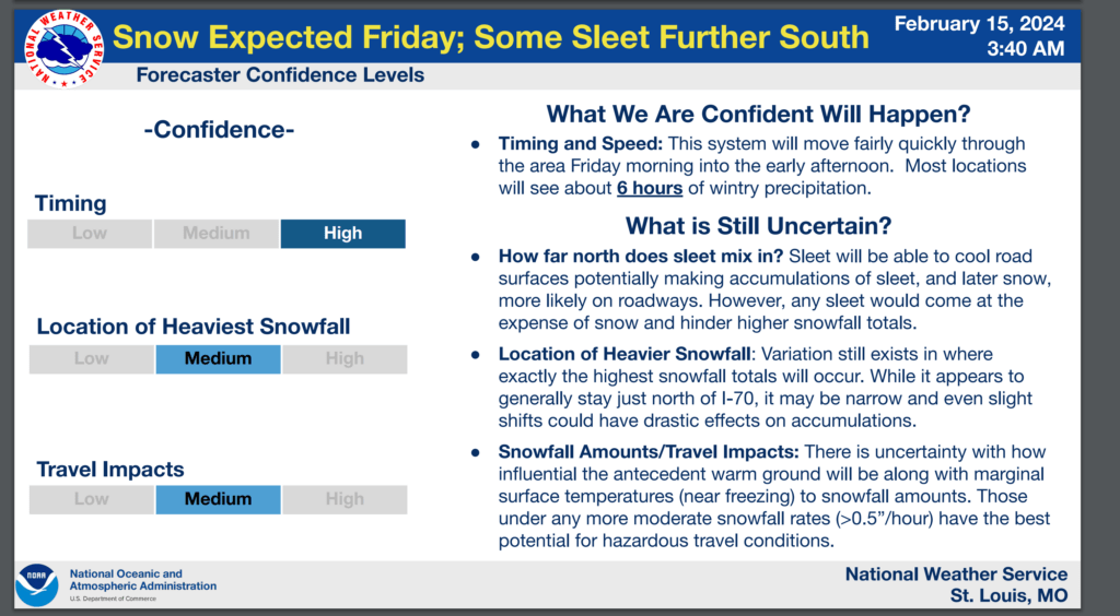
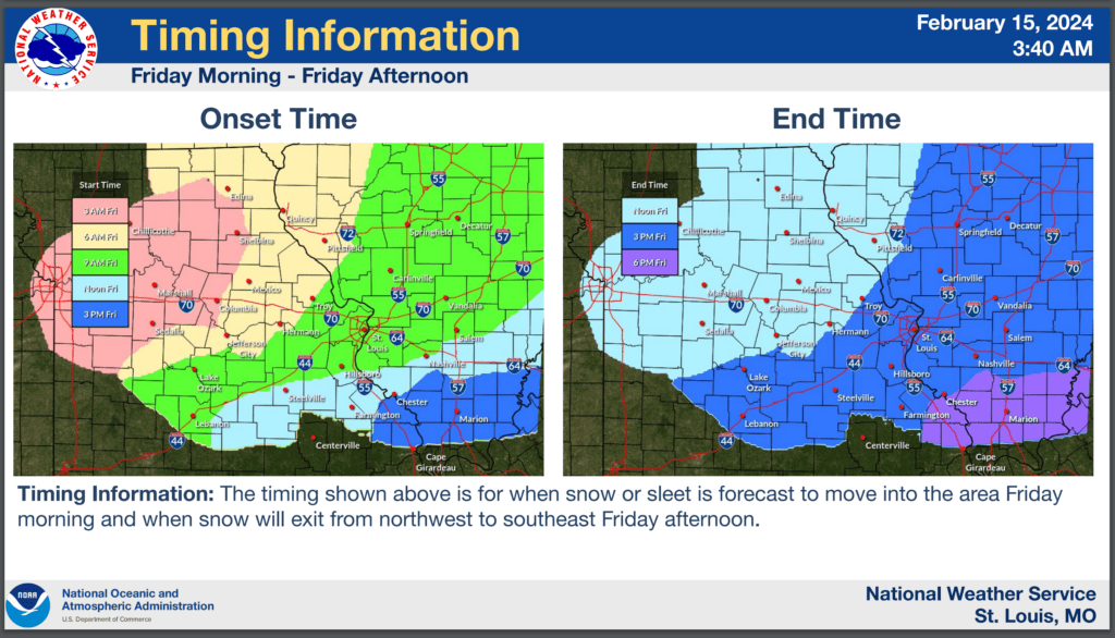
The St Louis, Missouri NWS posted these graphics.
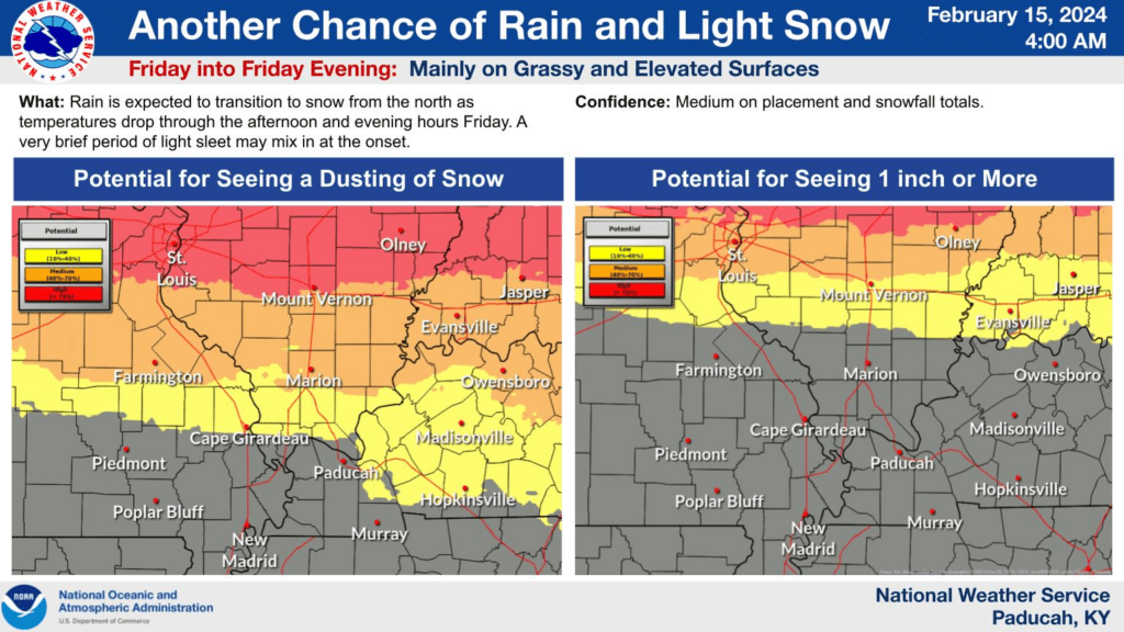
The Paducah, Kentucky NWS posted this graphic. As you can see, the chances are higher as you travel north and lower south.
The ground and roads are warm. This will cut down on accumulation. Temperatures will fall into the 20s Friday night. This is when the concern will be highest.
I can’t rule out some icy surfaces. Watch decks, sidewalks, and bridges. They tend to freeze first.
All in all, this is a light precipitation event. It only takes a little snow and sleet to cause issues. Use care Friday evening and night.
It will remain cold Saturday with highs only in the 30s. A nice warming trend next week will deliver sixties! Spring isn’t far off.


