Posted by Meteorologist Beau Dodson
Want to receive more weather information? I provide a service through www.weathertalk.com
Subscribe at www.weathertalk.com and then download the Beau Dodson Weather app from the app stores!
Check out our live exclusive weather radars.
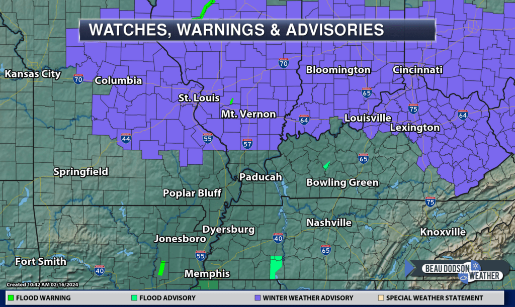
The Paducah, Kentucky, NWS radar is down for repairs. Some of the radars may not work. Use other radars or the regional radars. The NWS Paducah radar will be down another week. Perhaps a little longer.
Interactive local city-view radars. Clickable watches and warnings.
https://beaudodsonweather.com/weather-radars/
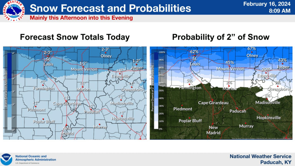
The NWS has issued a winter weather advisory for snow and sleet this afternoon and tonight. Patchy icy road conditions are possible.
Snow and sleet totals will be light (for the most part). A dusting to an inch or two. The higher amounts would run along a line from St Louis towards Mt Vernon and then east from there. Along that line and north of that line.
IF thunderstorms (with snow) develop, then enhanced snowfall totals of three to six inches will be possible. That would be more likely over our far northern counties (Mt Vernon area).
The rest of the area will experience showers and thunderstorms today and this evening. The rain may change to snow and sleet this evening, but accumulations would be little or none.
Watch for black ice as temperatures fall into the twenties tonight.