Posted by Meteorologist Beau Dodson
Information provided by the Paducah, Kentucky, NWS
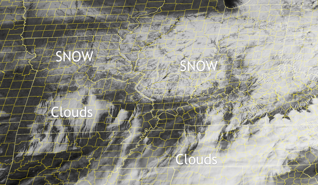
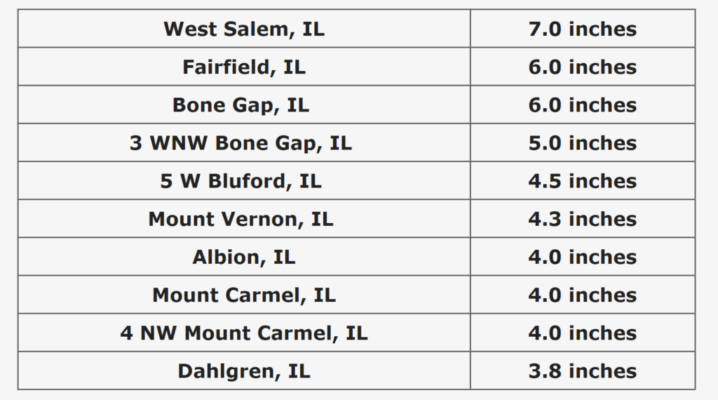
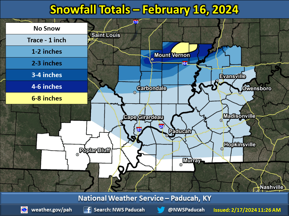
A quick-moving, dynamic clipper system brought bands of heavy snow to parts of southern Illinois and southwest Indiana during the afternoon and evening hours of Friday, February 16, 2024. With snowfall rates of one to two inches per hour and frequent lightning, the snow quickly accumulated on roads, bridges, and sidewalks, creating major travel impacts along and north of Interstate 64. Snowfall totals of three to seven inches were reported in Perry, Jefferson, Wayne, Edwards, Wabash, and Hamilton Counties in southern Illinois. In southwest Indiana, one to three inches of snow fell across Gibson and Pike Counties, while a trace up to one inch of snow fell across Posey, Vanderburgh, Warrick, and Spencer Counties.
The heaviest snow occurred along and north of Interstate 64 in Jefferson, Wayne, Edwards, and Wabash Counties in southern Illinois. These areas received three to seven inches of snow in just a few hours due to heavy snowfall rates of one to two inches per hour. Several instances of thundersnow were reported as the heaviest snow fell!
You can see the snow on satellite.