Posted by Meteorologist Beau Dodson
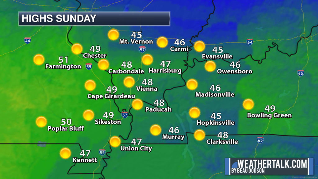
A decent day on tap for the region. No weather concerns. Temperatures will slowly warm later this morning into the afternoon hours. Cool, but not as cold as yesterday.
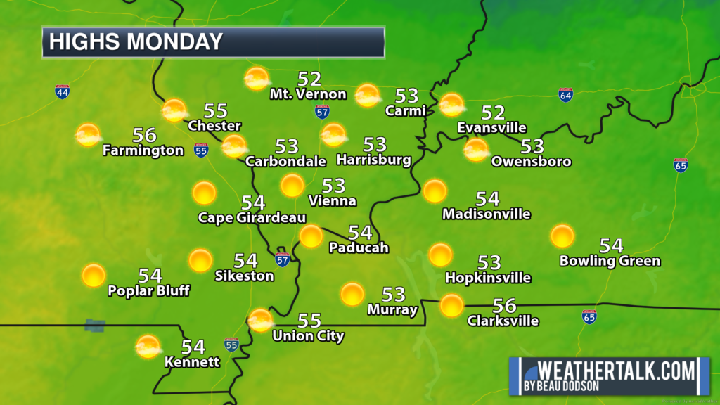
A strong warming trend tomorrow into the middle of the week!
Our next cold front will sweep through the region Thursday and Thursday night. You can expect scattered showers late Wednesday night and increasing shower and thunderstorm chances Thursday.
At this time, severe weather is not anticipated. That is the good news.
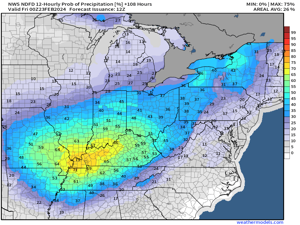
You can see on this graphic, that peak rain chances will be Thursday and Thursday night.
This graphic is for 7 AM Thursday to 7 PM Thursday.
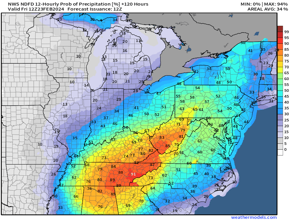
This is the rain probability map from 7 pm Thursday to 7 pm Friday.
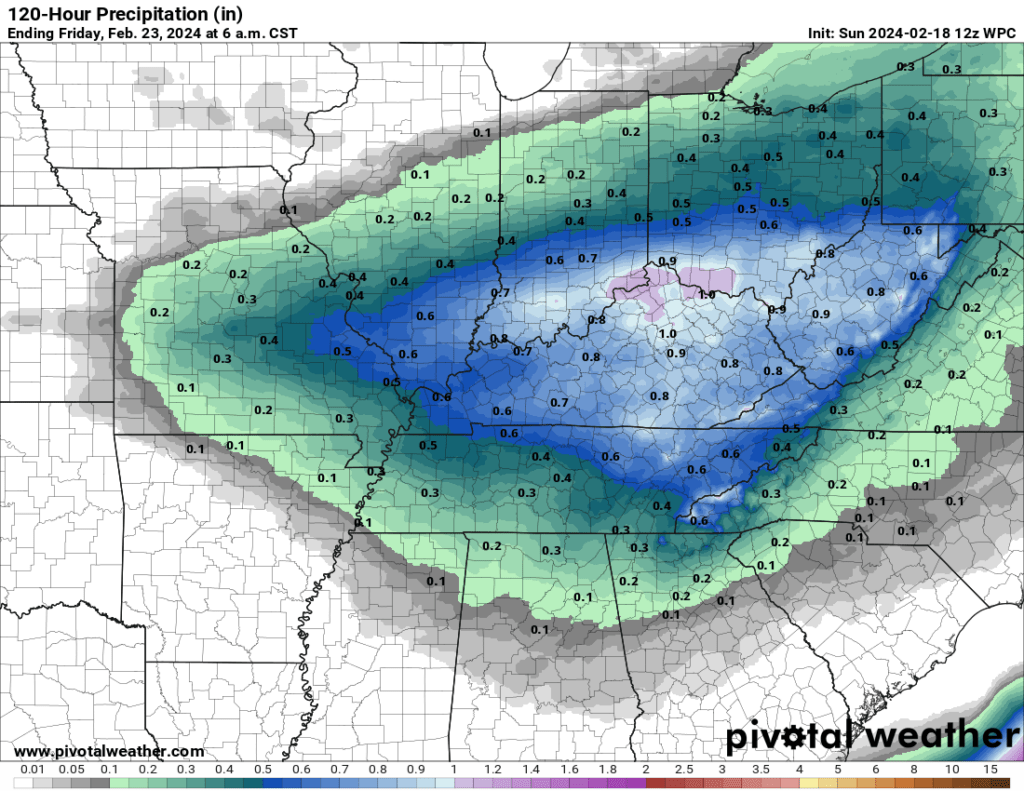
Expected rain totals