
Posted by Meteorologist Beau Dodson
Want to receive more weather information? I provide a service through www.weathertalk.com
Subscribe at www.weathertalk.com and then download the Beau Dodson Weather app from the app stores!
This is a SAMPLE of what subscribers receive on the Beau Dodson Weather Talk app.
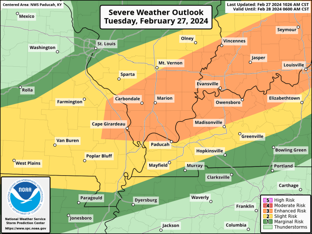
10:30 AM Severe Weather Outlook
Hatched means higher end severe possible.
Day One Severe Weather Outlook
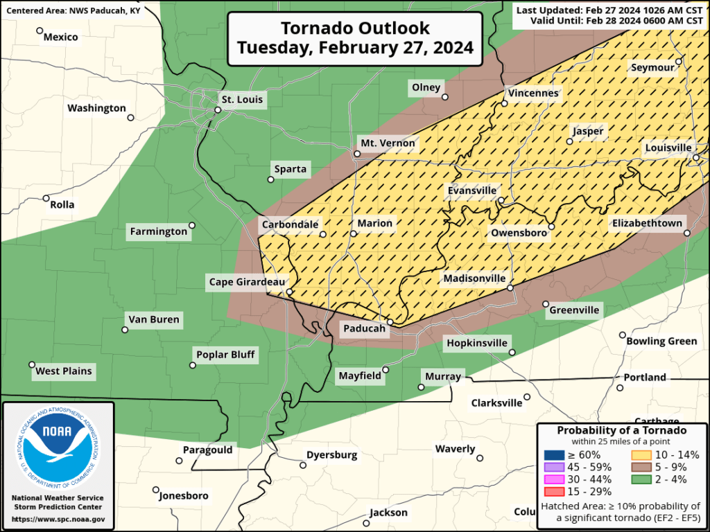
Tornado Outlook
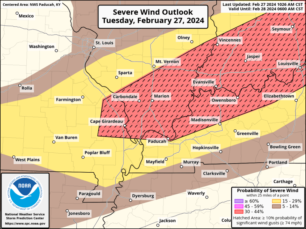
Wind Outlook
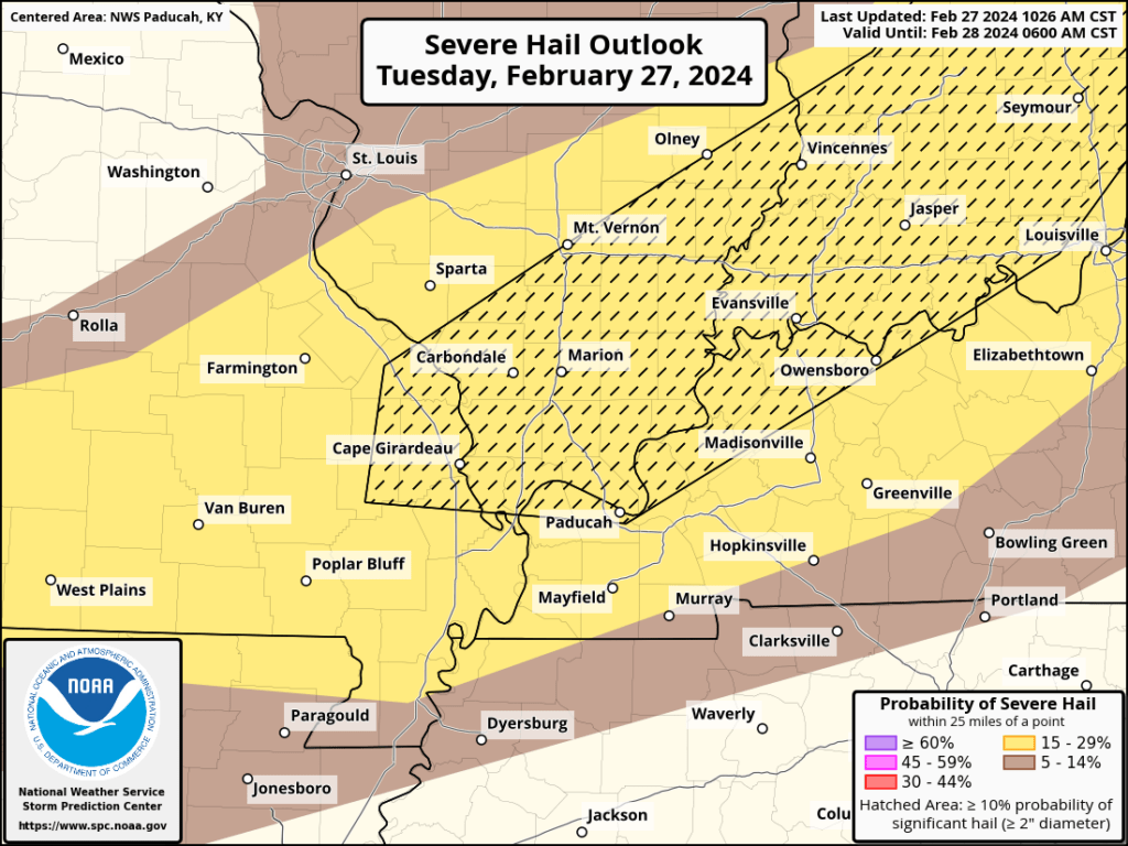
Hail Outlook
Outlook discussion. Link Storm Prediction Center Feb 27, 2024 1630 UTC Day 1 Convective Outlook (noaa.gov)
We have a threat of severe thunderstorms tonight and tomorrow morning.
WHEN: The primary timeframe of concern will be 5 pm tonight through 6 am tomorrow morning.
WHAT: Some of the thunderstorms could produce 70 mph wind, large hail, lightning, brief downpours, and even an isolated tornadoes.
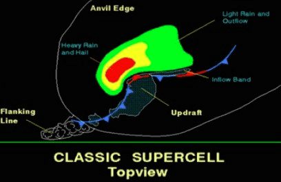
IMPACTS: If supercells form, then hail could cause damage to cars and property. High wind gusts could bring down some tree limbs and power lines. Lightning will be a concern for anyone outdoors. I can’t rule out a short-lived tornado. Monitor updates.
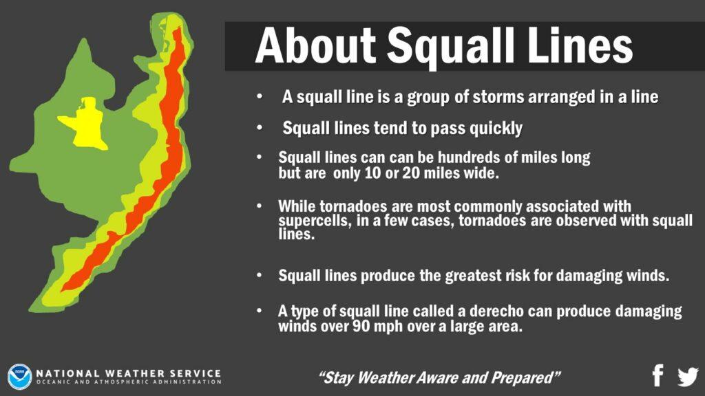
If a squall line forms, then you can expect a few reports of gusty wind, small to medium size hail, lightning, and brief downpours. A low risk of a short-lived tornado.
ADDITIONAL DETAILS: A cold front is pushing towards the region. Temperatures ahead of the front will be in the 70s. Temperatures behind the front will drop into the 20s. Showers and thunderstorms are likely to develop this evening and tonight. I am expecting a line of storms to form over Indiana, Illinois, and Missouri. The line will move east southeast and pass through the area.
Supercells can’t be ruled out.
UNCERTAINTIES: There will be a very strong CAP/lid on the atmosphere today. That raises questions on storm development. I do believe the cold front will have enough lift with it to break the CAP and storms will form. Whether supercell thunderstorms form is questionable. But, it can’t be ruled out. Especially over Missouri and Illinois.
What is a squall line? It is a solid line or broken line of thunderstorms.
What is a supercell thunderstorm? Supercells tend to be all by themselves. There can be scattered supercells on radar.
Here are some graphics from the Paducah, Kentucky, NWS.
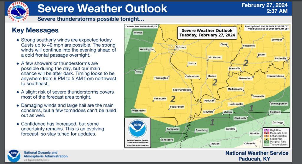
The Storm Prediction Center updated that map at 7 am. Some slight adjustments.
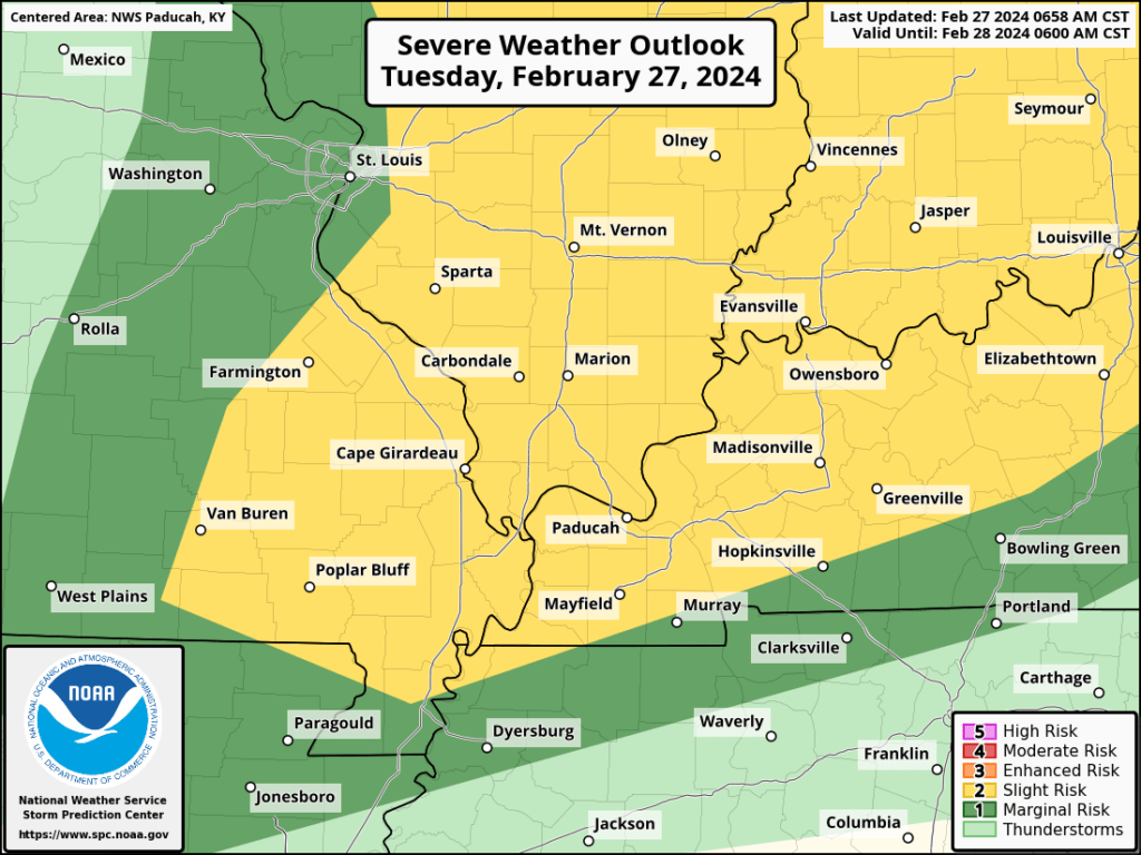
The primary time-frame of concern will be 6 PM to 6 AM. There remain questions about whether supercells will form ahead of the cold front or just a line of storms.
If supercells form, then larger hail will occur. A line of storms would primary mean gusty wind and small hail. Perhaps an isolated tornado risk.
Monitor updates.
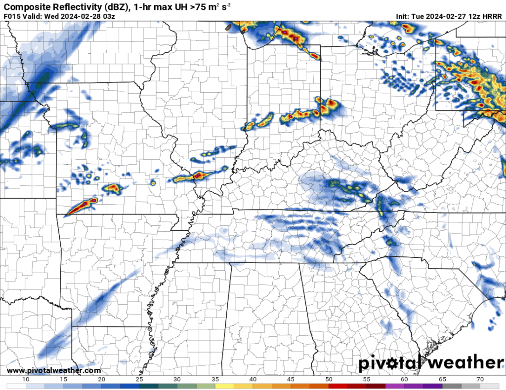
The Hrrr model shows development after 7 PM. Future-cast radar. 9 PM. This is what this model believes could happen. A few storms forming.
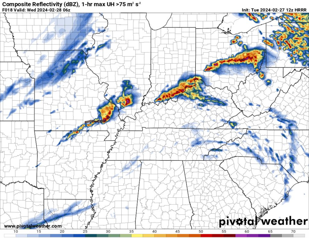
12 AM Future-cast radar. What radar MIGHT look like. Keep in mind, this is a model. Model’s aren’t perfect.
Beau Dodson Weather Radars and Lightning Data
Live Beau Dodson Radars with clickable watches and warnings.
https://beaudodsonweather.com/weather-radars/
Backup radar site in case the above one is not working.
https://weathertalk.com/morani
Regional Radar
https://imagery.weathertalk.com/prx/RadarLoop.mp4
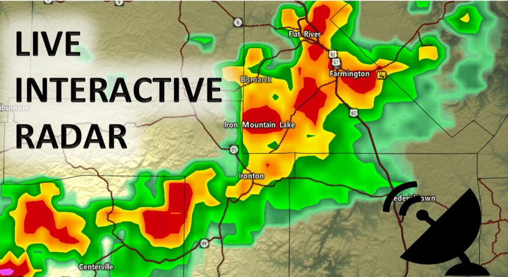
NEW Zoom interactive radar (with storm chaser streams)
https://wtalk.co/AVWG7GM7
Real time lightning tracker system two.
https://map.blitzortung.org/#5.02/37.95/-86.99
Lightning Data (zoom in and out of your local area)
https://wtalk.co/WJ3SN5UZ
Check out our new news website!
https://mylocalnewsfirst.com/
Want to receive an app notification when I post a new Facebook thread, update the weather blog, post rapid-fire tornado alerts, severe weather alerts, ice storm alerts, winter storm alerts, the daily forecast, and more?
Subscribe to www.weathertalk.com
Then, download the Beau Dodson Weather app
Apple users: Beau Dodson Weather App
https://wtalk.co/9EZYG8A8
Android users: Beau Dodson Weather App
https://wtalk.co/ZEWYU8ME
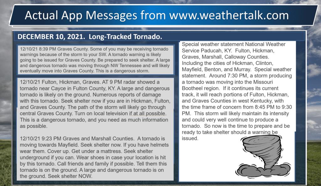
Here is a sample of what app messages you can expect during severe weather.


