Posted By Chief Meteorologist Beau Dodson
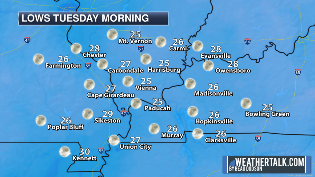
We are waking up to cold temperatures. Temperatures will fall a few more degrees before sunrise.
Widespread 20s in the region. Some 30s.
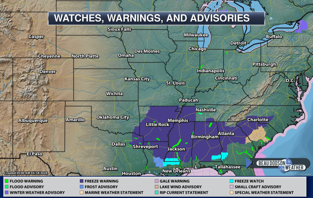
The NWS has freeze warnings almost to the Gulf of Mexico for tonight and Tuesday morning. Areas to the north aren’t officially in the growing season, yet. That is why there aren’t warnings farther north. Those areas will obviously be below freezing, as well.
Tuesday morning lows
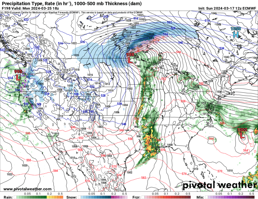
Our next good chance of rain will arrive Sunday night into Tuesdays.
The EC model brings the rain in as soon as Sunday PM. Other models hold off until Monday/Tuesday. I will need to fine tune the timing.
I can’t rule out intense storms, but it is still too early to know if severe weather will be an issue. Stay tuned.
Want to receive more weather information? I provide a service through www.weathertalk.com
Subscribe at www.weathertalk.com and then download the Beau Dodson Weather app from the app stores!
Apple users: Beau Dodson Weather App
https://wtalk.co/9EZYG8A8
Android users: Beau Dodson Weather App
https://wtalk.co/ZEWYU8ME
Need help? Email me at beaudodson@usawx.com
* Daily weather forecasts
* My personal weather blog with all sorts of weather information!
* Special weather statements sent to the Beau Dodson Weather app.
* Rapid fire tornado alerts.
* Severe weather alerts and forecasts.
* Severe weather updates throughout the day (when severe weather is occurring)
* Ice storm alerts and forecasts.
* Winter storm alerts and forecasts.
* Winter storm updates throughout the event.
* Regional weather videos.
* Long range weather videos.
* A daily forecast that I hand type for your county. Sent out every afternoon.
* Long range outlooks. Including week one, two, three, four, and monthly outlooks. Seasonal outlooks.
* App messages to alert you when I have updated the weather blogs and Facebook.
* And more!
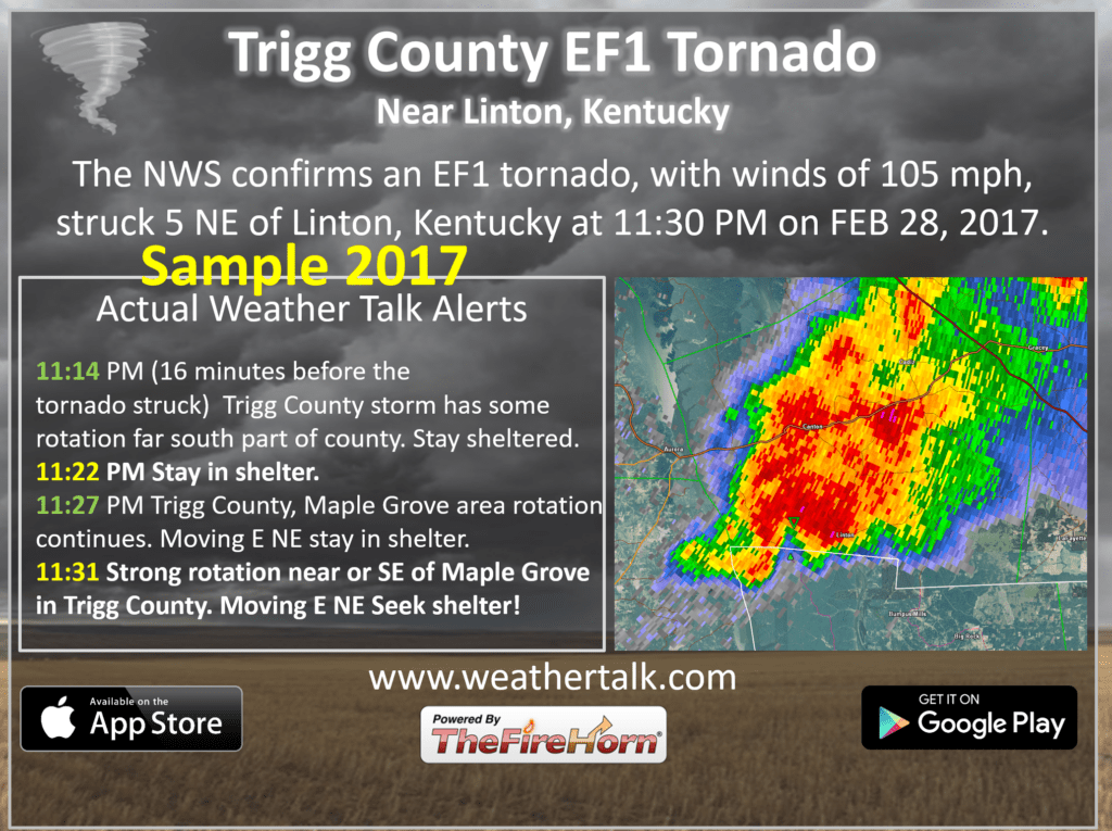
Here are some examples of what people receive when they subscribe to www.weathertalk.com