Posted by Meteorologist Beau Dodson
Want to receive more weather information? I provide a service through www.weathertalk.com
Subscribe at www.weathertalk.com and then download the Beau Dodson Weather app from the app stores!
Check out our live exclusive weather radars.
The Paducah, Kentucky, NWS radar is down for repairs. Some of the radars may not work. Use other radars or the regional radars. The NWS Paducah radar will be down another week. Perhaps a little longer.
Interactive local city-view radars. Clickable watches and warnings.
https://beaudodsonweather.com/weather-radars/
A windy spring day ahead of us!
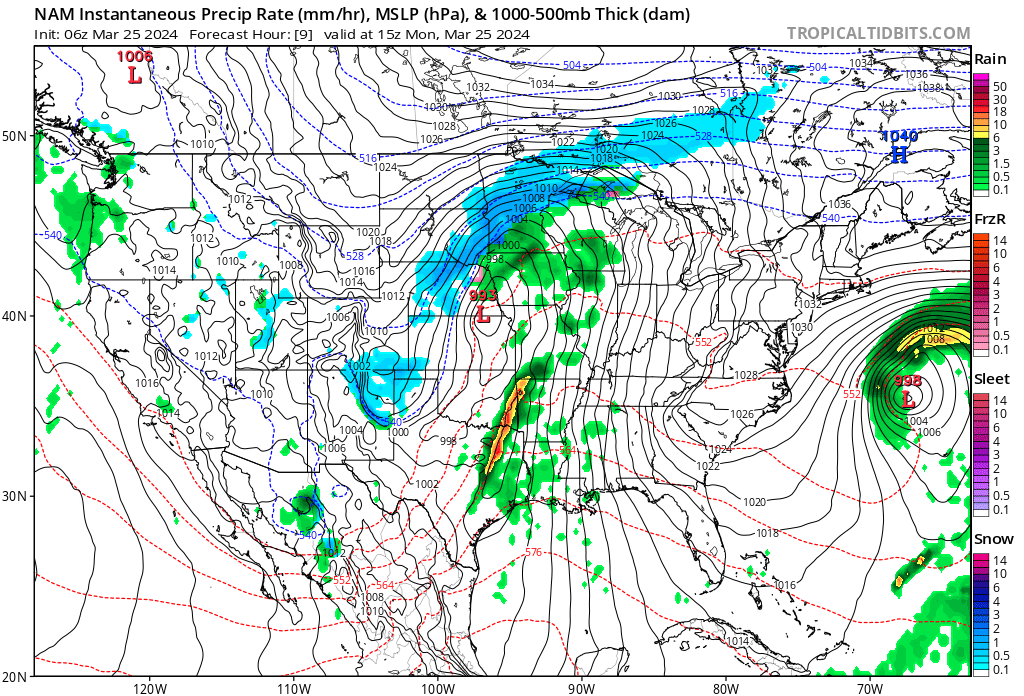
An area of low pressure will push off to our northwest today. Moving into the Great Lakes over the next 24 hours.
You can see that low on the morning weather map. The red L is the area of low pressure.
Those black wavy lines are isobars. Isobars are equal lines of barometric pressure. They are tightly packed and that means a windy day and night ahead of us.
Tightly packed isobars are a signal for strong winds.
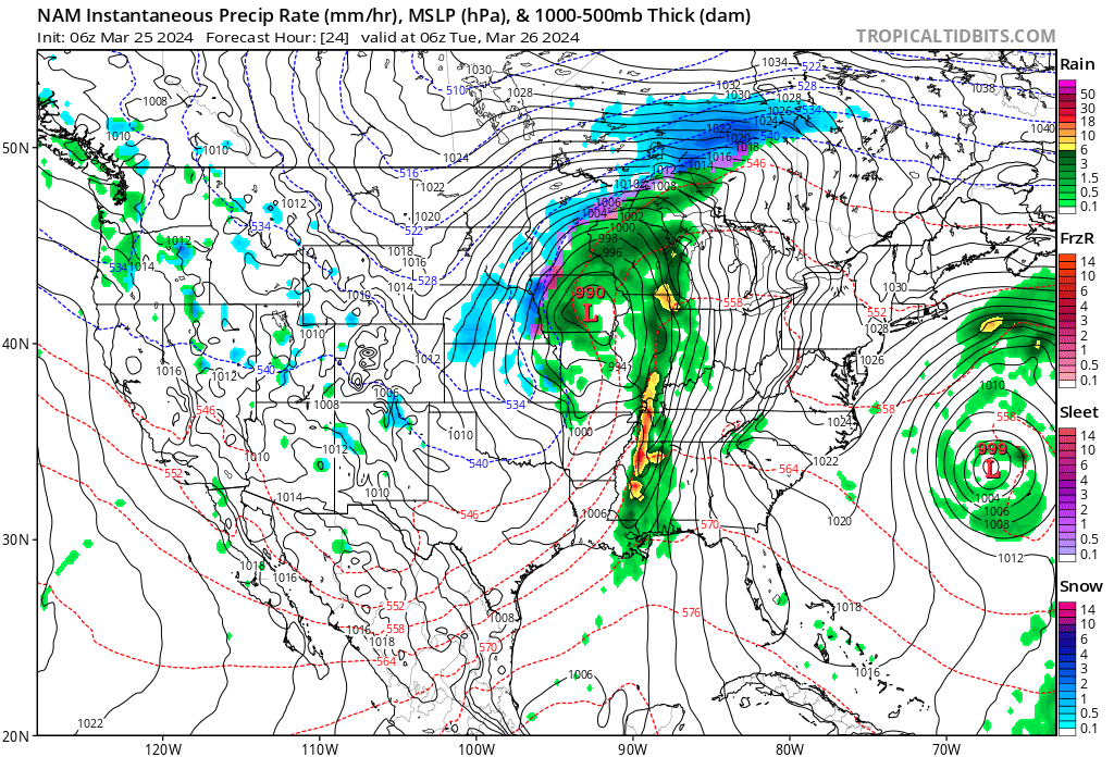
This evening’s weather map shows the line of showers and storms pushing across our region.
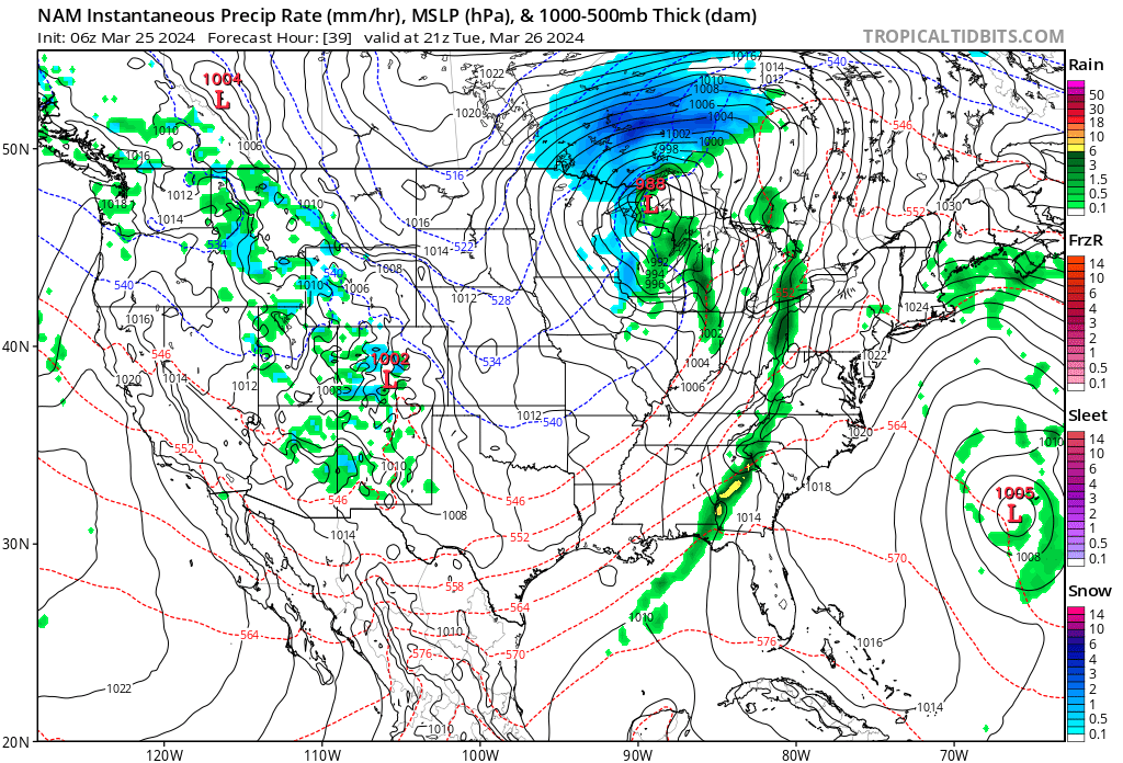
Tomorrow’s weather map.
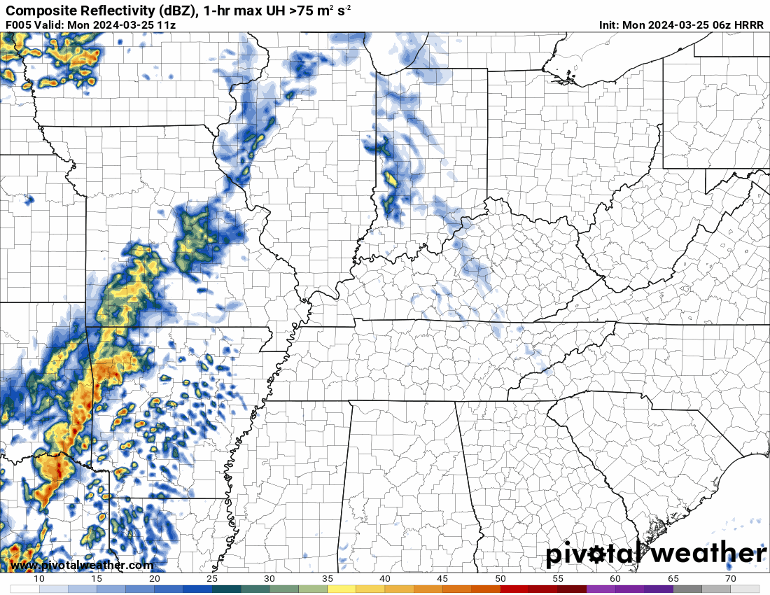
Here is the future-cast radar from the Hrrr model guidance. What radar might look like later today.
A few of the thunderstorms could produce strong and gusty wind, locally heavy rain, and lightning.
Let’s look at a few NWS graphics.
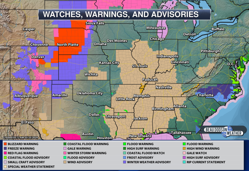
A high wind warning has been issued for portions of the Bootheel. The bright tan zone. The rest of the region is under a wind advisory.
Either way, it means windy conditions will occur today and tonight. Winds of 20 to 50 mph will be possible. Perhaps a bit higher over the Bootheel.


Speaking of advisories and warnings. Check out the large blizzard warning in the cold portion of this system.
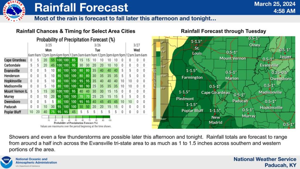
Peak rain time for a few local cities. Just find a city near you and compare. Rainfall totals on the right.
The risk of severe weather appears minimal, but not zero. I can’t rule out a few of the thunderstorms producing high winds.
Want to receive more weather information? I provide a service through www.weathertalk.com
Subscribe at www.weathertalk.com and then download the Beau Dodson Weather app from the app stores!
Apple users: Beau Dodson Weather App
https://wtalk.co/9EZYG8A8
Android users: Beau Dodson Weather App
https://wtalk.co/ZEWYU8ME
Need help? Email me at beaudodson@usawx.com
* Daily weather forecasts
* My personal weather blog with all sorts of weather information!
* Special weather statements sent to the Beau Dodson Weather app.
* Rapid fire tornado alerts.
* Severe weather alerts and forecasts.
* Severe weather updates throughout the day (when severe weather is occurring)
* Ice storm alerts and forecasts.
* Winter storm alerts and forecasts.
* Winter storm updates throughout the event.
* Regional weather videos.
* Long range weather videos.
* A daily forecast that I hand type for your county. Sent out every afternoon.
* Long range outlooks. Including week one, two, three, four, and monthly outlooks. Seasonal outlooks.
* App messages to alert you when I have updated the weather blogs and Facebook.
* And more!
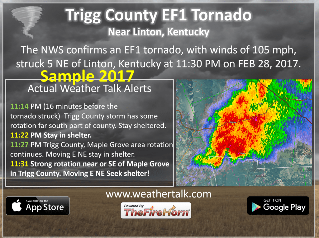
Here are some examples of what people receive when they subscribe to www.weathertalk.com