

Posted by Chief Meteorologist Beau Dodson

March 30, 2024
Updated forecast and severe weather outlook
Want to receive more weather information? I provide a service through www.weathertalk.com
Subscribe at www.weathertalk.com and then download the Beau Dodson Weather app from the app stores!
Check out our live exclusive weather radars.
Interactive local city-view radars. Clickable watches and warnings.
https://beaudodsonweather.com/weather-radars/
FORECAST UPDATE
There are a lot of moving parts to the forecast. Monitor updates and don’t walk away with one forecast idea and assume that will be the final solution.
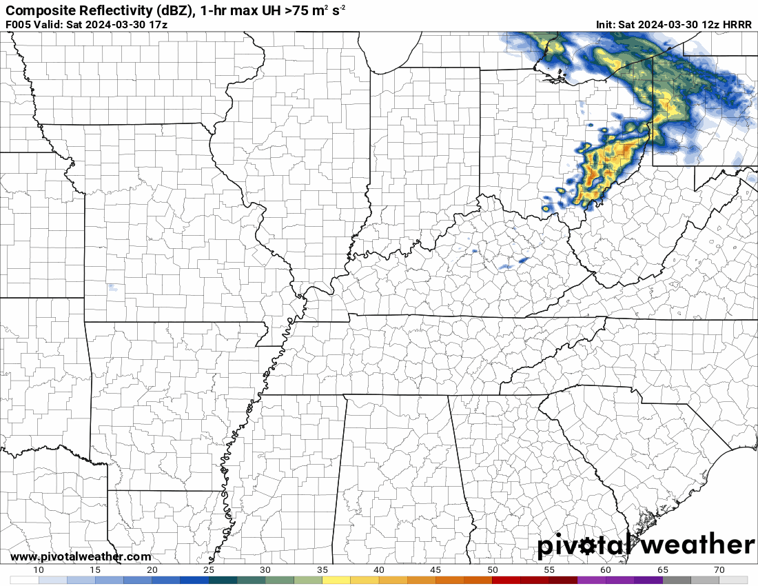
A couple of showers and thunderstorms will form later this afternoon and evening across southeast Missouri into northwest Kentucky.
This high res Hrrr model future-cast radar shows those forming after 3 PM. Then, they will move north northeast.

Animation. This is the high res Hrrr model. Future-cast radar. Zulu time. 00z=7 pm. 06z=1 am. 12z=7 am.
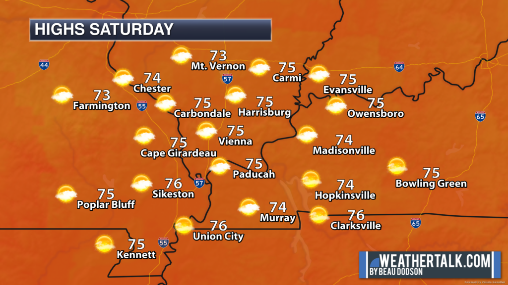
Otherwise, a beautiful day ahead of us. Warm today and tomorrow. Great Easter weather. A few showers and storms will be possible over mainly our northern counties into Monday morning. Thunderstorm chances increase area-wide late Monday into Tuesday morning.
Today
Tonight
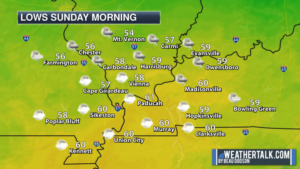
Sunday
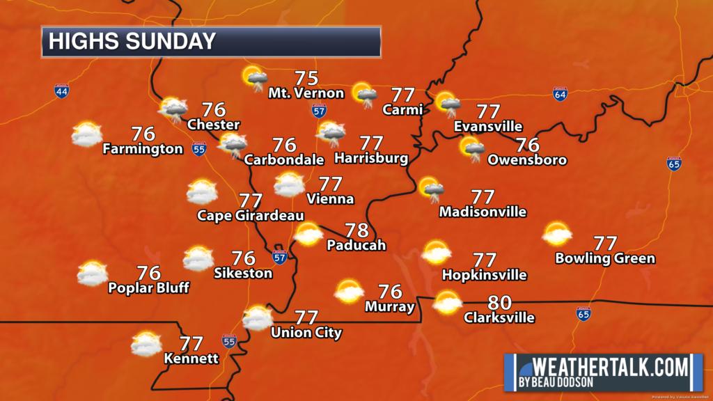
Gusty winds today into Tuesday with occasional gusts above 25 mph. Kite flying spring weather.

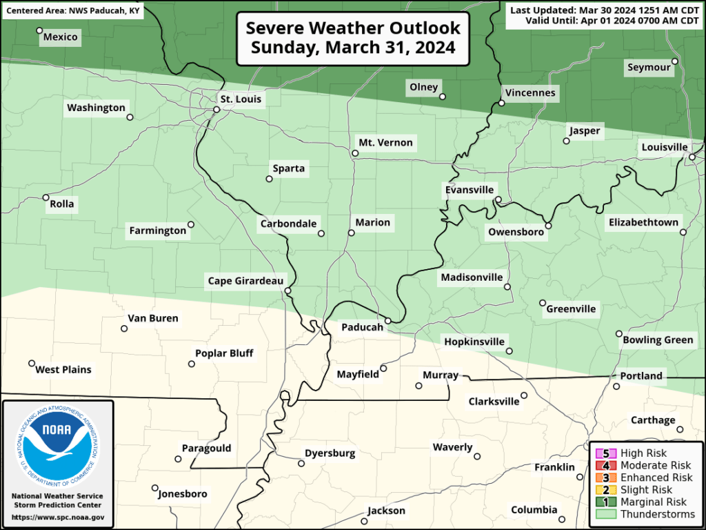
The graphics below show Sunday’s severe weather outlook (light green is sub-severe storms/lightning). Dark green is a level one risk.
The second graphic is the Monday/Monday night outlook.
The third graphic is the Tuesday severe weather outlook.
No severe weather concerns today or tonight.
At this time, no severe weather concerns Sunday or Sunday night. I will closely monitor the location of a warm front Sunday. Hailstorms are possible near and north of that front. That would be in the dark green zone.
It’s close to my northern counties, but for now is outside the aera.
Monday and Monday night/Tuesday morning continues to be the primary timeframe of concern, but questions remain on the extent of the severe weather threat.
The Storm Prediction Center has painted a higher risk to our west over western and central Missouri. Perhaps into portions of eastern Missouri. That would be the orange zone.
Then, a lower risk into our area with a level one and two risk (dark green and yellow zones). Keep in mind, it only takes one tornado to ruin the day. Whether that occurs in the orange zone, yellow zone, or dark green zone.
Historically, most of our tornadoes have occurred in a level one through three risk level. So, that shows you that the colors only go so far when forecasting the threat.
At this time, it appears the main concern will be Monday night. Damaging wind is the current concern, but if a line of storms does form, then we can’t rule out an isolated tornado risk, as well. QLCS type tornadoes. Short-lived and difficult to warn on.
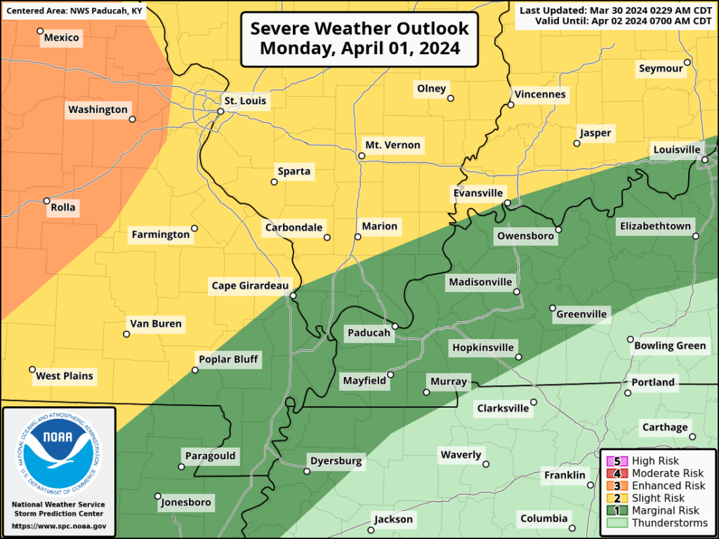
The main questions will be Monday’s cloud cover and instability. Data is mixed on just how much thunderstorm activity will develop Monday afternoon to our west.
That will influence what happens here. Currently, it appears that we will be capped most of Monday.
What does CAP mean?
Capped means a warm layer of air aloft that keeps air parcels from rising. If air parcels can’t rise, then storms won’t form.
I will need to watch it closely. IF storms were to form Monday afternoon and evening, then they could quickly become severe.
Of greater concern will be thunderstorms along an incoming cold front Monday night/Tuesday morning. This will be our peak chances of a few thunderstorms becoming severe.
High wind is the primary concern. A short-lived tornado is the second concern. Hail is the lowest concern.
Confidence isn’t great on how this plays out, yet. I continue to monitor trends in the guidance. Over the last few days we have been able to fine-tune more and more of the forecast.
For example, at one point we thought there might be a risk Sunday and Sunday night over our northern counties, but with time that risk has shifted northward. Which, we thought it might.
I will know more tomorrow/tomorrow night concerning Monday’s forecast.
As the front pushes eastward, this next graphic shows you the Tuesday severe weather outlook.
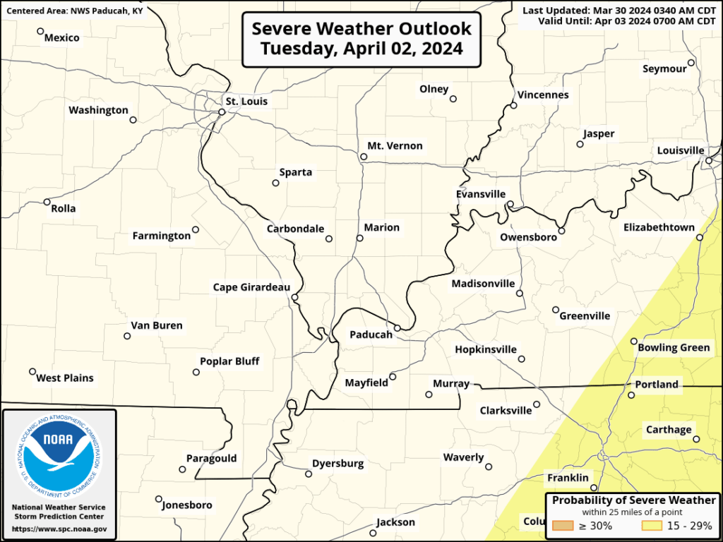
On Tuesday, it appears the front will push through fast enough to keep the severe weather risk to our east. It could be close though for our far eastern counties, thus monitor updates if you live there.
Monitor updates.
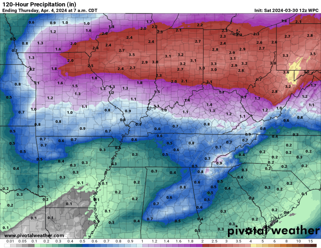
Rainfall totals will vary, as always. Thunderstorms can enhance rain totals. Higher totals north along the warm front. Lower totals far south.
This graphic is from the WPC/NOAA. Over the past few months, they have been a bit too high on their rain totals. We have been in drought.
Hopefully, we can pick up a decent rain from this event, but I do believe totals are going to vary by quite a bit.
Also, we will need to monitor in the event a couple of thunderstorms train over the same areas. If that were to happen, then some ponding of water could occur. Brief flooding of ditches and poorly drained roadways.
Want to receive more weather information? I provide a service through www.weathertalk.com
Subscribe at www.weathertalk.com and then download the Beau Dodson Weather app from the app stores!
Apple users: Beau Dodson Weather App
https://wtalk.co/9EZYG8A8
Android users: Beau Dodson Weather App
https://wtalk.co/ZEWYU8ME
Need help? Email me at beaudodson@usawx.com
* Daily weather forecasts
* My personal weather blog with all sorts of weather information!
* Special weather statements sent to the Beau Dodson Weather app.
* Rapid fire tornado alerts.
* Severe weather alerts and forecasts.
* Severe weather updates throughout the day (when severe weather is occurring)
* Ice storm alerts and forecasts.
* Winter storm alerts and forecasts.
* Winter storm updates throughout the event.
* Regional weather videos.
* Long range weather videos.
* A daily forecast that I hand type for your county. Sent out every afternoon.
* Long range outlooks. Including week one, two, three, four, and monthly outlooks. Seasonal outlooks.
* App messages to alert you when I have updated the weather blogs and Facebook.
* And more!
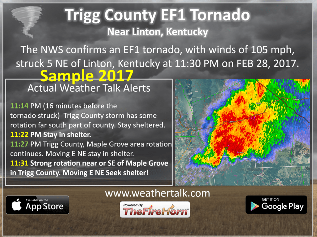
Here are some examples of what people receive when they subscribe to www.weathertalk.com
** NEW SERVICE **
We also have a new service to compliment your www.weathertalk.com subscription. This does NOT replace www.weathertalk.com It is simply another tool for you to receive severe weather information.
I use it myself. I encourage everyone to have 3 to 5 ways of receiving their severe weather information. All sources can fail and the more sources you have, the better prepared you will be in the event of severe weather warnings.
WeatherCall will call your cell phone or home number if your home is in a tornado or severe thunderstorm warning.
More information on the WeatherCall service here.
Beau Dodson Weather (weathercallservices.com)


