Posted by Chief Meteorologist Beau Dodson
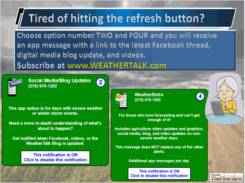
Want to receive more weather information? I provide a service through www.weathertalk.com
Subscribe at www.weathertalk.com and then download the Beau Dodson Weather app from the app stores!
Check out our live exclusive weather radars.
Interactive local city-view radars. Clickable watches and w
Good day, everyone.
A very active weather pattern ahead of us.
Forecast
Today and tonight:
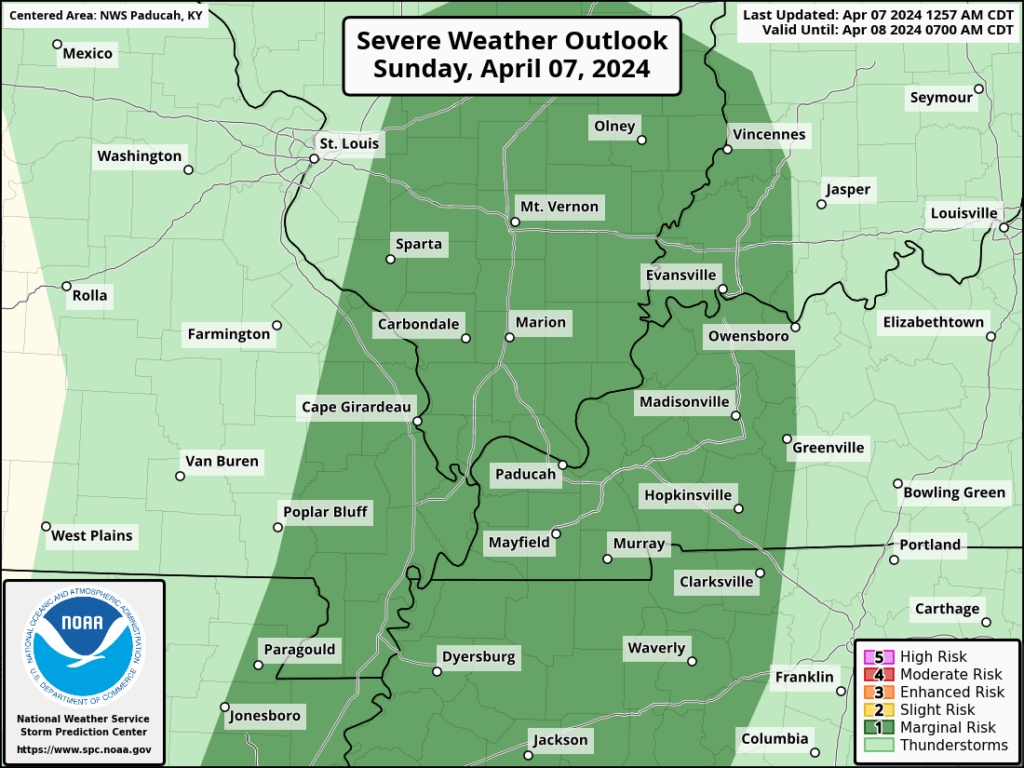
A cold front will push into the region later today and this evening. Showers and thunderstorms will develop along and ahead of the cold front. We do have a chance of severe weather.
The SPC has placed us in a level one severe weather risk. The dark green zone.
There are some limiting factors that raise questions about the severe weather risk this afternoon and evening.
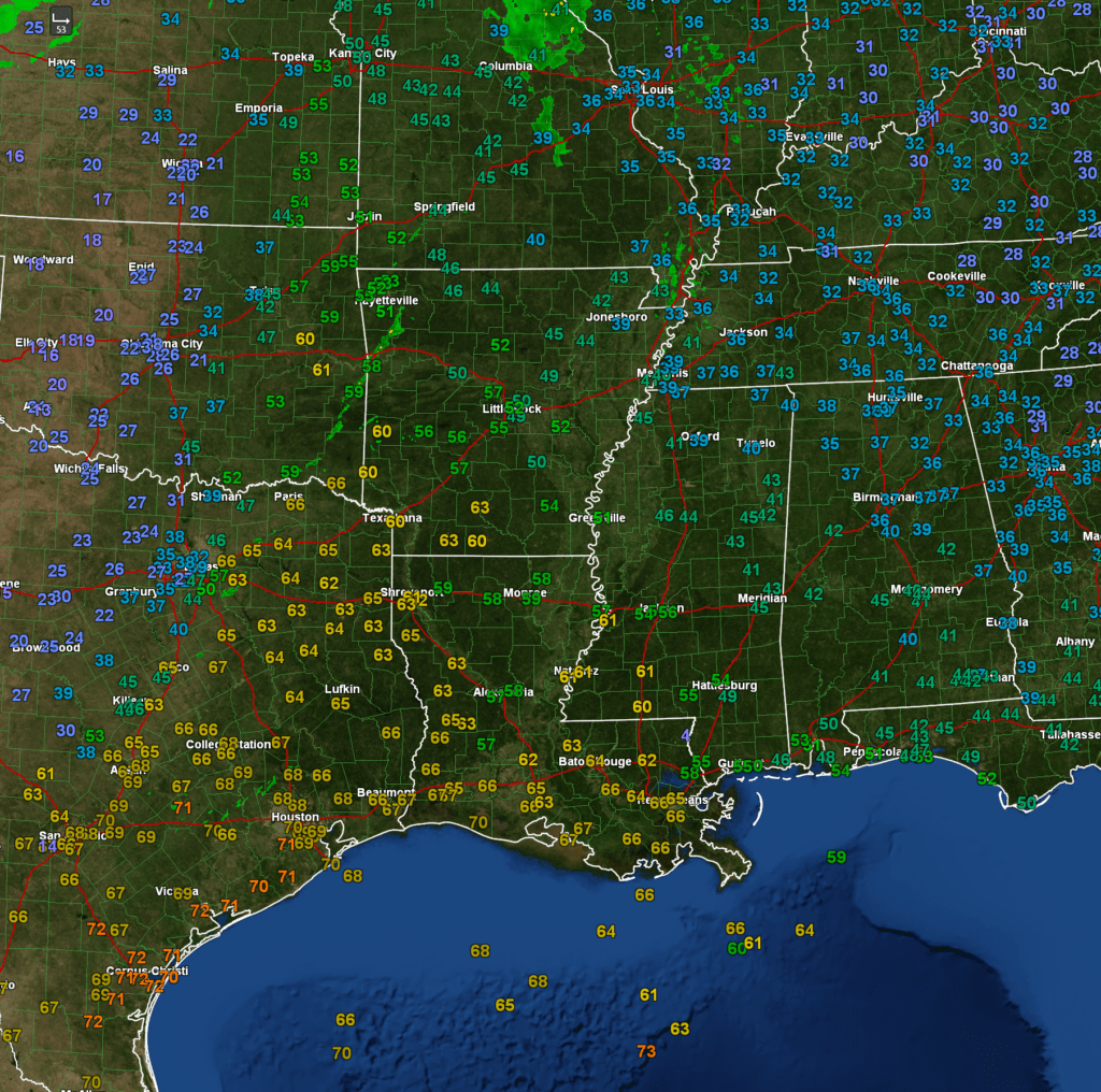
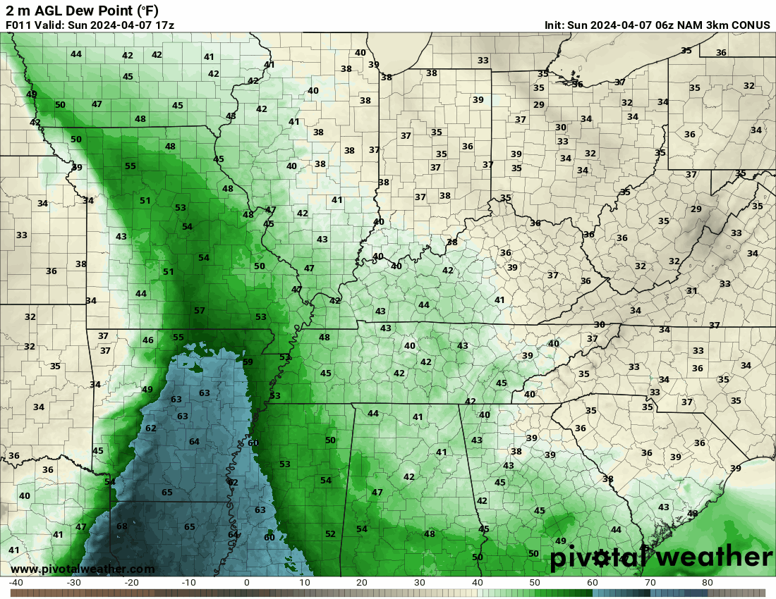
Dew point recover is one question. Dew point is a measure of moisture. We generally look for dew points of 58 degrees and above when thinking about severe weather.
Here are the early morning dew point readings.

If we zoom out, we can see higher dew points to our south.
Here is the dew point animation. You can see the front pulls higher dew points northward later today.
Double click on images to enlarge them.
If dew points recover later today, then the risk of severe weather will be an issue.
There is also some dry air aloft moving in from the west. This raises questions about the threat of severe weather, as well.
Overall, confidence is lower than average for this severe weather event. The concern would be a few reports of damaging wind, large hail, and a tornado or two.
Stay weather aware this afternoon and evening as thunderstorms develop and move through the region.
We will dry out later tonight into most of Monday.
High cirrus clouds continue to be a concern for the eclipse, but low clouds appear unlikely. It is possible the cirrus clouds cause some viewing issues, but that is better than low clouds.
Some patchy cumulus clouds will form during the afternoon, as well.
I hope everyone is able to view the eclipse. Get into the totality area. There is nothing like it! It is amazing.
Widespread showers and thunderstorms return to the forecast late Monday night into Thursday.
Locally heavy rain is a concern with some flash flood or flood warnings possible as we move through the week.
The latest WPC/NOAA rainfall totals continue to show heavy rain.

The Memphis, Tennessee National Weather Service posted this graphic. Some big totals are showing up in some of the model data.

Want to receive more weather information? I provide a service through www.weathertalk.com
Subscribe at www.weathertalk.com and then download the Beau Dodson Weather app from the app stores!
Apple users: Beau Dodson Weather App
https://wtalk.co/9EZYG8A8
Android users: Beau Dodson Weather App
https://wtalk.co/ZEWYU8ME
Need help? Email me at beaudodson@usawx.com
* Daily weather forecasts
* My personal weather blog with all sorts of weather information!
* Special weather statements sent to the Beau Dodson Weather app.
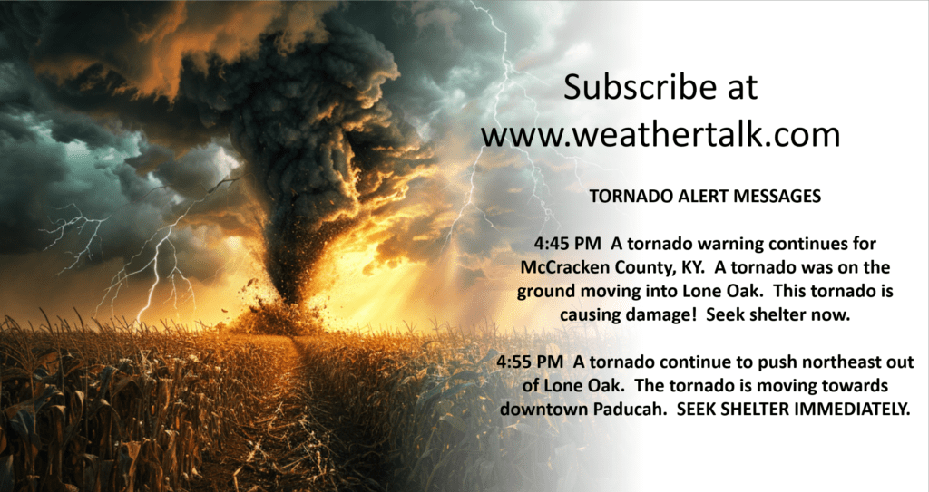
* Rapid fire tornado alerts.
* Severe weather alerts and forecasts.
* Severe weather updates throughout the day (when severe weather is occurring)
* Ice storm alerts and forecasts.
* Winter storm alerts and forecasts.
* Winter storm updates throughout the event.
* Regional weather videos.
* Long range weather videos.
* A daily forecast that I hand type for your county. Sent out every afternoon.
* Long range outlooks. Including week one, two, three, four, and monthly outlooks. Seasonal outlooks.
* App messages to alert you when I have updated the weather blogs and Facebook.
* And more!
Here are some examples of what people receive when they subscribe to www.weathertalk.com
We send out app notifications when we update the social media posts (Blog, Facebook, other)