
May 13, 2024
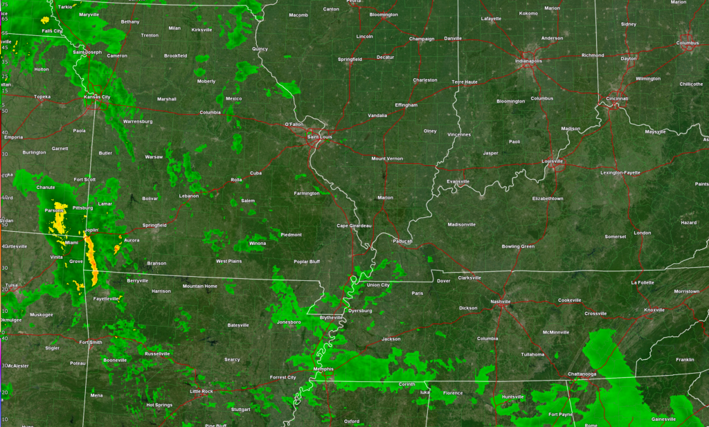
Rain is on the way. Showers are already showing up on radar (as of 9 am). You can see those here. They are streaming north northeast.
Rain showers will become more numerous as we move into the afternoon and especially tonight into tomorrow. The risk of severe weather is low, but perhaps not zero. An isolated storm or two could perk up to near severe levels. The atmosphere is not all that unstable, so I am not overly concerned.
Here is the severe weather outlook (as of 9 am). The dark green is where a couple of storms could be severe, but overall, the risk is low.

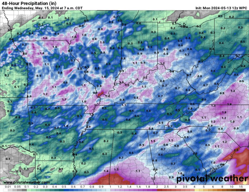
Over the next two days, rainfall totals of 0.5 to 1.00″ are anticipated. Locally higher rainfall totals are possible where multiple storms occur.
Another rain event is likely by Thursday night and Friday. Once again, it appears the threat of severe weather will be minimal with that event, as well.
Storm Tracking Links
Beau Dodson Weather Radars and Lightning Data
Interactive local city-view radars.
Clickable watches and warnings.
Link (new site)
https://beaudodsonweather.com/weather-radars/
Backup radar site in case the above one is not working.
https://weathertalk.com/morani
Regional Radar
https://imagery.weathertalk.com/prx/RadarLoop.mp4
*NEW* Zoom interactive radar (with storm chaser streams)
https://wtalk.co/AVWG7GM7
Real time lightning tracker system two.https://map.blitzortung.org/#5.02/37.95/-86.99
Lightning Data (zoom in and out of your local area)
https://wtalk.co/WJ3SN5UZ


