Posted by Meteorologist Beau Dodson
Hot hot hot. That will be the general rule today through next Thursday. Today will deliver widespread low 90s. We pop into the middle and upper 90s tomorrow through Wednesday.
Some locations could hit 100 degrees on Monday and Tuesday. Perhaps one of the hotter days of the year, thus far. At least temperature-wise. Heat index/feels like values will not be the highest of the year.
The heat index values will run from 100 to 106 degrees Sunday through at least Wednesday.
The good news is that a cold front will push into the region Thursday night and Friday. This will deliver a chance of showers and thunderstorms. Cooler drier air will arrive behind the front by next weekend.
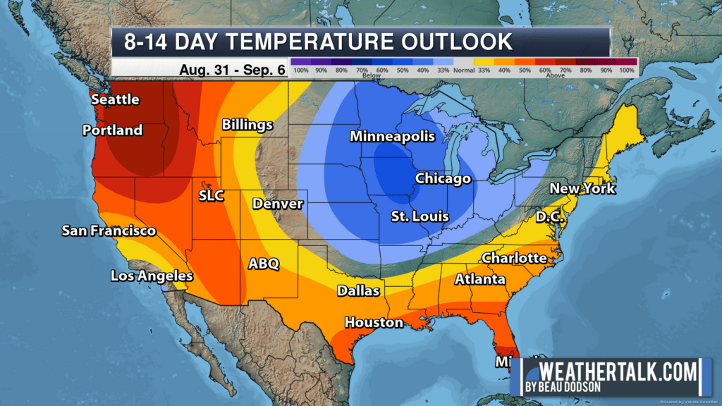
The latest temperature outlook for the first week of September is indicating temperatures will be cooler than average. The darker the shade of blue, the higher the probability of below average temperatures.