Posted by Meteorologist Beau Dodson
The heat is on!
Hot temperatures return today and will linger through Friday. Widespread 90s will be the general rule across the entire region. Peak temperatures will be Tuesday, Wednesday, and Thursday. Some reporting stations will likely hit 100 degrees. Heat index values of 100 to 106 degrees.
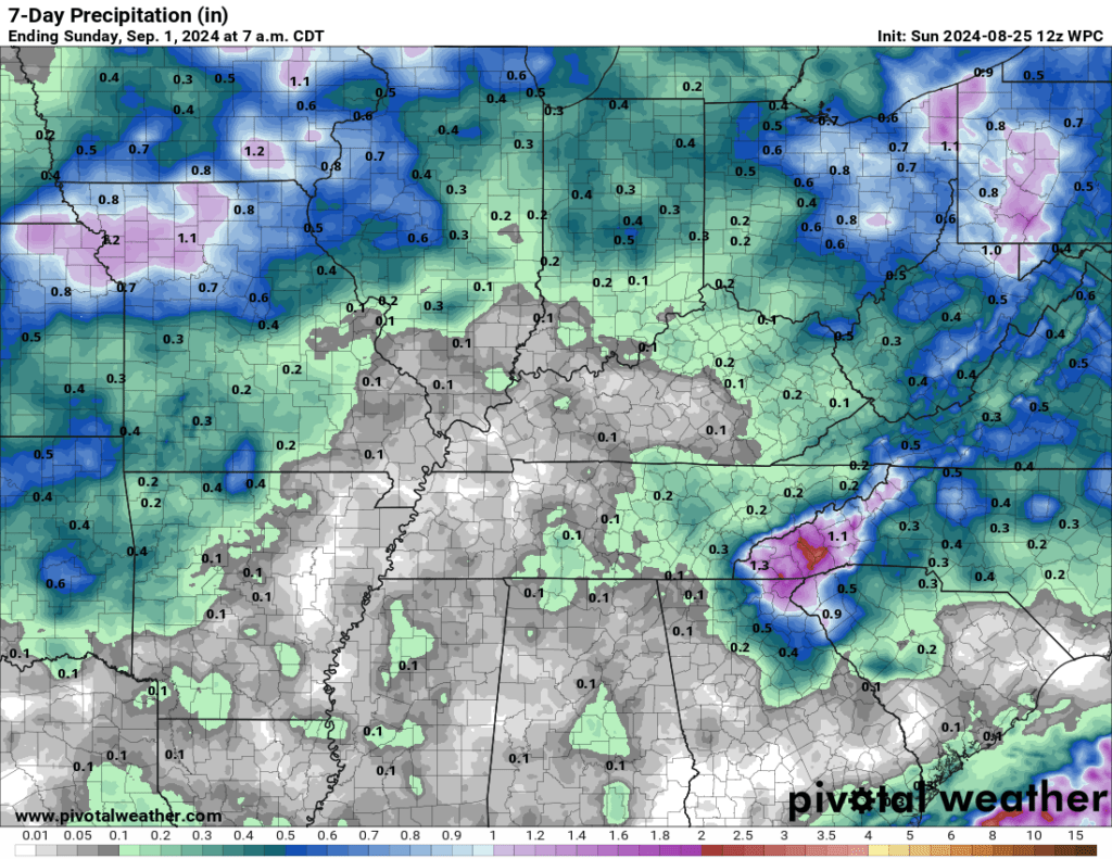
A cold front will push into the region Thursday and Friday. Scattered showers and thunderstorms will accompany the front. Rainfall totals will be on the low-end. I am expecting 0.00″ to 0.15″. Thunderstorms can always produce locally higher totals. Some locations will receive little or no rainfall.
Here is the latest seven-day rainfall outlook from NOAA. Not promising for our drought conditions.