Posted by Meteorologist Beau Dodson
Some good news in the weather department. A cold front will push into our area this weekend. This will bring relief from our string of hot days. Temperatures will drop into the 70s and 80s by early next week.
The front has slowed a bit. It will now arrive tonight and tomorrow.
I can’t rule out a stray shower or thunderstorm today, but the bulk of the rain will arrive tonight and Saturday. The rain may linger into Sunday along the MO/AR and KY/TN border.
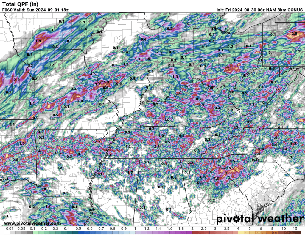
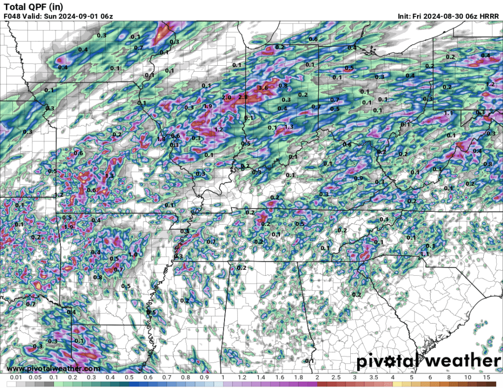
This will not be a drought breaking rain event. Unfortunately, rainfall totals will range from 0.00″ to 0.50″. Some of you will receive little or no rainfall.
At always, thunderstorms can produce much higher rain totals. Some locations will pick up well over an inch of rain. Typical rainfall pattern for summer. Hit and miss. Feast or famine.
Peak rain chances will arrive Saturday.
Here are two models. The colors represent rainfall totals. Now, this is a model. It won’t be exact, but you get the general idea. A wide range of rainfall totals are anticipated.